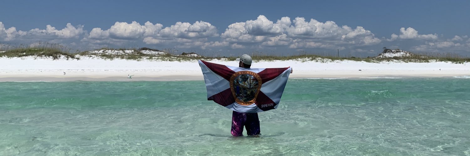
Meteorologist at Tampa Bay 28 | ’The Bearded One’ 🧔🏻♂️ | Florida State Seminole | Shark & Ocean Advocate | Pro Beach Bum | I ❤️ Florida | Rock/Metal Guy🤘🏻
Absolutely incredible rainfall totals last night, especially in Pasco County. Over 8" fell in a few hours in Zephyrhills which prompted a flash flood warning overnight. More rain on the way later today.
Here's an overview of the rain from yesterday to early this am. The majority of the heaviest rain was along the I-4 corridor and north. Hopeful for southern areas to get the heaviest rain later today. We hardly got any rain from downtown St Pete to Ruskin To Fort Meade south.
More rainfall reports from the NWS. Parts of Tampa saw more than 2" of rain but the airport official observation is 0.85". While PIE saw 2.79" in Pinellas Co, at Albert Whitted in downtown St Pete, we saw a trace... huge differences over short distances!
Expect partly cloudy skies through Memorial Day with afternoon and evening storm chances, very similar to the last few days. The sea breeze will fire up a few storms as it heads inland, widespread rain develops inland, then some of those showers and storms drift back west.
@johntfox That second wave stayed north of the airport so the final tally there was 1.25”. Radar estimates of 2” to over 4” showed up north of I-4 from Temple Terrace to Sem Heights to the Vets Expy!
TAMPA RECORD RAINFALL | In the midst of our drought, today's storm over TPA dropped a new daily record amount of 1.17" of rain, breaking the old record of 1.11" back in 1991!
While not technically in the rainy season just yet, it's been a LONG time since the 7 day had a rain chance every day!
Coverage will be much lower next week compared to today, but hey, at least we're still talking about some rain as we're about to wrap up the dry season.
Poor little dude is either super confused about it actually raining, or he’s doing a super fancy possum rain dance 😂😂😂 Definitely pulled my inner @omgitswicks “what’s going on out here?!” when I saw him 😂😂😂
It's gonna be a hot one today as highs climb well into the 90s away from the beach. Beach temps will stay below 90 but a mile or two inland, you're in the low 90s as well.
NEW | Tornado Warning now issued for areas from Hudson north and east through Pasco and into SW Hernando Co. Rotation holding together and moving inland,
UPDATE | Tornado Warning for coastal Pasco continues. Rotation moving onshore right now from Bayonet Point north to Hudson along Hwy 19. Red and green together is area of concern.
Watching this storm closely off the coast of Pasco Co. Holding together well for the last 45 mins and is rotating. Waterspouts are possible offshore and if it holds together, could pose a severe risk for coastal Pasco. We’ll keep you posted!
Monday's forecast is pretty much like today's with a slightly better inland pop up storm chance. Tonight's data does increase the rain chance Tuesday, but it's been really inconsistent. I've got the rain chance at 40% with our next cold front coming in.
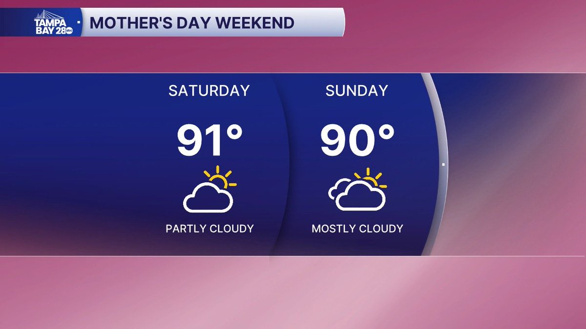
Your Mother's Day forecast is looking good! Still hot and muggy but nothing us Floridians can't handle. Make sure you get Mom lots of cool refreshments and plenty of time in the AC!
UGHHHHHHH... so close to the cold front, but so far away. We're stuck on the hot side of the front for Mother's Day, but it will work its way south Monday. Unfortunately, it won't bring any heat relief with it by the time it gets here. Humidity will drop a little by mid week.
Happy Mother's Day weekend! The forecast looks dry with hot and muggy conditions. Temps inland continue to near record highs in the mid 90s with lower temps near the water in the mid to upper 80s.