That guy who looks so familiar but you can't place it and just figure he must have gone to high school around here. Also telling stories on TV for @CBSNews
Paxton and Trump share the stage.
And a bit of news, with the President saying he will be delivering more FEMA funding for the flash flooding this year in Central Texas
New World screwworm has been detected in a hunter-harvested elk in Pecos County
NWS is a devastating pest that can kill infected animals.
Hunters, please inspect your harvest for maggots or a rotted flesh odor.
DETAILS 👉 https://t.co/d48Ei5FijI
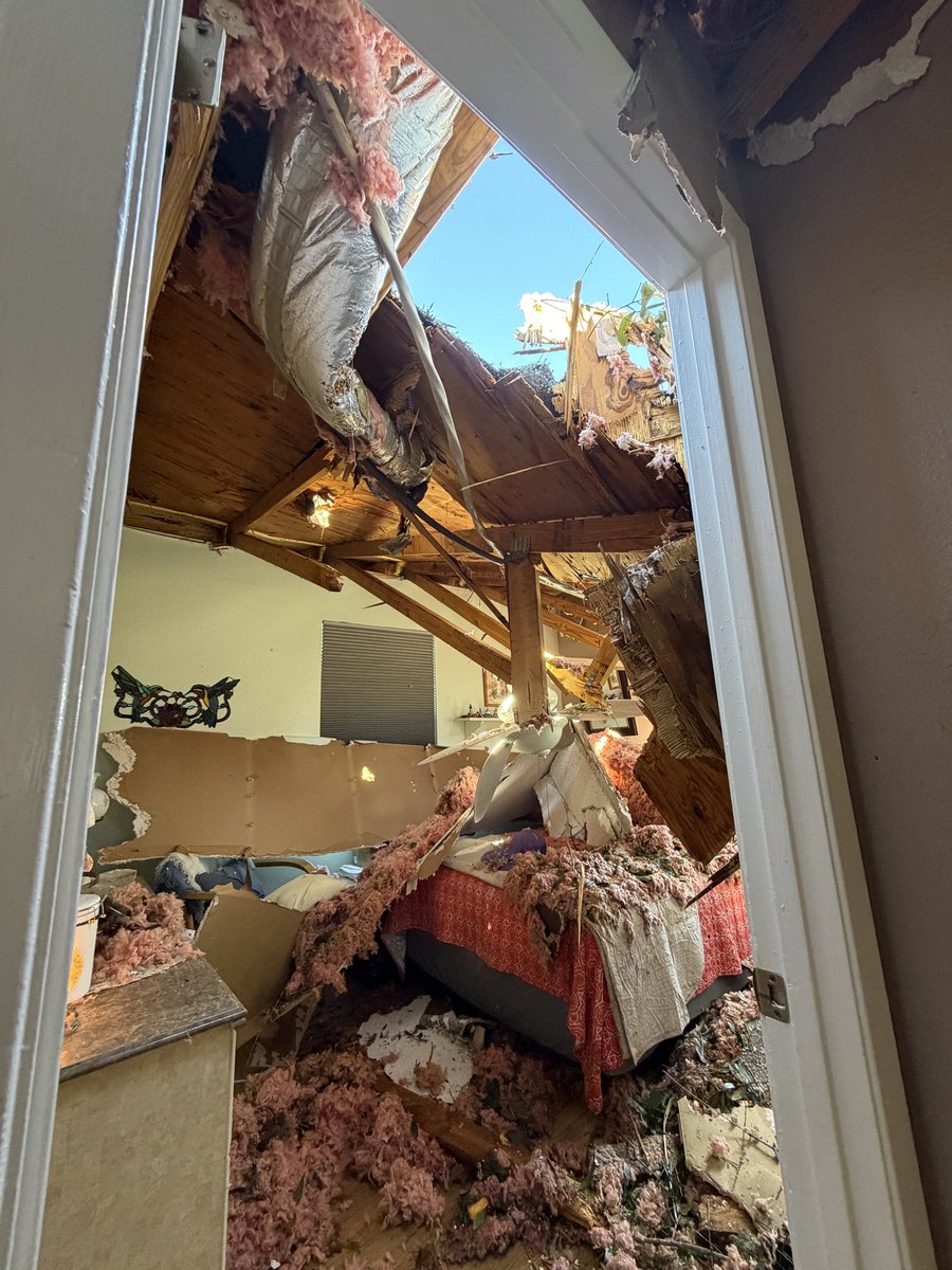
Massive tree crushed this house in Milton, FL, during Isaias.
Owner was sleeping in the adjacent bedroom. A limb knocked the ceiling and roof trusses on top of her, but she wasn’t seriously hurt
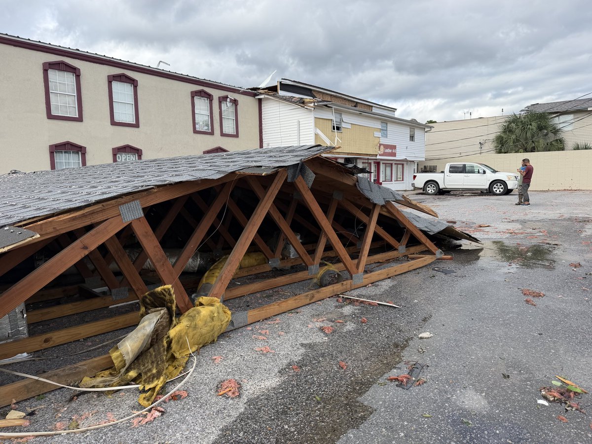
What a difference 12 hours can make.
Coastal cities west of landfall were spared the worst from Isaias.
Curfew has ended here in Gulf Shores. Bridges back into town have reopened.
Through the storm, into the eye. 🌀
See what the Air Force Reserve Hurricane Hunters saw this afternoon in this time-lapse of their flight through Hurricane Isaias.
Stay #WeatherReady: Follow official weather updates and local officials’ safety instructions.
#HurricaneHunters #ReserveReady #Isaias
Something to watch. Storm after storm where I end up on the “weak” side, it’s the backside winds post-landfall that are often the strongest, and most sustained
💨Widespread tropical storm force winds and damage will occur well away from the center, with damaging hurricane force winds near the center close to the coast. Potential exists for strong winds even on the west side if the storm.
⚠️Don't let your guard down west of the center!!
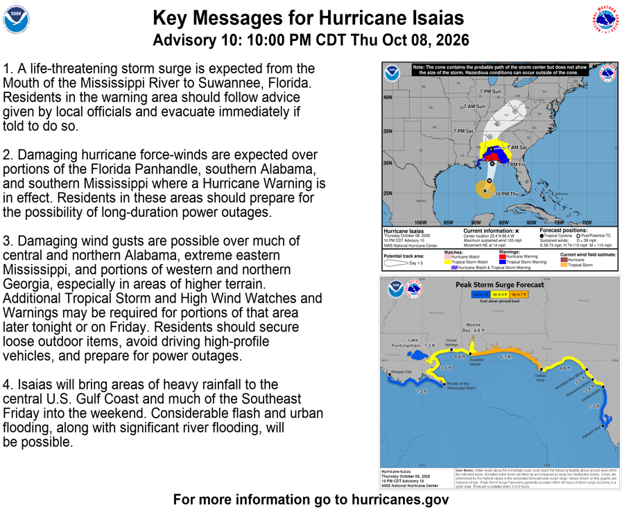
10 PM CDT Thu Oct 8 (Advisory 10) Key Messages for Hurricane #Isaias. Latest info: https://t.co/GrztW6mQJV
10 PM CDT jueves 8 de octubre (Aviso 10) Mensajes clave sobre el huracán #Isaias. Más información: https://t.co/GrztW6mQJV
TROPICAL STORM #ISAIAS
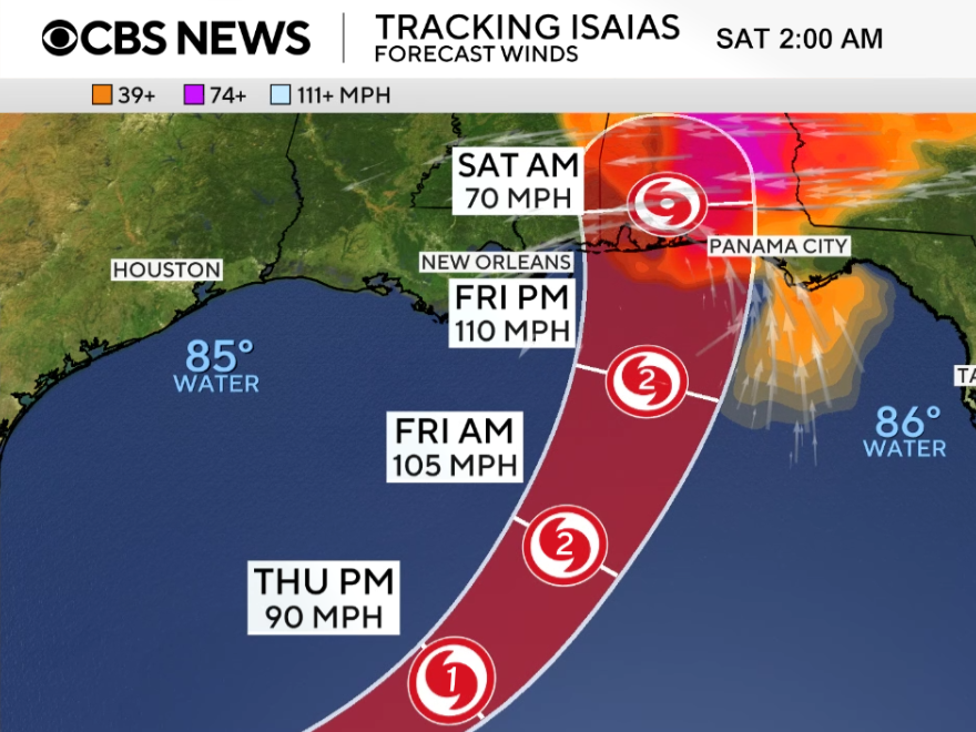
- Forecast to become the first hurricane of the Atlantic season
- Moving north, aiming at U.S. Gulf Coast
- Landfall likely Fri night between MS & FL panhandle
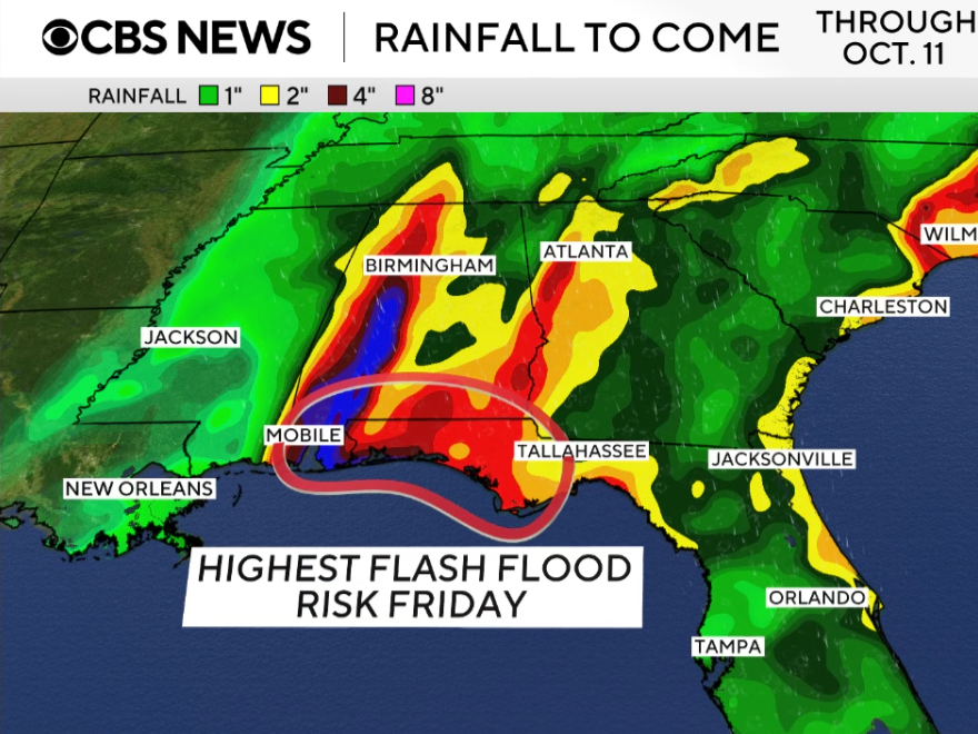
- Flash floods near I-10 Fri PM
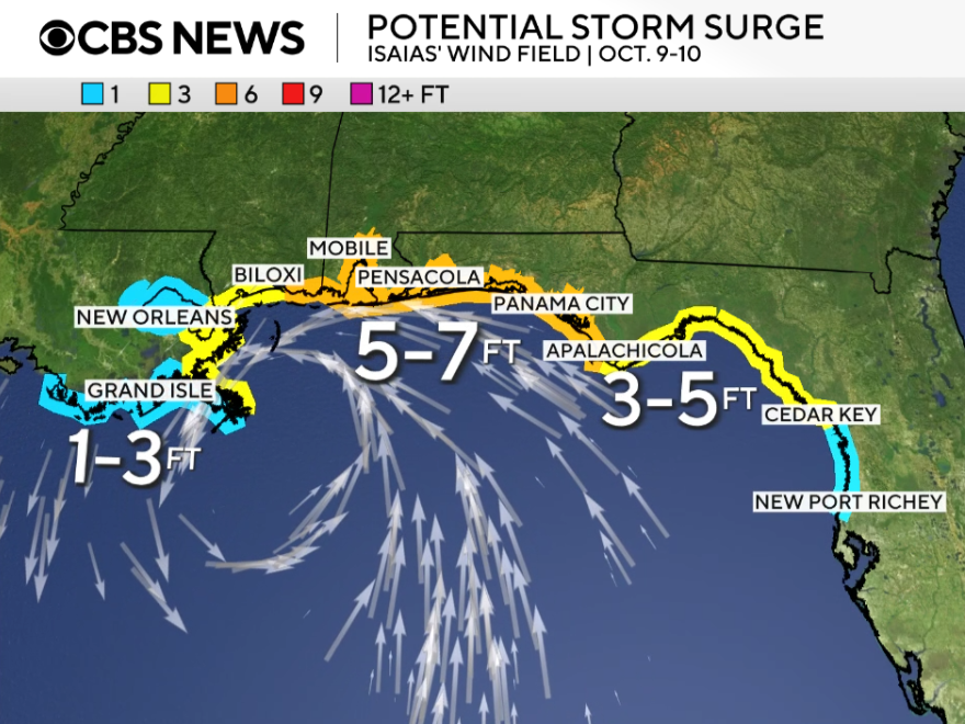
- Storm surge up to 7 ft possible Fri PM-Sat AM
#MSwx#ALwx#FLwx