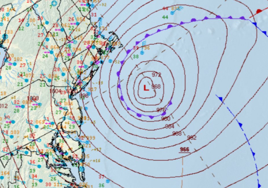
The analyzed central pressure at 7 am EST was 966 mb. This is an estimated 41 mb drop in 24 hours compared to yesterday's analysis at the same of 1007 mb.
[Monday Blizzard Update]
❄️Highest snowfall amounts: 18-24 inches with pockets up to 30 inches possible
🚨Greatest risk for tree damage and power outages is in southeast MA and RI where 55-75 mph wind gusts combine with heavy, wet snow.
🕑Heaviest snowfall rates 4 am-noon
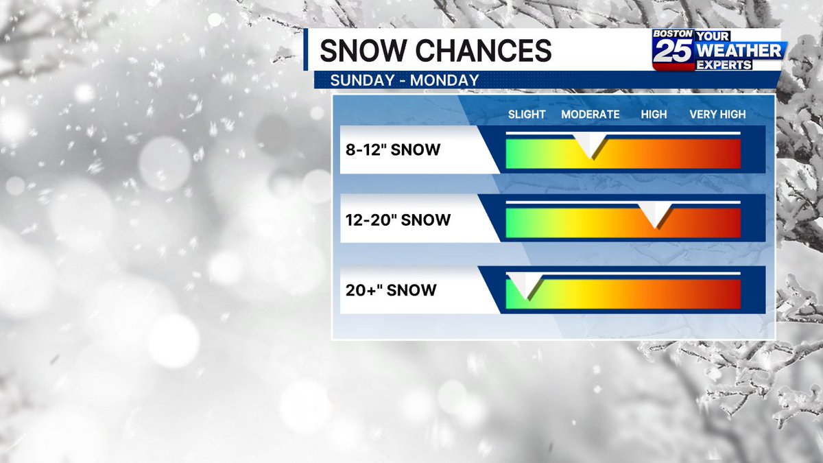
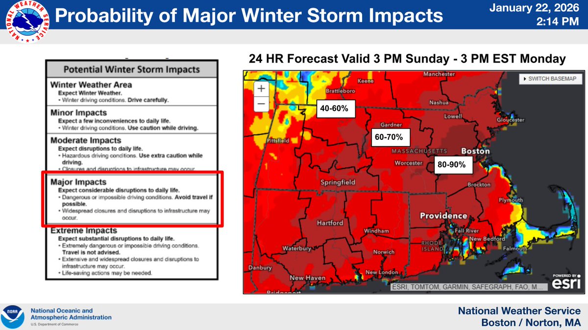
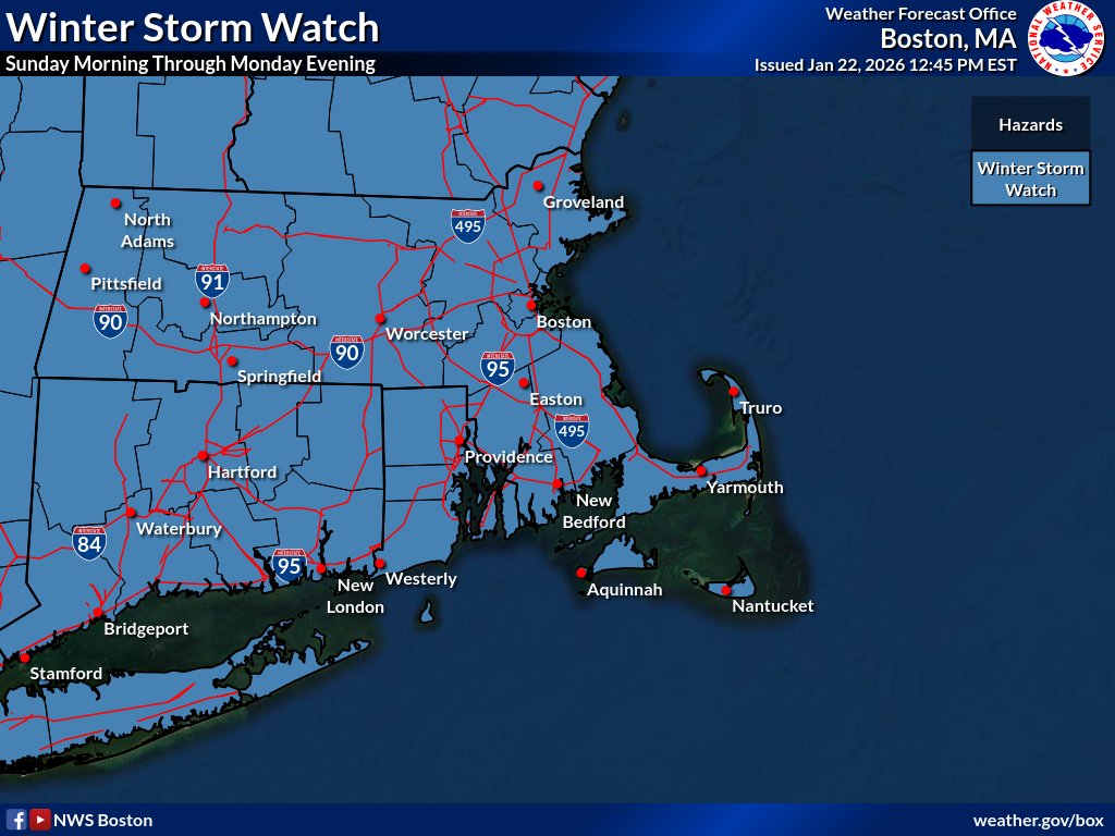
A Winter Storm Watch is in effect for all of Southern New England starting Sun AM through Monday PM. Confidence continues to increase that a winter storm will bring moderate to major impacts to the region with increasing probability of 12 inches of snow. #MAWX#CTWX#RIWX
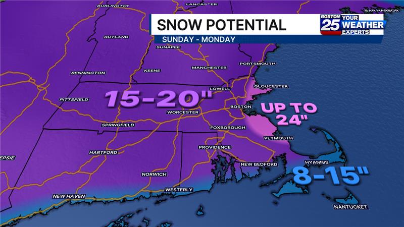
Here is the trend today (Thursday) for widespread snowfall in southern #NewEngland Sunday-Monday. Most likely range is 12"-20" across Massachusetts. This graphic is just the first step to give you insight into what we're expecting and help you prepare. @boston25
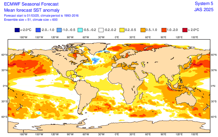
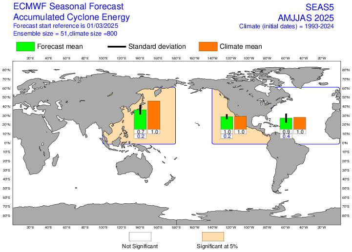
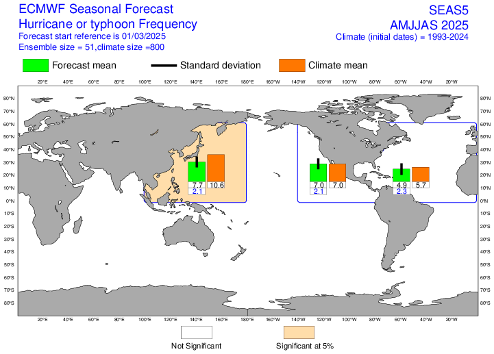
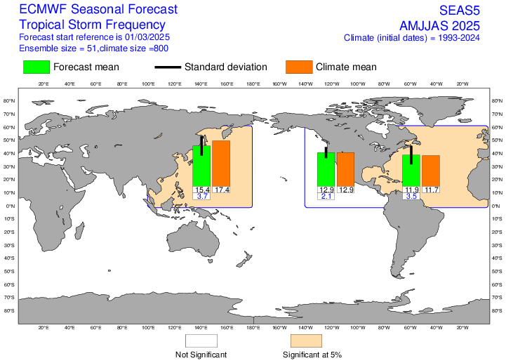
Forecast from ECMWF calls for a near-average Atlantic #hurricane season through Sept, with ensemble average of ~12 named storms, ~5 hurricanes and ACE of 90% of normal. Forecast near-average tropical Atlantic sea surface temperatures and ENSO neutral likely primary contributors.
@sarahwroblewski Underfunded is an awful reality - if you haven't heard of Runway to Hope yet check them out they are doing great work to raise funds and awareness. Sending love to y'all!!🙏
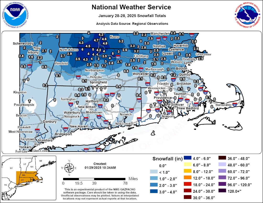
Snowfall totals from last night's storm are in! Heaviest snow fell north of the Mass Turnpike. #MAwx#RIwx#CTwx
For an interactive map, click here https://t.co/nO7BMbHSaW
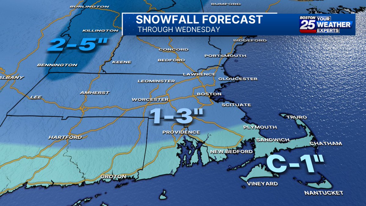
Although a few local town could see a snow squall this morning with a coating, MOST OF THIS WILL STICK MIDNIGHT - 5 AM WENDSDAY! @Boston25#mawx#nhwx#newengland


![NWSBoston's tweet photo. [Monday Blizzard Update]
❄️Highest snowfall amounts: 18-24 inches with pockets up to 30 inches possible
🚨Greatest risk for tree damage and power outages is in southeast MA and RI where 55-75 mph wind gusts combine with heavy, wet snow.
🕑Heaviest snowfall rates 4 am-noon https://t.co/cermW1kWeC](https://pbs.twimg.com/media/HByOrRwXQAEnUsG.jpg)
![NWSBoston's tweet photo. [Monday Blizzard Update]
❄️Highest snowfall amounts: 18-24 inches with pockets up to 30 inches possible
🚨Greatest risk for tree damage and power outages is in southeast MA and RI where 55-75 mph wind gusts combine with heavy, wet snow.
🕑Heaviest snowfall rates 4 am-noon https://t.co/cermW1kWeC](https://pbs.twimg.com/media/HByOqsQXcAAGWhr.jpg)
![NWSBoston's tweet photo. [Monday Blizzard Update]
❄️Highest snowfall amounts: 18-24 inches with pockets up to 30 inches possible
🚨Greatest risk for tree damage and power outages is in southeast MA and RI where 55-75 mph wind gusts combine with heavy, wet snow.
🕑Heaviest snowfall rates 4 am-noon https://t.co/cermW1kWeC](https://pbs.twimg.com/media/HByOosXXQAAf_wn.jpg)


![VickiGrafWX's tweet photo. Officially a blizzard for parts of our area
[Visibility <1/4 mile, gusts 35 mph +, heavy falling or blowing snow, 3 hours or more] https://t.co/qE2C2OmCg3](https://pbs.twimg.com/media/HB2cjPeW8AATPl6.jpg)
![NWSBoston's tweet photo. [Monday Blizzard Update]
❄️Highest snowfall amounts: 18-24 inches with pockets up to 30 inches possible
🚨Greatest risk for tree damage and power outages is in southeast MA and RI where 55-75 mph wind gusts combine with heavy, wet snow.
🕑Heaviest snowfall rates 4 am-noon https://t.co/cermW1kWeC](https://pbs.twimg.com/media/HByOwjnX0AAlO3y.jpg)