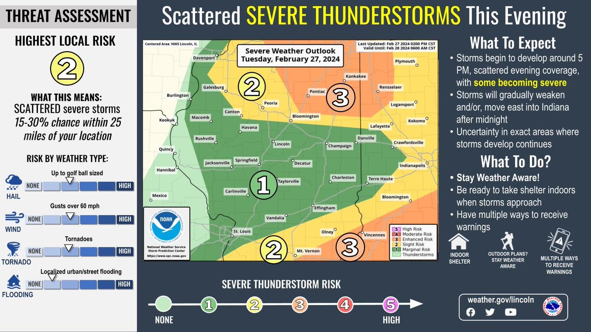
Scattered thunderstorms ahead of a strong cold front will affect the region this evening. Some of these storms could be severe, with large hail, damaging wind gusts, and tornadoes possible. #ILwx
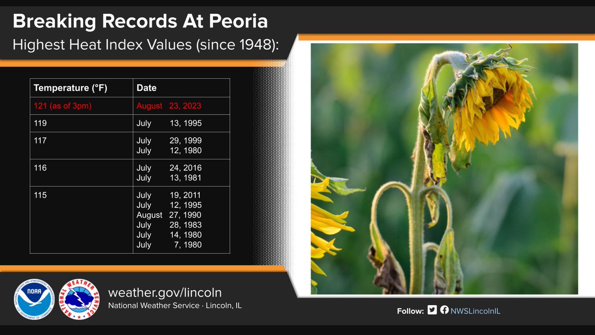
A record-breaking heat index has been measured for the Peoria area today at 121° F, upsetting the previous record of 119° F set back in 1995. Stay cool my friends. #ILwx
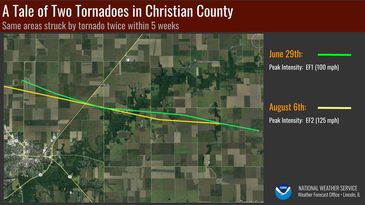
The track of yesterday's tornado northeast of Taylorville was almost identical to the one embedded within the June 29th derecho in that same area. Some people had just finished repairs from the first storm when yesterday's storm struck. #ILwx
10 am Saturday ➡️ 10 am today.
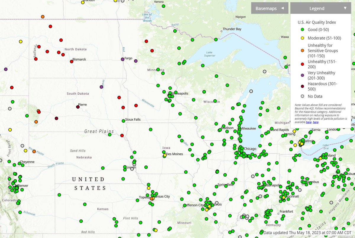
Wildfire smoke originating from Canada has resulted in unhealthy air quality and hazy conditions across central and southeast IL. #ilwx
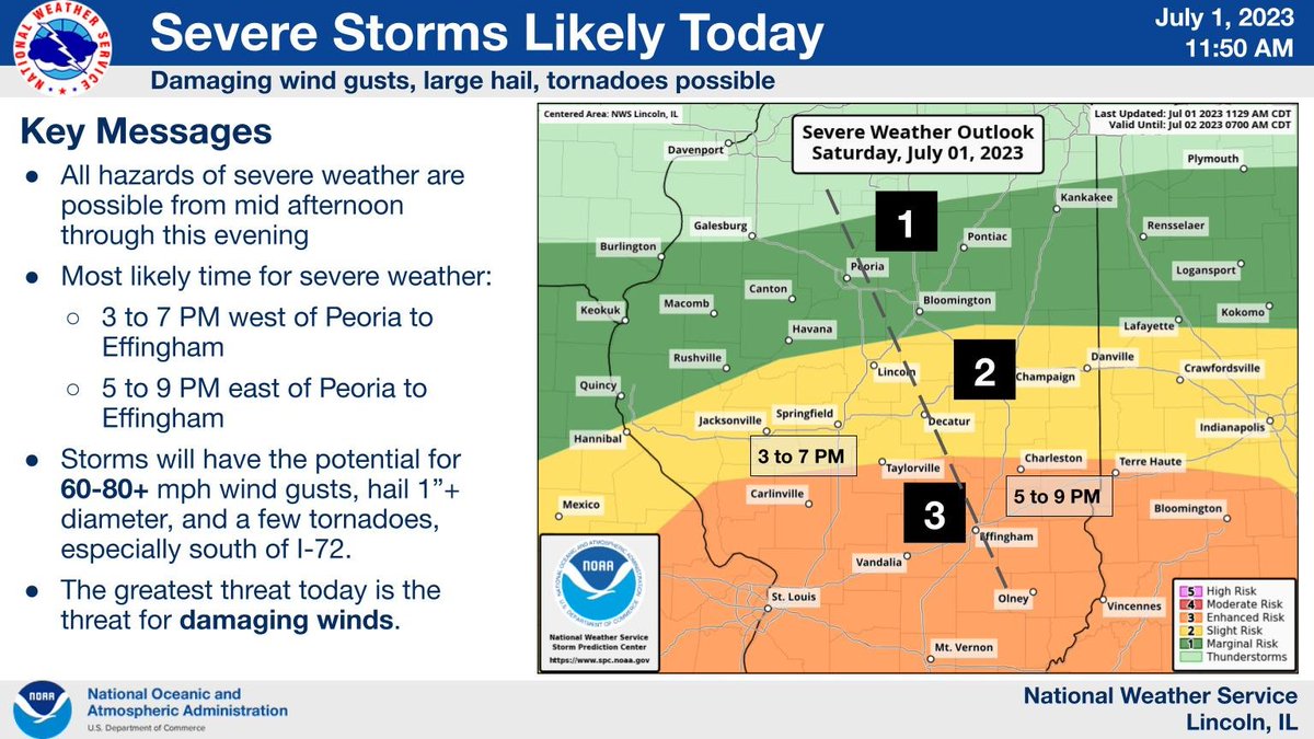
Thunderstorms are expected to develop across parts of west-central and southwest Illinois this afternoon, and shift eastward through the evening. These storms will have damaging wind potential, especially south of I-72. Large hail and tornadoes are also possible. #ilwx
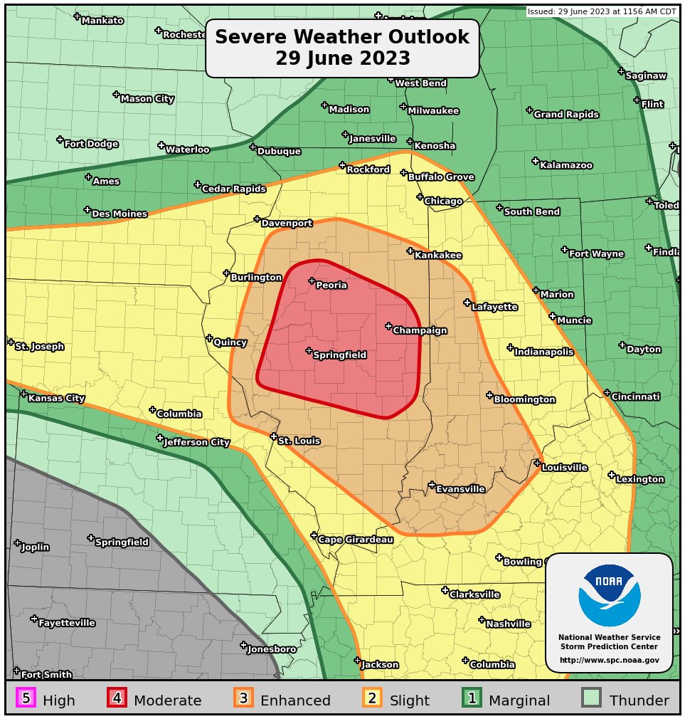
A broken line of thunderstorms will bring a risk for all severe hazards, but especially very large hail and intense damaging winds which could exceed 80 mph in places. SPC has a risk 3/5 (enhanced) for today. #ilwx
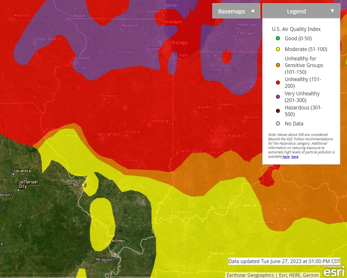
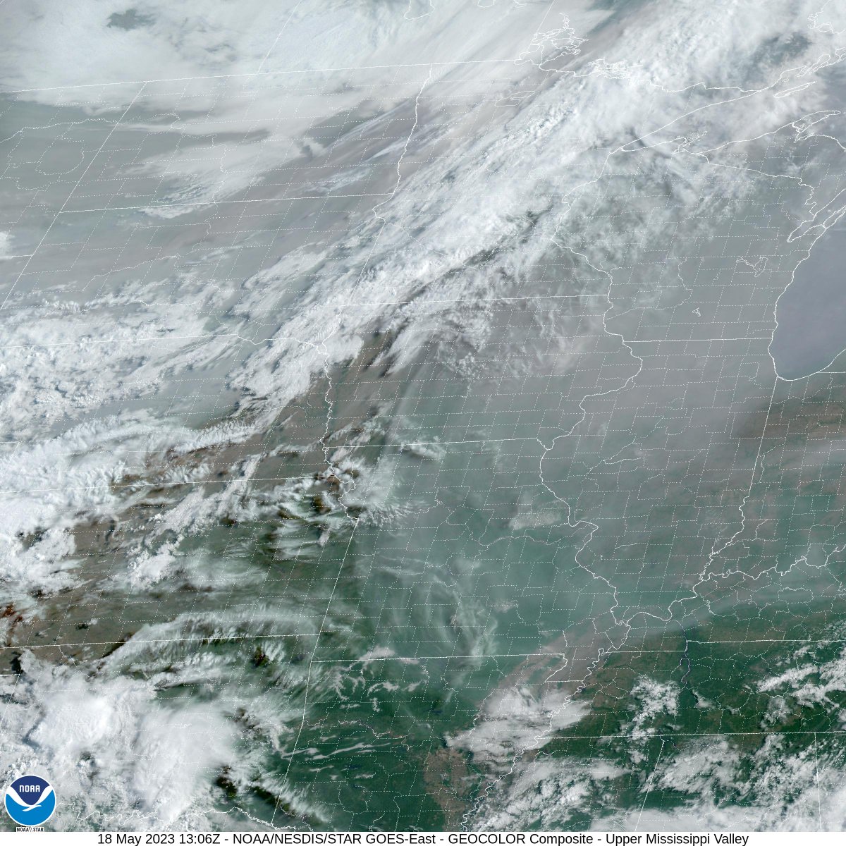
Air quality remains unhealthy across most of central and southeast IL due to Canadian wildfire smoke. Below are images of the air quality, satellite imagery showing the thick layer of smoke, and visibility (in miles) as of 2 pm. #ilwx
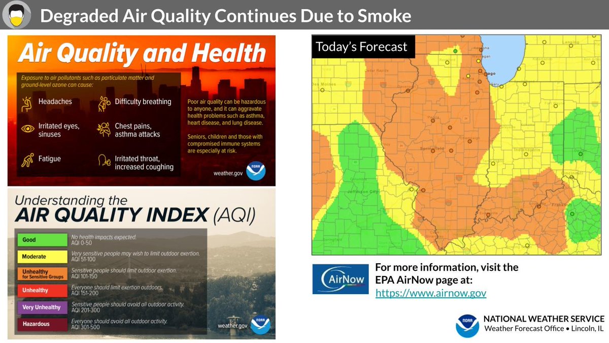
Degraded air quality will continue today, as wildfire smoke comes to the surface. Air quality is forecast to be unhealthy for sensitive groups. Monitor air quality forecasts from @ILEPA at https://t.co/QylZUrzzCg . #ILwx
Smoke remains widespread across the Midwest this morning. Air quality is generally not being impacted in our area. However, some of it is being drawn to the surface over the Dakotas, due to a cold front in that area. #ILwx
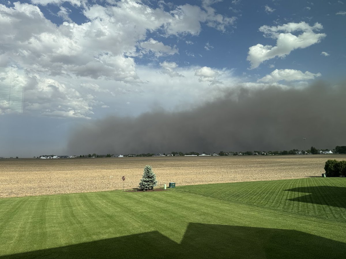
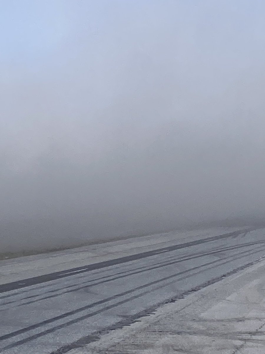
No crashes at this time, but SB and NB I55 between mm 63 and 82, the same stretch as yesterday, are being closed by IDOT, ISP due to high winds and low visibility. Signs will be posted and detours in place. Updates here when available.
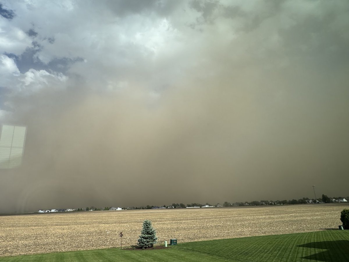
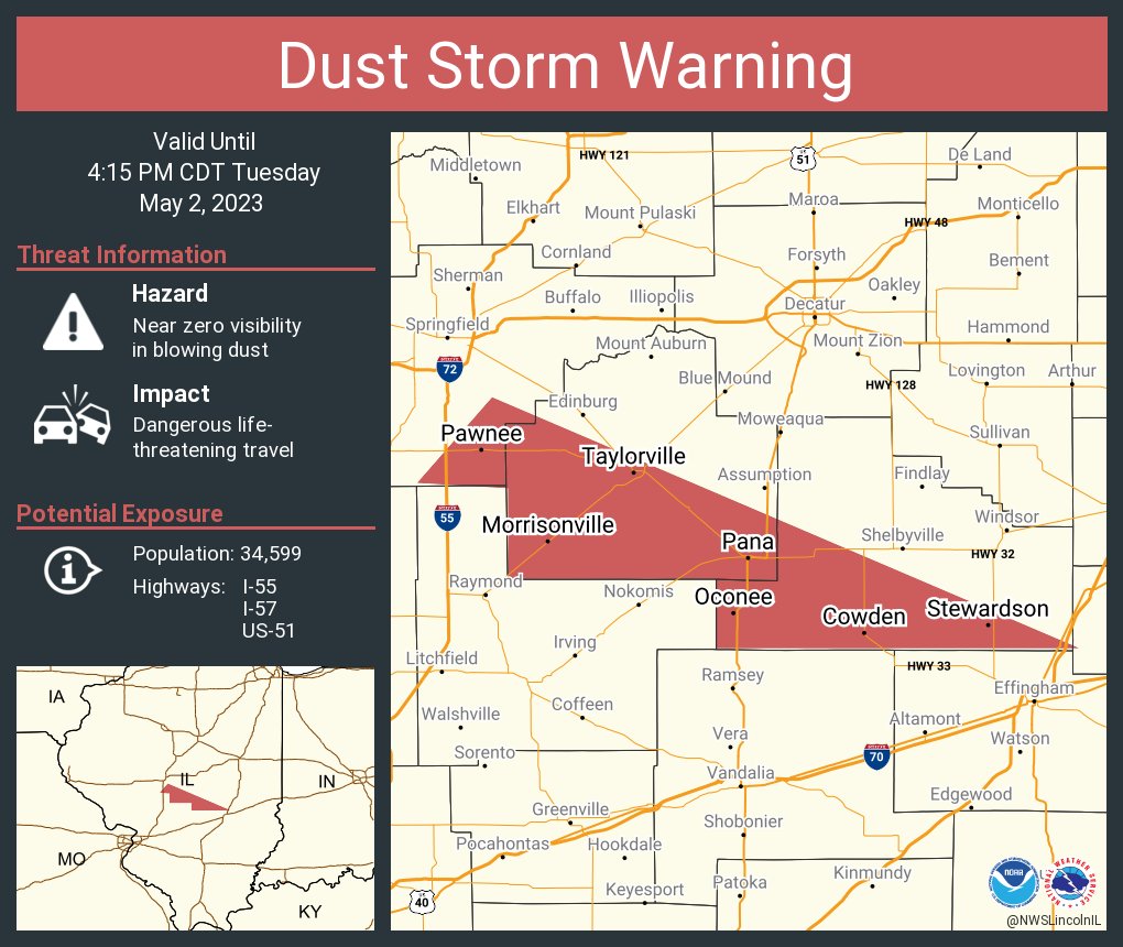
Dust storms are relatively common in the SW / plains regions...not so much in IL. The dust originated from freshly plowed farm fields, and was kicked up by wind gusts of 35-45 mph. ISP reported over 70 vehicles involved; several fatalities and a few dozen injuries were reported.
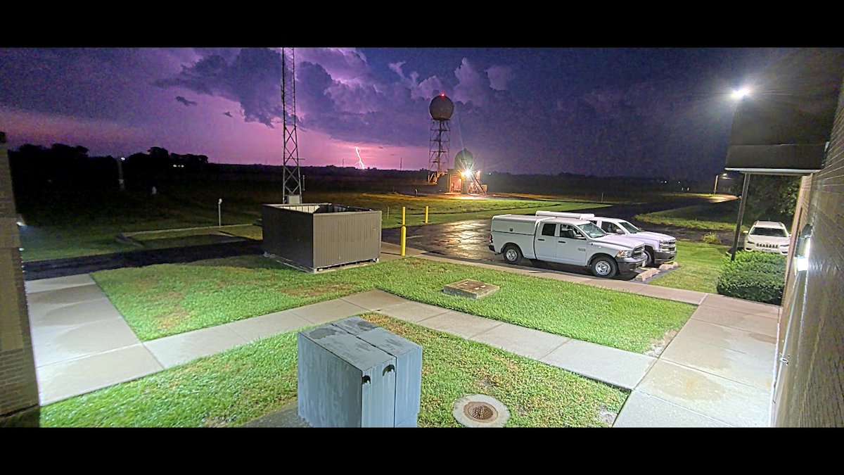
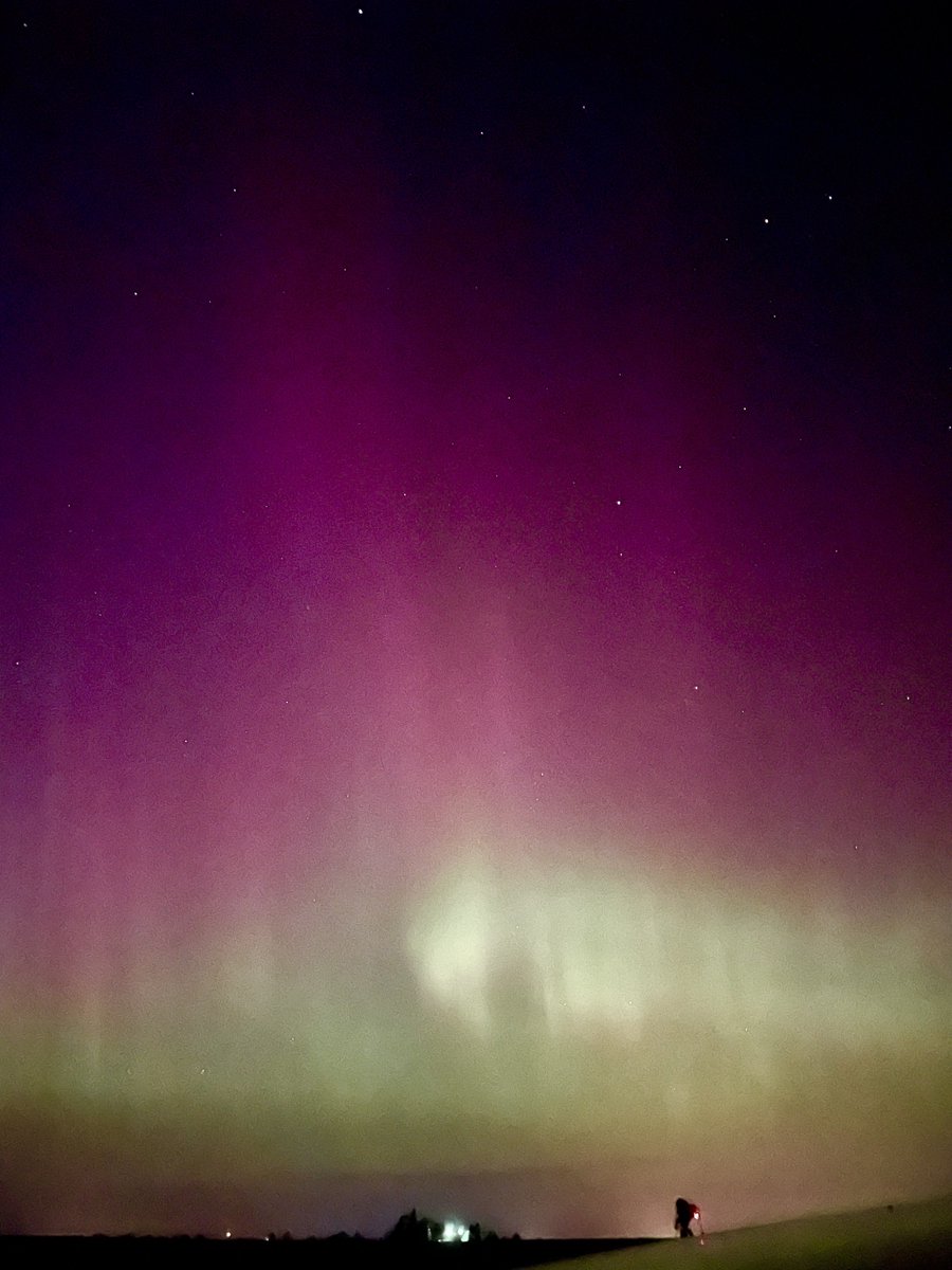
Vibrant shimmering, #aurora coming directly overhead now in Champaign County, Illinois. This is unreal, haven’t seen anything like it since the middle 2000s. #aurora#NorthernLights
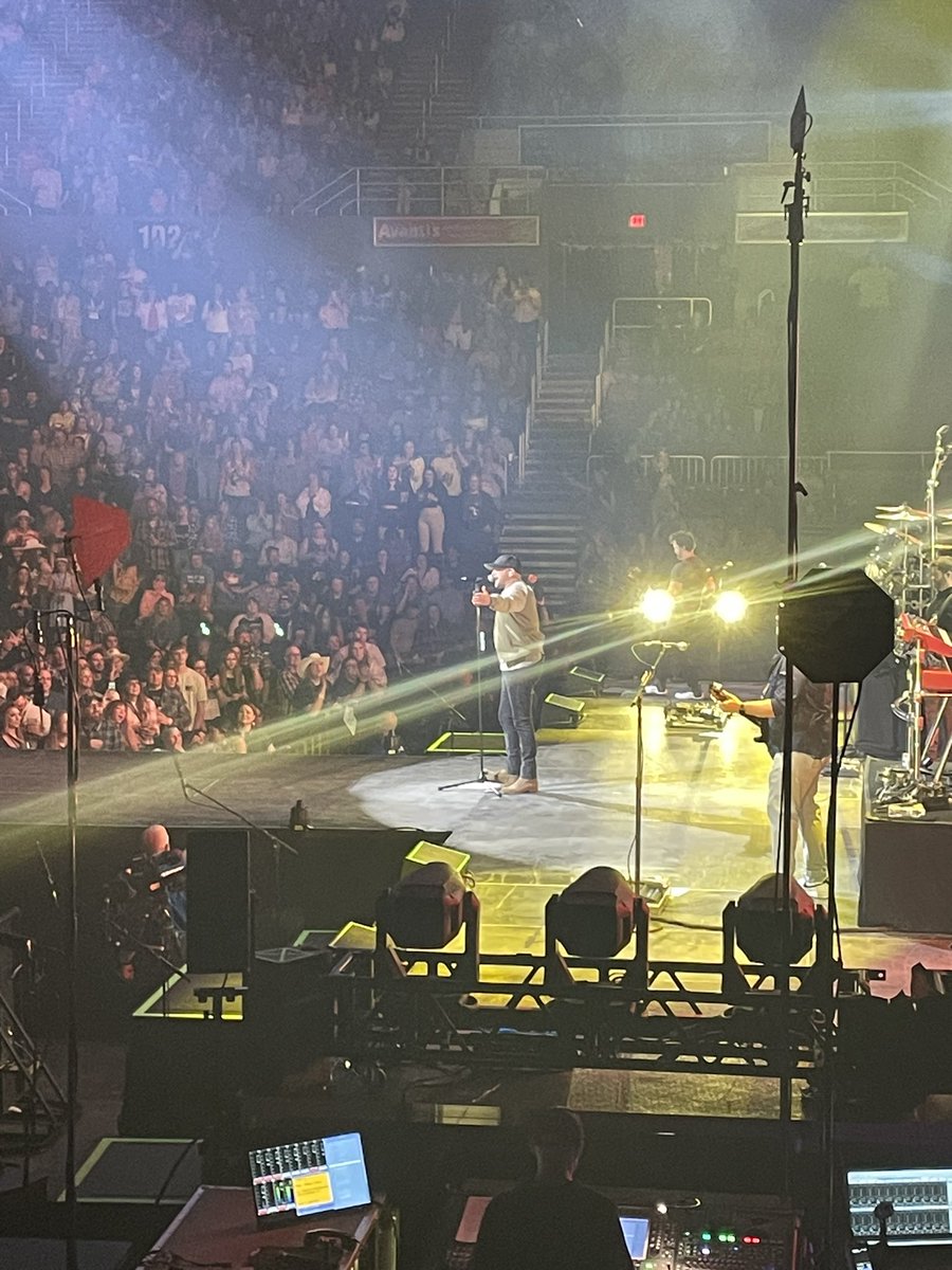
iPhone photo: