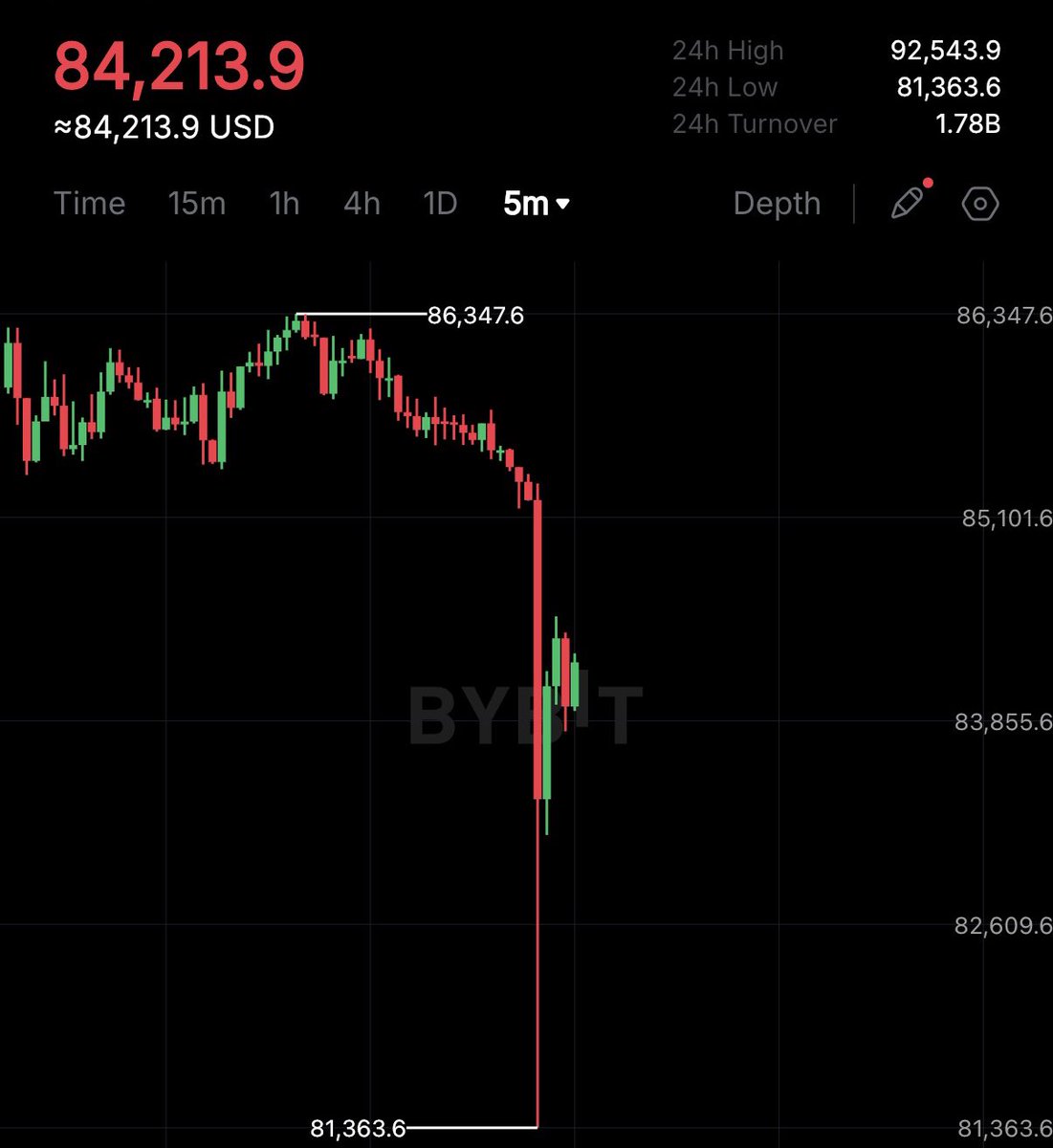
Cartels just liquidated $1 billion worth of long positions in the past 60 minutes, and you think this dump is natural and not a pure market manipulation?
GET READY for very high winds tomorrow (Friday March 14) across the northwestern half of #Texas, especially between 9AM-6PM. A strong low pressure system forming to our north will usher extremely dry air into most of Texas tomorrow, along with high winds. The highest gusts will exceed hurricane force, and even tag 80mph. Fire danger will be exceptionally high along and west of I-35. Blowing dust will be as bad as or worse than last Tuesday. #Txwx #wind
Let’s make something clear about analogs…
There’s a lot of talk about analogs for Saturday, which are events that have occurred in the past which have meteorological and potential outcome similarities.
For Saturday, there really aren’t that many meteorological analogs, and one of the closest modern day synoptic analogs is April 27, 2011.
Now, we stress, this does NOT mean that the outcome will be the same, or even similar to any degree. This does mean that the setup does have similarities and shows what the ceiling of a setup *could* look like.
We can see that the primary low is in the Upper Midwest, along with a secondary shortwave on the southern branch of the jet stream, very alike in these two setups. These similarities can also be found in other levels of the atmosphere.
But why the likely different outcome? April 27th was a once or twice in a lifetime event, something that will generally only occur once every 30-40 years. Prior to 4/27 was April 3, 1974, along with 1932 and 1884. These Super Outbreaks are very rare. While we did sort of have an unofficial ‘Super Outbreak’ on March 31, 2023, the extreme impact level that the official Super Outbreaks induced is on a generational level.
We’re not saying that Saturday may not carry high or even extreme levels of impact, but we can’t be comparing outcomes apples to apples, that’s not quite the way to do public messaging. If a tornado were to impact you directly, all of these analogs go out the window and that’s your April 27 2011 or April 3 1974.
What we want y’all to do is to be prepared, not scared. Have the supplies you need for before, during and after the storm. The chances of you being hit directly, even in a High Risk is still incredibly low, but the potential is there. Stay informed and ready to take action if necessary (under a watch or warning). We’ll have more preparation info in the coming days and on Saturday.
🚨#BREAKING: DOGE officials announced that they have dug up and recovered nearly $1.9 billion dollars in taxpayer money that was misplaced during the Biden administration.
Still on track to see our coldest temperatures of the season next week, and it will be impactful.
Arctic air arrives Tuesday night with the coldest temps Wednesday & Thursday. Thursday AM shown here with wind chill values approaching 0°. Dangerous/pipe-bursting cold #atxwx