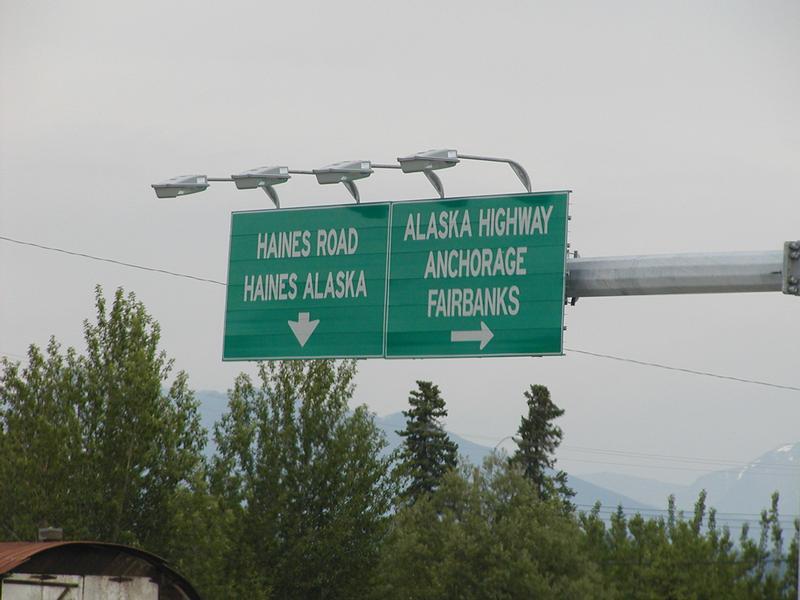
6/22/2001: The traffic light and intersection southbound on the Alaska Highway, approaching the north/west access road to Whitehorse, our destination for the night. We checked back into the River View Motel around 9. Day 16: 406 miles, total so far: 6059 miles. #AlaskaPlus25
6/22/2001: We stopped again at Sheep Mountain. We were also here on the way up. The difference is, this time there were some sheep on the mountain. But since we had seen so many in Denali, I didn't even take a picture. #AlaskaPlus25
6/22/2001: The biggest difference we noticed since our trip northbound on this same segment of the Alaska Highway 8 days earlier is that the wildflowers really came out since then. #AlaskaPlus25
6/22/2001: Tok to Whitehorse was our only significant backtracking west of Chicago, so we have fewer pictures from this day. We stopped for a break at an overlook of the Kluane Icefield Ranges, where it was unfortunately pretty cloudy. #AlaskaPlus25
6/22/2001: Through Canada customs and on to Beaver Creek for lunch at Ida's Cafe. We also stopped for other things at the Mile 1202 Store and picked up a GST refund form at the visitors centre. #AlaskaPlus25
6/22/2001: #AlaskaPlus25 Day 16 began at the Showshoe Motel in Tok, Alaska. By a little after 10, it was back onto the Alaska Highway, now headed south/eastbound back toward the Yukon.
6/21/2001: We got to Tok around 8, checked into the Snowshoe Motel, got dinner at Young's Cafe, then did our laundry at a Texaco station. We were back from all that at 11, still plenty light on solstice day. Day 16 Mileage: 316 miles, total so far: 5665 miles. #AlaskaPlus25
6/21/2001: We headed back north toward Glenallen and were treated to some great views of Mount Sanford, Mount Blackburn, and Mount Drum at Mile 112 of the Richardson Highway.. #AlaskaPlus25
6/21/2001: We made a side trip from Glenallen south on the Richardson Highway. Given time constraints, we only went as far as the Visitors Center for @WrangellStENPS. The sign is really all there was. Though we did get a park map and a list of volcanoes inside. #AlaskaPlus25
6/21/2001: As we approached Glenallen, peaks of the Wrangell Mountains appeared to our east. An Alaska thunderstorm blocked our views for a while, but we had some really nice looks at the Wrangells (but no good pictures). #AlaskaPlus25
6/21/2001: The Chugach Mountains and Nelchina Glacier from Eureka Summit, about 60 miles West of Glenallen on the Glenn Highway, and some other scenery. Plus some very tall posts I assume are there so plows can find the road in a heavy snow. #AlaskaPlus25
6/21/2001: Further along the Glenn Highway, we had views of the Chugach Mountains to the south, and we think it's Nelchina Glacier coming out of that valley. I believe this was in the area of Tahneta Pass and just before Eureka Summit. #AlaskaPlus25
6/21/2001: After the walk on Matanuska Glacier, we had lunch here, at the Long Rifle Cafe. It was good, and came with a lot of stuffed wildlife inside and a nice view of the glacier outside.
Back at the car, then driving out on this narrow, rickety bridge to climb a narrow and seemingly pretty unstable road back up to the highway. Well worth that for what we just did and saw, though.
Working our way toward the white ice, we have a long walk over what is at this point, some pretty soft sediment piles. As we get closer, there are small streaks in the ice.
This large wall of ice and rocks above a small lake didn't look like much at first, but standing there for a few minutes, we noticed that rocks and pieces of ice were falling from it into the water. Once in a while, a larger rock would come down and make a bigger splash.