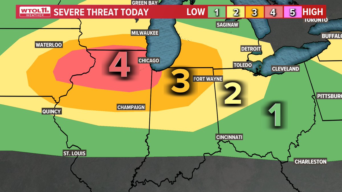
The Storm Prediction Center has issued a Level 4 risk for parts of Indiana, Illinois, Iowa and Wisconsin. Us in NW OH are under a Level 2 & 3 risk. Timing for storms will be 12AM to 5AM. More details coming up tonight at 5 on WTOL.
Another round of showers and thunderstorms will move in late tonight through daybreak Monday!
Severe weather is NOT expected, as the atmosphere is still pretty stable from the previous rounds of rain earlier. Hour-by-hour timing coming up at 10 and 11!
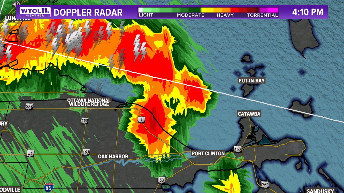
Heavy thunderstorm moving east toward Put-In-Bay!
Could clip Catawba as well. After this storm moves out, the Toledo metro will likely be dry for the rest of the evening.
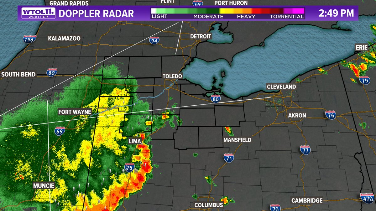
2:50 PM Radar Check
The strong storm risk will move southeast into central Ohio. A few garden variety showers are possible through the early evening, but severe weather is not likely for northwest Ohio.
Another round of rain and thunder will be possible late overnight.
A few strong to severe storms may impact locations southwest of Toledo. ⛈️
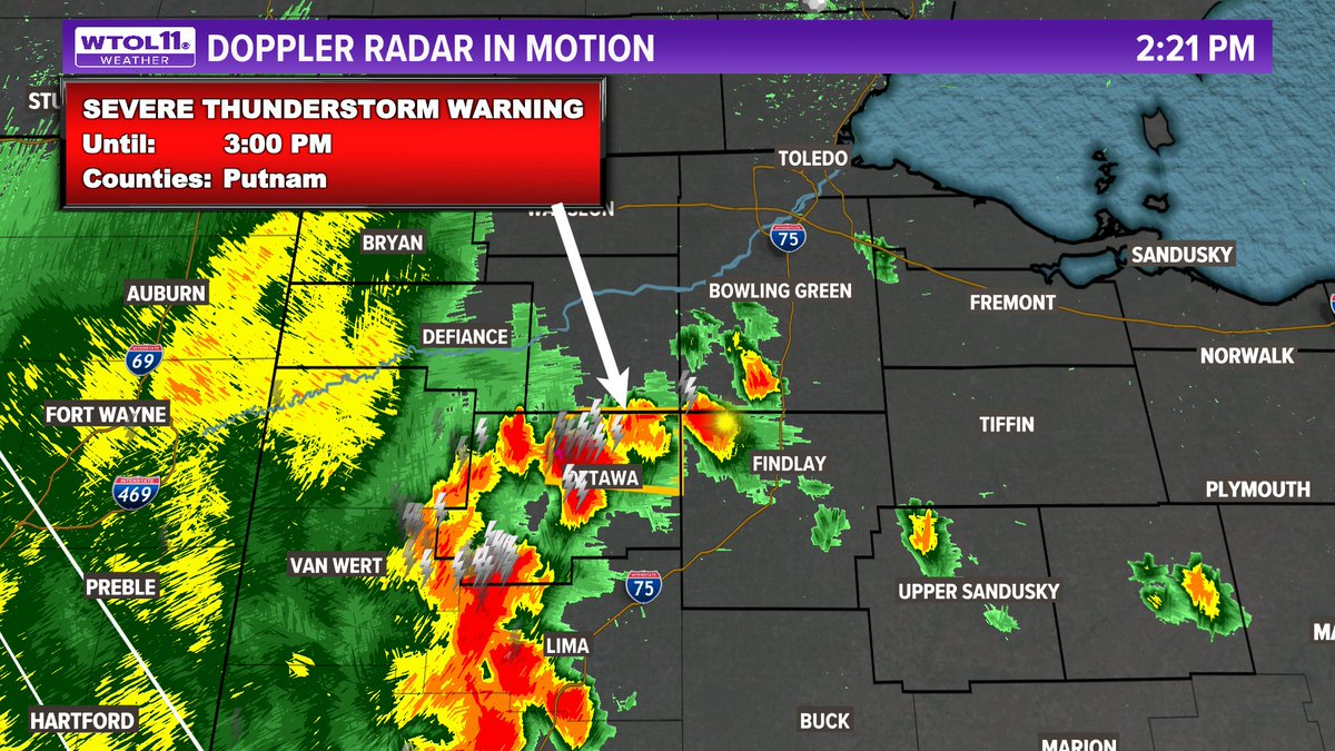
The overall severe risk will remain scattered with mostly just some downpours and rumbles of thunder, but a few strong winds may be possible, mainly along the line between Fort Wayne to Lima and south.
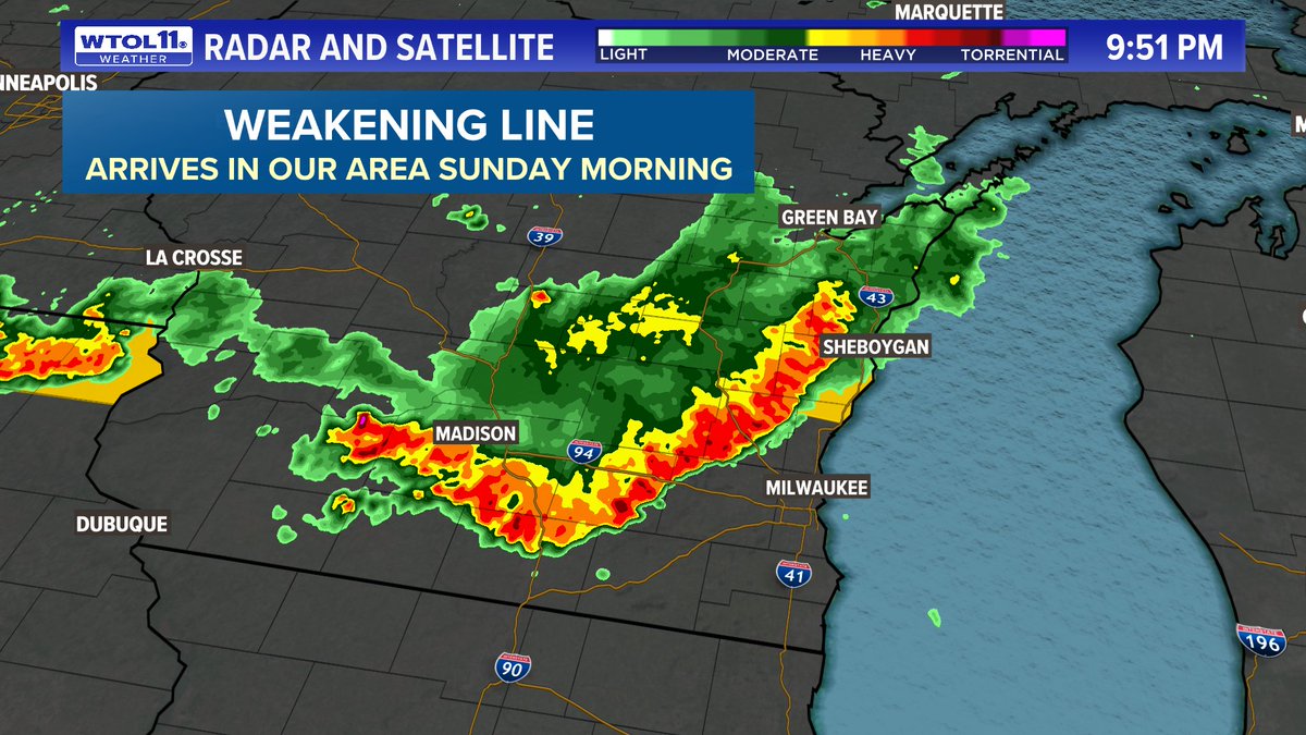
Our next rain chance will come from the remnants of this weakening line of storms near Milwaukee.
Latest data brings these showers to our area sometime Sunday morning. The overall severe weather risk is low, but a few gusty storms are possible. Forecast coming up at 11!
Tracking a couple rounds of showers and storms Sunday into Monday! ⛈️
Sunday, gusty storms are possible mainly from late morning through early afternoon. A few strong storms may be possible. Another round of rain and non-severe storms are expected after midnight. #WTOL11Weather
A strong cold front will bring a break from the heat and humidity mid to late week!
Seeing signs of a significant change in the weather pattern. Latest 10-day forecast LIVE on @WTOL11Toledo.
Beryl has travelled over 5,000 miles, impacting areas from the Caribbean to Canada!
Quite the voyage of all that tropical moisture. The impacts will clear out of our area tonight as some more normal summertime weather returns into the weekend.
Beryl's remnants have sparked a severe weather outbreak in central New York, including a Tornado Warning near Ithaca where I went to college!
It's not too often you get tropical moisture and intense wind shear in New England.
No weather worries here at home!
ALL CLEAR from severe weather for the night. Still some steady rain and a few rumbles of thunder southeast of the Maumee River, but nothing strong or severe.
Tornado Watch for southern Ohio has been cancelled!
Biggest concern overnight will be torrential rain, though the flood risk should be greatest west of Toledo.
Still can't rule out a couple stronger storms for northwest Ohio through 2 AM or so.
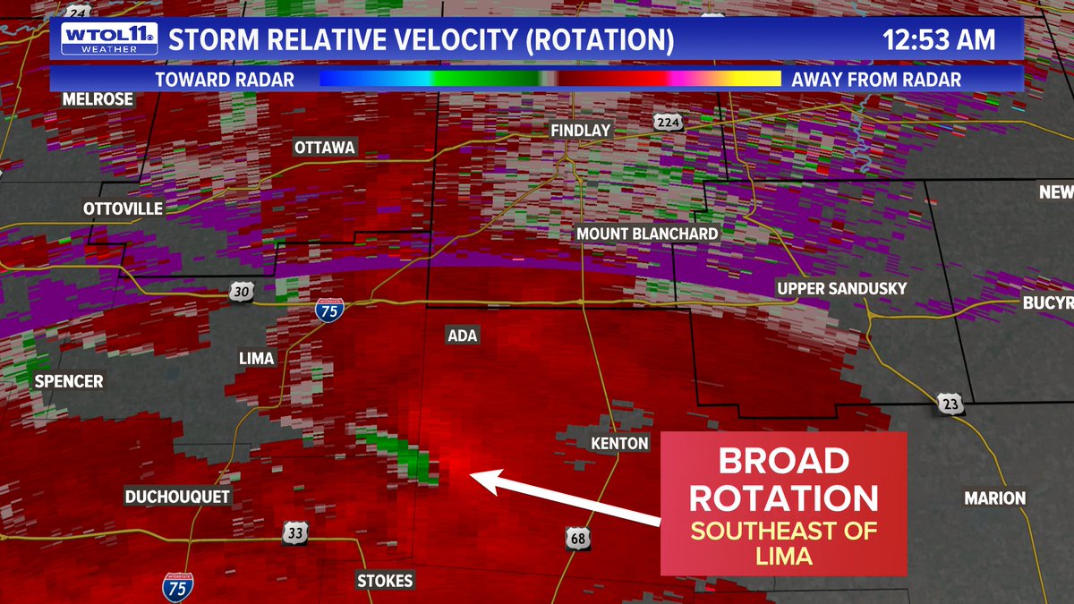
No active warnings, but watching an area of broad rotation in the atmosphere from Beryl's remnants to the southeast of Lima.
Tornado threat is low, and radar data isn't the best in this area. At the very least, this will bring some heavy rain to Hancock County!
Midnight radar check: Steady rain now moving into northwest Ohio with a few thunderstorms far south of Toledo.
Still looking at widespread 1-2" of rain overnight. Isolated strong storm threat diminishing.