@GoldyHappens The rare AZ team that can give up a 4th and 13 for the season, but still not rip your heart out. They deserve everything and more. Forks high.
🚨SHV ISSUES ALL-TIME HIGH TEMPERATURE STATEMENT🚨
As of 5PM today, Shreveport Regional has reached a high temperature of 110 degrees. This ties the all-time record high temperature for Shreveport set back on August 18th, 1909.
A Severe Thunderstorm Watch is in effect until 5 p.m. Saturday. Damaging wind gusts and large hail are possible with a cluster of ongoing storms. Additional storms are possible late this afternoon into tonight. Forecast: https://t.co/jFi1XTh6wV
A Flash Flood Warning in effect until 10:45 a.m. for Hempstead and Howard counties Arkansas. Storms have dropped about 1 to 2 inches of rain, with more falling at the moment. Radar: https://t.co/lBRWMIeJR0
Here’s why we are stressing to not cross flooded roads. Think if this was still underwater where you couldn’t see it. Precinct and highway crews along with first responders are working on barricading the many roads flooded and damaged from the weather this morning.
It has been a flooded morning commute in east Texas and Louisiana, including the Shreveport/Bossier metro. A Flood Watch remains in effect through 1 p.m.
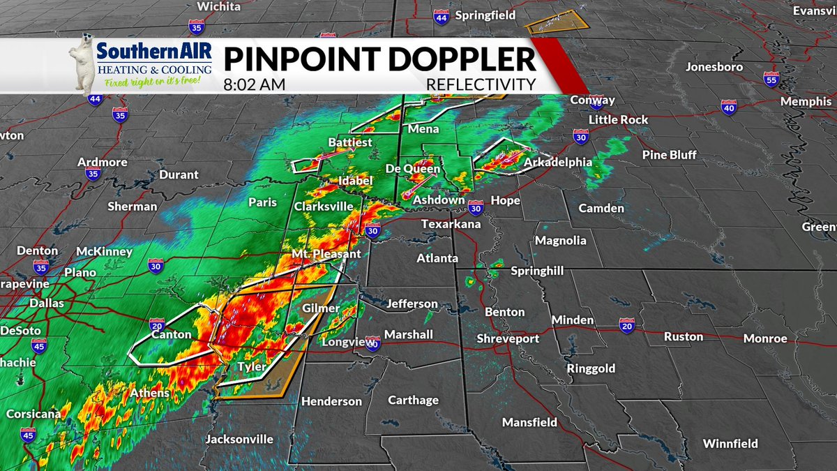
8 a.m. radar update: Strong thunderstorms are moving across the northern ArkLaTex where a Tornado Watch is in effect until noon. Damaging wind and hail will be possible as well. Forecast: https://t.co/sNxWB1jBfK
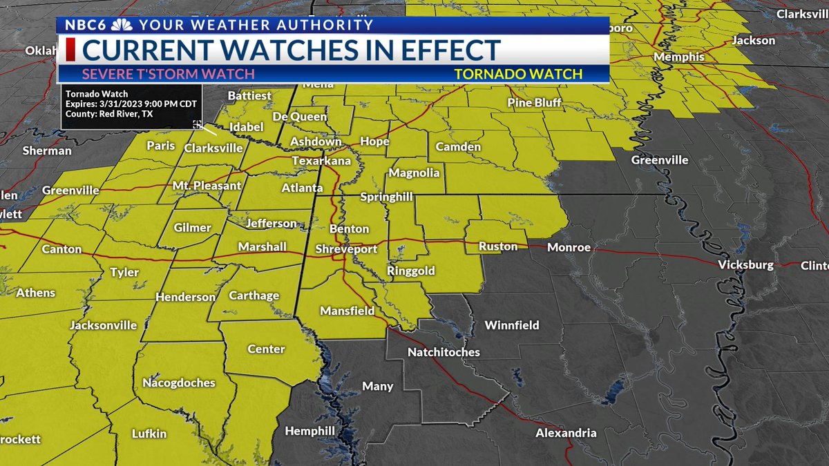
Tornado Watch in effect through this evening. Storms already ongoing near I-30. Next round of storms now developing between Dallas and Shreveport and these will be the storms that impact most of the ArkLaTex.
The entire ArkLaTex is under a Tornado Watch until 7 p.m. In addition to a few tornadoes, thunderstorms will also be capable of large hail, and damaging wind gusts.
Severe thunderstorms may return as soon as this afternoon, with a likely push of severe storms coming in between 6 p.m. and 3 a.m. tonight. Damaging wind, large hail, and a few tornadoes possible. Forecast: https://t.co/qy0vzj90LS
It's relentless. After a cool Tuesday, and warmer Wednesday, severe storms are possible Thursday afternoon into Thursday night. This slow-moving cold front will also drop some heavy rain. Forecast: https://t.co/2dK36NfWX4
A SEVERE THUNDERSTORM WATCH is in effect until 3 a.m. for Bowie and McCurtain counties, as well as all of SW Arkansas. Storms will be capable of very large hail up to golf ball or baseball sized tonight. https://t.co/R6iyZtJtJF
I-20 from east Texas into Louisiana is dealing with some dense fog this morning. Spring pattern continues with on and off rainfall through Thursday night. Forecast: https://t.co/ZM0XsJeCZX