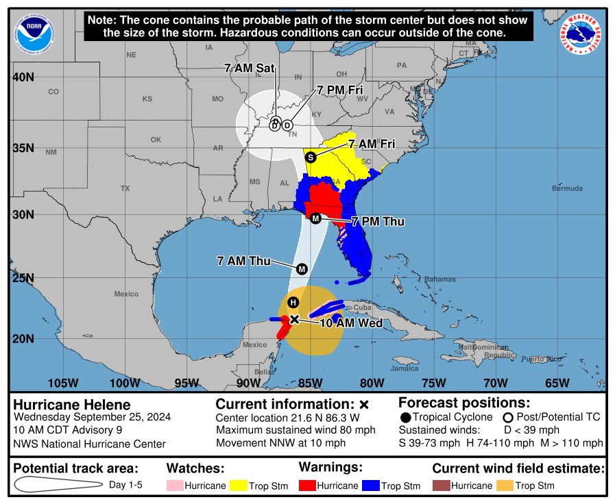
HELENE will be a MAJOR impact well inland. Georgia, the western Carolina's, Tennessee and Kentucky! This is actually a rare meteorological setup for this side of the world. This is called the "Fujiwara Effect" -- notice how major hurricane Helene gets boomeranged NW and around a low pressure aloft over west TN. Think like two planets orbiting each other than consolidating into one. This complicated, and uncommon meteorological process will help keep the forward speed of the remnants very high. Destructive wind gusts throughout central Georgia, Atlanta area and east TN.
This won't be like Ike remnants in 2008 in TN/KY but I think will surprise many with the inland wind gusts Friday well inland. I could see 50-60 MPH gusts all the way to the Ohio River solely due to this complex meteorological phasing.
Most times, a hurricane this time of the year goes NE, not hooks a hard NW (left) turn when inland. Really, a rare occurrence.
Here's a little crop of what my telescope is looking at right now, pointed towards the core of our galaxy.
So. Many. Stars.
How many of them have worlds just like Earth? No way we're alone.
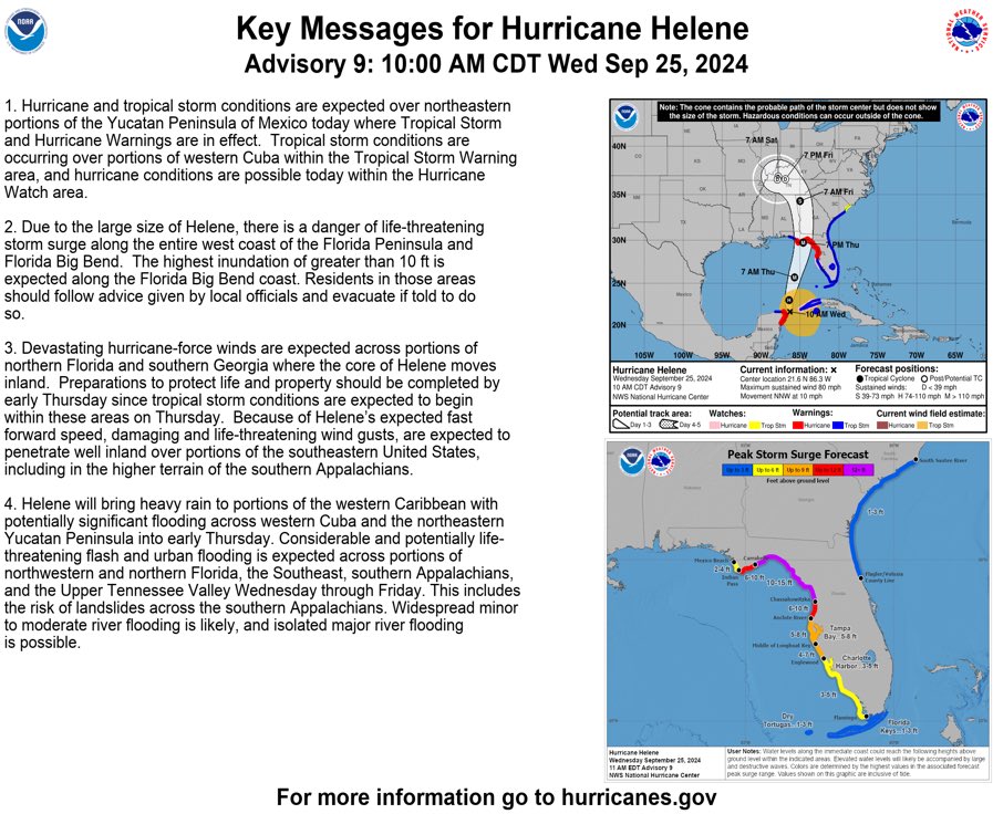
It cannot be understated the threat #helene poses across the southeastern United States just based on current intensity projections. There doesn’t appear to be any wiggle room on the downside either. This will be a historic storm for many including southern Appalachia with flooding and wind damage. Pray I’m wrong, I want to be. Be safe all and protect your families and property as best you can.
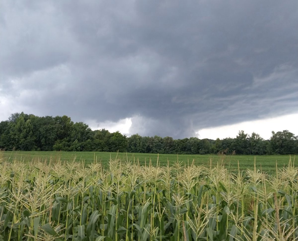
Blatant rotation & lowering on the supercell that just moved over Rochester. Thanks to Dewayne Mckinney for the photo looking west from Provo. #kywx@NWSLouisville