Summary - 2026 NAM outlook: potentially hot & dry thru early August ➡️ increased heavy rain & flash flood potential late Aug. thru Sep. Not a typical monsoon season. I'd like to hear others' thoughts! #nmwx#azwx
Look for heat stress and intensifying drought across New Mexico July through early August. Areas along/east of the central mountain chain may be an outlier at times; slightly greater risk for moisture surges & flash flooding - esp. on/near HPCC & Ruidoso burn scars. #nmwx
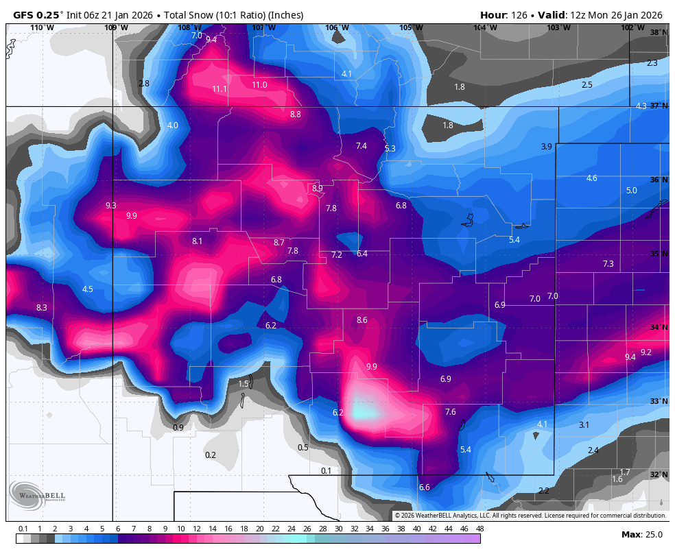
For skiers/riders this is mainly a SW flow storm, w/ a shift to W-NW flow occurring from N-S late Sat afternoon thru Sun morning. Generally speak, 1-2 ft of low density/fluffy snow is possible.👇are ~ridge level winds & hourly EC snowfall for general visualization purposes. #NMwx
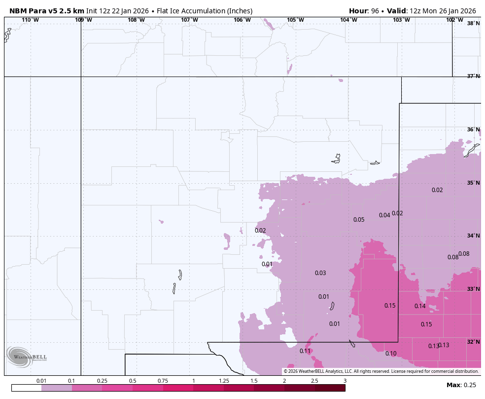
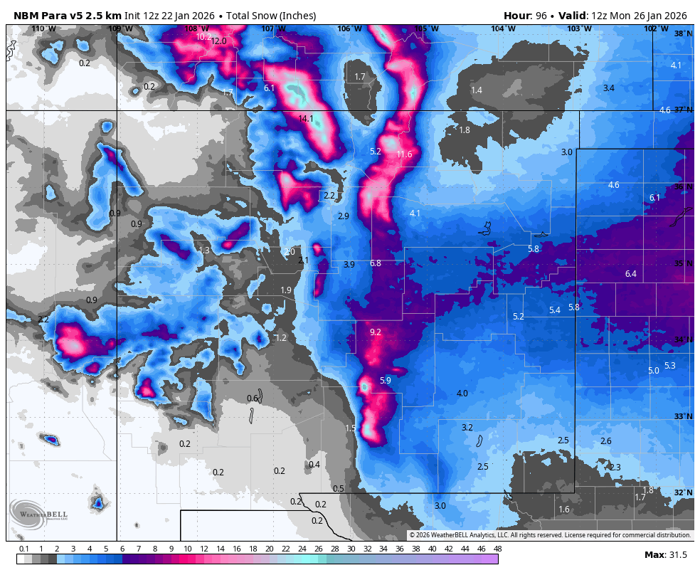
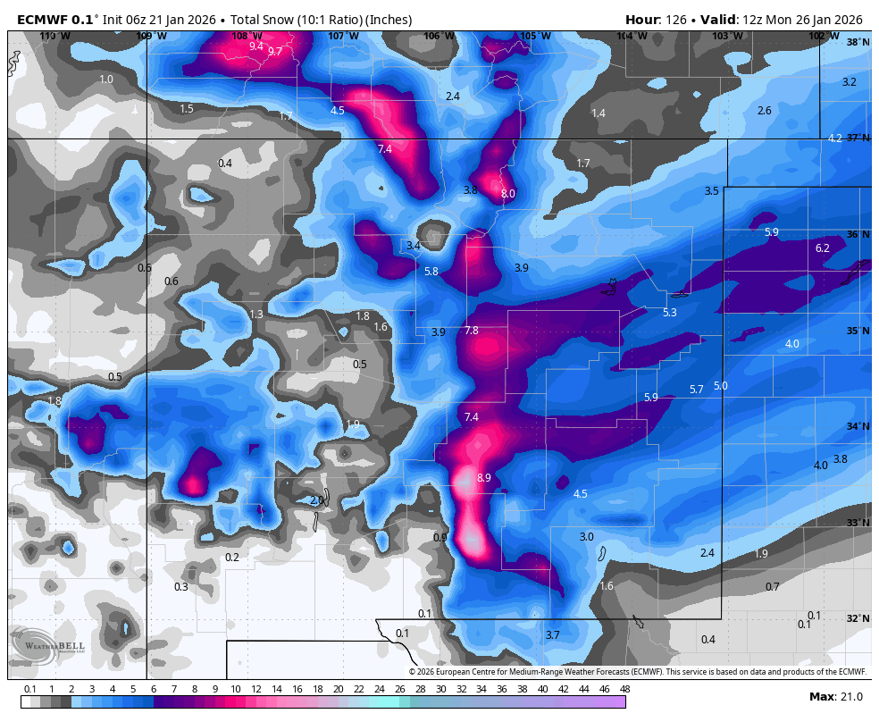
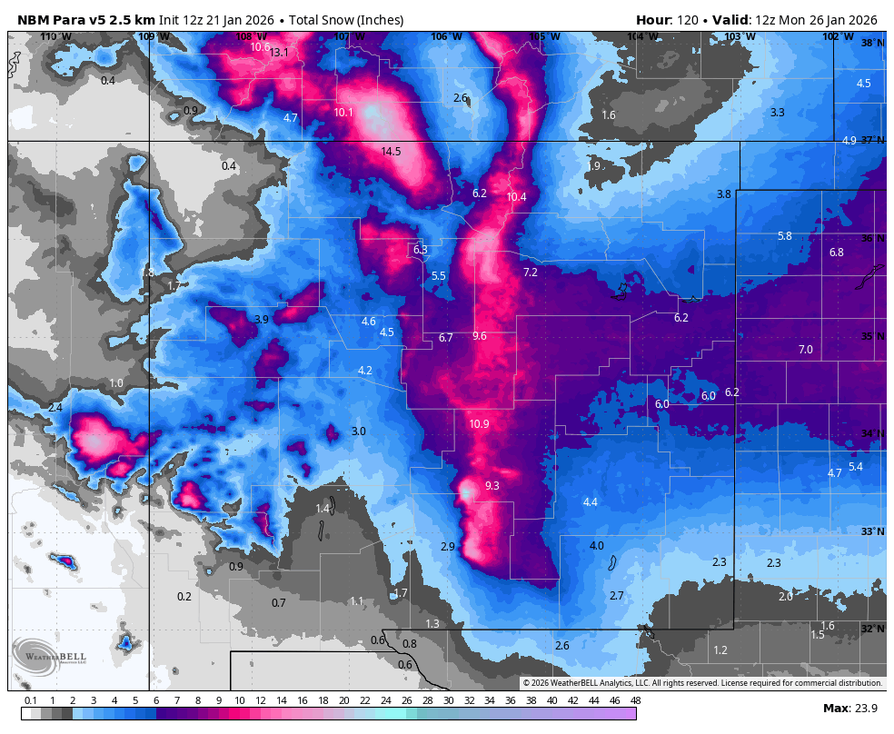
Winter storm is on track for NM Fri-Sun. Winter driving conditions develop across the mtns Fri afternoon/evening, into N half of NM Fri night, & then C & S NM Sat. Improvement from N to S late Saturday night through Sunday morning. Greatest impacts along/E of C mtn chain #NMwx
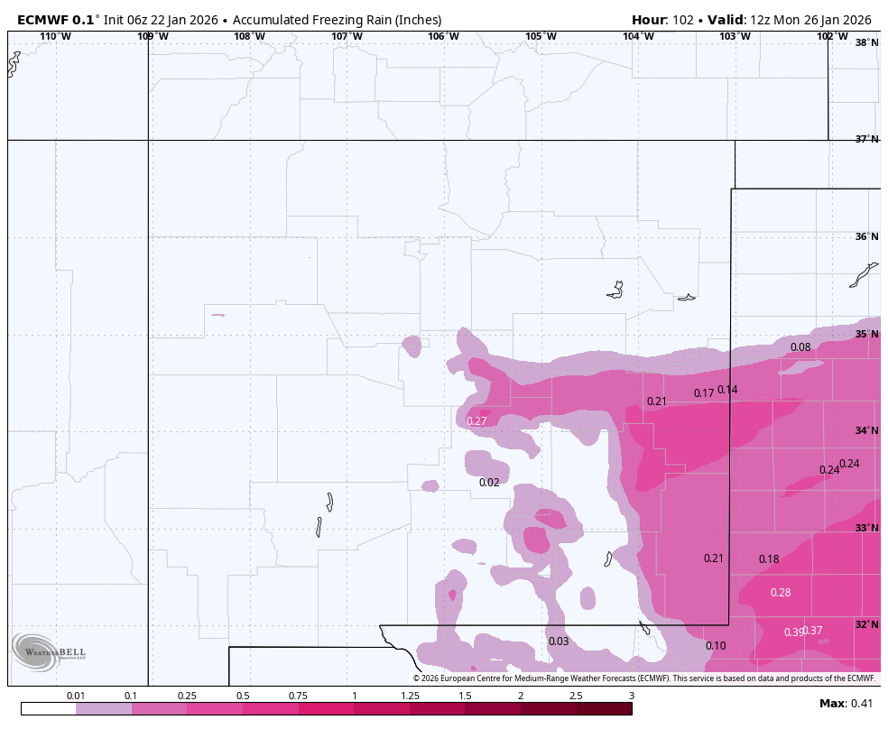
Winter/travel impacts begin across NM from SW-NE Fri/Fri night, likely peaking Sat/Sat night, & then wane Sun. Below are NBM v5 & 6Z ECMWF/GFS snowfall (10:1 ratio) thru 5am Mon. Snow ratios will largely be ≥ 10:1. Specific details become clearer over the next 48 hours #NMwx
Confidence continues to grow for the potential of a significant winter storm across portions of NM Friday thru the weekend. A cutoff low, subtropical moisture, & jet stream merge w/ polar jet stream/wave pattern. Backdoor cold front moves into E NM by Fri & C NM Sat. #NMwx
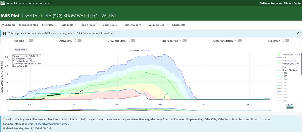
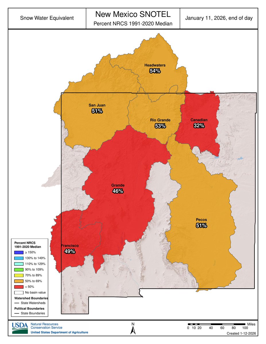
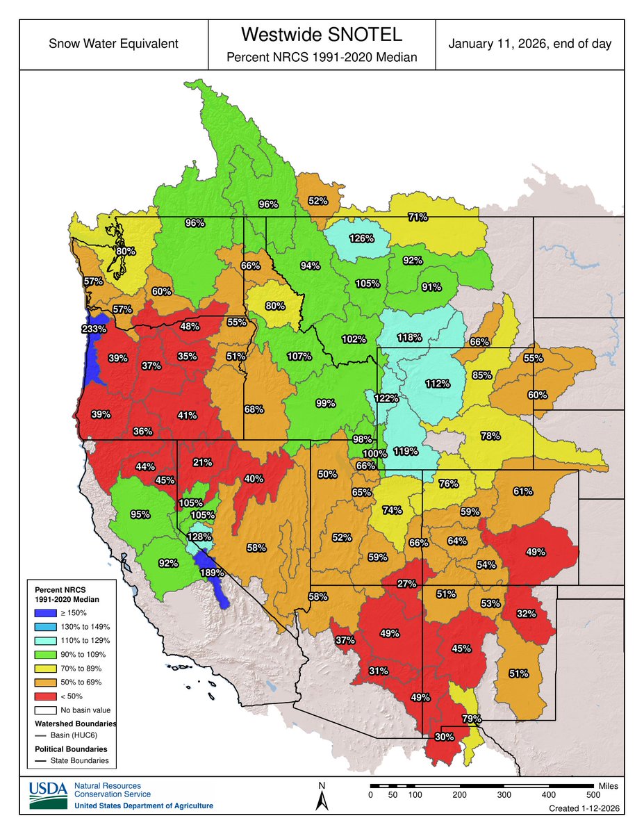
How does the snowpack or snow water equivalent (SWE) across the western U.S. & NM look? Overall well below average across NM & the Rio Grande/Pecos basins. However, Santa Fe SNOTEL is at 84% of median (5.2” SWE), but Taos Powderhorn is only at 51% of median (4.4” SWE) #NMwx
Another extended period of quiet wx for 7-10+ days for NM. Signals hinting more “active” wx may develop for the Desert SW near/after Jan 22-24🤞as PACNW ridge possibly retrogrades towards the Gulf of AK around/after the 18-19th - of course confidence is low @ that lead time #NMwx
WNW-NW winds start cranking Thu/Thu night across the higher peaks/east slopes of the Sangre de Cristos & continue Fri, while spreading into the eastern plains Fri #nmwx
A storm will move thru the Desert SW Wed/Thu & exit NM Fri afternoon/evening. The most widespread light valley rain & high mtn snow impacts western NM Thu morning w/ little to no precip east of the central mtn chain through Fri. #nmwx
Snow levels start ~10000’ Thu & fall to ~7500’ Fri A.M. w/ ~0.5-3” of snow for the peaks of N NM. Moisture largely resides below the snow growth zone; efficient rime production - w/ rimed snow & maybe some freezing drizzle mixing in over the higher terrain Thu-Fri morning #nmwx