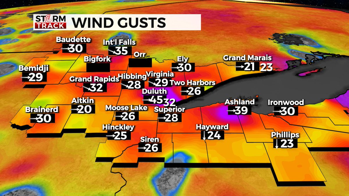
GUSTY WINDS WATCH: As of 3:45 pm gusts have exceeded 40 mph in Duluth. The good news is you will notice a considerable weakening of winds in the next 3 hours. See https://t.co/hCUgwM9hCJ for your complete forecast.
SEEING SNOW! We're seeing some snow pop up on the radar this afternoon. More snow is possible in the Northland tonight. @Chief Meteorologist Justin Liles will have more at 5,6, and 10pm.
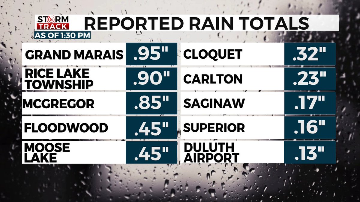
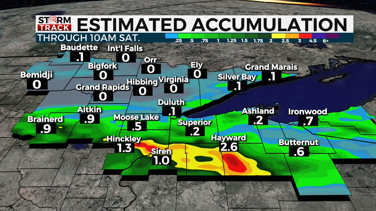
STORM ALERT DAYS: Isolated to strong thunderstorms are likely from tonight and lasting through the weekend. The biggest threat for localized flooding will the south of HWY 210 Friday night into Saturday.
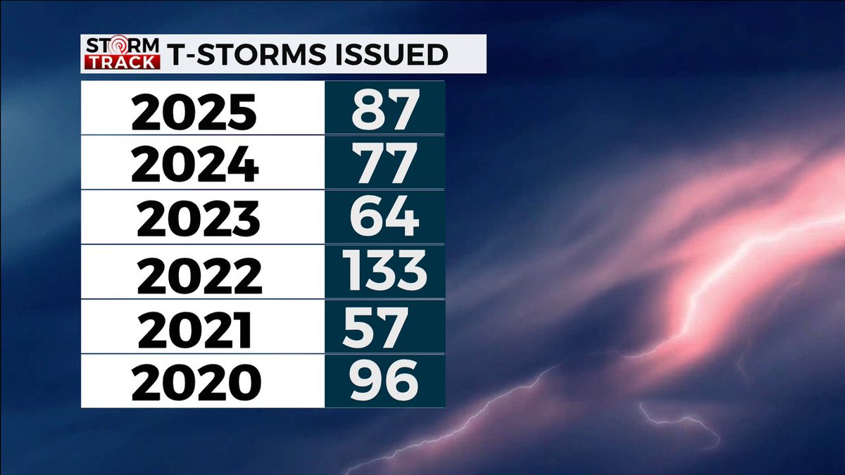
INTERESTING! With strong thunderstorms approaching by Friday, the National Weather Service has issued a total of 87 severe thunderstorm warnings this year as of today.
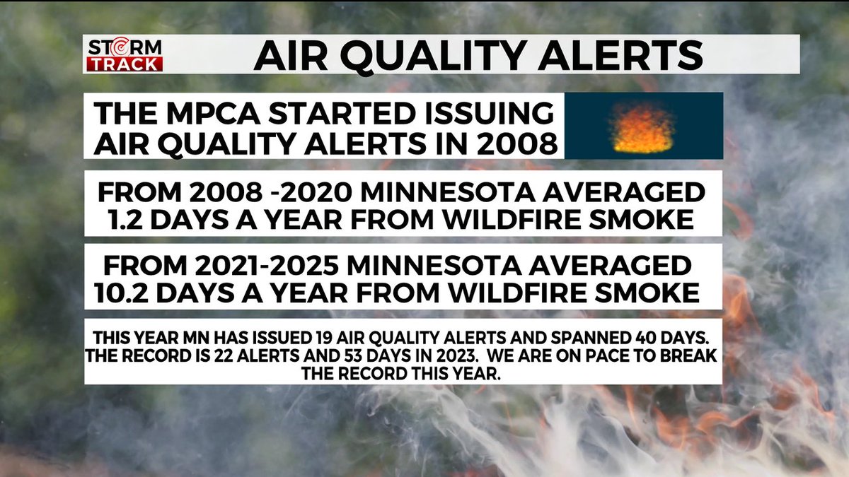
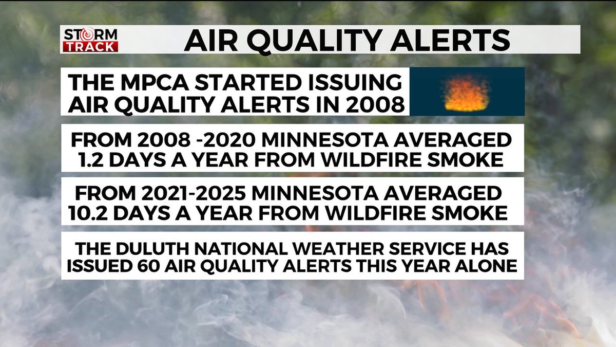
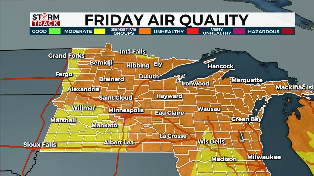
SKYLINE SMOTHERED: WILDFIRE SMOKE BLANKETS THE REGION
Air quality for the entire region will continue to deteriorate as we head into Wednesday. Over 15-million acres are currently burning in Canada.
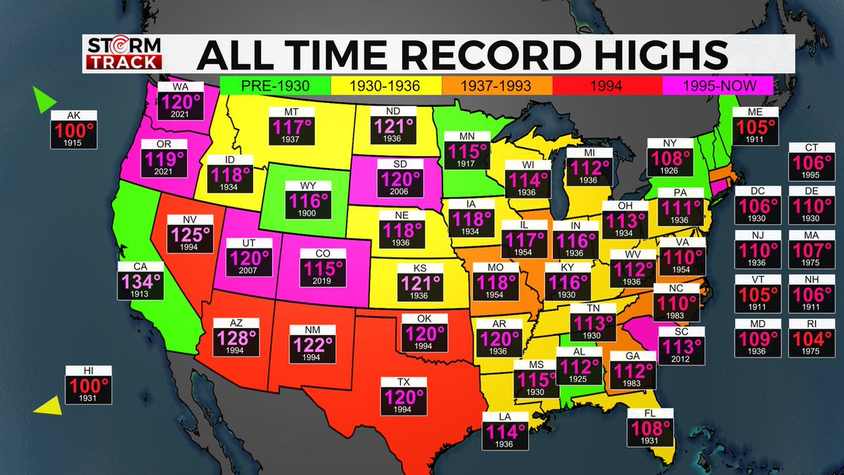
DO YOU WANT TO KNOW YOUR STATES ALL TIME RECORD HIGH? Minnesota (Beardsley, MN 115° July 29th, 1917), Wisconsin (Wisconsin Dells 114° July 13th, 1936), and Michigan (Mio, MI 112° July 13th, 1936).
POOR AIR QUALITY CONTINUES FRIDAY. Talk about our weather being caught between a rock and hard place. It should read "Weather in the Northland is like being caught between a swamp and ashtray."
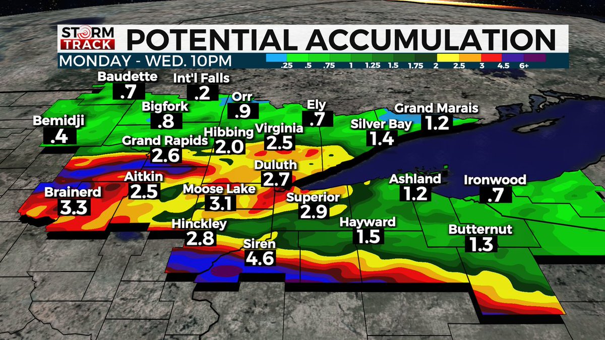
STORM TRACK WEATHER ALERT! As of 3:30pm Monday afternoon heavy rain leading to flooding through Wednesday could become a major issue. Amounts and locations can change so stay tuned for future developments at https://t.co/hCUgwM9hCJ