Good evening @trovefinance please I need explanation on how my withdrawal is showing null and I haven't been refunded neither was I paid into my bank account. Thank you
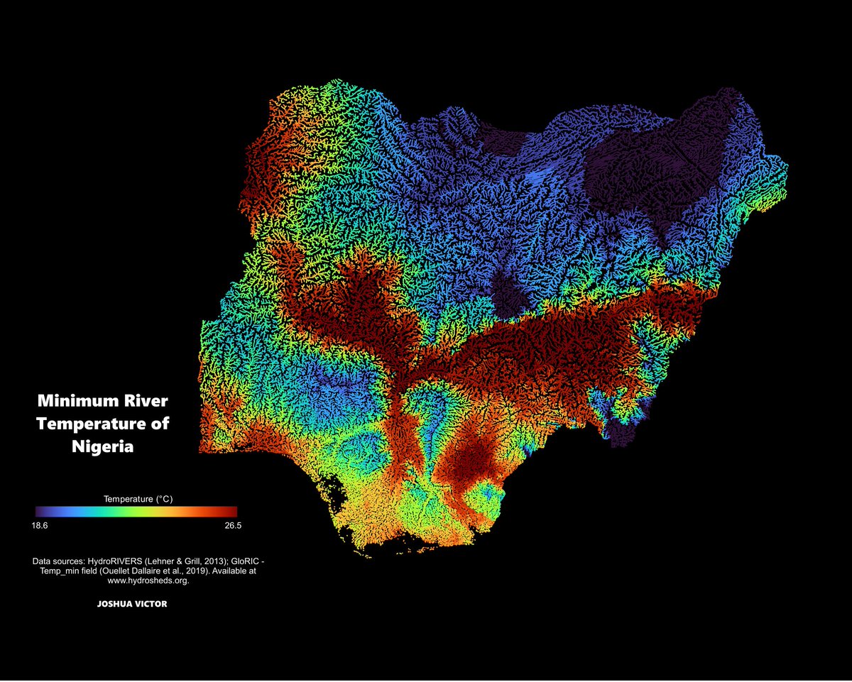
Global datasets often assign 0⁰C to Coastal/delta zones where data is missing. Because Nigeria's rivers don't freeze, I used a definition query (Temp_min>0) to wipe out those rogue pixels. This revealed the true minimum inland water floor: a realistic 18.6⁰C
The river networks were mapped using HydroRIVERS (Lehner & Grill), while the water temperature attributes were derived from the global GloRIC database.
I'm excited to introduce GeoLibre, a lightweight, cloud-native desktop GIS built with MapLibre GL JS and Tauri.
GeoLibre is designed for modern geospatial workflows, combining the flexibility of web technologies with the performance of a native desktop application. The current prototype includes a MapLibre-powered map workspace, local vector data import, project persistence, and built-in plugins for basemaps, layer control, swipe, street view, lidar, GeoAgent, and GeoEditor integrations.
GeoLibre can run directly in a web browser or as a standalone cross-platform desktop application (<30 MB).
GitHub: https://t.co/VXq8c1o2Nd
Website: https://t.co/7VA2AQoCUc
Live demo: https://t.co/Cq5Mg3ojNQ
Feedback, ideas, and contributions are welcome.
#GeoLibre #GIS #Geospatial #MapLibre #OpenSource #CloudNative
Two crucial steps when getting into a Geospatial career
1. Understand the Basics of GIS
- What is GIS?
- How does it work?
- Learn about spatial data (vector vs. raster)
- Explore real-world GIS applications
2. Learn GIS Software & Tools
- Start with a GIS software - QGIS or ArcGIS
- Master data visualization & mapping techniques
- Work with attribute tables, symbology and labeling
- Learn about geoprocessing tools and spatial analysis
Access over 66 recorded topics and sessions on GIS and QGIS at https://t.co/hWP7YKD4oL