⚠️ Heads up, yinz. Saturday night could get rough across eastern Ohio and western Pennsylvania.
If you're anywhere from Youngstown to New Castle, Pittsburgh, Washington, Wheeling, or Erie, now's the time to pay attention. Damaging wind looks like the primary threat as storms organize into a line Saturday evening and race east after sunset. Don't wait until they're knocking on your door, make sure you've got a way to get warnings before heading to bed.
you guys are one of the best weather apps out there and I don't say that about many apps as I am very picky about my weather. put it this way, theres one other app I know that can compare with what you guys offer and that's wxl23 all in one app.
Did you know?
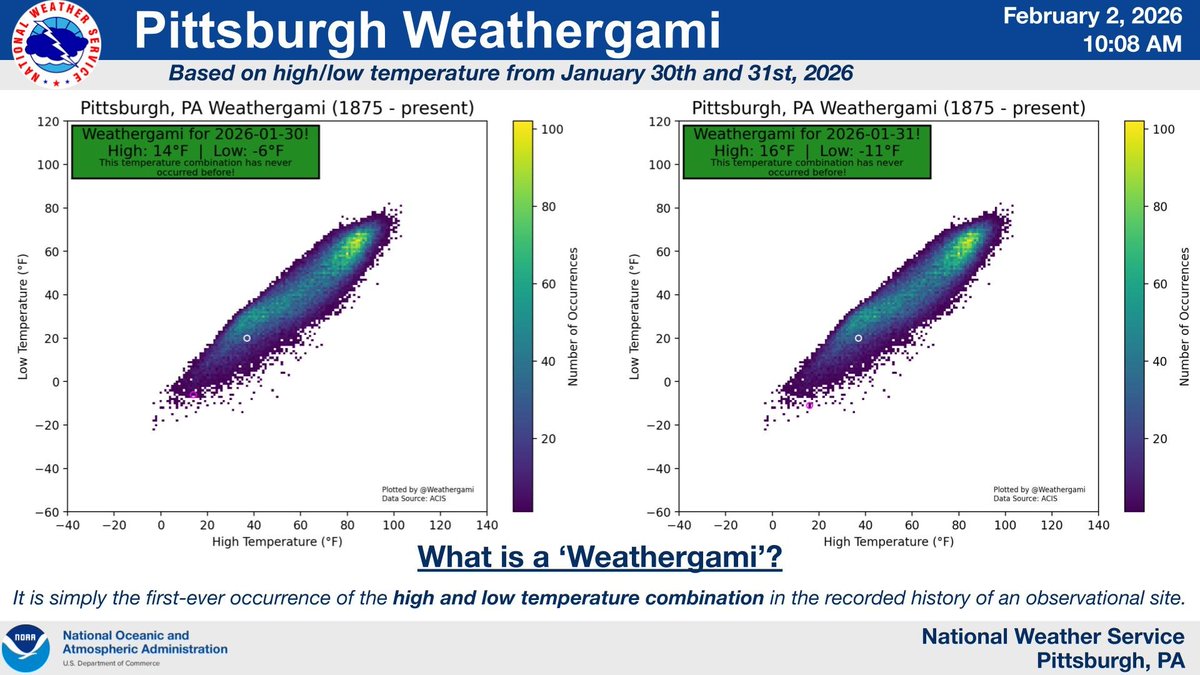
The Pittsburgh International Airport scored a 'Weathergami' on January 30th and 31st, 2026! What is a Weathergami, you ask? It is a fun title given when a high-low temperature combination occurs that has never been observed in a site's observational history.
@KC3CDU@PITairport from the airport even? what? come on... NWS Pittsburgh is much more precise than this... I am sure this is meant as a joke though but still... with all the fluff already online about totals and such, this to me just seems unnecessary.
@HarrisInkwell its not twitter anymore, I mean like even after the name change to me I still call it twitter but when I said its not twitter I mean its not like the same thing like it use to be.
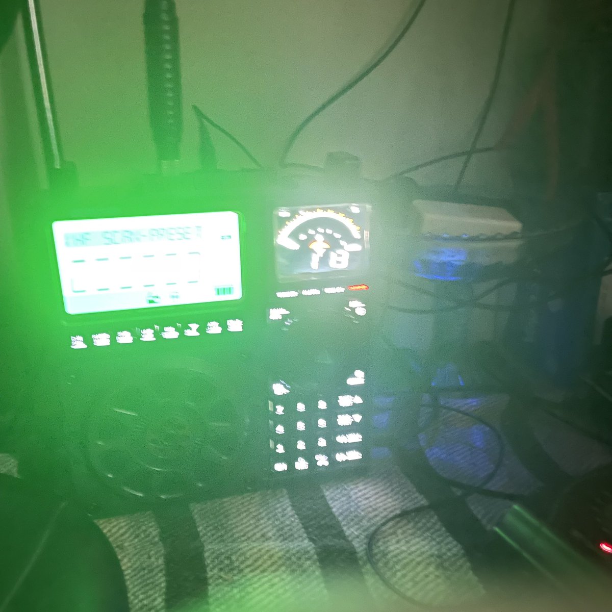
thought I would share, I am more active on threads, same username but heres my favorite radio. love this thing, do so much listening on this thing all from my little spot in Pennsylvania.
For I am persuaded that neither death nor life, nor angels nor principalities nor powers, nor things present nor things to come, nor height nor depth, nor any other created thing, shall be able to separate us from the love of God which is in Christ Jesus our Lord.
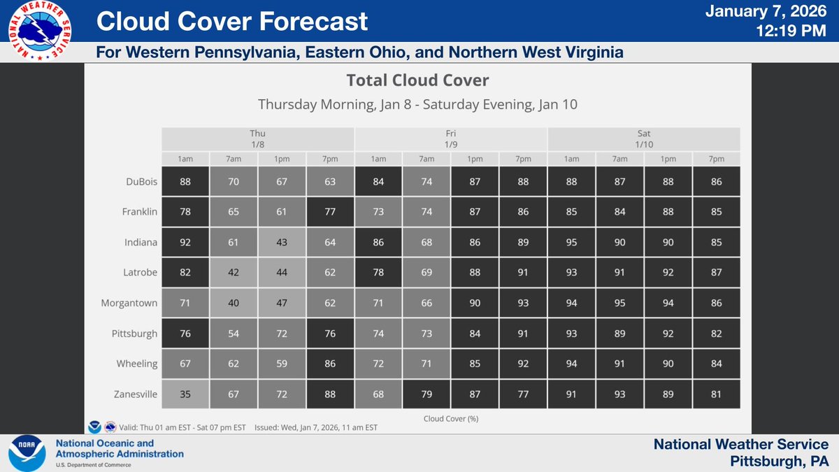
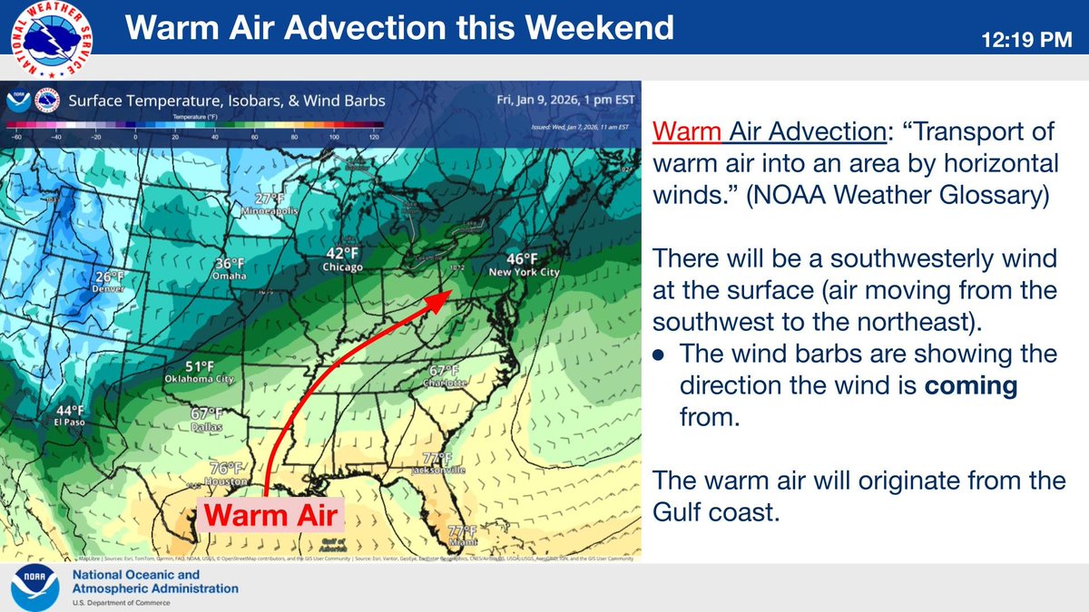
From Thurs-Sat, highs will be in the upper 50s/lower 60s for most of the region. How will temps get this warm? Not through sunshine. Overcast skies are expected through parts of tomorrow as well as all day Fri./Sat. The main driver for this change will be warm air advection.
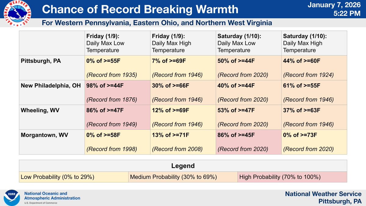
Anomalously warm temperatures Friday and Saturday will allow a chance to break some long-standing daily temperature records across the area. See below for more details:
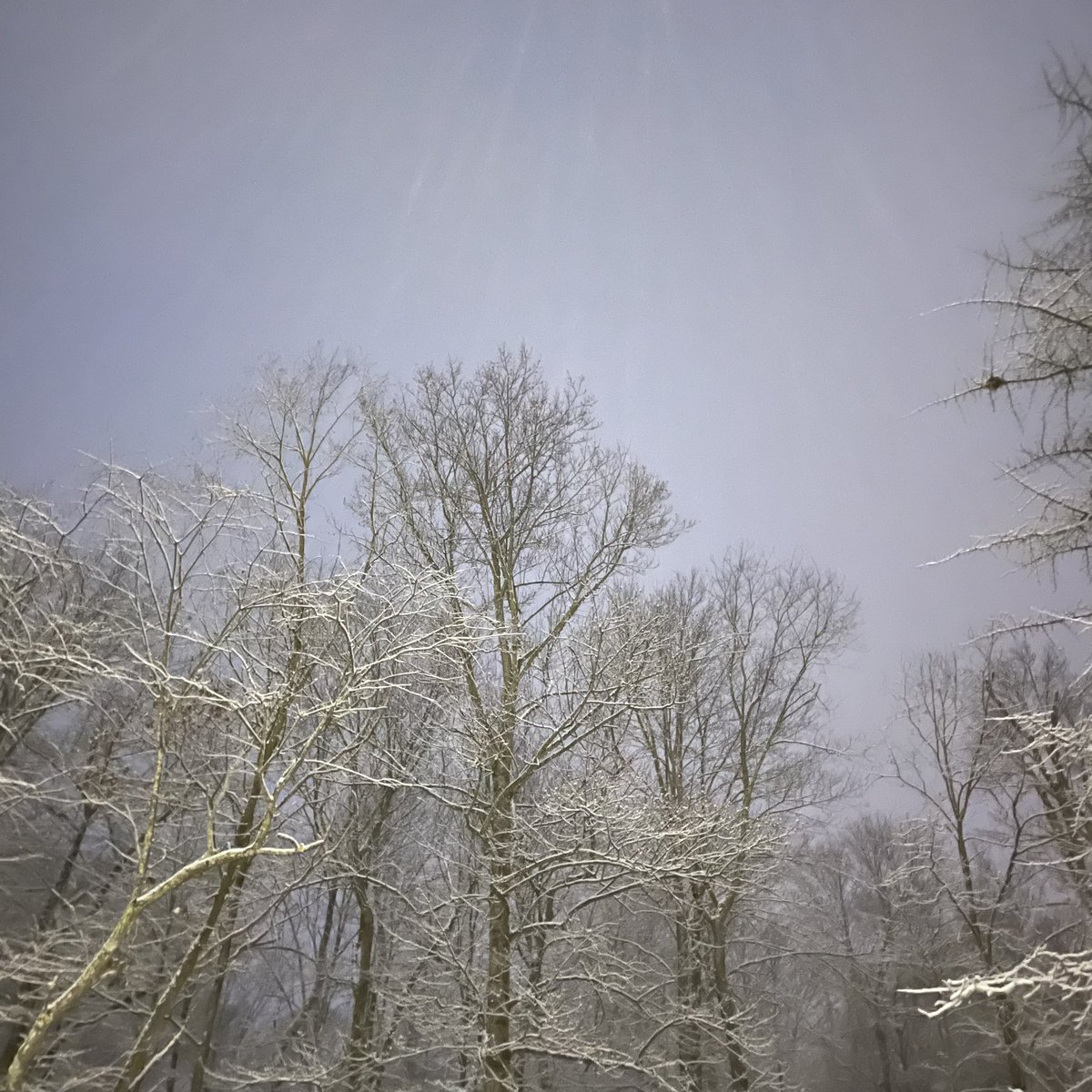
@NWSPittsburgh filed this with cocorahs pa-wt-18 this morning. 7.0 inches but thought you would like to see a photo, 8:27 AM this morning December 14 2025.
@WxFront what would be nice is if somethings behind a paywall that you would have a little thing come up each time you click it rather than just once, that way your not just sitting there. I am blind and a skywarn spotter and mping and cocorahs, is there a way you could streamline that?
@WxFront hey, I got your weatherfront app, I am a skywarn and cocorahs and mping observer. I am not paying for the subscription, but that brings me to my question, why are publically available models and their products behind a paywall?
if twitter is your only platform you can reach out to me here also and I will respond, however I will not switch to any platform unless I already use it... have a blessed day.
for those of you who have followed me, if any of you want to follow me on a place where I am active that would be threads, same username. twitter is generally used for information purposes these days.