KIMT Storm Alert Weather 3 provides the latest forecast + weather updates for southeast Minnesota and North Iowa. Follow the team: @SaraKnoxWX @HunterDonahoeWX
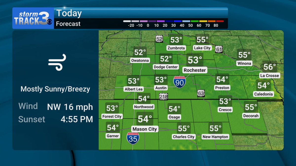
❄️ Much cooler Wednesday with highs in the low to mid 50s. Breezy NW winds will wane into the afternoon. Winter returns this weekend with highs dropping to the freezing mark by Sunday. Still tracking potential snow Saturday #mnwx#iawx
🐪 Happy Hump Day! 🐪
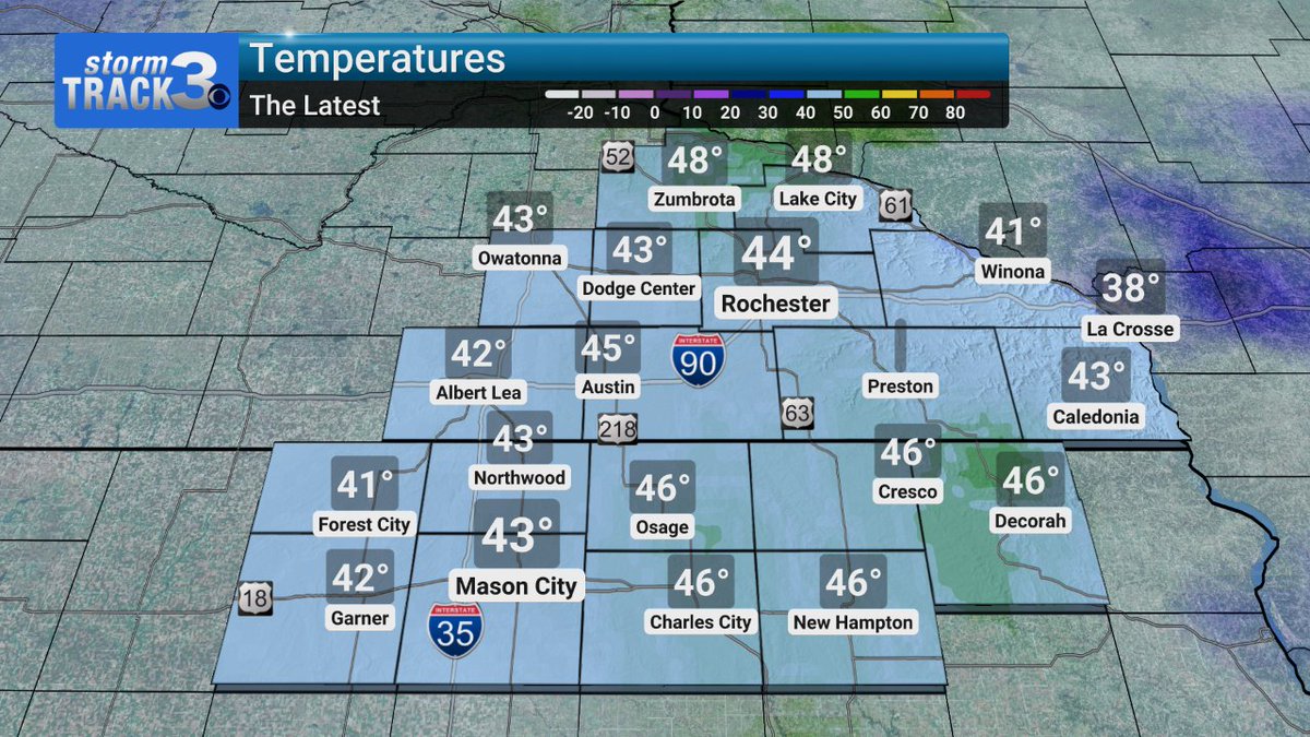
5 AM - A breezy start to the day with sustained NW winds of 15-25 MPH. Wind chills are holding in the mid 30s for some, so an extra layer is needed. Much cooler today with highs in the low to mid 50s #mnwx#iawx
🇺🇸 Perfect weather for Election Day!
🌬 Remaining breezy through end of week
☃ Tracking the potential for measurable snow Saturday
#mnwx#iawx https://t.co/a9Mai4tQWw
🌡️ You couldn't ask for a better forecast for Election Day! Highs set for the low 60s with plenty of sunshine and breezy south winds. A massive cooldown is coming through the weekend with the potential for snow #mnwx#iawx
😎 Happy Tuesday! 😎
5 AM - We are starting off on a chilly note, but with breezy south winds and plenty of sunshine will launch us into the 60s! You couldn't ask for a better forecast for Election Day! #mnwx#iawx
🌬️ Beautiful weather to start out the work week with highs in the mid to upper 50s. Breezy westerly winds will bring a slight chill, but a sun-filled sky will help us stay relatively warm. Colder weather is on the way this weekend #mnwx#iawx
☀ Happy Monday! ☀
5 AM - Chilly, but well above average, start to Monday. NW breezes are keeping wind chills in the 30s. We will remain breezy today with highs in the mid to upper 50s under a sunny sky #mnwx#iawx