A HEAT ADVISORY will be in effect Saturday from 1PM to 7PM as it will feel like 100+ degrees in many parts of SD. Limit outdoor activity & drink plenty of water... both you AND your pets! #sdwx#heat#pets#firstalert
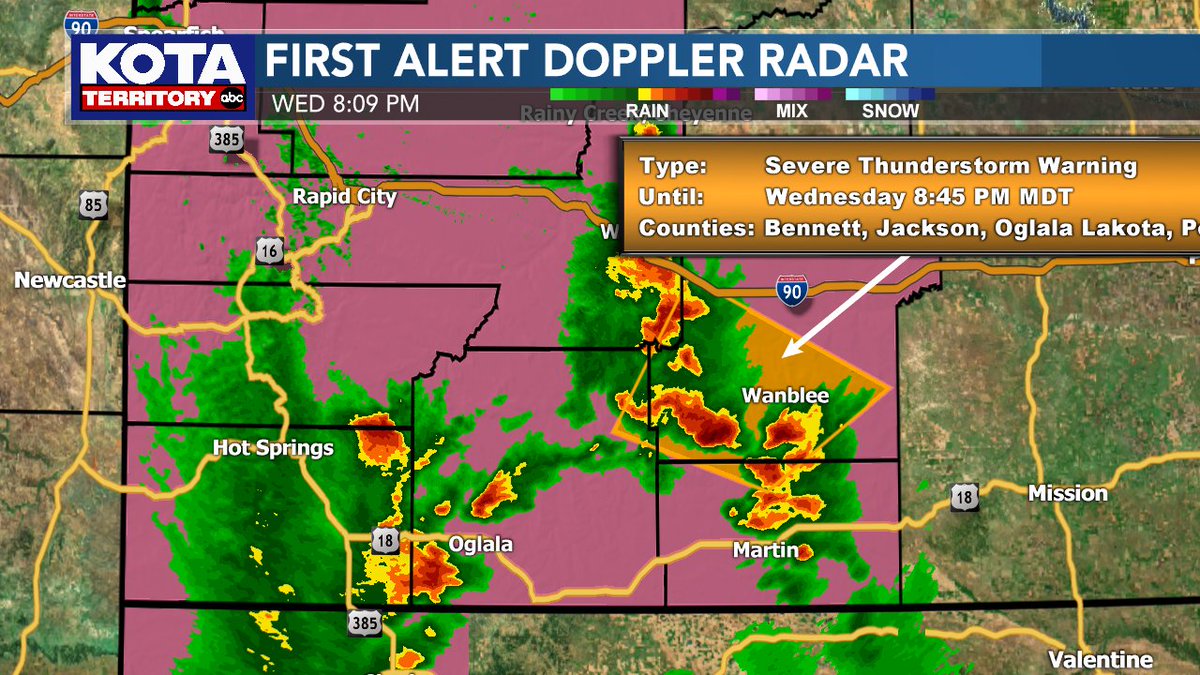
Strongest storms are moving into Jackson and Bennett counties. Doppler radar indicates 1" hail and 60 mph wind gusts with these storms. Seek shelter in these areas until the storm passes.
Meteorologist Mike Modrick
No severe weather for the rest of the night, and the last of the showers moving thru now, ending after midnight. Scattered showers will pop up again Tuesday and winds will top 25 mph in the afternoon. Dry Wednesday, then more showers develop Thursday.
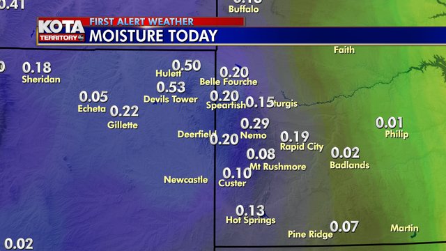
Only .01" of rain in downtown Rapid City so far, but the next round of rain is moving thru right now. Doppler radar estimates show some areas with over 1" today. Lingering showers will end after midnight, more popping up Tuesday.
A Severe Thunderstorm Warning continues in northeast WY until 7:45pm. Doppler radar indicates a storm with 60mph winds and 1" hail south of Sundance, moving southeast at 35mph. Additional storms could develop through the evening.
A Severe Thunderstorm Warning is in effect for parts of Crook and Butte Counties until 5pm. Doppler radar indicates a storm with 60mph winds and 1" hail near Belle Fourche, moving east at 15mph. Additional storms could develop through the evening.
Craig Bernie sent in this drone photo of Sunday's storms. Interesting views of storms this year!
We're giving away a Severe Weather Alert Radio from Chris Supply every day this week on the 5:30pm and 10pm news! Quiz question live on Good Morning KOTA Territory and our Noon News!
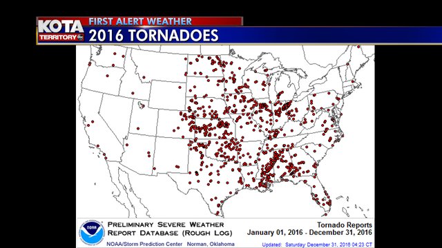
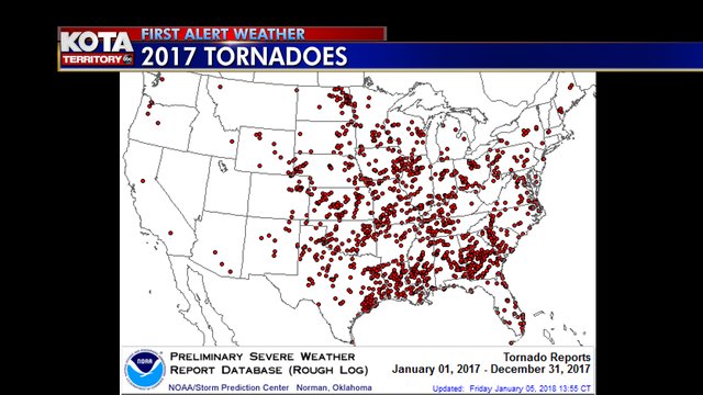
Talking severe weather all week, and we are very lucky in our part of the country. We see very few tornadoes compared to the rest of the plains and the southern states. These maps show all the tornadoes in 2016 and 2017, just a handful of rather brief and weak tornadoes for us.
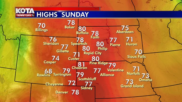
Summertime Sunday is still on track! What will you do with the warmest weekend of 2018? Biking? Hiking? Gardening? Nothing? Inquiring meteorologists want to know!
Get ready for the warmest weekend of 2018 (so far)! Probably not records, but we could be in the neighborhood Sunday as we push 80° for the first time!
Enjoy, and remember your sunscreen - it's been a LONG winter this Spring!
Snow was very light in most areas, but 6" in Weston, WY and 3.3" in Lead. Skies clear out tonight with chilly temperatures. Then big time warmth returns Wednesday and even bigger time warmth for the weekend.
The warmest weekend of the year (so far) is on the way!
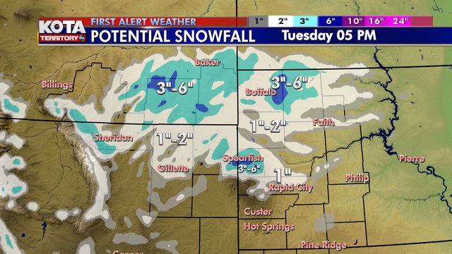
It was a nice afternoon rain, 0.19" in downtown Rapid City, a half inch at Devils Tower. Snow will mix in overnight, but very little in Rapid City, around a half inch that's likely to melt on most warm roads. The northern hills and plains could see 3"-6" of snow.
It was a nice afternoon rain, 0.19" in downtown Rapid City, a half inch at Devils Tower. Snow will mix in overnight, but very little in Rapid City, around a half inch that's likely to melt on most warm roads. The northern hills and plains could see 3"-6" of snow.
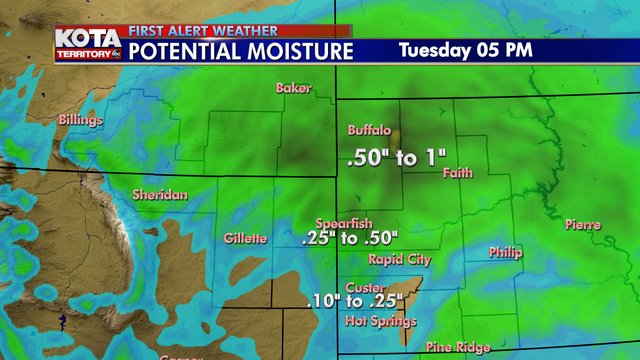
Great moisture potential tonight, mixing with snow overnight!
In Rapid City any snow will be minimal and tend to melt on the roads, with a quarter to half inch of liquid possible. The snow-rain mix continues Tuesday morning, then the sun peeks out late in the day.
Great moisture potential tonight, mixing with snow overnight!
In Rapid City any snow will be minimal and tend to melt on the roads, with a quarter to half inch of liquid possible. The snow-rain mix continues Tuesday morning, then the sun peeks out late in the day.
Rain will be very light this evening with just a touch of snow in the Hills. The farther south you are, the more moisture you could see.
Then we warm up into the weekend!
We have a cool evening ahead with a few light rain showers, a little snow high in the Hills. Clouds linger Saturday but we warm up to average, then up to 63° for Earth Day on Sunday!
Then another round of April showers late Monday.
Meteorologist Mike Modrick
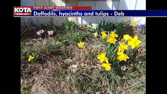
Sure signs of Spring - The bluebird (although a little confused!) and the flowers blooming in Gillette!
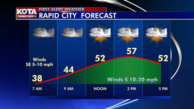
Skies clear out and the winds die down tonight. And we start with sunshine and light winds in the morning, then the clouds and winds pick up after Noon.
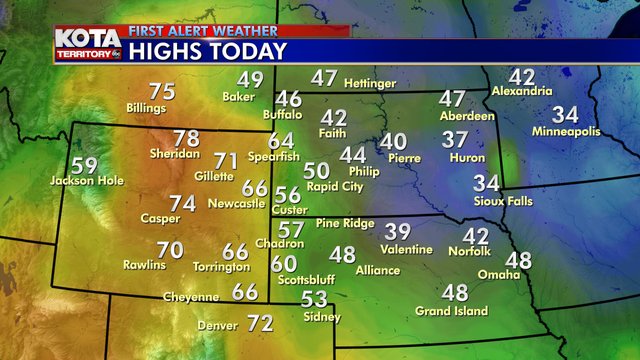
72 hours ago snow was falling. Today Spring sprung in Wyoming with highs in the 70s. And we melted a lot of snow in South Dakota!
A small storm for Tuesday, gusty winds and few rain and snow showers. But we're also tracking a Sunday warmup, too!
Meteorologist Mike Modrick
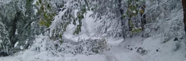
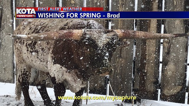
The animals don't seem too happy with the snow! Officially 9.3" downtown Rapid City. Most roads have a thin layer of ice created as the last of the blowing snow drifted over wet roads. Drive carefully! I-90 is still closed east of the Hills. I-29 closed in eastern SD.