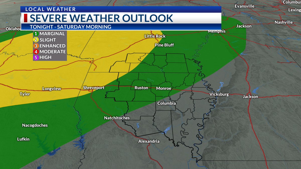
Strong t-storms are expected around the ArkLaTex region, but parts of the ArkLaMiss could see some of these storms late tonight into the early morning hours tomorrow. Gusty winds and hail will be possible. An isolated spin-up cannot be ruled out. #SevereWX#LAWX#ARWX
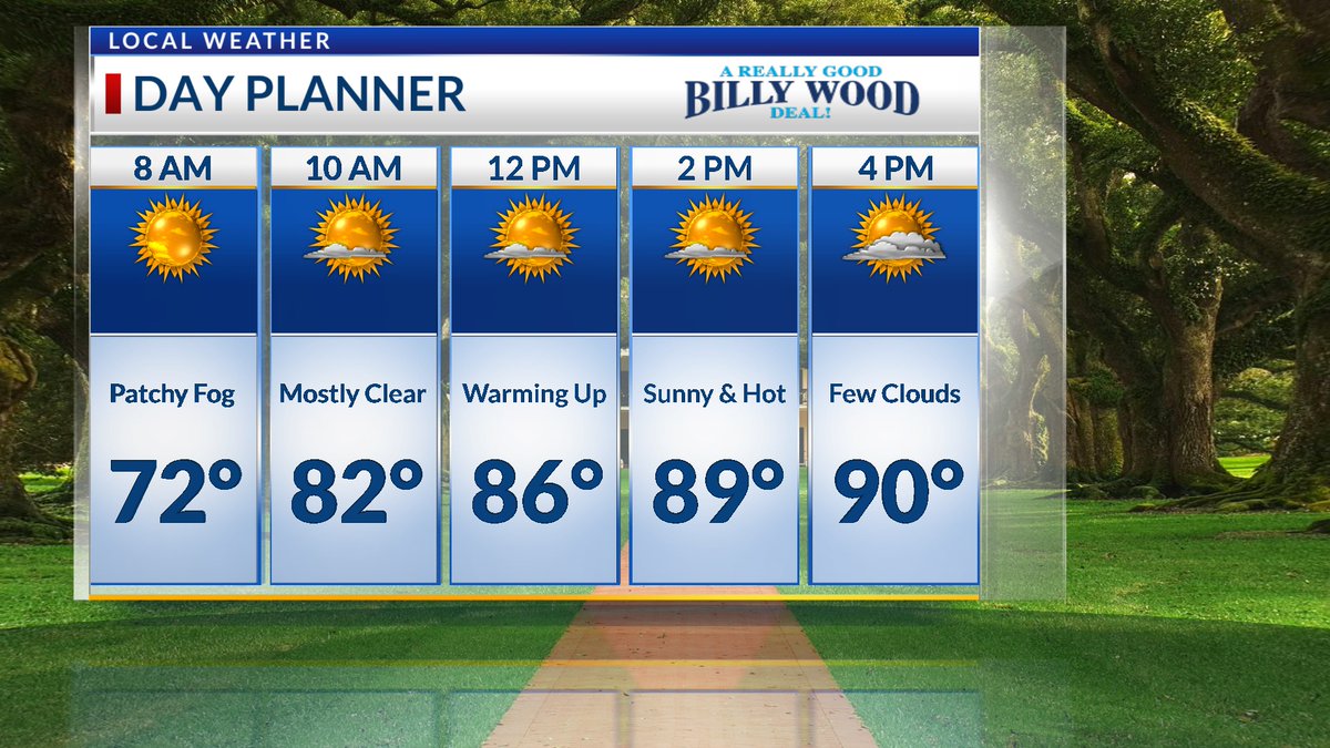
Some light patchy fog will be possible this morning, but otherwise mostly sunny. It will be much warmer today as we get into the upper 80's with many places hitting the 90's. A few clouds will linger in this afternoon and strong t-storms are expected overnight. #LAWX#ARWX
A Slight and Marginal Risk for severe weather extends across the ArkLaMiss for late Friday into Saturday. Damaging winds and hail are the primary concerns, but an isolated spin-up cannot be ruled out. Stayed tuned to KTVE/KARD for the latest updates. #LAWX#ARWX#SevereWX
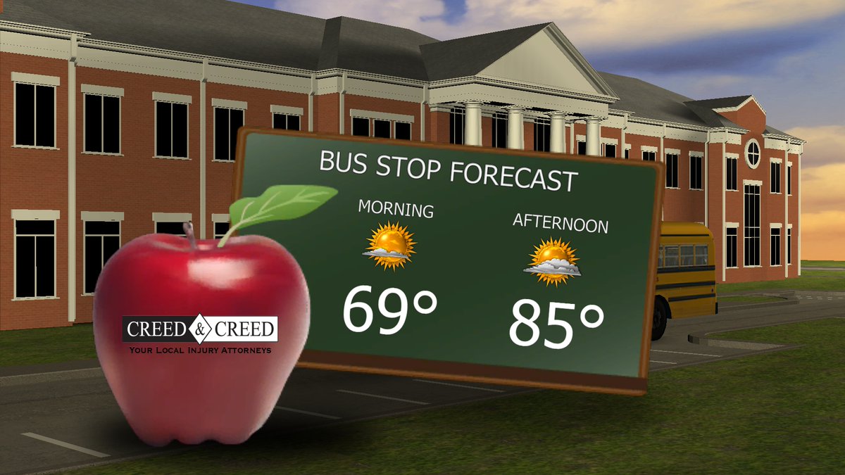
It will be mostly clear for your morning commute. A few clouds will linger in later today and a spotty shower cannot be ruled out in our eastern zones towards the MS River Valley. Daytime highs will be in the mid 80's today before warming to the 90's tomorrow. #LAWX#ARWX
There is a chance for severe weather in our viewing on Friday. Primary threats will be damaging wind gusts, small hail, and an isolated tornado cannot be ruled. Still a few days out, but keep it tuned to KTVE/KARD for the latest updates. #SevereWeather
Rain chances stay relatively low throughout the remainder of week. A few scattered t-storms will be possible on Saturday with a few isolated t-showers into next week. #LAWX#ARWX
Happy Hump Day!! This morning will start off on the sunny side with mild temperatures. A few spotty t-showers will be possible in our area later this afternoon. Not everyone will pick up rain as most of the t-showers will be isolated. #ArkLaMiss#LAWX#ARWX
Rain chances increase this afternoon and will linger into the overnight hours. Any showers tonight will be spotty and isolated. We will have another round of showers and t-storms as we head into the weekend with a slight chance into next week. #ArkLaMiss#LAWeather#ARWeather
Good Tuesday Morning!!! Expect clear skies and sunshine this morning. However, scattered showers and t-storms will be possible later on this afternoon. A few showers will linger later on tonight and more storms will be possible tomorrow afternoon #ArkLaMiss#LAWeather#ARWeather
Heat advisories have been issued for the ArkLaMiss until 7:00 PM this evening. Expect highs in the upper 90s and low 100s with heat index values close to or near 105. #ArLaMsWX
Severe Thunderstorm Warning issued for much of Ashley County until 6:15p. Frequent lightning and damaging winds in excess of 60 mph will be possible in this storm. This warning does include Crossett and Hamburg. Seek shelter indoors. #ArLaMsWx#severewx
RADAR RED GLARE: Sorry for the Fourth of July pun, but some widely scattered storms are back in across the #ArLaMsWx. Occasional lightning, heavy downpours, and gusty winds will be our main hazards through early evening. Exercise caution on all waterways!
2:45p Radar: Scattered storms are drifting northeastward across the #ArLaMsWx this afternoon. Occasional lightning and heavy rainfall will be the primary hazards in most storms.
Severe Thunderstorm Warning issued for south-central Ouachita County until 10:30p. Quarter sized hail and damaging wind gusts will be possible, along with frequent lightning. #ArLaMsWx#severewx
Severe Thunderstorm Warning issued for a chunk of Lincoln, Union, Ouachita, and Jackson parishes until 5:45p. Damaging winds and quarter sized hail are possible. This storm does include Ruston, Farmerville, Monroe, and West Monroe. Seek shelter indoors. #ArLaMsWx#severewx
Severe Thunderstorm Warning out now for eastern Union County. This is a storm still capable of producing some damaging winds and hail, although rather small in areal coverage. #ArLaMsWx#severewx
Flash Flood Warning has been issued for most of Bradley County and western Calhoun County. Heavy rain from a slow-moving thunderstorm could cause some localized flooding concerns. Be careful on the roadways! #ArLaMsWx
Severe Thunderstorm Warning issued for northern Calhoun and Bradley counties in southern Arkansas until 3:15p. Large hail and damaging winds will be possible with this storm. Seek shelter indoors. #ArLaMsWx#severewx
Severe Thunderstorm Warning issued for parts of Richland, Madison, and Franklin parishes until 3a. Damaging wind gusts will still be possible, along with heavy downpours and frequent lightning. #ArLaMsWx#severewx
Severe Thunderstorm Warning issued for Richland, Morehouse, and West Carroll parishes until 2:30a. Storms have been slowly weakening, but some hail and damaging wind gusts remain possible. Stay vigilant overnight, folks! #severewx#ArLaMsWx