Northern Hills Fire is planning to burn up to 150 machine piles, as snow permits, over the next few weeks. The piles are located on the north and south side of the Galena Road, approx. 2 miles west of the Galena Road & Vanocker Canyon junction.
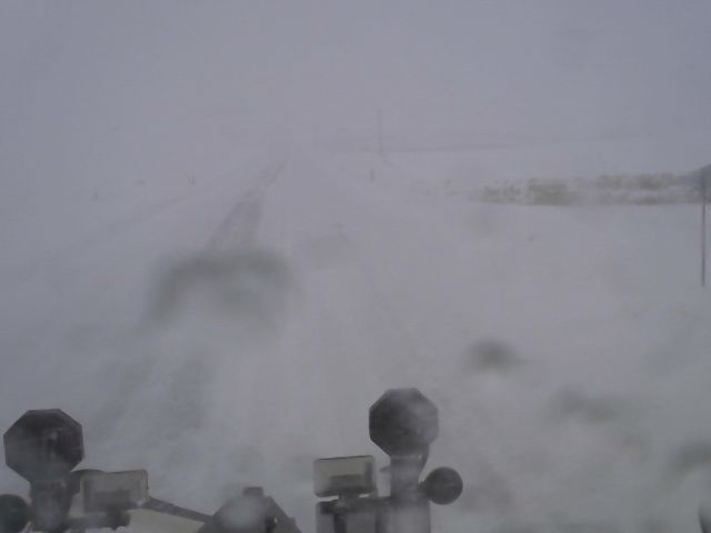
There are many vehicles that are trying to take secondary highways during this winter storm. Most of the state is in a no travel advisory and these secondary highways aren’t any better than the interstate. Please stay off the roadways and don’t travel unless necessary.
12/15/2022 242pm MST/342pm CST: Here is a look at a VERY PRELIMINARY snow reports. We know these will change as it continues to snow, especially in/near the northern Black Hills. #SDwx#WYwx https://t.co/IwnWM2XoRq Image courtesy Kellan P. 5E Tilford
Interstate 90 (both eastbound and westbound) will be closed from Rapid City to the Wyoming state line beginning at 10 a.m. (MT) / 11 a.m. (CT) on Thursday, Dec. 15, 2022.
Read the full update on the additional closures at: https://t.co/JZAOr9WexX
https://t.co/jAj5PbAmq4
The downtown snow removal alert applies to the multi-block boundary area of 5th Street to W. Blvd and Kansas City Street to Omaha Street. All cars remaining in the affected area will be ticketed and towed at the owner’s expense.
The City is issuing a downtown snow removal alert for overnight tonight. Street crews will be plowing and all cars must be removed from the affected area between the hours of 2 a.m. and 8 a.m. /1
I90 is closed east and westbound from the Chamberlain exit. We expect road conditions to continue to deteriorate as the day continues. If you can, please stay home. If you must travel, ensure you have an emergency kit in your car, give yourself lots of extra time, and slow down!
Smoke from other fires is drifting into the area. If you see a defined smoke column or see flames, please call 911.
Otherwise be aware that we do have smoke drifting into the area.
DYK: Since Friday the Dakotas have experienced...
Tornado Warnings
Blizzard Warnings
Severe T-storm Warnings
Flood Warnings
High Wind Warnings
Red Flag Warnings
Wind Advisories
Flood Advisories
Winter Weather Advisories
Tornado Watch
Severe T-Storm Watch
Fire Weather Watch
@j_rj_n We have been undergoing some lengthy maintenance. Taking much longer than we expected. Hopefully complete in about 20 days. Thanks for your patience!
Dangerously cold wind chills across the region late this morning, and it will only get worse tonight and Tuesday. Make sure you are covered from head to toe, leaving no skin exposed, even if you're only going to be out for a few minutes. #sdwx#wywx
Day crews will stay late & night crews are coming in early with plans to stay late if needed to address any issues that arise overnight w/roadways. Be aware of scattered slippery conditions during late afternoon/evening commutes. Allow extra time to reach your destinations safely
Crews have been out throughout the day addressing issues associated with today’s snowfall. Nat'l Weather Service advises system should push out within the next 1-2 hours. Street Dept will continue to have crews monitoring road conditions and treating any issues that may arise.
Pennington County Sheriff’s Office is investigating a serious incident in Hill City. We are in the beginning stages. Expect to see First Responders staging near the 1880 train. Please give us space to work. We will release more information as it becomes available.