1/6
Looks like a bimodal setup will be in the cards for tomorrow for SK. The red is where 12Z ensemble guidance shows the highest probability for tornadoes. The blue is just out of reach for the U.S CAM's, but cooler 700mb temps, really have my attention.
#skstorm
1/6
06Z model analysis:
Looks like severe weather will be possible tomorrow across southern SK into SW MB. The red is where the highest chance of severe storms will form, they may be supercells at first, and produce large hail, before rapidly...
#abstorm#skstorm#mbstorm
An updated morning statement from the PASPC on this coming severe weather threat in #Saskatchewan beginning this weekend and into early next week. #SKstorm
So Saturdays storms feel like a storm of 2 tales the dark side and the bright side what a beautiful storm might be hard to beat this one this year #skstorm
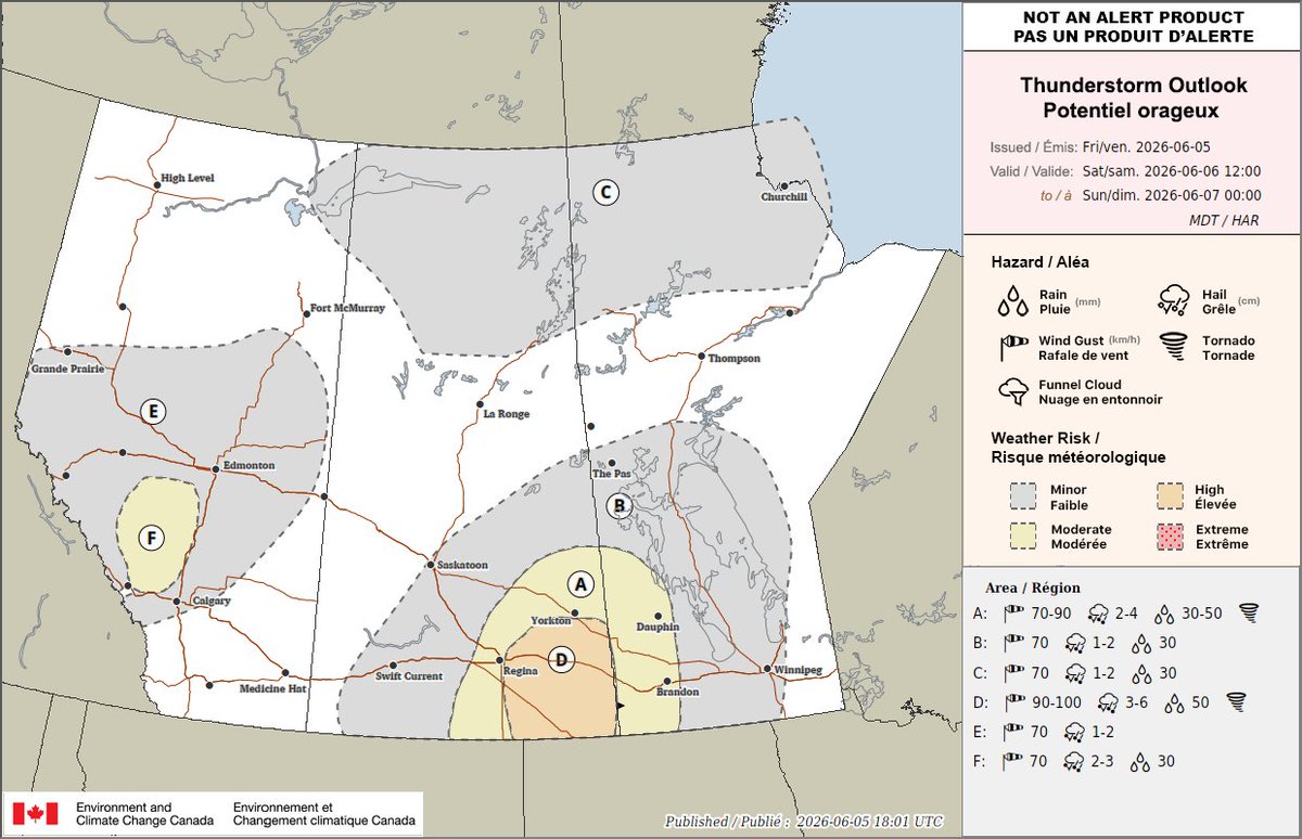
Day two outlook issued. Expect super cell storms in the orange and yellow region, capable of producing large to very large hail, and the possibility of a tornado. Make sure to stay tuned to ECCC alerts for Saturday and Sunday. https://t.co/7CXCQPqKn1
#skstorm#mbstorm
Today’s updated thunderstorm outlook.
Moderate chance for thunderstorms in southern Manitoba where we could see some become severe.
Not like yesterday though, the tornado threat isn’t there and the storms should be less intense overall.
#yegwx#abstorm#skstorm#mbstorm
Barely gotcha but fkn gotcha. 🤣🤣 between the snow squalls and the heavy cloud cover we finally see some space weather!
Periods of heavy snow and high wind continues for much of Saskatchewan. Travel carefully!
#SKstorm#aurora#northernlights