#30DayMapChallenge - hats off to my colleague Thomas for compiling all his 30 day map challenge maps into an amazing @Cadence_GIS_ story. Really great to see the diversity of the mapping over the last month: https://t.co/TWzuCERaHx
#30DayMapChallenge Day 30 - Make Over. I can't believe it is the final day of the challenge. I decided to do a make over of my maps from Day 28. Here are a couple of different versions, all in @Cadence_GIS_
#30DayMapChallenge Day 29 - Raster.
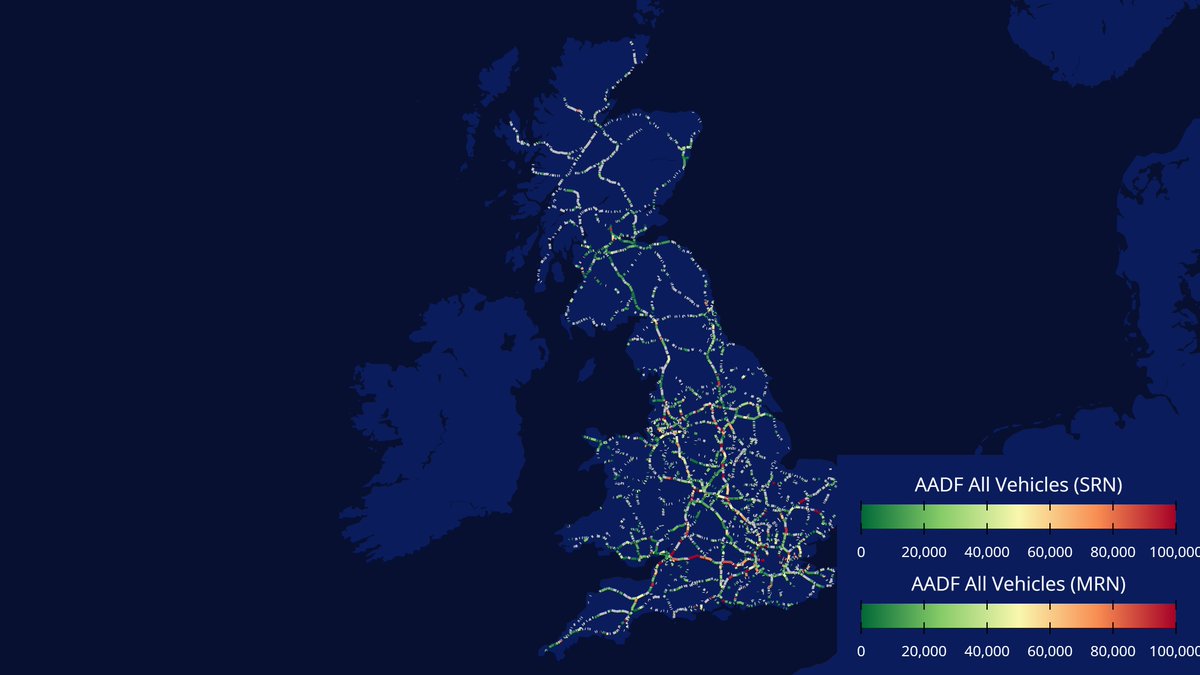
Raster layer plus geojson oceans polygon. I was surprised how difficult it was to find easy-to-use open raster data, so will aim to sort that out in 2026. Nice to see the versatility raster brings to @Cadence_GIS_
New ONS migration data has British nationals broken down by age band for the first time. Around 53% of the net outflow is aged 16-24, and 46% aged 25-34. Goodbye, Nick (30)...
#30DayMapChallenge Day 27 - Boundaries. @Cadence_GIS_ makes it easy to copy whole packs of analysis from one location to another. Check out this video showing how a simply change in the Project Bounds enables you to copy your analysis to another location.
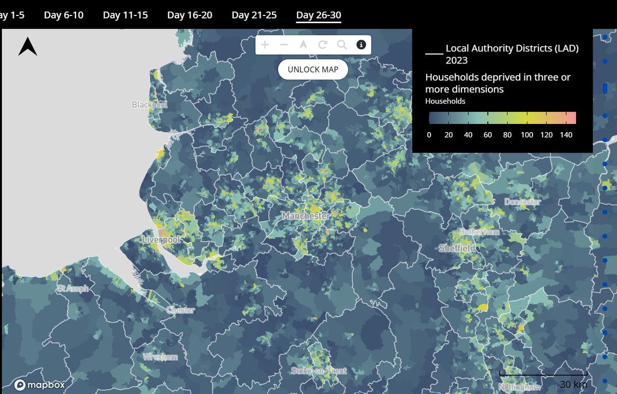
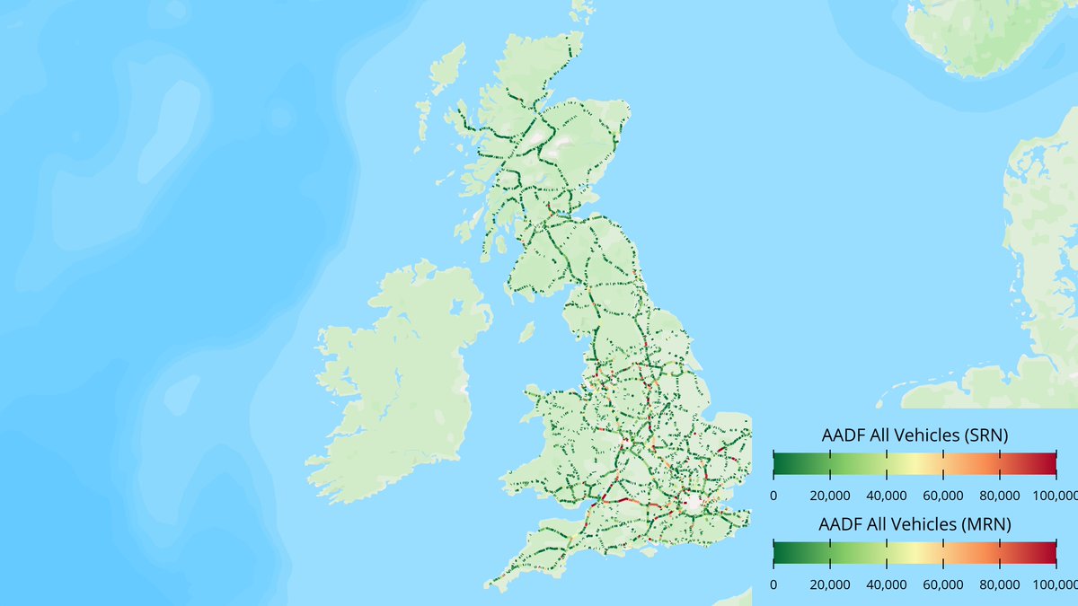
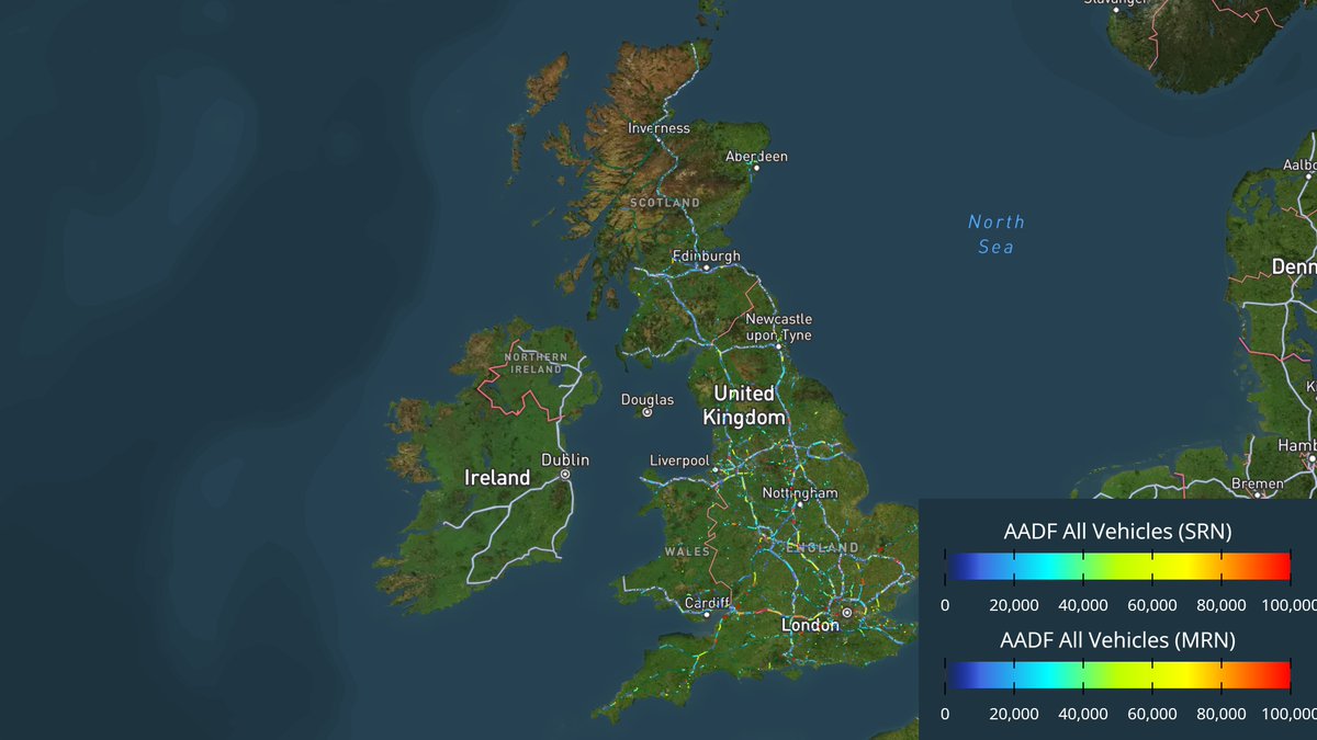
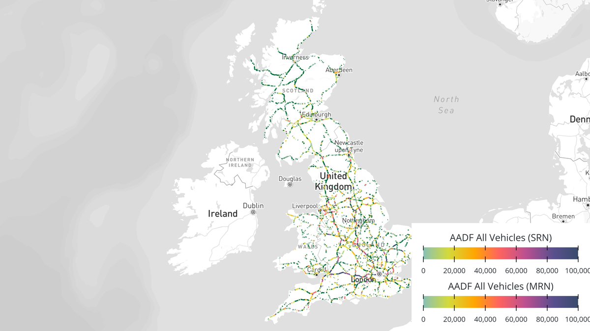
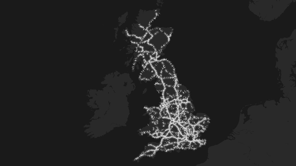
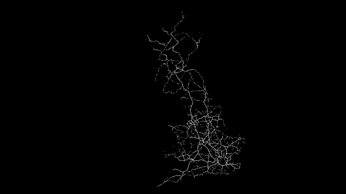
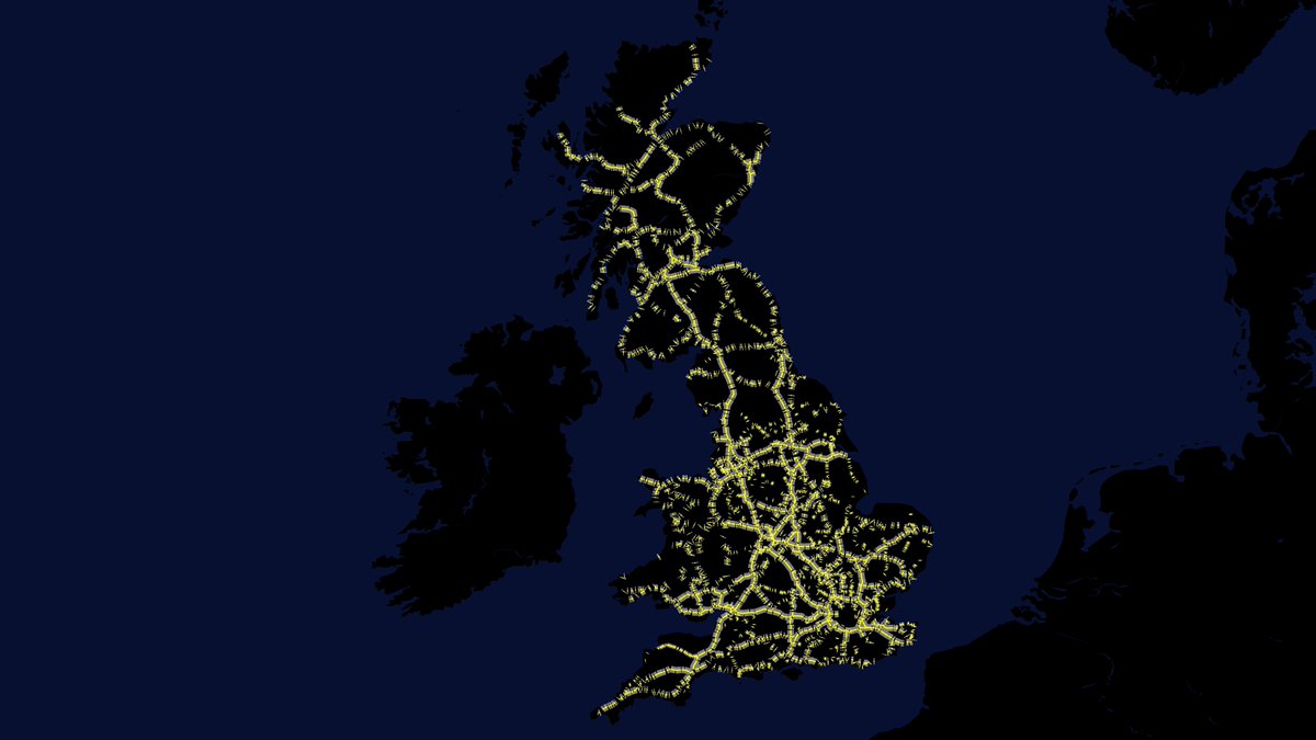
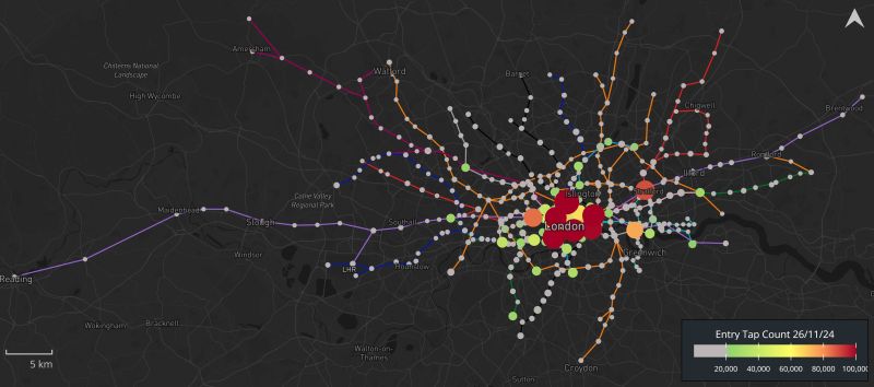
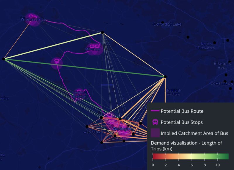
Day 26 of the #30DayMapChallenge with #Cadence. Today's theme: Transport.
Cadence's intuitive interface makes creating maps like these easy, with tools like:
Isochrones
Stories
Desire Lines
Annotations
Charts
Learn more and get started: https://t.co/Ei4BgdbzYg
#30DayMapChallenge Day 26 - Transport. I didn't know where to start (or finish) today as there is so much transport functionality in @Cadence_GIS_ for both transport planners and modellers. So I just made a video to help introduce you to my Cadence Story: https://t.co/LOWyL35Eow
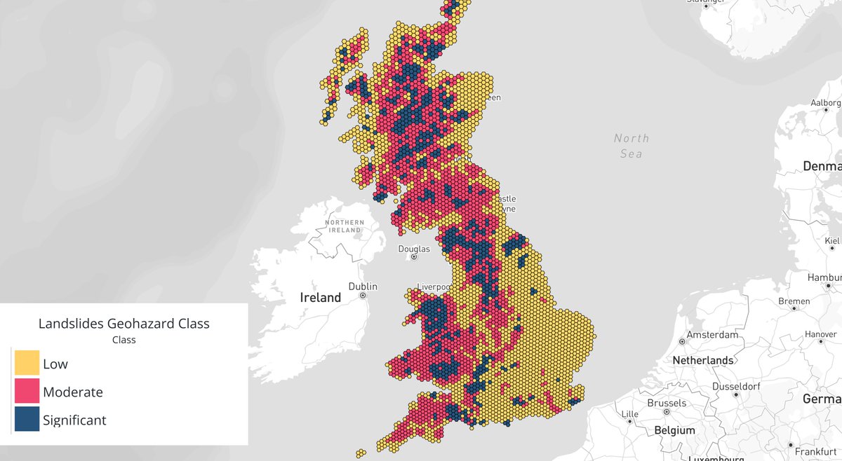
#30DayMapChallenge Day 25 - Hexagons
Thank you @Cadence_GIS_ - with your in-built open data from the British Geological Survey, I am no longer scared of hexagons.
#30DayMapChallenge Day 24 - Places and their Names
I live in a place called Exmouth which shares its name with Exmouth... Australia. Have a look at my interactive map highlighting 11 more places with naming links. What others can you spot?
https://t.co/pgJmZ8iymQ
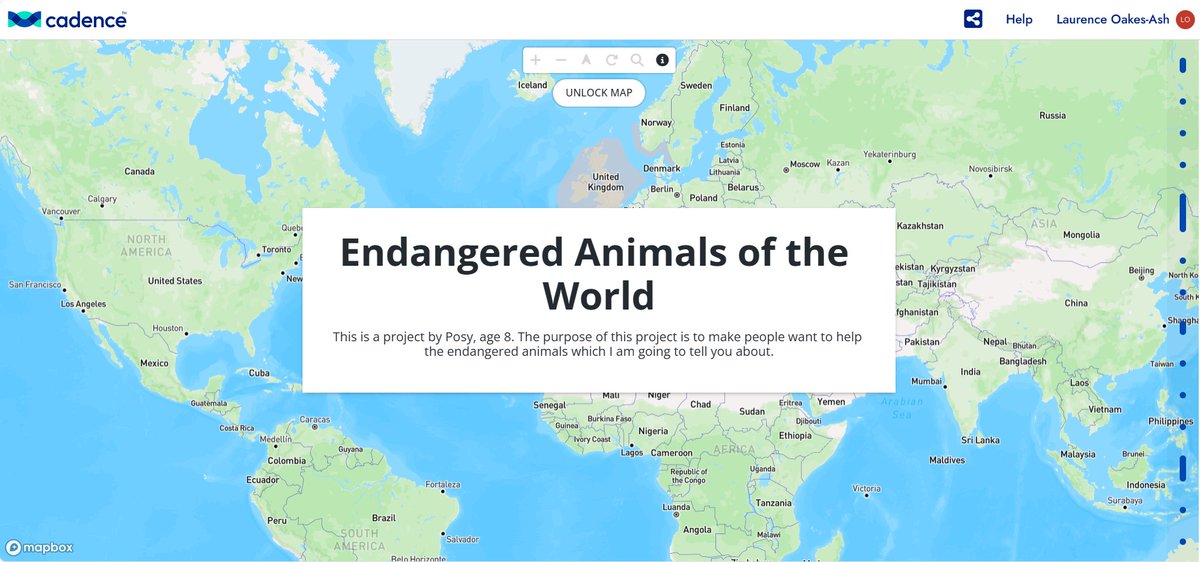
#30DayMapChallenge Day 22 - Natural Earth. Here's a @Cadence_GIS_ Story my daughter is working on looking at endangered animals: https://t.co/HQB0RKopzm
#30DayMapChallenge Day 21 - Icons. Today I made a little map of the "Top 10 Pop Culture Icons of the 21st Century" based on an article from imdb. Have a look at the interactive map https://t.co/CsqAHf2UXg. Create and share one yourself in @Cadence_GIS_
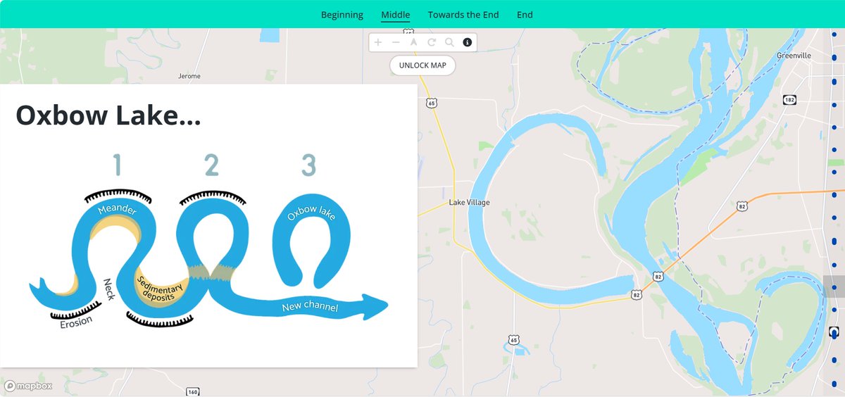
#30DayMapChallenge Day 20 - Water.
I thought today I'd show the most important water feature learned in geography - the Oxbow Lake.
Log into @Cadence_GIS_ , grab some cool basemaps, pick a region and see how many oxbow lakes you can find.
#30DayMapChallenge Day 19 - Projections. As a non GIS expert, I shudder at the "projections" theme. That is one of many reasons we built @Cadence_GIS_ - to make things like projections easy. Instead, I've made a Story looking at shadows in a range of different @Mapbox basemaps
I rewatched The Big Short to remind myself that whatever is now written in retrospect, the overwhelming majority of macro analysts totally failed to predict the GFC in 2007/8. And once again I am being told there is no bubble to burst! Yeah right.
https://t.co/KmgvbgV9qL