🚀Early Adopter Alert!🌐We've been beta-testing the #Esri#ArcGIS Indoors for #AutoCAD extension before its release last month. Overall, we think it's a great diagnostic tool. Enjoy the short demo.
Is ArcGIS Indoors right for your next mapping project? Let's talk. #DigitalTwin
Big thanks to Cognitive Corp and The AI Innovators Collective for hosting this thought-provoking discussion on the future of AI in the Built Environment as part of their monthly web show: https://t.co/ofHaaouYWS
How will AI transform the way we build, maintain, and operate facilities? The future is closer than you think, with generative AI strategies and digital technologies leading the way. Catch highlights from the 30-minute session or watch the full replay: https://t.co/0RBhIgvxkJ
Wishing you a happy Thanksgiving from the LandTech team! We hope you are able to enjoy the opportunity to unplug, savor delicious food, and create lasting memories with the ones who matter most.
#MayThe4thBeWithYou! Cheers to our favorite digital twin - the holographic plans for the Death Star. The rebel alliance put this digital representation of the as-built plans to effective use to understand & identify security vulnerabilities! https://t.co/62qcXgbceb
We're passionate about developing solutions that help our clients work smarter, not harder. Our team recently built a mobile app that allows utility owners & operators to collect location information, attribute data, and sync to their GIS database: https://t.co/vyWMjiTnuj
Check out our new American Mapper Pro app. By simply scanning a barcode in the field, field teams can easily collect location and asset data on water valves and fire hydrants while syncing it back to their in-house GIS database in real-time.
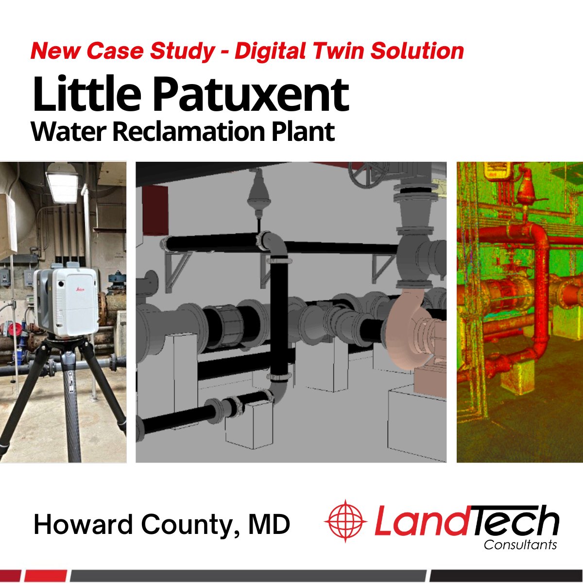
New case study! In partnership with Gannett Fleming, LandTech provided an #Esri#ArcGIS integrated #DigitalTwin solution to improve Howard County's wastewater plant asset management and field operation workflows. Read now: https://t.co/JhBvqywHac
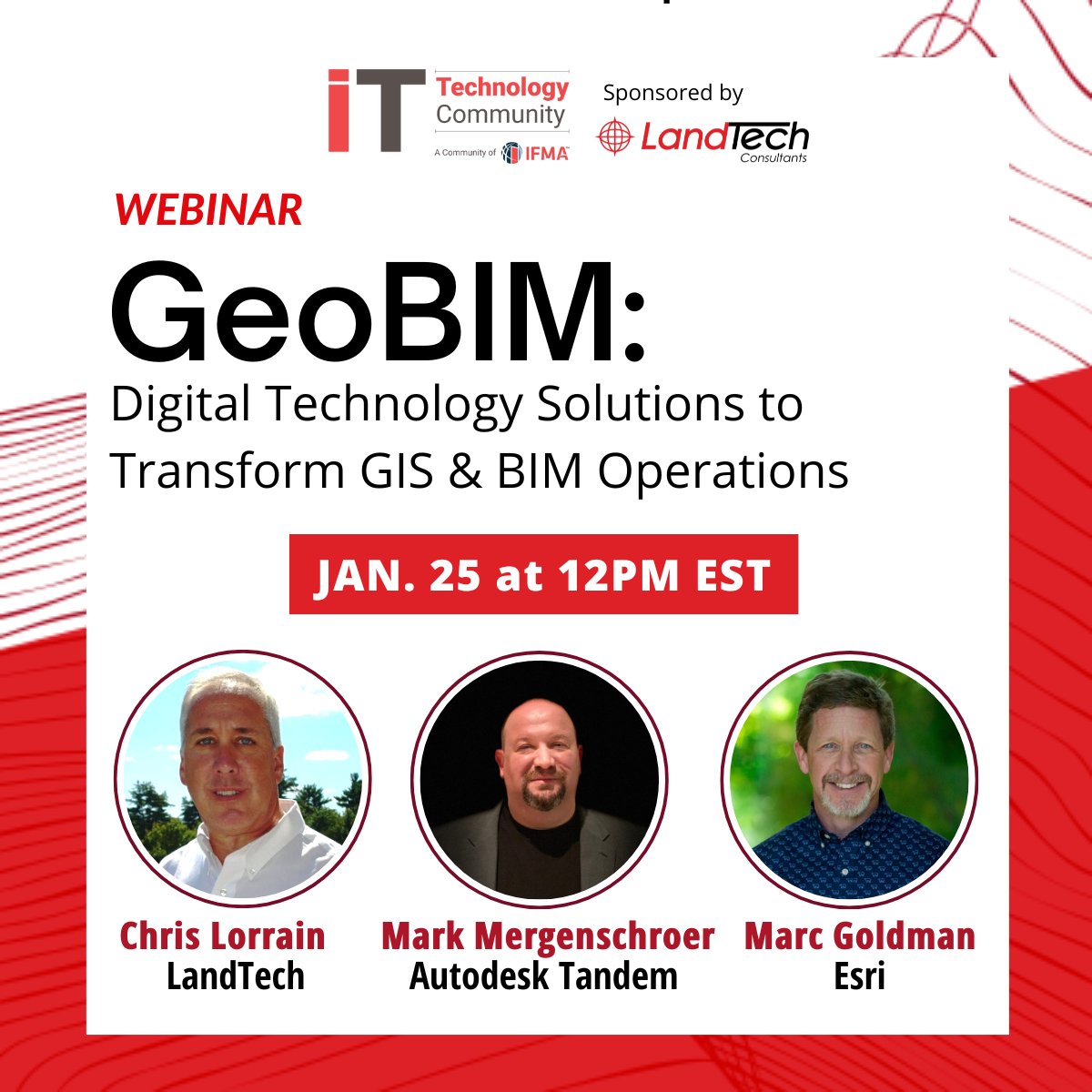
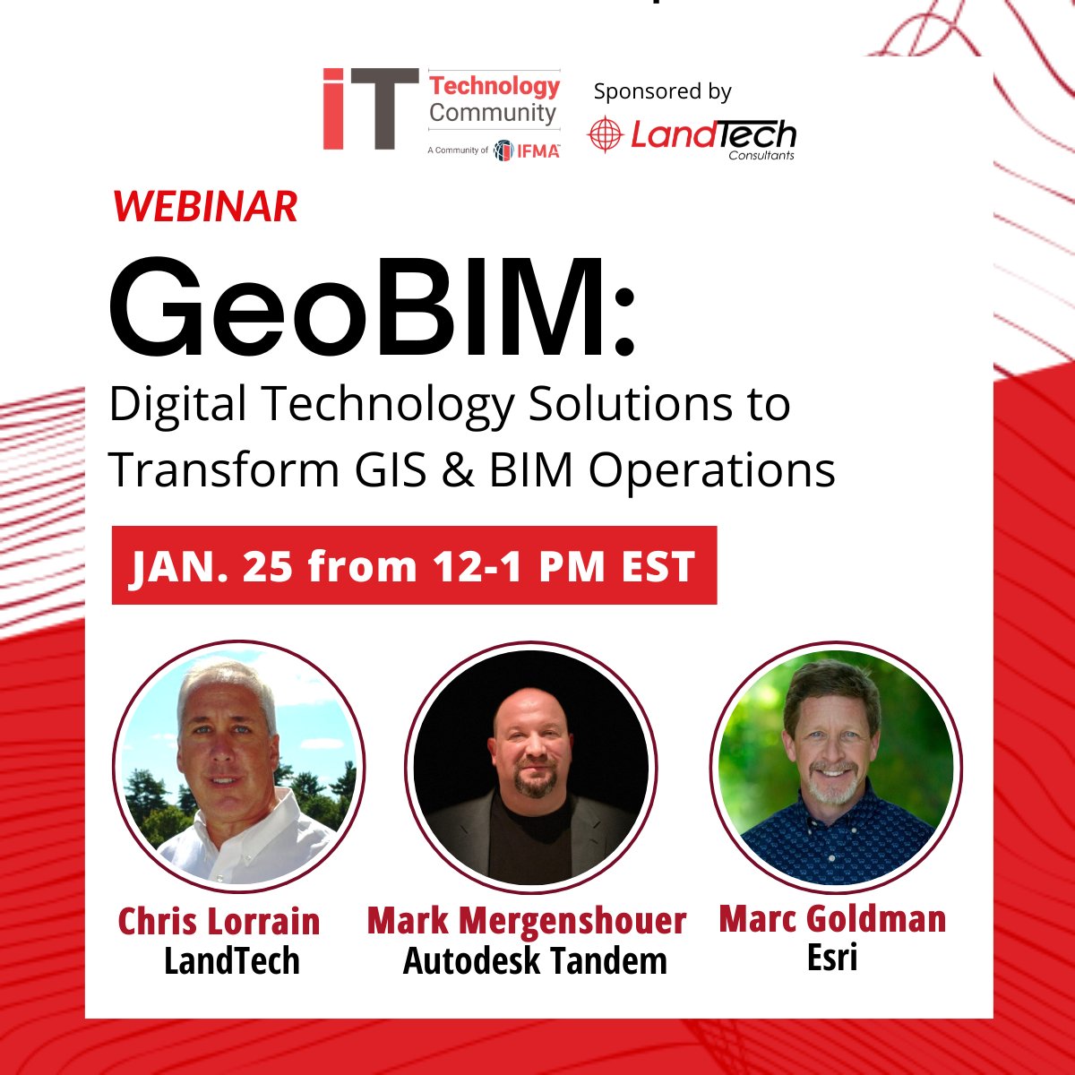
New year, new solutions! Learn how #GeoBIM technology solutions can unlock new possibilities for smarter facilities management. Register now to join @autodesk, @Esri, @IFMA & LandTech for the 1/25 webinar: https://t.co/dOtp6GthEf
Join us! #GeoBIM webinar on Jan. 25th at 1PM EST. How can digital technology solutions bridge the gap between #GIS and #BIM for your operations? Register: https://t.co/dOtp6GthEf
#IFMA#Autodesk#Esri
It's time to talk about the elephant in the room. Buildings are getting smarter, facilities managers are retiring, and there's a sizeable workforce gap. Are your facilities prepared for 2023? Learn more: https://t.co/gap3qFqH1b
How do you measure the ROI of Digital Twin integration? If you missed the stellar Digital Twins panel discussion with #IFMA ITC last week, enjoy this short clip. https://t.co/IIfb6zO1oy
Traditional land surveying or laser scanning - which is right for your next project? Either way, we can help you make the most of your budget and to Do More with Less. #clicheoftheday
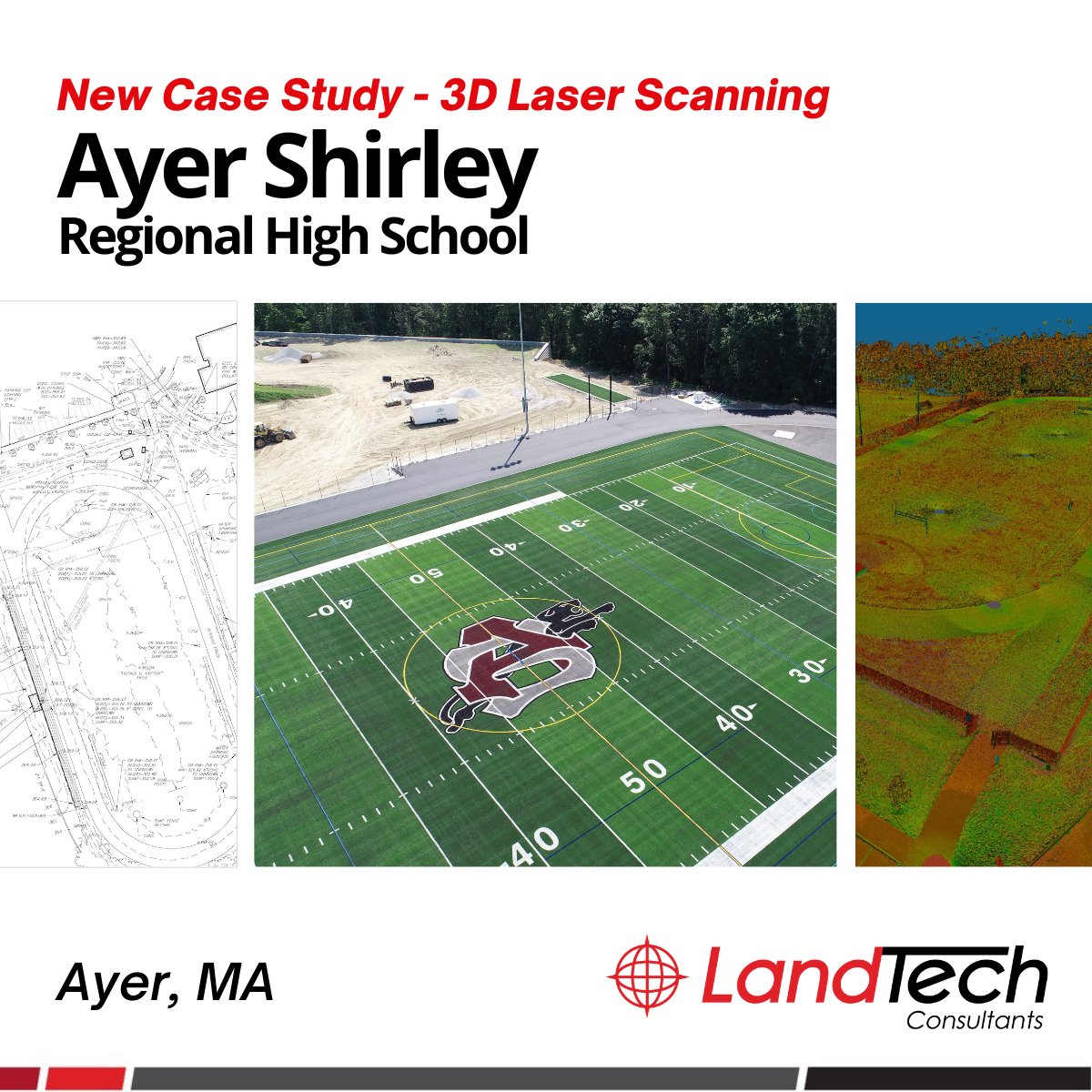
Who's ready for some football? LandTech was proud to partner on the renovation of the beautiful new synthetic turf field, expanded track, baseball diamond and ADA-compliant facilities for Ayer Shirley Regional High School. Go Panthers!
Read more: https://t.co/lpwFrlBOcJ
Nothing to see here, just us slowly lowering (upside down, into the sewer) our boss's favorite new survey-grade 3D scanner. Inverting the laser scanner in confined entry areas ensures a safer, faster completion, with reduced project costs - and reduced risk to our crews.