Cool app for Drone imagery annotation/labelling/reference data for CNN-based segmentation used ar
∆Paper1: for Multispectral imagery ~https://t.co/H6JRhIFOXE
∆Paper2: LiDAR point clouds co-registered to RGB imagery ~https://t.co/fnrHiHnPan #computervision#deeplearning#nvidia
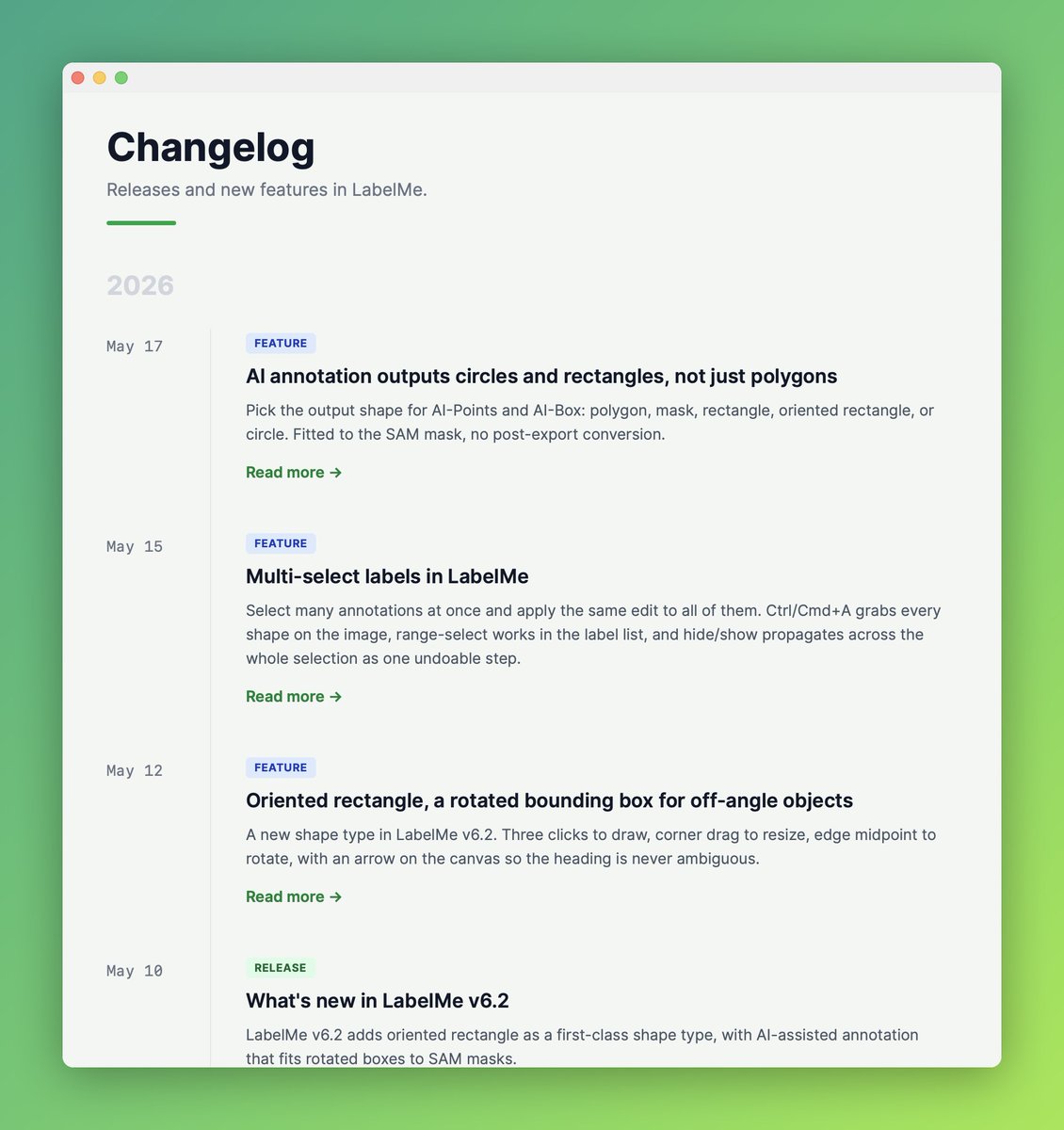
LabelMe v6.3 is out.
- Mask-aware NMS: nested SAM masks that share a bbox (tree cluster, single tree, branch) collapse to one shape per object.
- Existing-shape suppression: AI prompts over already-labeled objects are skipped.
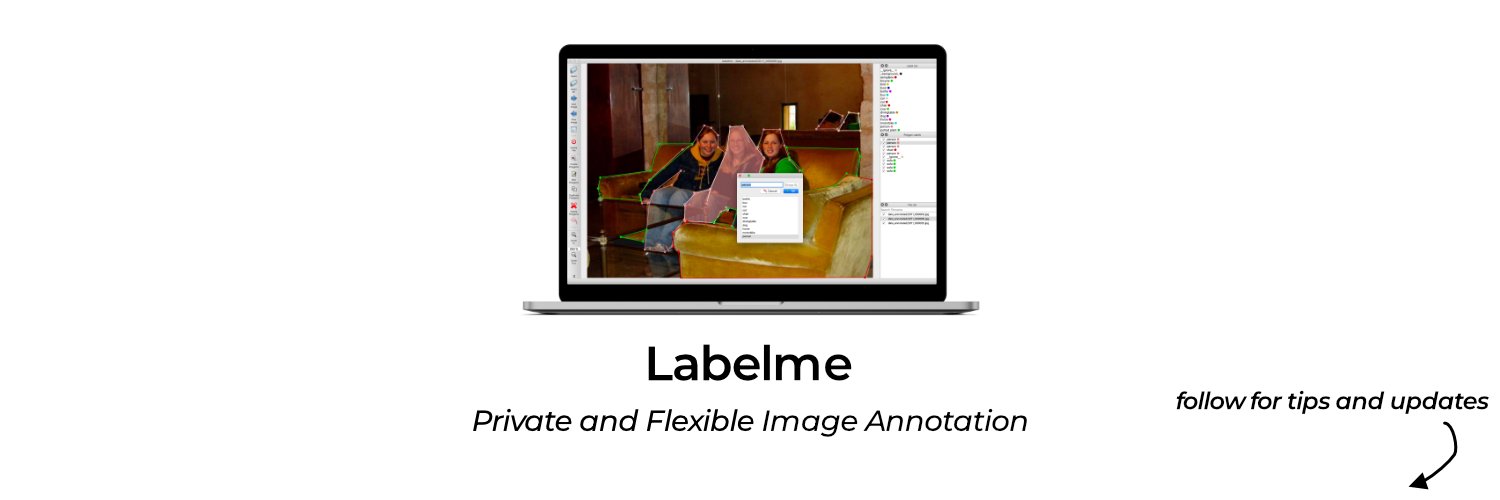
New blog and changelog pages are live!
We'll be sharing new release, feature deep dive, guides/tips, and our thoughts on future image annotation and computer vision.
@Dadojvk You mean like in another platform like web/js/rust etc?
In Python + PyQt space, I've already rewritten the code fully, so it's already how I want it to be.
LabelMe v6.2 is out.
- Oriented rectangle shape: a rotated bounding box that hugs off-angle objects (parking lots from above, ships, scanned text).
- More AI-assisted shapes: oriented rectangle, rectangle, and circle, fitted from a SAM mask.
Just chatted with @lauransotomayor
I got to know her use case of @LabelMeAI on drone imagery to vegetation and more.
Cool to see the AI-assisted annotation working in there.