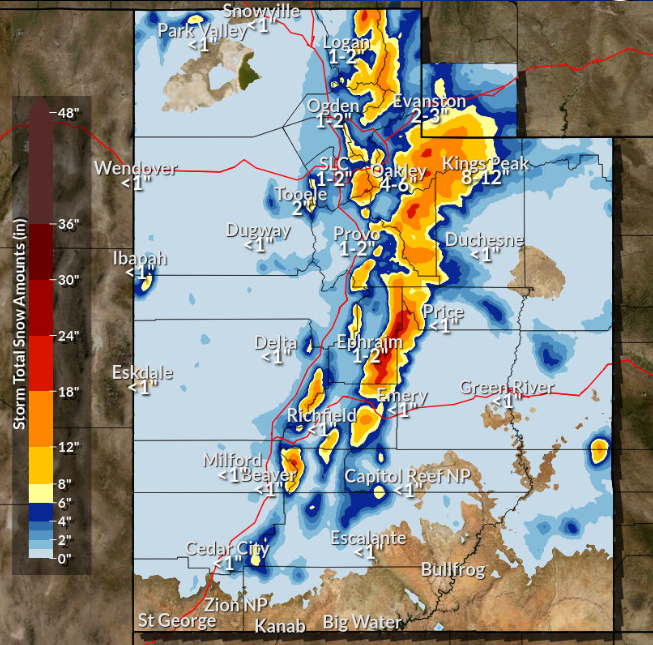
We are asking you to delay travel tomorrow (3/18) morning if possible. We’re expecting more snow, and the morning commute could be a bit tricky.
Please share to spread the word. 🤝
This is the #WinterStorm forecasted to move through northern #Utah early #Saturday afternoon and squalls could bring up to 1-2 inches of snow per hour, with #ThunderSnow also possible. The #snow will also accumulate in valley locations as temperatures drop drastically once the front moves through. Expected snowfall of 4-8 inches on the valley floor with higher amounts in the mountains.
Say bye to our 60s! A powerful cold front will quickly change rain to snow in the valleys tonight. Those with plans to be on the roads should be prepared for hazardous driving conditions. Most valleys can expect a quick 1-4". The Wasatch Back will get 2-8" & the mountains 10-20".
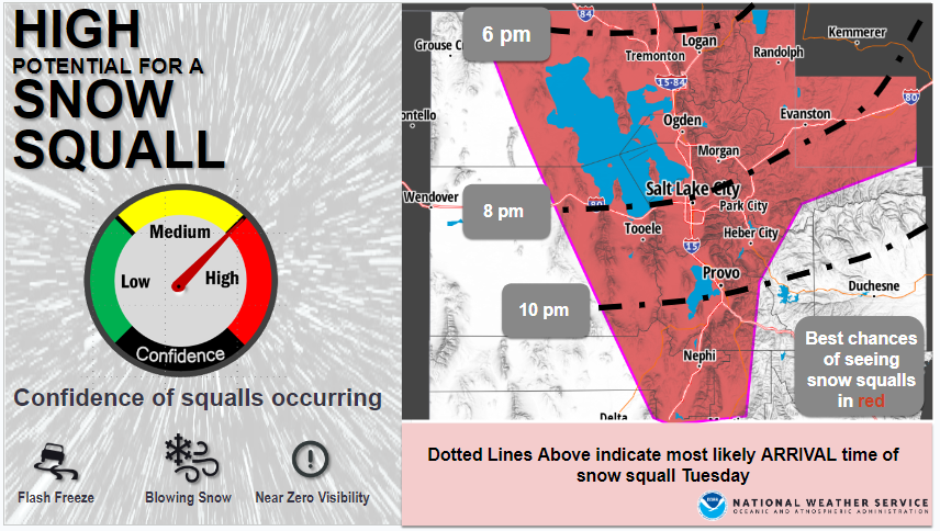
❄️🚨Don't be caught off guard...Snow Squalls are in the forecast Tuesday evening AND for your Wednesday evening commute.
Evening commuters will be most impacted in the Cache Valley and between Layton to Ogden. #UTWx
❄️We're sure you know by now, but another round of snow is incoming this evening with areas/periods of heavier snow overnight into Sunday morning. That's a range of 4 to 6 inches along the Wasatch Front. Check out your latest forecast at https://t.co/xQwsdiBMVl #UTwx
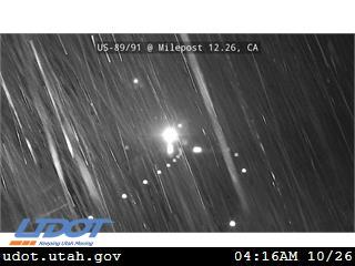
Good morning, Utah! We have rain coming down in the valleys of northern Utah/SW Wyoming, but we are seeing snow along mountain passes. Here is a udot camera in Sardine Canyon. Give yourself some extra time if driving through higher terrain this morning. #utwx#wywx
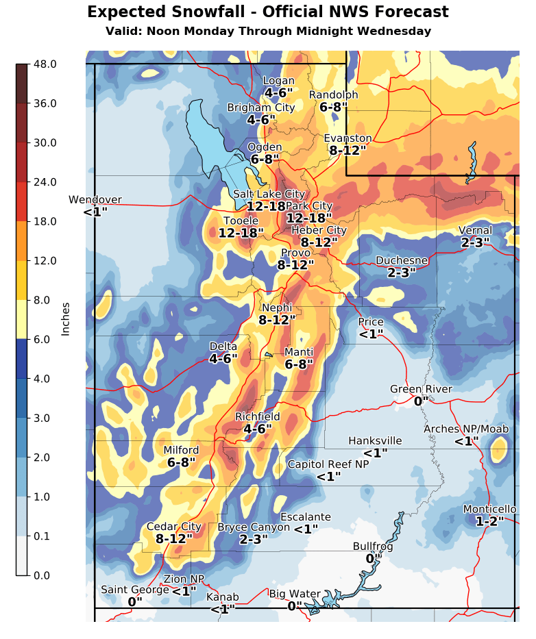
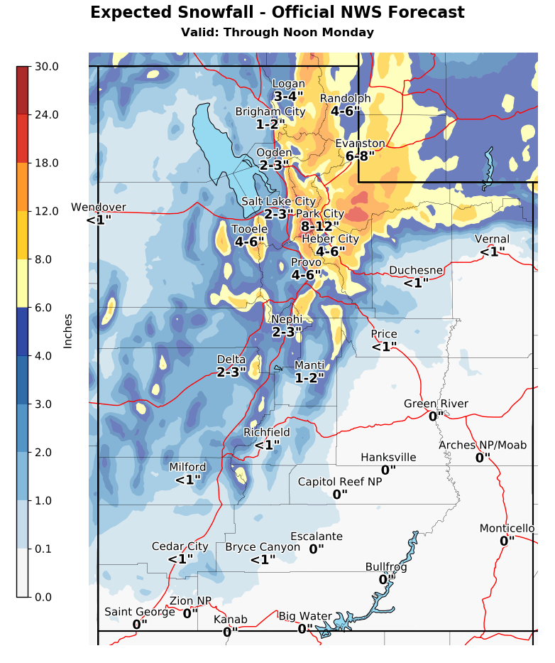
❄️🧵(1/4) Our upcoming storm will be a LONG DURATION event with many aspects of the storm, but here we will break down the storm into two phases. TLDR; Phase 1: Snow totals Now-Noon Monday (left image)
Phase 2: Snow totals Noon Monday-Midnight Wednesday (right image) #utwx#wywx
An atmospheric river arrives Tues. P.M.- Thurs. A.M. bringing gusty winds, high snow levels, & lots of moisture. Valleys that still have a deep snowpack need to monitor for any localized flooding. Make sure storm drains & window wells are cleared. Remove deep snow from rooftops.
❄️ (2/3) A SIGNIFICANT winter storm will bring significant snow to the valleys of northern Utah Tuesday P.M. - Thursday A.M. See attached graphic for valley impacts and third tweet for snow totals. #utwx
⚠️Dangerously cold wind chills expected tonight into Monday morning
-Cache Valley
-I-15 Corridor Brigham City to ID
-Northern Wasatch Front
-I-84 Corridor Tremonton to ID
-Great Salt Lake Desert
These cold wind chills can cause hypothermia and frost bite quickly #utwx
Here is a look at our next week of winter weather. Periods of cold temperatures and two more winter storms will keep the snow and winter conditions around. Bundle up, drive safe and stay weather aware as winter is seemingly here to stay as we move into December! #utwx
A composite image from this morning's eclipse showing the moon in various stages throughout the night. The size and shape of Earth's shadow is clearly visible here. These events are absolutely magical to witness and quite surreal.
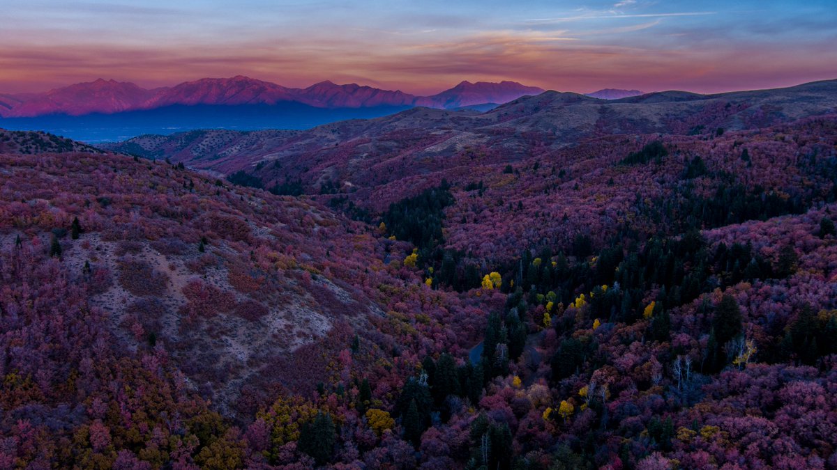
😍WOW! Tonight's view from Butterfield Canyon. Can't get anymore beUTAHful than that!
📍: Salt Lake County, Utah
📷: Chris Williams, via https://t.co/rfXQN8lDEa