You don’t need to be a scientist to make an impact 🐿️🌿
With Locus GIS, anyone can map biodiversity, collect field data 📍, and support research 🔬
Perfect for schools 🏫, community groups 🤝, and nature enthusiasts 💚
Start your citizen science project today 🚀
#LocusGIS
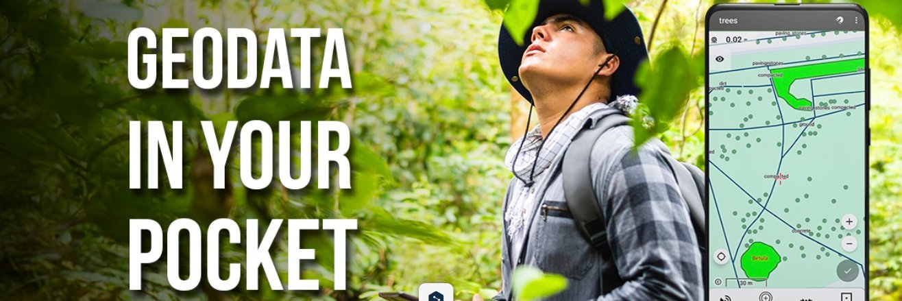
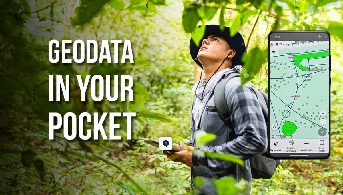
From moorlands to airports — field monitoring made easy. Track vegetation, find rare plants, monitor restoration. Custom forms, offline maps, export anywhere. Accuracy & flexibility in the field.
#LocusGIS#FieldMonitoring#GISFieldwork
Infrastructure mapping, simplified. With Locus GIS, document water & drainage networks — map pipelines, plan inspections & keep utility data organized from your phone. Edit, export & collaborate easily.
Keep your city's infrastructure running smoothly. #LocusGIS#WaterMapping
Every nest, burrow & habitat — mapped. 🐾🗺️ With Locus GIS, record wildlife locations 📍, monitor populations 📊, and map habitats right in the field. Add photos 📸 + notes 📝 on your phone 📱, then share data with your team 🤝 and support conservation efforts 🌿.#LocusGIS
Bring your site plans to life on-site. 🦺📍 With Locus GIS, you can view vector drawings 🗺️, edit plans at the construction site 🏗️, add notes 📝, photos 📸, and annotations ✏️ — all organized by project 📂. Stay on top of every detail ✅
#LocusGIS#SitePlans#Construction#Urban
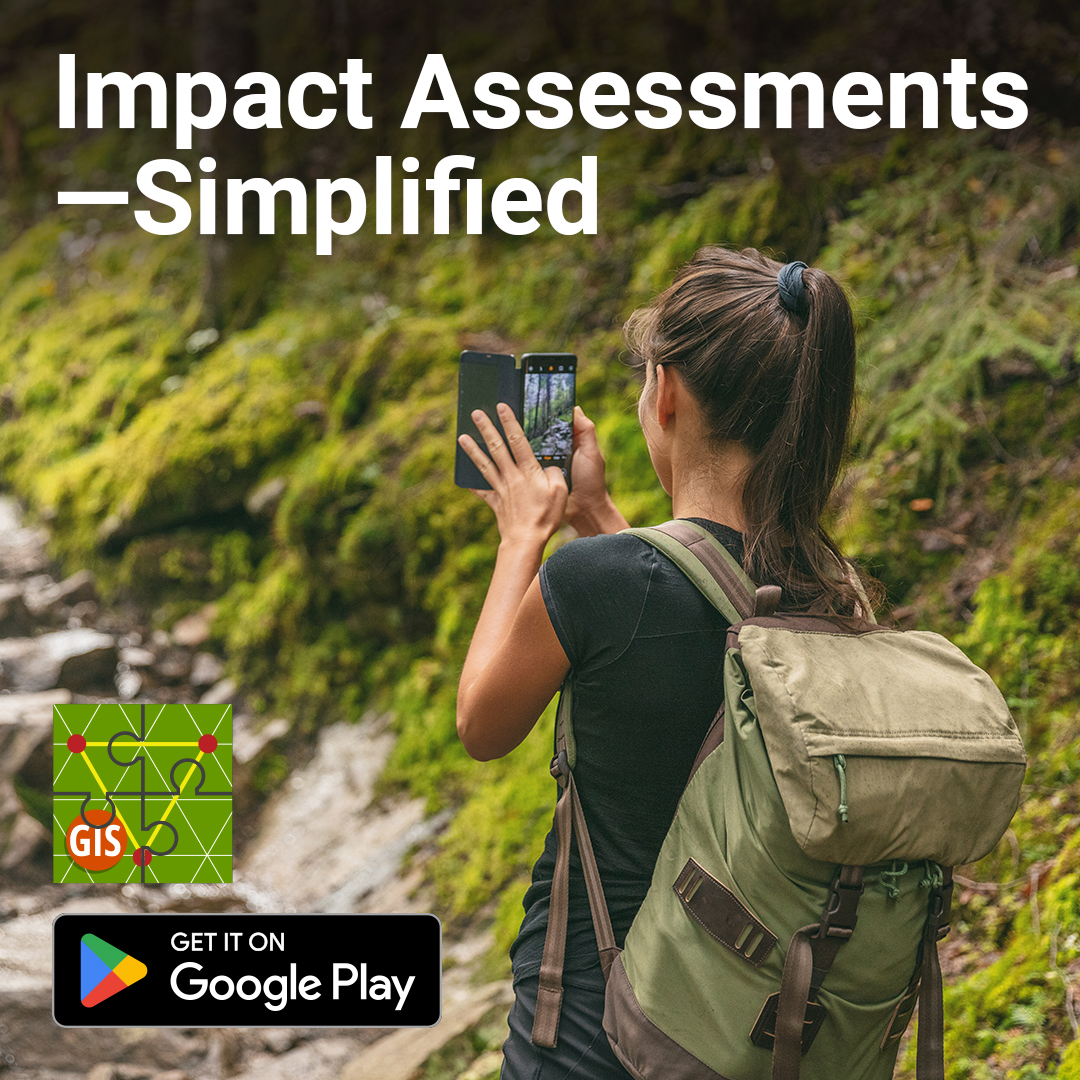
Impact assessments, simplified. 🌿📋 Locus GIS lets you run faunal surveys 🐾, assess habitats 🌳, and track changes over time — on your phone 📱. Add notes 📝 + photos 📸, capture GNSS coords 📍, and export for analysis 📊 & compliance ✅.
#LocusGIS#EnvironmentalMonitoring
Plan cities, not just streets. 🏙️🗺️ Locus GIS helps urban planners map infrastructure, utilities & land use on the go 📍. Update road databases, plan inspections ✅, edit SHP attributes ✏️ and export data ⬇️ — all from your phone 📱.#LocusGIS#UrbanPlanning#CityMapping#GIS
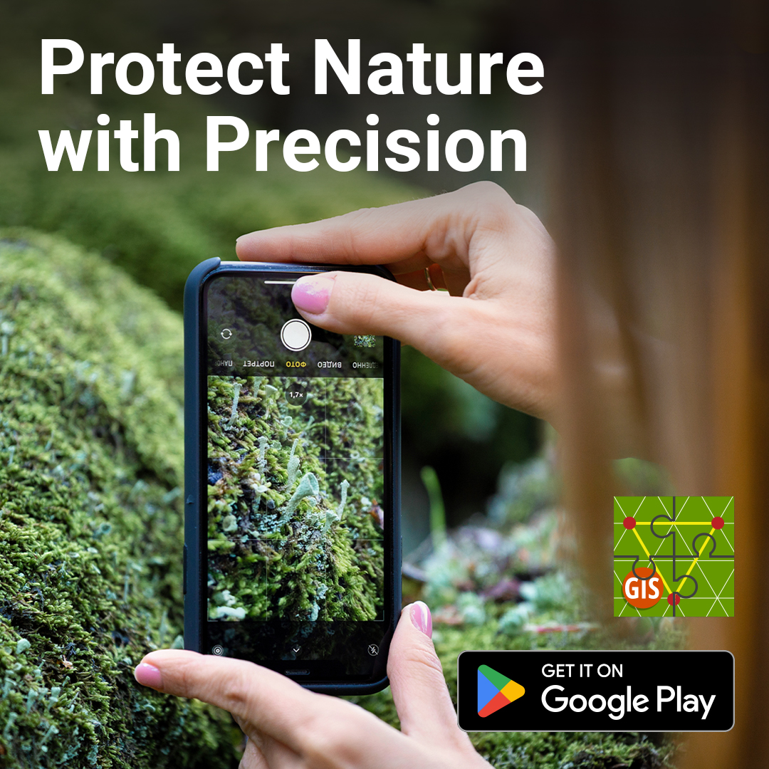
Conservation starts with accurate data. 📍 With Locus GIS, map plants, animals & habitats in the field: record GPS points, add photos 📸, track changes over time — even offline 🗺️ on Android. Export & share findings with your team.
#LocusGIS#Conservation#Ecology#FieldSurvey
A new year opens like a fresh map 🗺️ — full of possibilities. ✨
Thank you for your support 🤝 and trust.
May 2026 bring clarity 🔍, meaningful discoveries 🌍, and landscapes worth mapping. ❄️
#LocusGIS#NewYear2026#GISCommunity#MappingTheFuture
When winter softens the landscape and everything turns quiet, we wish you a Christmas filled with calm moments and a touch of outdoor magic.
May this season bring you clarity, inspiration, and peaceful days — wherever your work takes you.
#LocusGIS#Christmas#WinterLandscape
🌳 City tree inspections made easier.
Arborists & urban forestry teams use Locus GIS to plan routes, map trees with GPS 📍, attach photos 📸, and record condition data 📝 — all directly in the field. Plan smarter. Inspect faster. Keep cities green 💚
#LocusGIS#UrbanForestry
🌲 Protect your forest with better data.
With Locus GIS, you can:
🪵 Document tree damage
🐾 Record biodiversity
🗺️ Map protected zones
📆 Monitor long-term changes
A single app brings your field data + maps together.
Your phone becomes a powerful GIS tool. 📱✨
#LocusGIS#GIS
See your forest from a new perspective. 📷📷
Map roads, trails, harvest zones, and more — right in the field.
Overlay cadastral maps, capture attributes, and export for planning.
Faster, clearer forestry mapping with Locus GIS.
#LocusGIS#forestry#GIS#fieldmapping#geospatial
🌲 From the forest to your database — in just a few taps. With Locus GIS, record tree positions 📍, add species & age 🪵, attach photos 📸, and export to QGIS 💻.
No more paper forms — just clean, accurate field data ready for management & inspections. 🌿
#LocusGIS#Forestry#GIS
📏 Efficient Field Documentation for Surveyors
🛰️ Locus GIS helps record points, lines & polygons with notes, sketches & photos.
🗺️ Add WMS/WMTS layers & 📤 export to QGIS.
💡 Save hours — collect once, use everywhere.
#LocusGIS#GIS#Surveying#Mapping
🌍 Stake out points, lines & polygons with ease!
📱 Locus GIS turns your phone into a survey assistant:
🔹 Import SHP/CSV
📍 Navigate & mark with offsets
📸 Record attributes & photos
📡 Connect GNSS for accuracy
Bring digital plans to the field ✅
#LocusGIS#Surveying#GNSS#GIS
📐 Survey boundaries with confidence – right in your pocket. With Locus GIS, surveyors connect GNSS devices, navigate markers & geodetic points, record evidence via NTRIP, and add notes & photos in the field. From tax mapping to land disputes, nothing gets missed.
#LocusGIS
🌿 Mapping Nature, Protecting the Future
From bird nests 🪺🦇 to rare plants 🌸🌳 — Locus GIS helps biologists & conservationists worldwide:
✅ Monitor habitats 🐾
✅ Map zones 🗺️
✅ Document species 📷📍
✅ Work offline 🏞️
#BiodiversityMapping#LocusGIS#NatureConservation
A 6.500 m² field smiley made of ram till, phacelia, and mustard :). Accurately plotted out using Locus GIS and a precise RTK. The Google Map screenshot displays an early stage of the grow(draw)ing in 2018. Greetings to Bavaria!