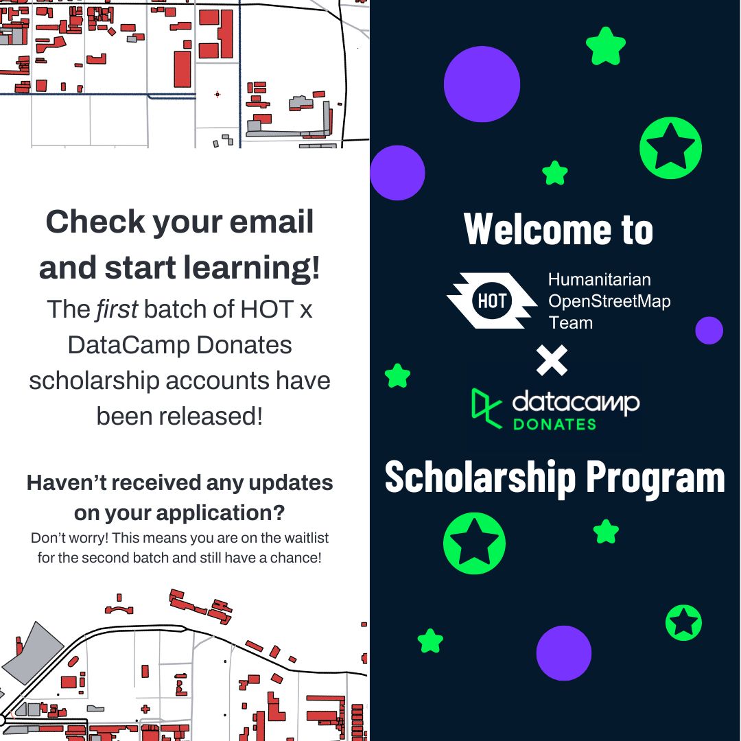
We are pleased to share that we have been selected to be a #DCDonates Partner! 💫
That means that we will get access to their online learning platform for free for one year! From data concepts to coding, all trainings are interactive!
Start your learning with @DataCamp today!🚀
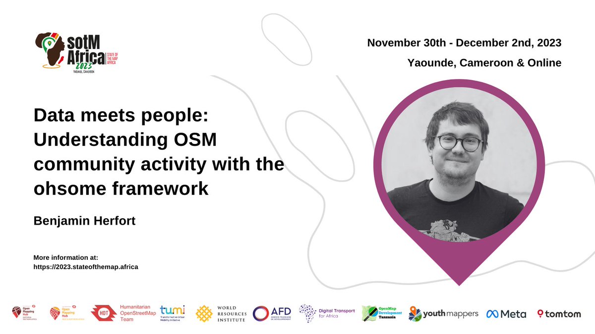
Discover insights from Benjamin Herfort of @GIScienceHD as he discusses "Data Meets People: Understanding OSM Community Activity" using the ohsome framework at #SotMAfrica2023. Don't miss!
🔗 Explore further: https://t.co/roEhQZAyMX
Join @Marie_Makuate from @openmapping_wna as she sheds light on "Women-Centered Disaster Resilience in Saloum Islands, Senegal" at #SotMAfrica2023. Gain insights into empowering women for effective disaster response and resilience!
🔗 Learn more: https://t.co/roEhQZAyMX
Thanks @sotmafrica, I’m really looking forward to learning together and sharing our diversified knowledge and experience.
Excited to see my old friends that I missed and meet new ones too. 😊
#SotMAfrica2023
🌍 Join @CharleChilufya for an insightful panel discussion on Bridging Gender Gaps in #OpenStreetMap! 🚀 Get ready to hear firsthand experiences and insights on addressing gender biases in technology. Don't miss it! #SotMAfrica2023 🗺️👩💻🌟
Explore more at https://t.co/cvAUT8vnEM
We are thrilled to announce and share some of the exciting sessions that will be hosted at the upcoming #SOTMAfrica2023 conference!
Starting us off is @kateregga1, who will talk about the current state of #OpenStreetMap in #Africa, highlighting both the challenges and successes.
@ezekiel_kiariro from @Geotetanzania will present on their innovative sustainability project on Mapping Trees for Climate Resilience in Morogoro Municipality in Tanzania
#SOTMAfrica2023
Leverage #OpenStreetMap for Climate Action! Creating spatial indicators for urban development & the 15-Minute City. Discover how @GIScienceHD advances climate readiness & sustainability at #SotMAfrica2023 with Prof. Dr. Alexander Zipf
Learn more: https://t.co/dpeJkmfZg8
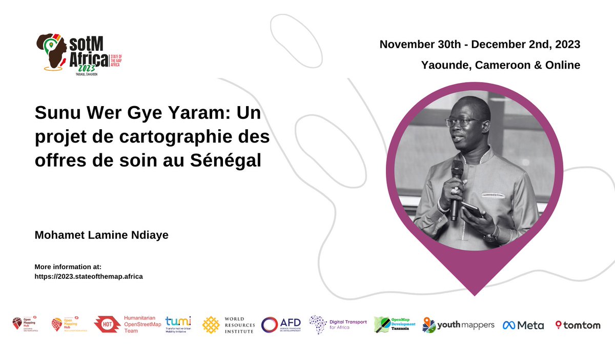
Découvrez 'Sunu Wer Gye Yaram': Une initiative de cartographie des soins de santé au Sénégal, autonomisant les communautés et améliorant les services de santé. Présenté par @lamineyasey à #SotMAfrica2023.
Pour plus d'informations, cliquez ici : https://t.co/WGALIehBqq
Venez découvrir le monde de la cartographie des transports en commun en Afrique de l'Ouest et au Liban lors du webinaire mensuel de #DigitalTransport4Africa qui aura lieu le 15 novembre. N'oubliez pas de vous inscrire ▶️ https://t.co/BOcuslI7ka #DT4A#PublicTransit
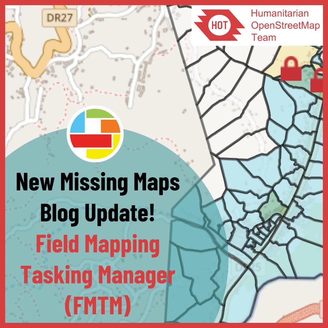
🌐 Field Mapping Tasking Manager (FMTM) 🌐
Discover how HOT’s FMTM is taking mapping to the next level!
Currently in its alpha version, we are looking for inputs to support improvements, feel free to try it out: https://t.co/Xkiw7GL2Ag
Read more here: https://t.co/9HGg7UqhPp
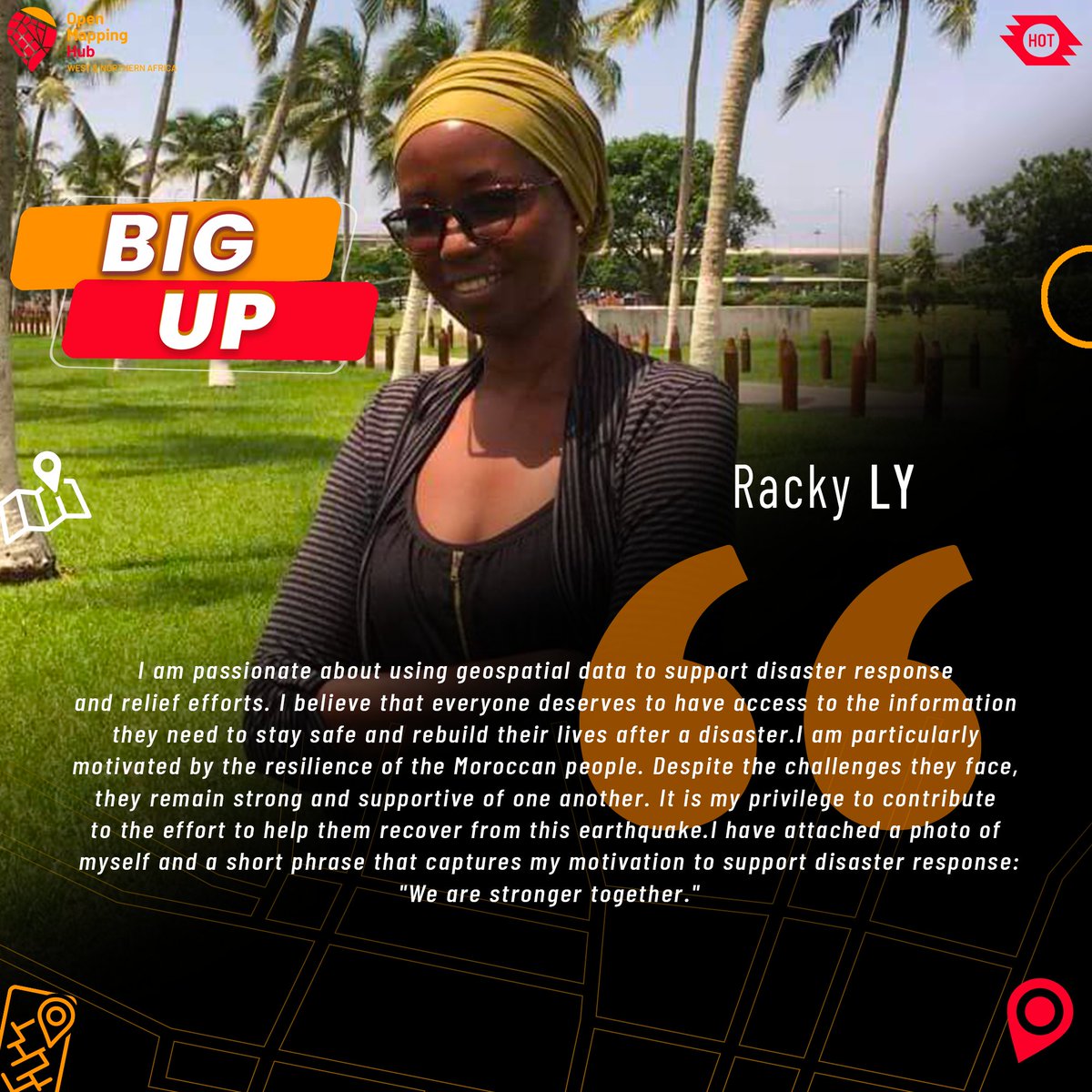
In Morocco, the situation is dramatic and the needs are enormous.
You can help them. You can give them hope. You can save lives. How can you help? By taking part in remote mapping here: https://t.co/gKwjni3U1A
#WNAH#HOT#MoroccoEathquake
🌍🗺️ Join the Open Mapping Hub WNAH and Médecins Sans Frontières (MSF) in an exciting collaboration ! We're launching the OSMer in Residence program for mapping enthusiasts to work with MSF for 6 months. Apply now: https://t.co/yfJirTghHq
#OSMerInResidence
Attention intermediate and advanced mappers and validators! The Disaster Services Team could use your help in completing this project which is supporting the response to Hurricane Julia: https://t.co/3qeP1SlYu1