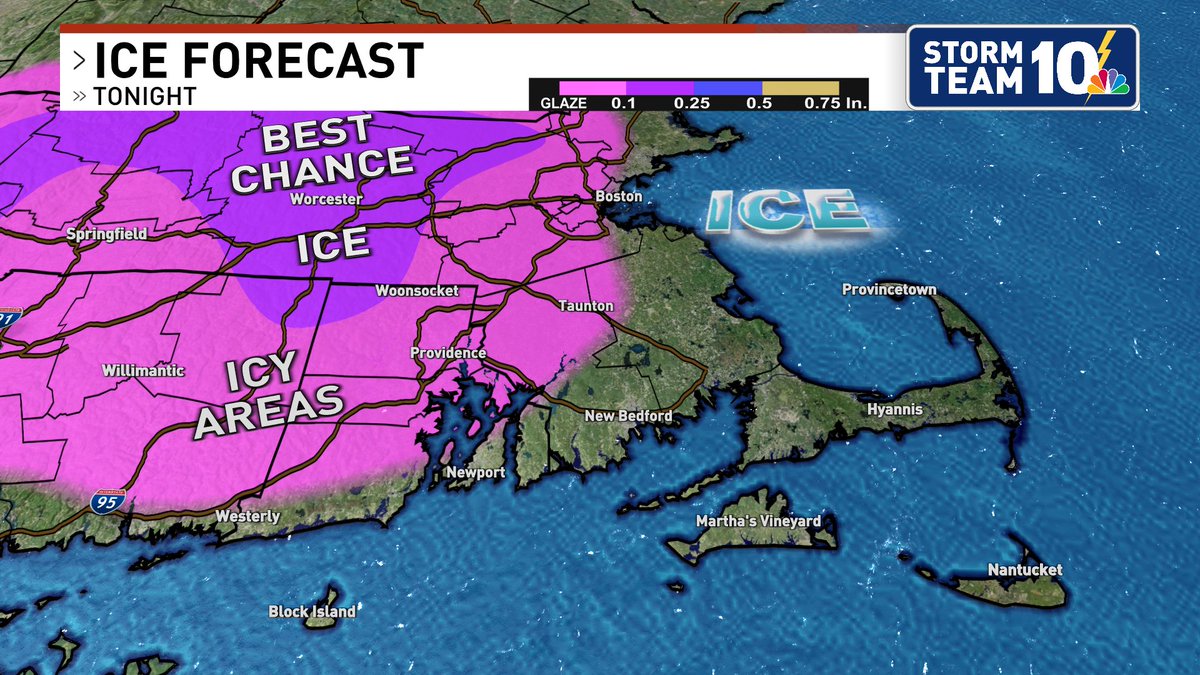
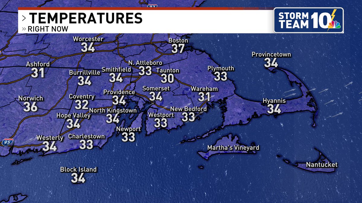
#WeatherAlert for icy travel tonight as a wintry mix of snow, sleet, and rain/frz. rain falls onto our cold ground. Getting many reports of icy parking lots, deck, driveways, and untreated secondary roads!
❄️All of Rhode Island’s emergency pop-up sites will be activated for those in need of a safe, warm space during the storm.
Additional shelters will be open across the state—no one will be turned away without a place to go. See the full list: https://t.co/ssUETVMpon
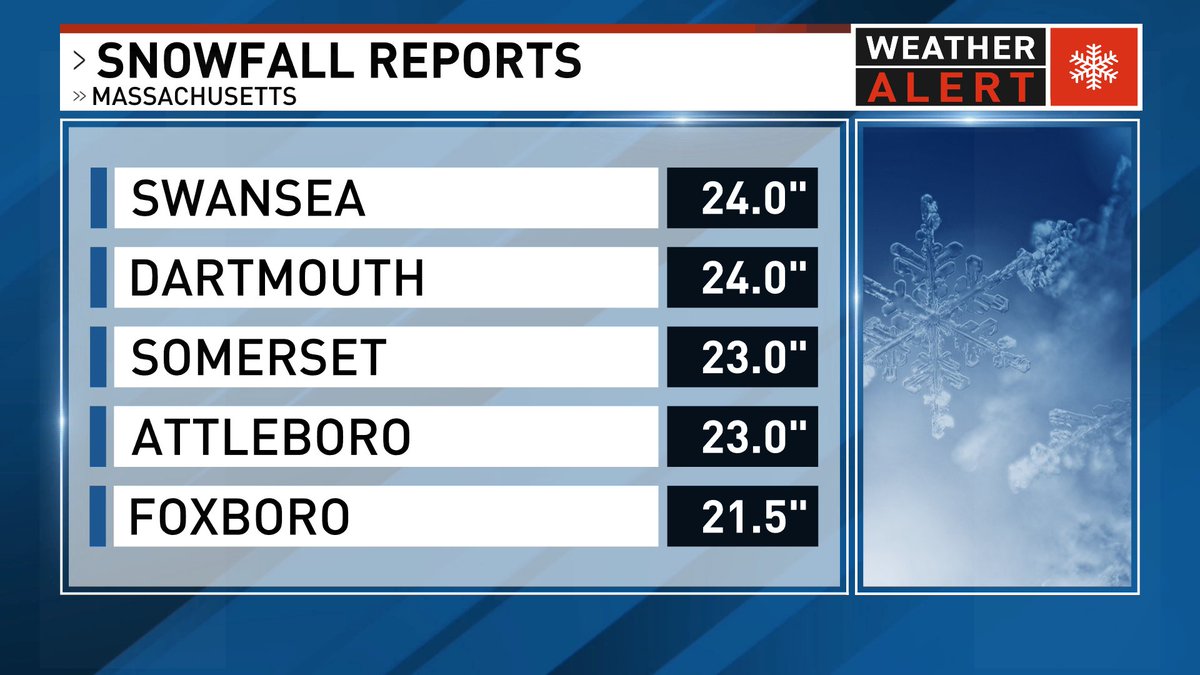
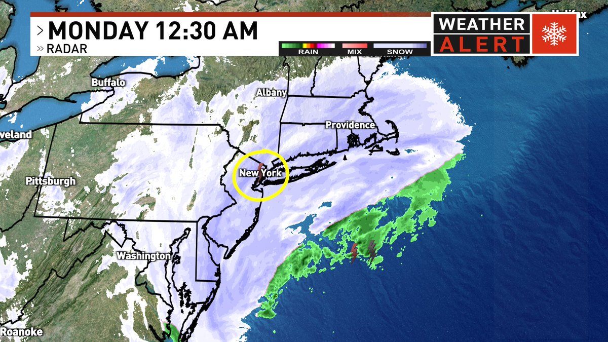
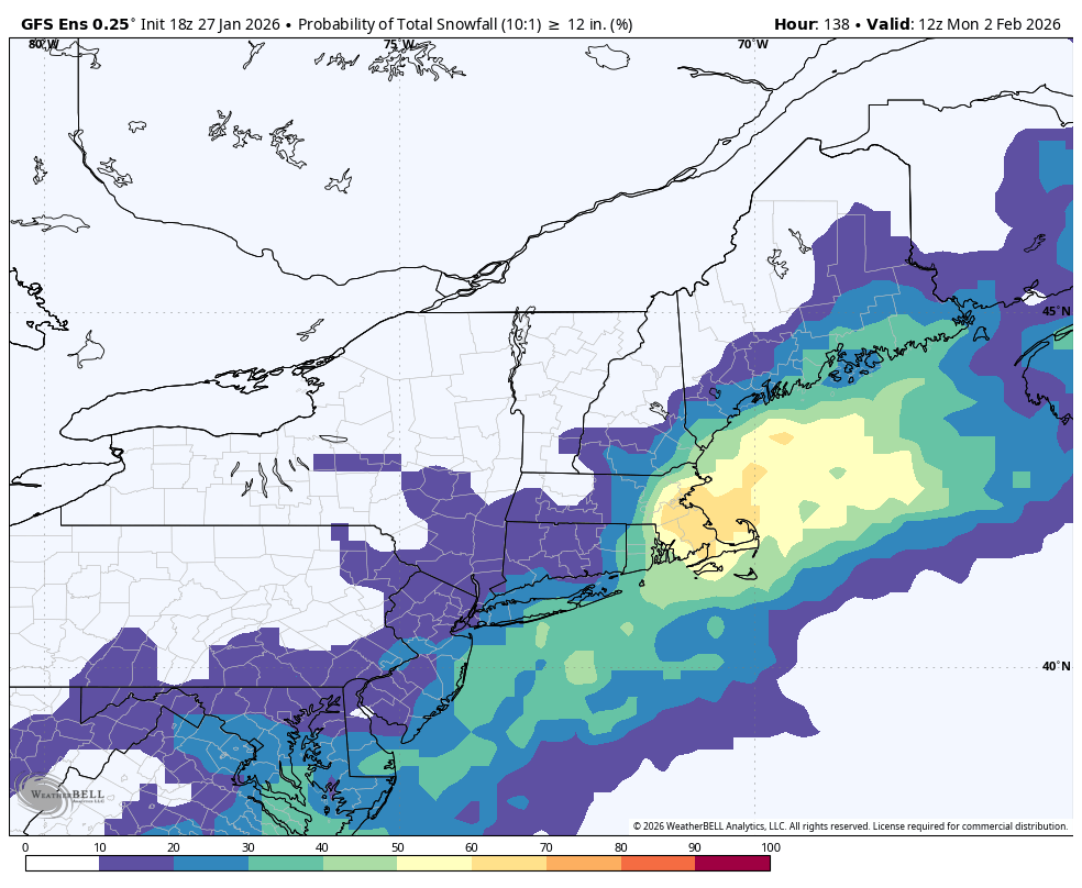
Trends continue to favor a closer track and higher impact from the Sunday night-Monday coastal storm. Probability of 6"+ and 12"+ of snow for us are high! Wind potential is considerable too...35-55mph NE gusts or higher...more to come later today. @NBC10
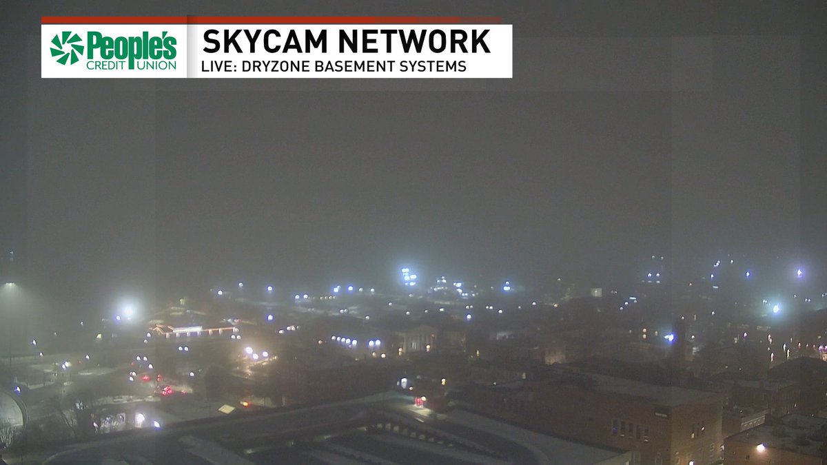
Fog is becoming increasingly dense tonight, and the concern is that this moisture may freeze on contact with some of our cold surfaces. Be mindful of icy spots overnight into early Wednesday morning!
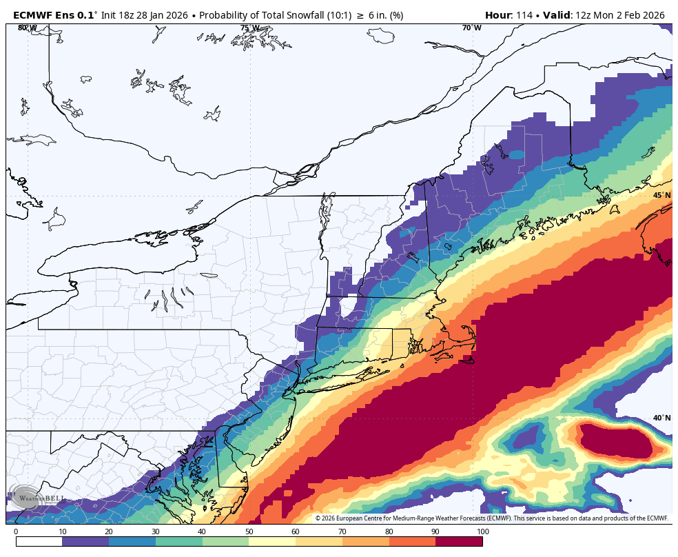
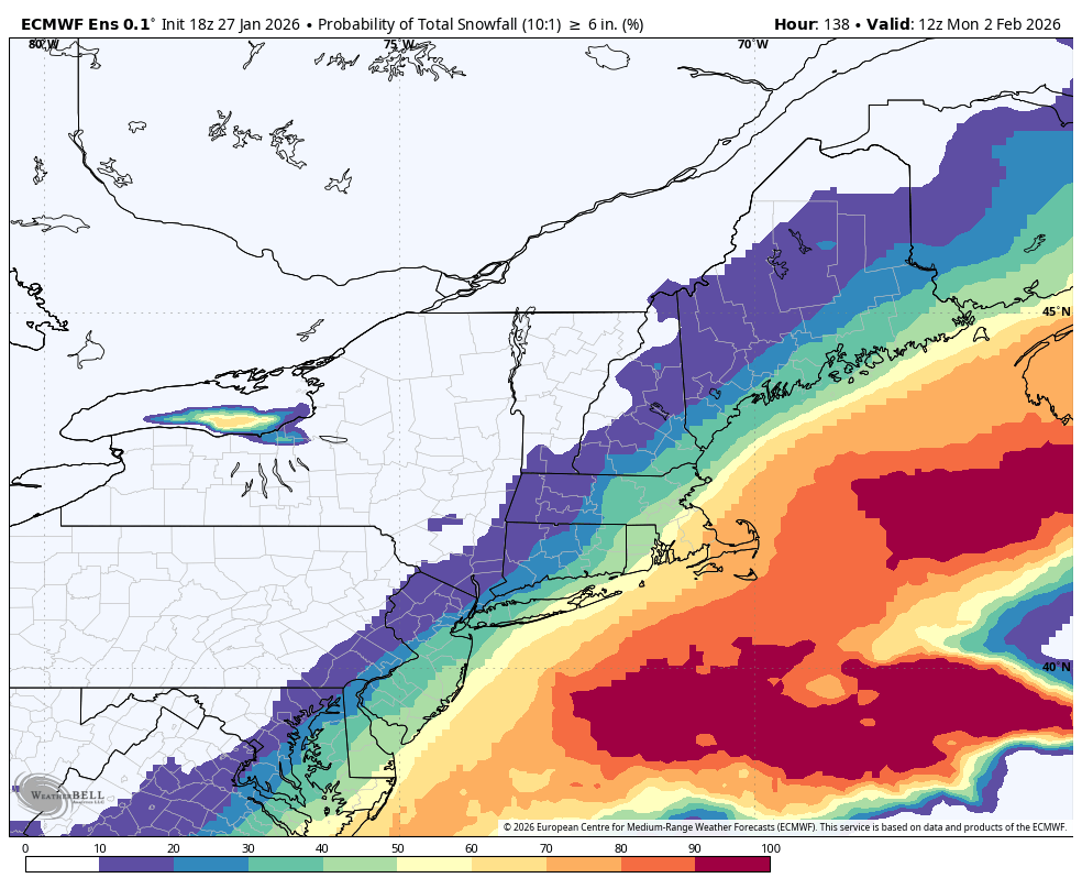
Tonight it's the Euro Ensembles that are by far the most "west" for the Sunday storm. Shows a 60% or higher chance of 6"+ of snow. American GFS & Canadian ensembles are much more offshore.
By no means is this a certainty, the surface low won't form until Saturday, keep watching!
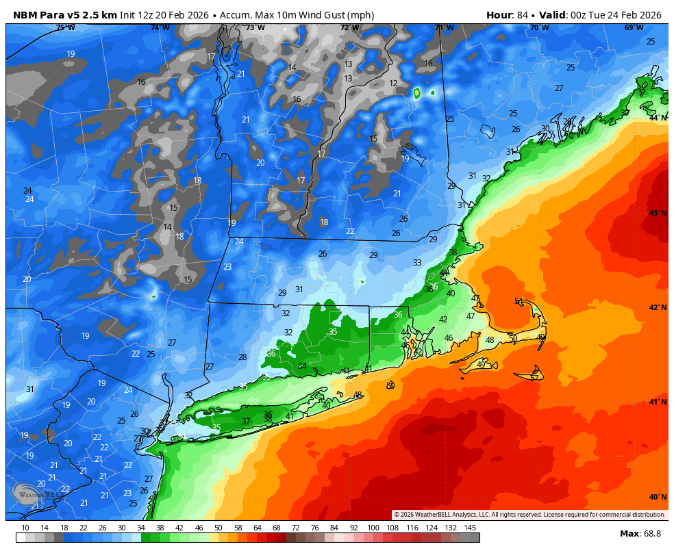
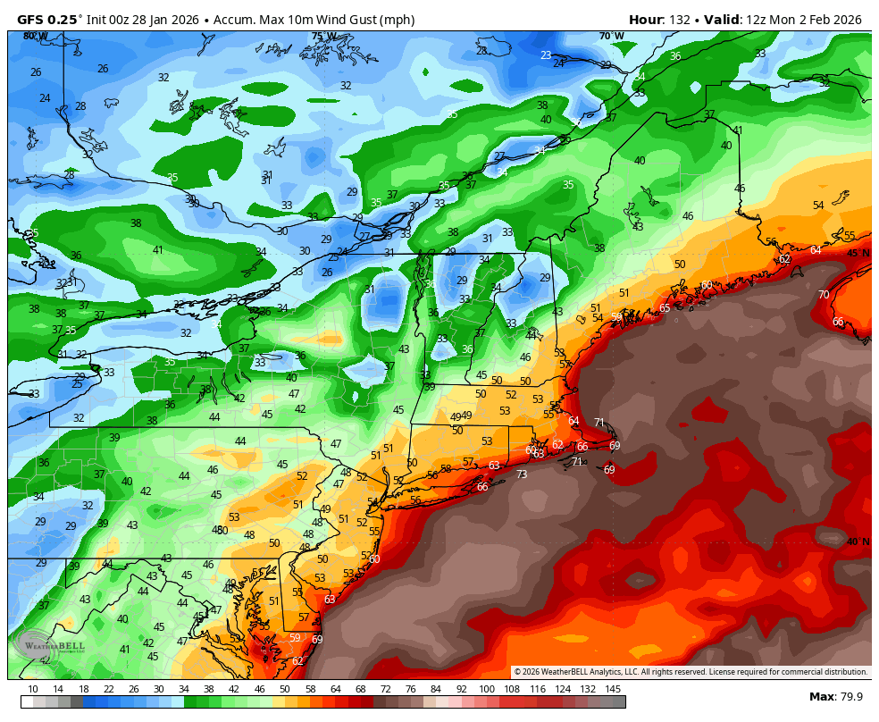
The latest 10m wind gust swath from the GFS, again nothing is certain yet but this just speaks to the potential and why we watching this storm so closely. Those are near hurricane force gusts on the Islands!
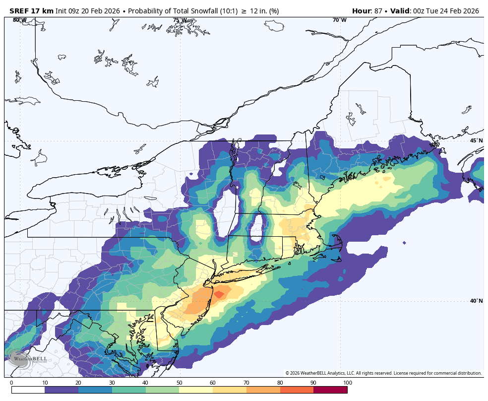
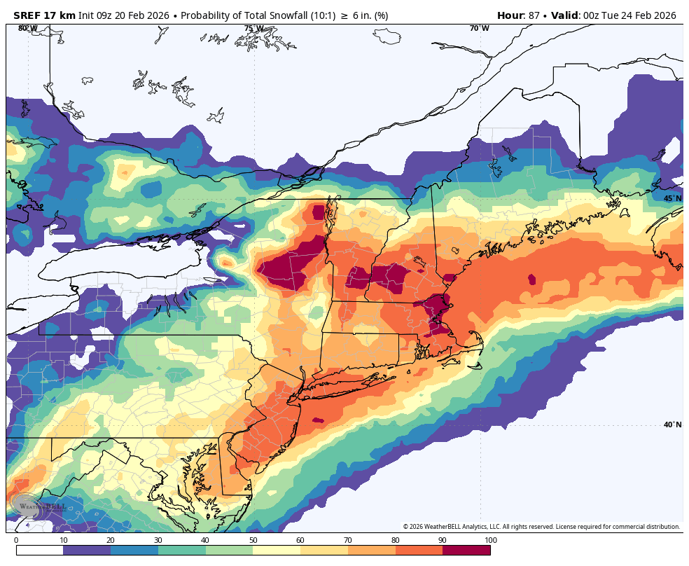
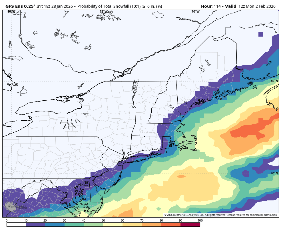
18Z Ensemble snow probabilities Sunday-Monday:
Euro 50% or greater of 6"+ for SE Mass, 30% or greater for 12"+
GFS closer to the coast, 60% or higher for 6"+ all of RI eastward, 30% or higher 12"+ (60% chance eastern MA) Stay tuned!
Hopping on @wpro at 2pm with Matt Allen to talk #WeatherAlert ...all things you need to know about the bitter blast and snow for this weekend. Our evening news on @NBC10 and @CoastalABC will have comprehensive storm coverage. Possibility of a foot of snow in the conversation!
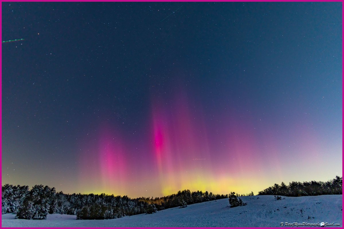
(2/2) Solar energy levels are forecast to drop off gradually tonight, so if you want to see them, head out away from light, look north, and use your phone's camera for the best results. Oh, and dress warmly!!! Good luck!!
(1/2)
The #northernlights are visible tonight across southern New England tonight. Peter captured the first picture from West Greenwich, Deana sent in the second photo from North Smithfield.
ENHANCED VIDEO: We are releasing an enhanced video of the person of interest in the Brown University incident. Footage was captured on the East Side of Providence on Saturday afternoon before the incident.
Please share widely and contact the official tip line if you have information or an ID: 401-272-3121 https://t.co/Gi5746TPDu