Most of middle TN is now under a SEVERE THUNDERSTORM WATCH (within blue outline) until 8 PM tonight.
Threats include:
- Scattered damaging winds up to 70 mph
- Isolated large hail events up to 1 inch in diameter possible
This is a watch meaning that conditions are favorable for these threats.
Stay tuned for more updates!
#severethunderstormwatch #severeweather #middleTN
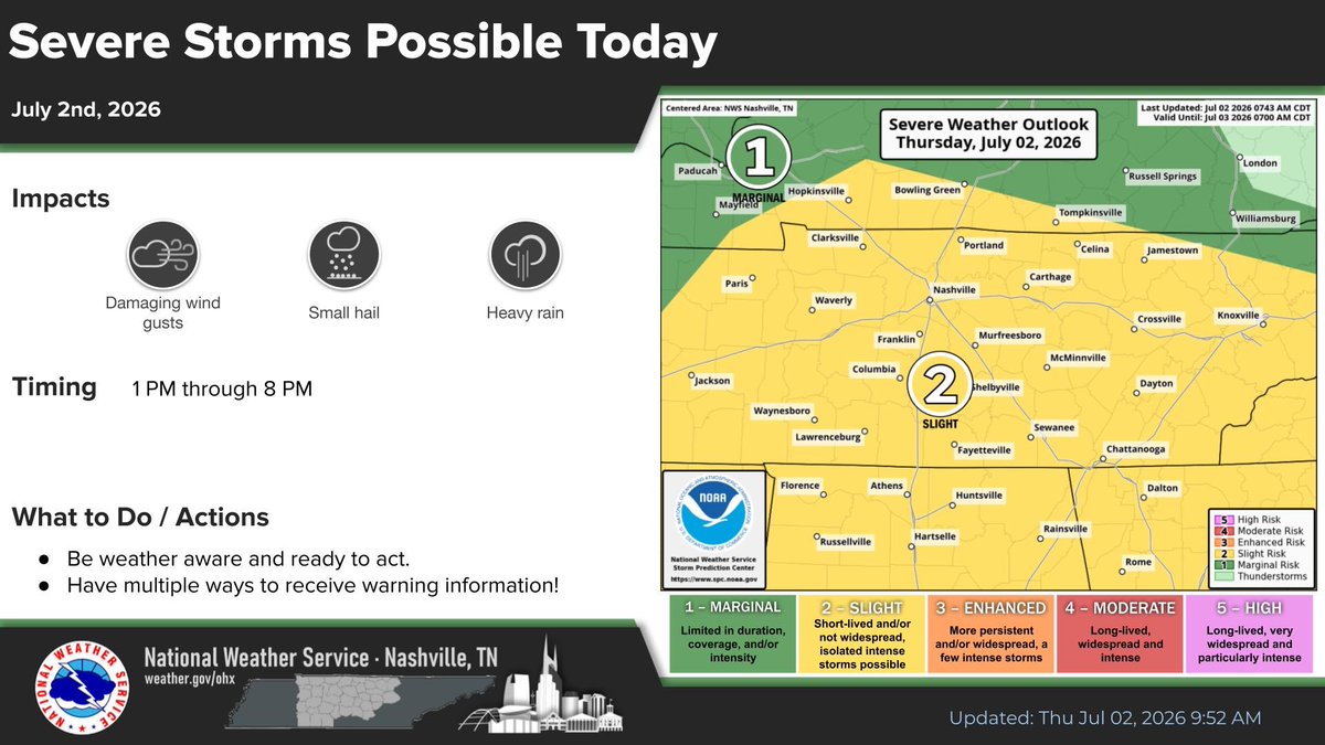
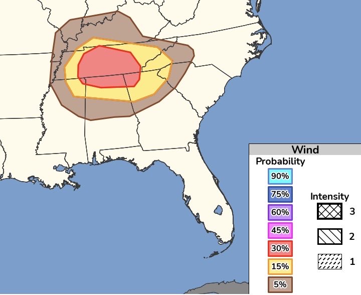
POSSIBLE SEVERE WX TODAY: Areas of middle TN are currently under a slight risk (level 2/5) for severe weather today. We also have areas of middle TN under 15% (yellow) and 30% (red) for strong winds today.
The threats that we will experience today come from a phenomenon called wet microbursts. Microburst threats generally occur when a rush of cool air, called a downburst, descends from a thunderstorm. This can produce heavy rain, hail, damaging winds, and localized flooding.
Today, the main threats are heavy downpours, winds up to 70 mph locally, and hail. With CAPE values at BNA around 2100 J/kg, storms will develop quickly, so make sure to have an umbrella or rain jacket on hand!
Timing will be from 3 pm into the evening.
#middleTN #weather #microburst #heavyrain #wind #hail #severeweather
POSSIBLE SEVERE WX FRIDAY:
Most of us here in the Southeast are experiencing above average temperatures for this week ranging from the mid 60s to the low 70s. We are expecting a strong cold front to move in on Friday. The SPC has issued a 15% chance of possible severe weather for the area in the image.
When: Friday afternoon into Friday night.
Where: Parts of Middle TN, most of MS, Northeast LA, Southwest KY, Northwestern corner of AL, and Eastern AR.
It is still a little early to determine threats and exact timing for this event. More will be coming later!
#weather #severe #southeastwx #TN #AR #KY #LA #MS #AL
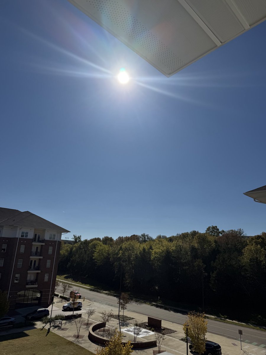
Today felt very fall like and it will continue to feel that way tonight! Beautiful, clear skies tonight with a low in the 30s.✨Tomorrow will be mostly sunny with a high in the mid 60s.
We will be warming up back in the 70s by the end of this week! ☀️
#MSUwx
Happy Halloween! 🎃 Clear, blue skies again today! Expect the high to be in the mid 60s by this afternoon. Today’s skies will be mostly clear. Tonight we will have lows in the low 40s so bring a jacket while trick or treating! More coming up later.
#MSUwx
SEVERE WEATHER TODAY:
Most of Mississippi is under a slight (level 2/5) risk today. Main threats include strong wind gusts up to 60 mph and small hail.
Even though the tornado threat is low, a few spin-ups are possible. Stay tuned!
Timing for central Mississippi below:
#Severeweather #Mississippi #Weather
SEVERE WEATHER THREAT:
Parts of the Ozarks and Mississippi valley have been upgraded to a slight (level 2/5) risk! Strong winds, hail, and tornadoes are possible!
Timing coming up later!
#weather#severewx#Mississippi#Arkansas#Tennessee
Got this crazy shot over in Leipers Fork at 2:50 PM. It was over Thomson Station and eventually became a mini line bringing heavy rain and lightning to Brentwood and Franklin, TN
#shelfcloud#stormy#weather@DanielleBreezy
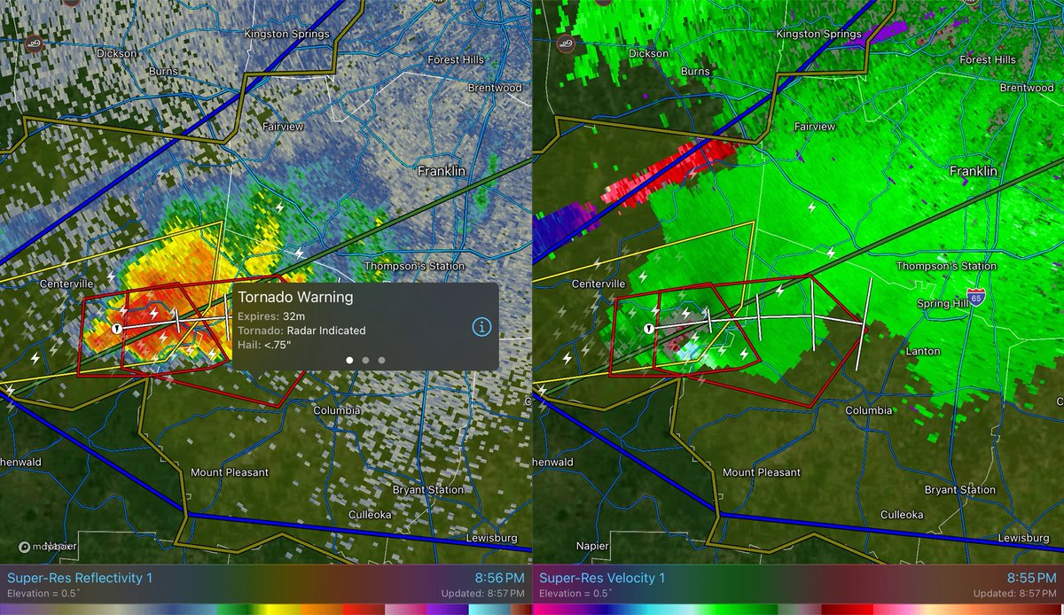
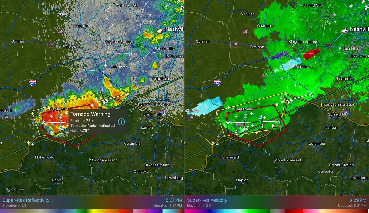
UPDATE: The Tornado warned storm in Maury County looks like it is weakening, but this does not mean that there is no threat! NWS says they are going to allow for a couple more scans to see if they are going to let this warning cancel.
This TORNADO WARNING is not backing down. The rotation is strengthening and another tornado warning will most likely be warned soon for locations like #NewHopeTN and #SantaFeTN.
#tornadowarning
TORNADO WARNING: If you are in #LewisTN, #MauryTN, or #HickmanTN, get to your safe place now! This previous tornado warned storm has spun back up and tightened! This will be heading in the direction of #NewHopeTN and #SpringHillTN soon! Stay tuned!
#tornadowarning
SEVERE THUNDERSTORM WARNING: The tornado warned storm is now a severe thunderstorm warned storm with a tornado possible tag heading towards #CentervilleTN. This could spin back up so stay tuned!
#severethunderstormwarning