📉📊📈 Great Resource Alert!
@humdata has created a #dataviz showing #COVID19 cases & deaths in countries w/humanitarian operations.
➡️https://t.co/NlmjNSWU6P
And a #coronavirus page with datasets from partners:
➡️https://t.co/KnnlcirZgy
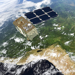
Landsat satellites have been gathering data for 48 years, equipping scientists and farmers to answer big questions about how to improve #agriculture around the world.
From mobile phones to satellite imagery and from tablets to cloud computing, these innovations are helping gather data in fragile situations. https://t.co/RVFBC9RVB4 #dev4peace
Looking back over the past decade, the @WorldBank present 10 charts from their research department that transformed their understanding of development. #data4SDGs#SDGs https://t.co/dOX7zJuQ5Z
The @FAO's Agricultural Stress Index System (ASIS) monitors agricultural areas with a high likelihood of water stress/drought, using satellite technology.
Learn how ASIS is helping to protect livelihoods and safeguard food security https://t.co/5PSyPNPGCf
The use of machine learning for land cover mapping now offers sub-national clients the opportunity to interactively engage and benefit from a new frontier set of technologies. https://t.co/ui60ShQ7R9 via @worldbank