Pile burning operations are planned the week of November 4th on the Malheur National Forest. Implementation will be dependent on weather conditions.
Read more here: https://t.co/Ntt7TBsuWq
Joint News Release: Public Comments welcome on Joint BLM and Forest Service Emergency Wild Horse Gather in Murderer’s Creek Area
Read more here: https://t.co/kpgaHK26fa
The Blue Mountain Forest Plan Revision team announce public meeting opportunities for December 2024! More information and meetings links will be available at https://t.co/6sgYMMsnJN.
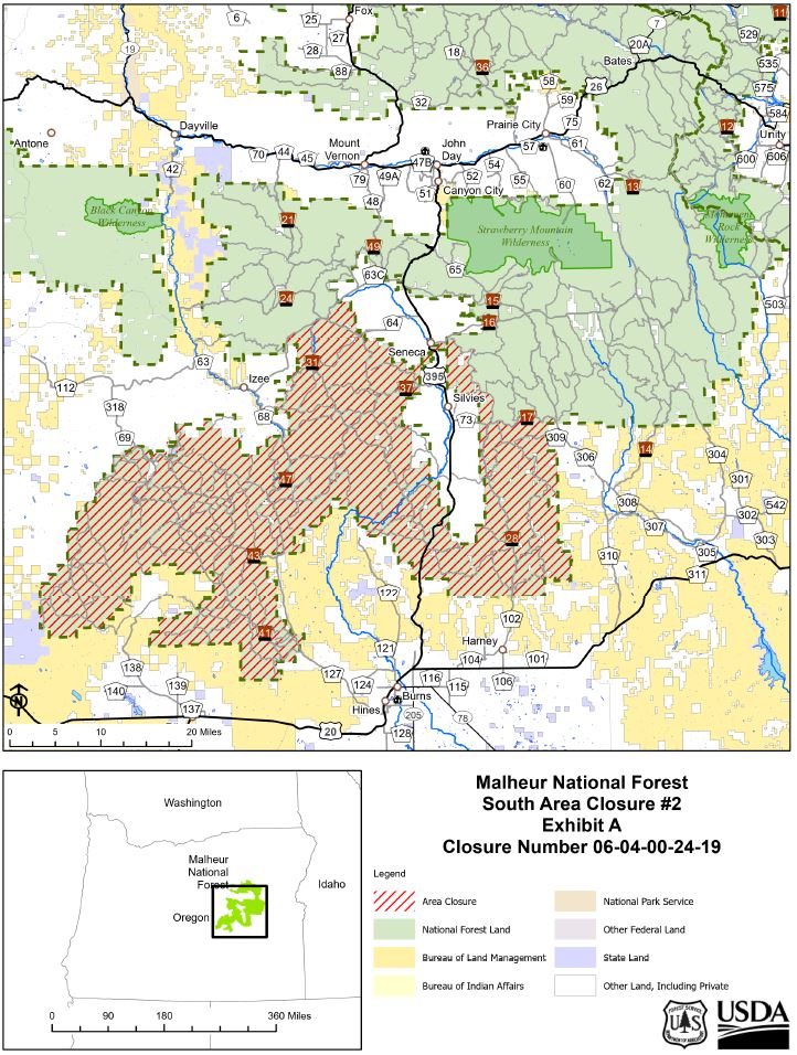
A map with the Rail Ridge Fire footprint, Forest Closure areas, and the ODFW Hunter Management Units is now available.
Safety hazard information and a downloadable map are available on our website: https://t.co/hPWLx0SYOs.
Rail Ridge Fire information: https://t.co/AzyD9uU70K.
The Blue Mountains Land Management Plan Revision team is pleased to announce that the Final Summary Assessment, Final Assessment Reports, and draft Preliminary Need to Change documents are available.
To read, please visit: https://t.co/eJ5Zj1503l.
Head on down to our Hunter Information Booth located in the public restroom parking area in John Day! The booth will be staffed today and tomorrow, October 3 and 4, from 7 a.m. to 5 p.m.
See you there!
https://t.co/wtQUfpnnrJ.
Magone Lake Recreation Area Reopens
(September 25, 2024) — After Grant County Search and Rescue operations have concluded, Magone Lake Recreation Area reopens to public access.
NEWS RELEASE:
https://t.co/OStH2HQtm7
Effective 9.25.2024 @ 12:01am, Malheur National Forest, Emigrant Creek Ranger District will move to PUR Phase A. All of the Malheur National Forest will lower to an IFPL I & Fire Danger Level will remain Moderate.
https://t.co/IWWYGUK6r0
Pie DxPre Reoffer Sale:
The Forest Service will receive Sealed bids at Malheur National Forest, Supervisor's Office before or at the time of public bid opening at 10:00 AM local time on 09/25/2024.
https://t.co/1FVS6hqc85
Over 6,500 lightning strikes were recorded over the weekend in the region. Thanks to firefighters and precipitation, impacts of new fires have been minimal. #FireYear2024.
Malheur National Forest North Zone Decreases Fire Danger and IFPL Levels
The North Zone has moved to a fire danger level of High and IFPL III. The South Zone remains at a fire danger level of Extreme and IFPL IV. Both Zones remain in Phase C of PURs.
https://t.co/e03H0cS9pv
A Burned Area Emergency Response (BAER) Team has started their assessment of Forest Service lands affected by the Falls, Sand, and Whiskey Mountain Fires.
BAER Team assessments are also planned for the Courtrock, Telephone, and Poison Creek Fires.
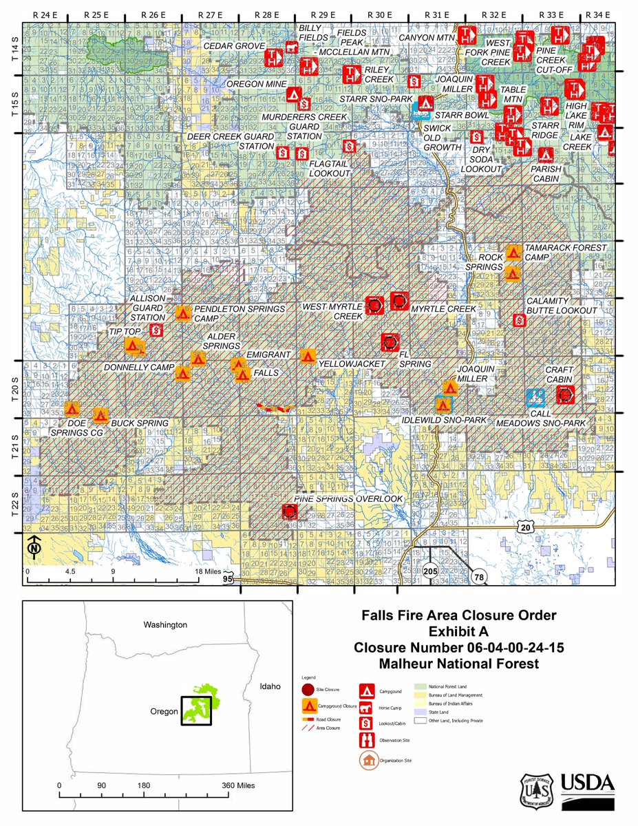
Falls Fire Update:
Current Acres: 957
Status: NW IMT Team 8 will be in-briefing this evening and assuming command of the fire 7/12/2024.
📸: C. Rott, BIFZ