FALL COLORS - We're approaching peak colors in teh Midwest - not quite there yet. High colors are noted in northern parts of the Plains, the upper Great Lakes, and the New England states.
Map courtesy: https://t.co/d4G72o2jj0
#INwx
WEDNESDAY - Some patchy areas of dense fog have been slowly rolling in from northwest Ohio into northwestern Indiana. The view from Angola shows some very low visibility. Most of that stays north of #Indy this AM. Another great day today! Enjoy it!
#INwx
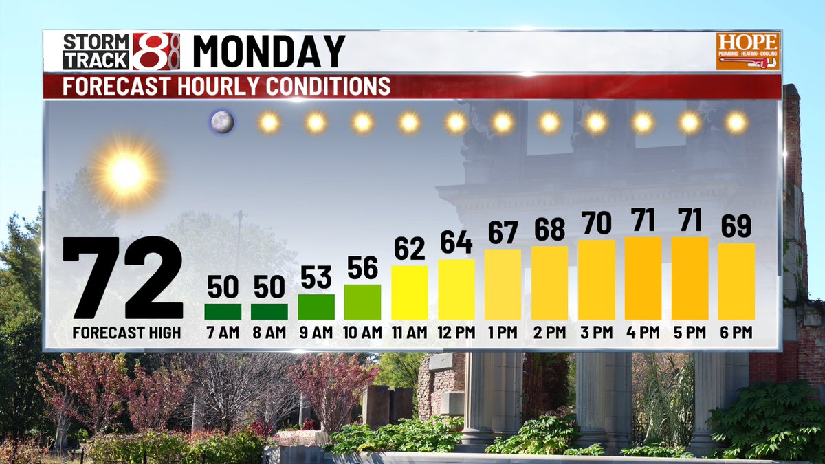
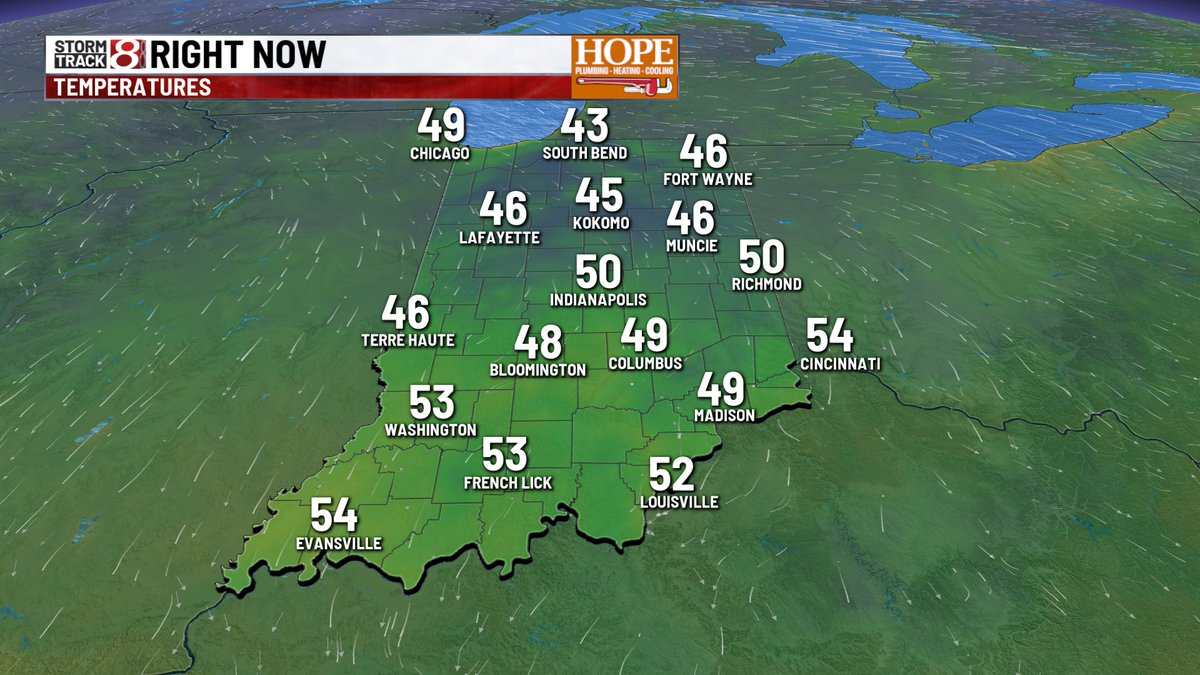
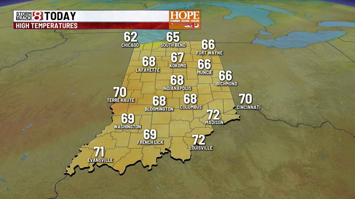
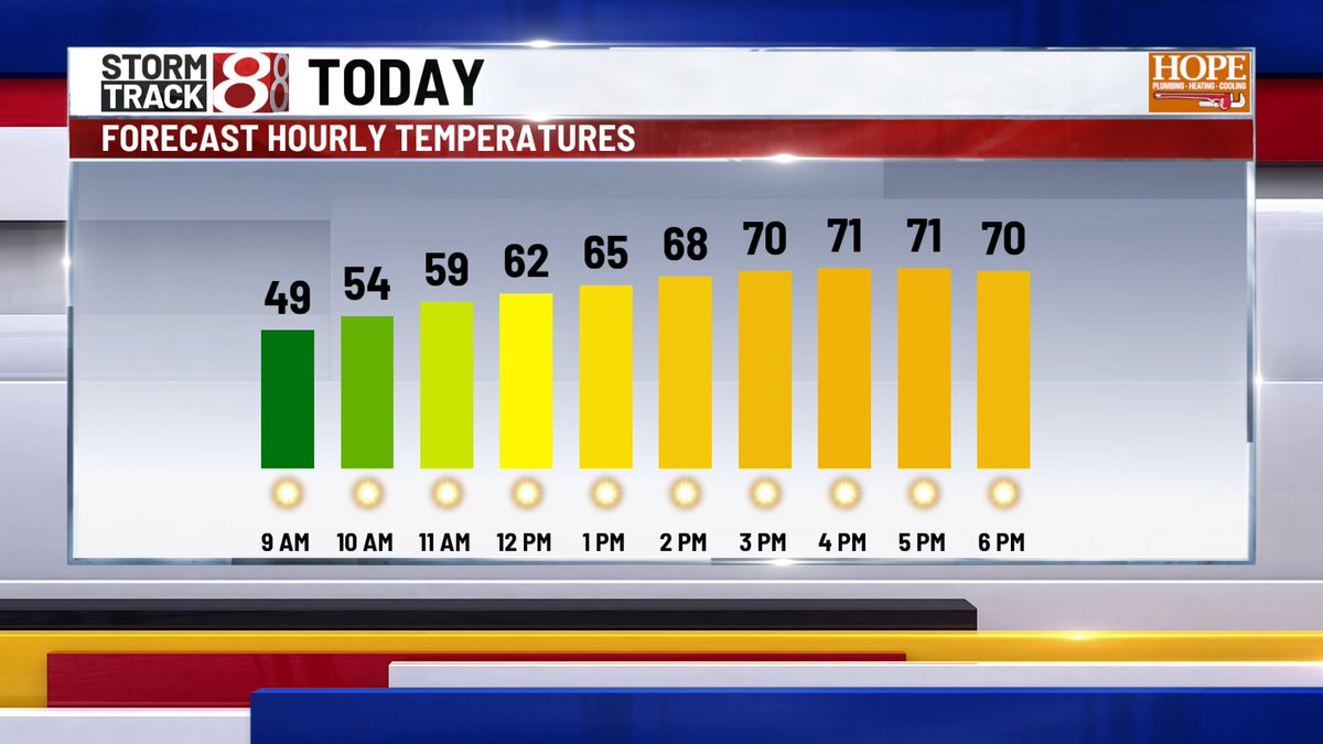
MONDAY - Frosty start for some this morning - and we could get a bit colder before daybreak around 8am. Temps bounce back nicely, hitting the upper 60s this afternoon.
#INwx
7:20 am #ISAIAS NOW A CAT 3 - Latest update has winds up to 120mph - likely will maintain CAT 3 status through much of the day before weakening as it approaching landfall later tonight. #Hurricane#Gulf#INwx
8 AM EDT #ISAIAS UPDATE - #Hurricane Isaias is on the brink of becoming a major CAT 3 storm - 245 miles south of #Pensacola right now - and likely will reach CAT 3 strength by lunch time, with peak winds up to 120mph. Landfall comes late tonight along AL/FL coast
#INwx
5 AM UPDATE ON HURRICANE ISAIAS - storm has strengthen, with 110 mph winds, now a CAT 2 storm, and forecast to hit CAT 3 status this afternoon, with winds up to 120mph. Landfall still expected along AL/FL coast late Fri night. #Isaias#Hurricane#INwx
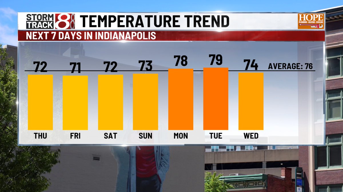
Our stretch of dry weather will continue until at least Saturday evening - when the remnants of #Isaias work into the Midwest. Rain chances ramp up late Saturday, with on and off rain, breezy winds, and cooler temps on tap for Sunday.
#INwx
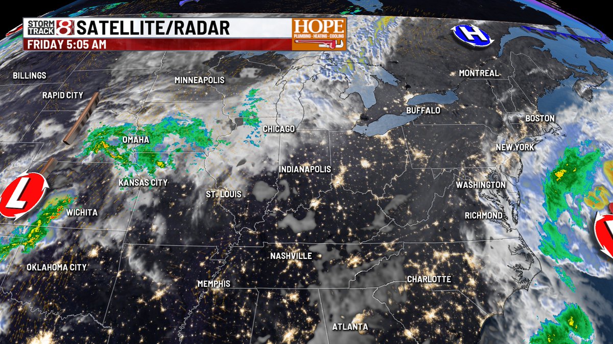
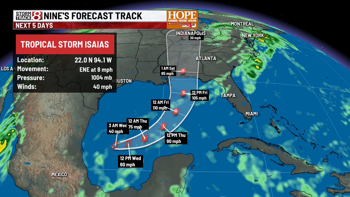
HURRICANE #ISAIAS - Cat. 1 storm, with winds at 80mph. Storm is moving ENE at 9mph, and expected to make landfall Friday night near the Alabma/Florida state line. Storm surge could reach 4-7 ft from Gulfport MS, to Miramar Beach, FL. Hurricane warnings are now in effect.
#INwx
TD 9 has now been upgraded to Tropical Storm Isaias in the Gulf, with winds up to 40mph. Track remains unchanged, making land fall late Fri/early Sat. as a high end Cat 1. hurricane -with winds near 100mph along the MS/AL/FL coast.
#INwx
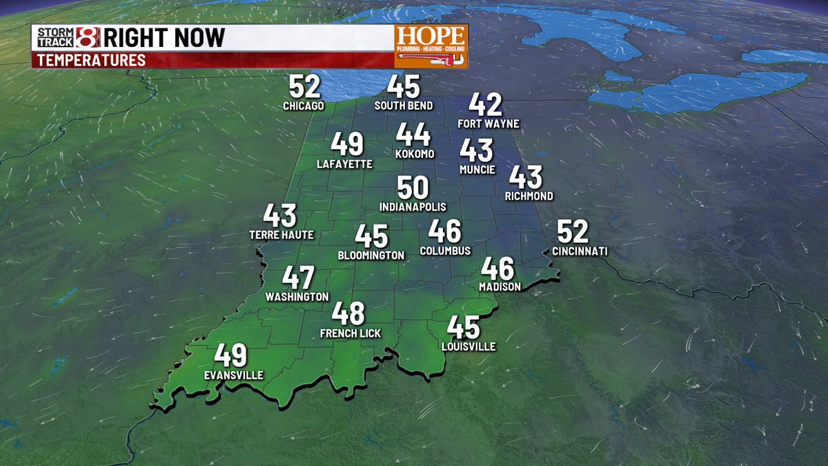
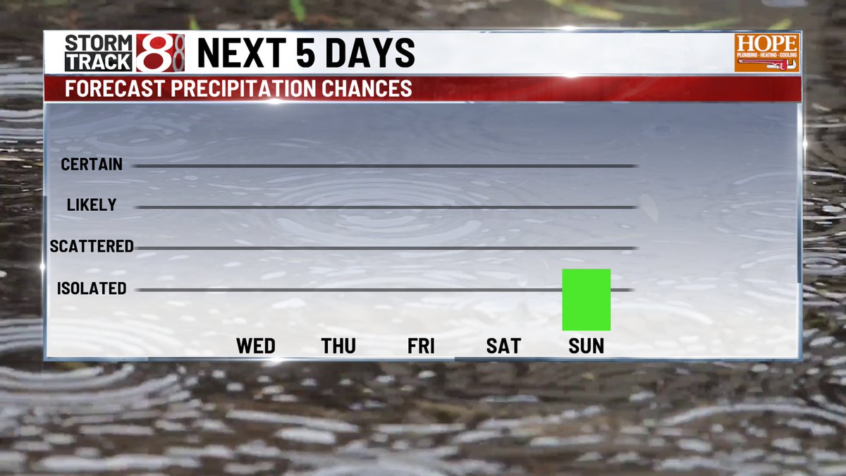
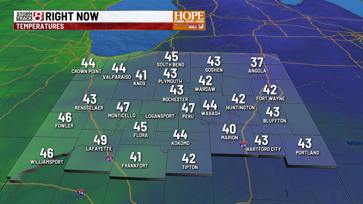
TUESDAY - As advertised, it's the coolest morning we've had in a while over much of the state - with some areas alread in the 30s in far northeastern IN. Another day of full blast sun - as highs top out near 70°. Dry days ahead, but some rain now possible Sunday.
#INwx
MONDAY - Crisp and clear to start the morning. We should be in for a fantastic finish this afternoon, with highs hitting the low 70s, with cyrstal clear skies all day!
#INwx
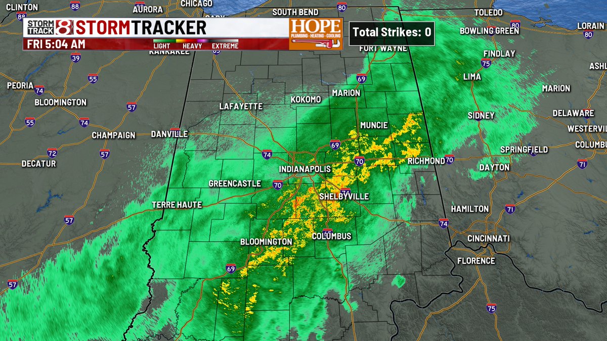
FRIDAY - Rain is pushing through along a front this morning. Nothing severe, but bus stop/morning commute will be impacted. Temps have already hit maximum - so expect mid/upper 60s through this afternoon under cloudy skies.
#INwx
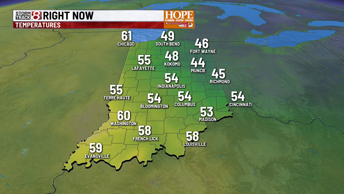
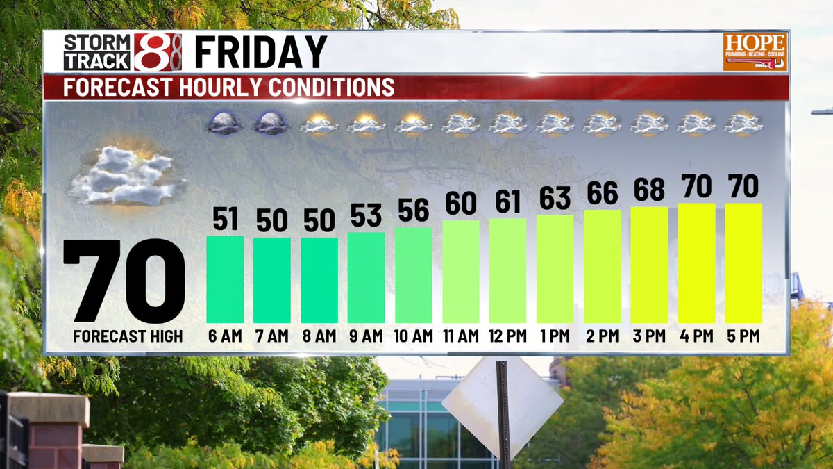
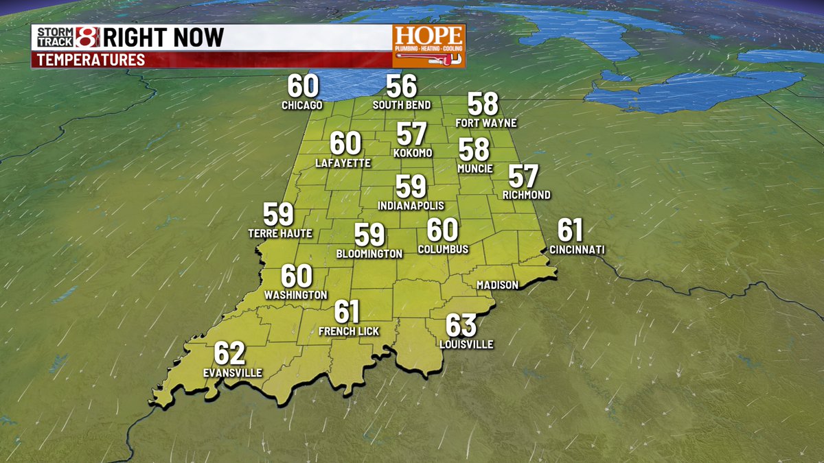
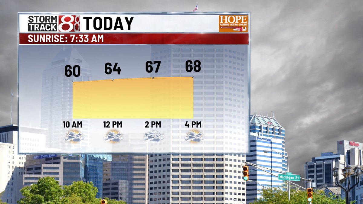
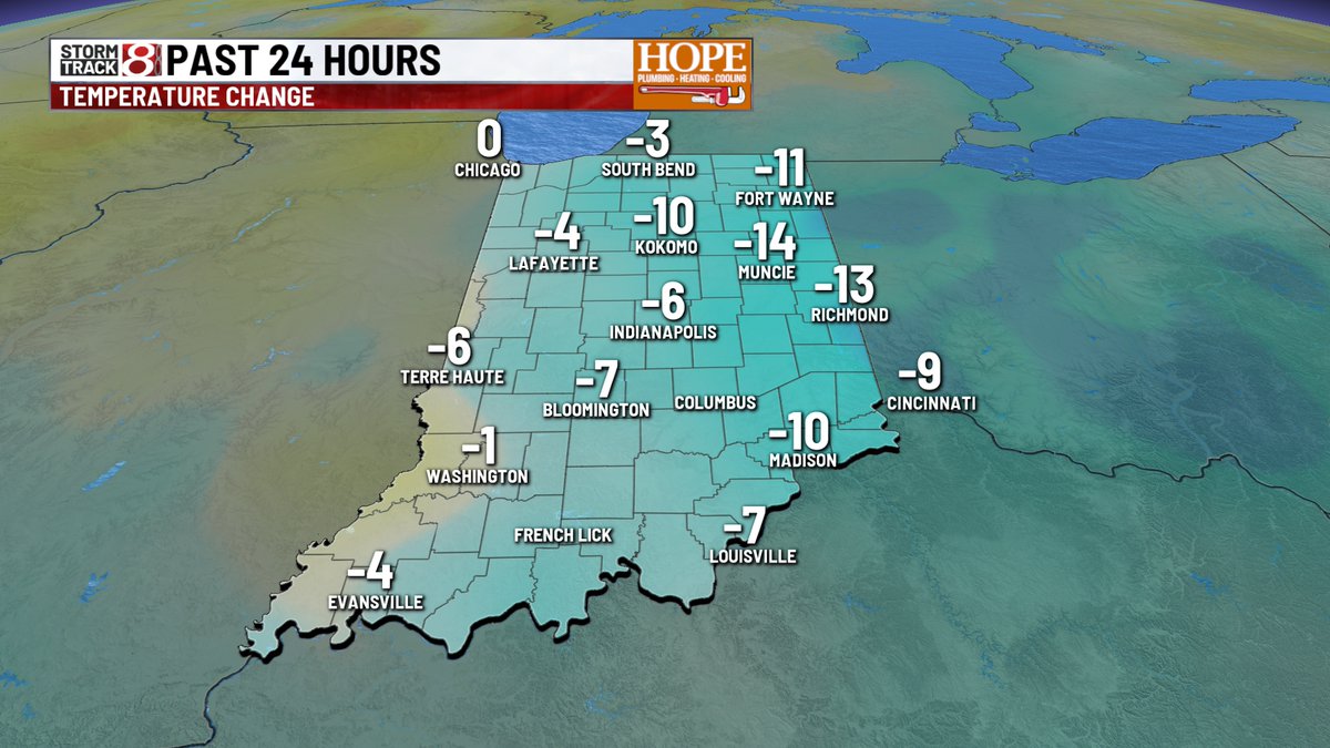
FRIDAY - Skies have cleared this morning - and as expected, temps have dropped quite a bit. We are anywhere between 5 to 15° colder than Thurs. AM. Nice rebound with filtered sunshine today - Highs should hit the upper 60s/lower 70s.
#INwx
4:44 AM - Terrible crash on I-70 westbound just at Rural/Keystone exit just east of downtown. Traffic is down to one lane heading into downtown from the eastside. Several vehicles innvoled.
https://t.co/JBetSbObuS
THURSDAY - Another morning full of clouds and drizzle. Gray skies continue for much of the day - but I'm hopeful we get a few rays of sunshine later this afternoon. Highs should push closer to 70° this afternoon.
#INwx
WEDNESDAY - Gray, damp, and cool. Areas of drizzle have settled in this morning - and will hang around all day long and like into this evening. Temps only hit the mid 60s again today. Hang in there - sun returns late Thurs. with warmer temps.
#INwx
TUESDAY - We're coming off a much cooler Monday - in fact, the coolest day we've had since late May. More of the same today - cloudy, breezy, and cool. Highs will hit the upper 60s this afternoon.
#INwx
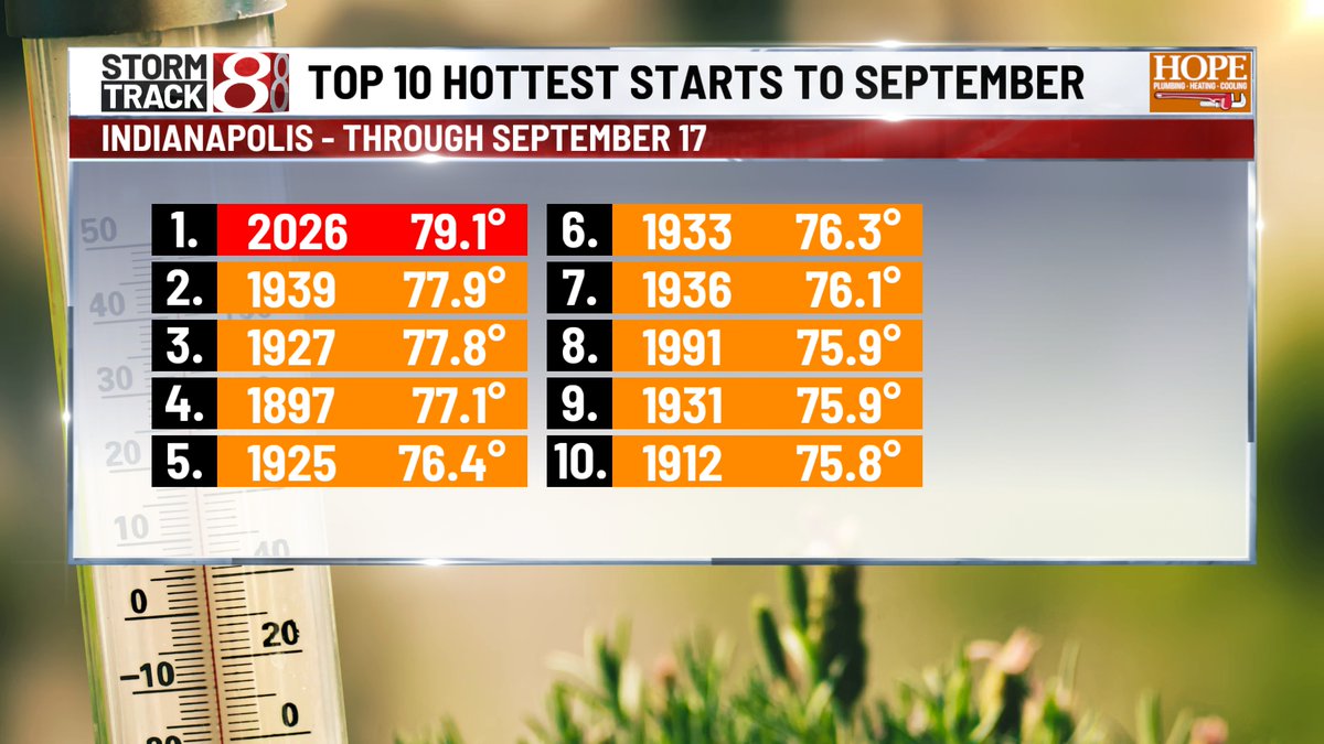
We're 20 days into the month - 2/3 of the way through and we remain ranked #1 warmest on record - and it's not really close. Out of 20 days, only 3 high temps have been around average - the others have been above - in some cases, well above average.
#INwx
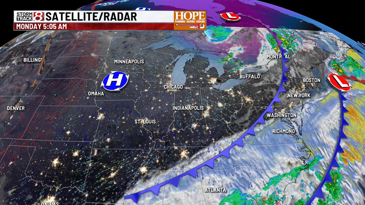
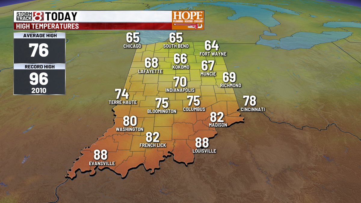
MONDAY - Today is a day of change - hot temps are moving out and cooler air is moving in. In between, we have showers & storms across much of central IN this AM. Rain will taper off later this afternoon.
#INwx
HOT SEPTEMBER - Thursday was day #9 of 90°+ heat for the month of September - it's the most since 1983 and ties for the 5th most on record. Through 17 days, this is the hottest start to the month on record - and it's not really close at this point.
#INwx