On this night 19 years ago, thousands of Americans kissed their loved ones goodnight for the last time, including 23 NYPD officers, 343 @FDNY firefighters, and 37 @PANYNJ officers. The 9/11 Tribute in Light serves as a reminder of the lives lost on that tragic day.
#NeverForget
Stay weather alert this afternoon and evening as scattered to numerous severe storms are expected to move across our area from west to east. The main threat will be damaging wind gusts, but tornadoes cannot be ruled out. For the latest forecast visit https://t.co/t54l4ELo2o
Showers and storms are beginning to organize over west-central PA, these will eventually make their way to our area this afternoon. Some storms may become severe in nature with the most likely impacts being damaging winds. Visit https://t.co/MW83KHFiJb for important updates.
For the latest local information on potential impacts from Hurricane #Laura follow @NWSHouston@NWSLakeCharles and @NWSShreveport. This will not just be a coastal event. Strong winds and heavy rainfall & flooding are likely to occur well inland along the storm's path.
A few showers today especially near and east of I-95. Fun fact of the day: DCA's streak of 50 consecutive days of a minimum low temperature being 70° or above has been broken as of this morning with a low of 66°.
Rain is in store for the entire region today and tonight with the heaviest amounts expected along the Blue Ridge Mountains and the I-64 corridor in central Virginia where a Flash Flood Watch remains in effect.
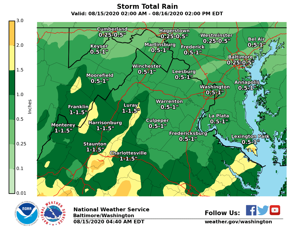
Where has the most rainfall been recently? Amounts are very erratic when viewed regionally; often true with summer thunderstorms. Image shows the highest & lowest rainfall amounts over the past 3 days. (Map is a radar estimate only, should not be used for exact amounts)
Dangerous flash flooding is possible this afternoon & evening due to heavy rain & slow moving storms. Stay weather aware & have more than 1 way to receive our alerts. Remember, do not cross flooded roads! Visit https://t.co/t54l4ELo2o for the latest info. #vawx#mdwx#dcwx#wvwx
A slow moving cold front will enter our area and stall Wednesday, allowing showers and storms to develop and linger, warranting a Flash Flood Watch. The watch is for areas east of the Blue Ridge Mountains and Central Shenandoah Valley effective noon to 11:00 pm Wednesday.
Cumulus clouds are building, especially over the Washington and Baltimore Metro areas toward central Virginia. A few popup showers and thunderstorms are expected this afternoon and evening, but coverage should remain isolated to scattered.
The Flash Flood Watch was expanded to now include all of northern/central VA, the WV panhandle, and all of central/southern MD. It was also extended until 6 AM Friday morning. Heavy rain is expected to develop this afternoon into tonight and could lead to flash flooding.
The National Weather Service in Wakefield has Issued a Flood Advisory for Central Sussex County in Southeastern Virginia. https://t.co/6rUbjDkEJp ##vawx#mdwx#ncwx
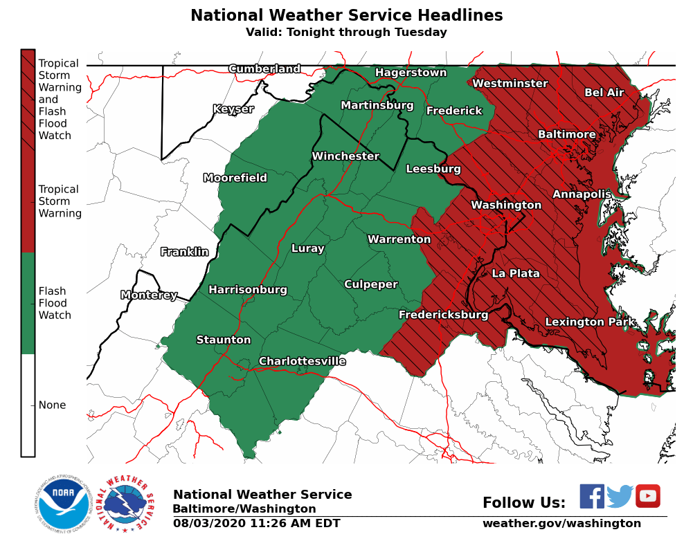
A Tropical Storm Warning is now in effect for much of central and southern MD, DC, as well as portions of northeastern VA along the I-95 corridor. Flooding rain, wind damage, and tidal flooding are all threats to the area. See https://t.co/NrmMNLJviC for further details.