Happy Friday y'all!
Here's a TL;DR look at your weekend forecast:
Saturday: Near perfect
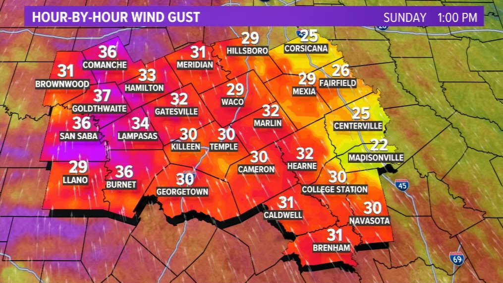
Sunday: Nice Temperatures, very windy
Sunday Night: Storms push through overnight. Not expecting severe.
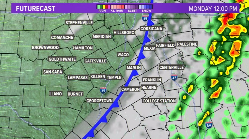
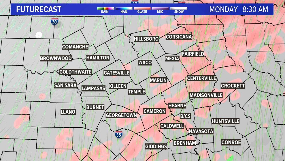
Monday: Storms exit the area by lunchtime.
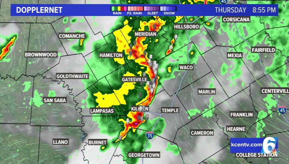
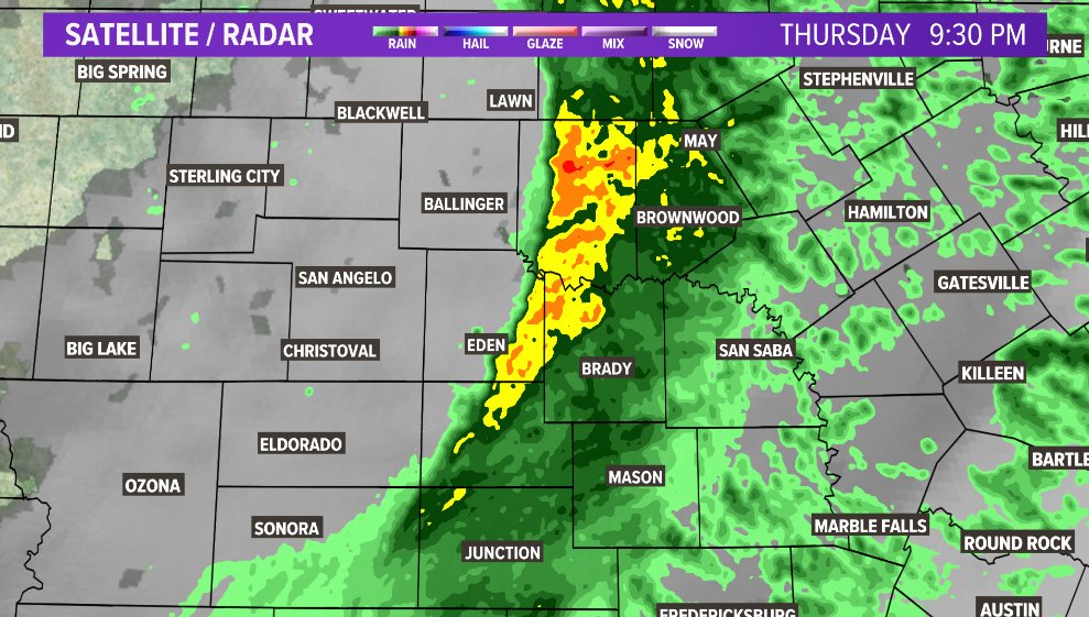
8:55pm - A solid line of storms now approaches I-35.
Nothing severe, just rain, thunder and lightning. You can see the bow in the storm from Hamilton down through Killeen.
This is the area I would be watching for gusty winds.
Radar estimates indicated ~35mph winds in this area.
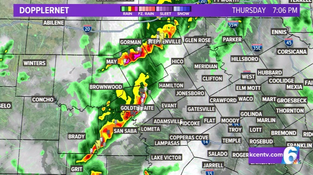
7:10PM - Still tracking those storms to the west.
As models showed, activity is forming into a fairly solid line.
Main threats right now would be heavy rainfall, small hail and strong wind gusts.
Nothing severe right now.
Storms are moving east at about 20 mph.
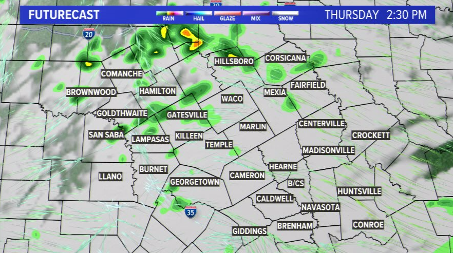
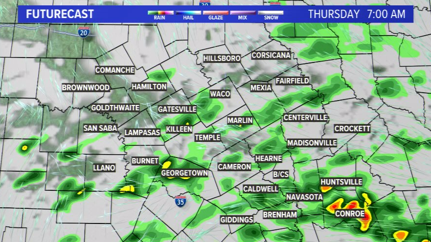
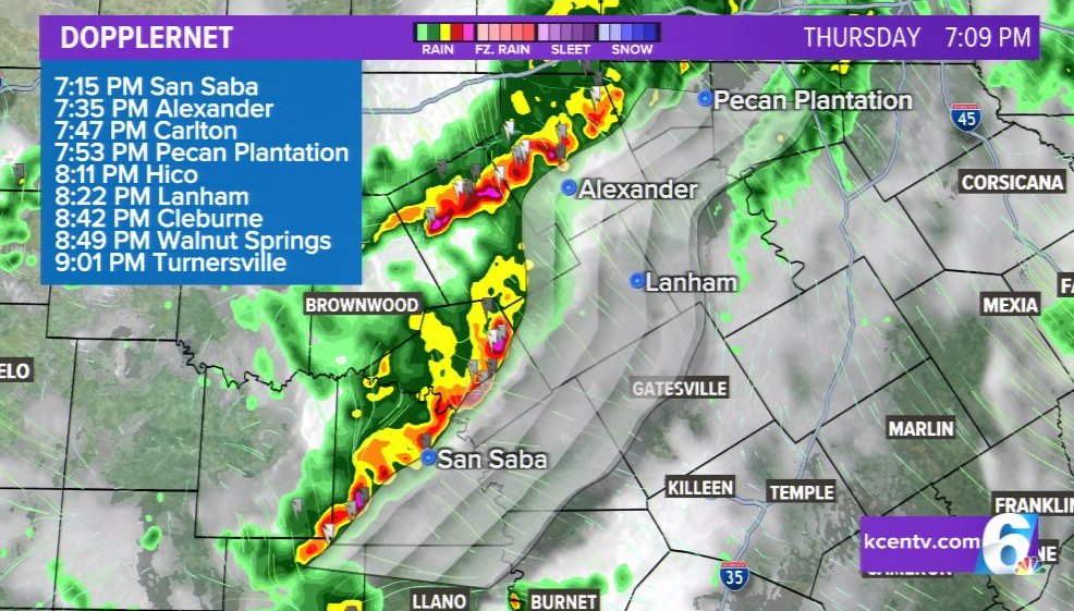
Heads up for Thursday!
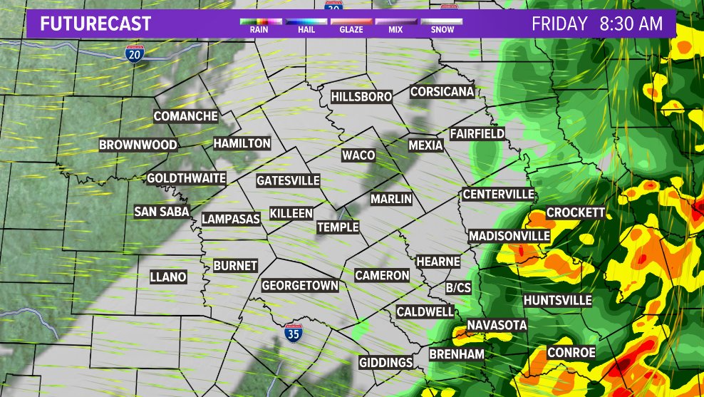
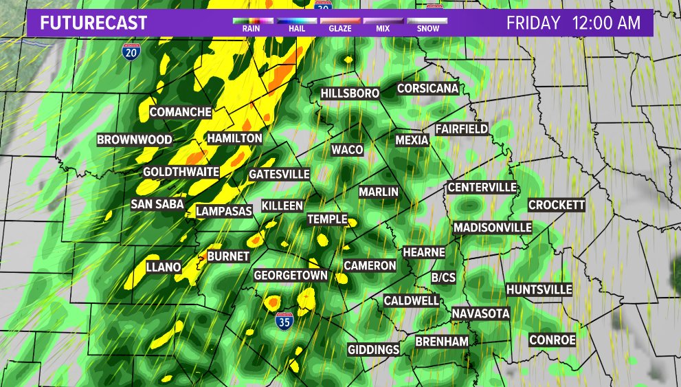
We're tracking thunderstorms in two waves tomorrow.
Wave #1 moves in overnight and into the morning. Just expecting basic storms here.
Wave #2 arrives late aft/eve - brings an outside risk for isolated strong to severe storms, with hail the main risk.
I want to send a HUGE shout out and Thank you to the Kindergarten class over at @KPESstars for having me come out and talk to the kids about weather this morning!
It was great getting to see the kids and meet all of the staff.
Flash Flood Warning in effect for parts of Washington, Brazos and Grimes counties until 10:15pm
Emergency Management is already reporting road closures due to high water. You can read about it in the second image.
It only takes 6" to move a car. It's not worth the risk.
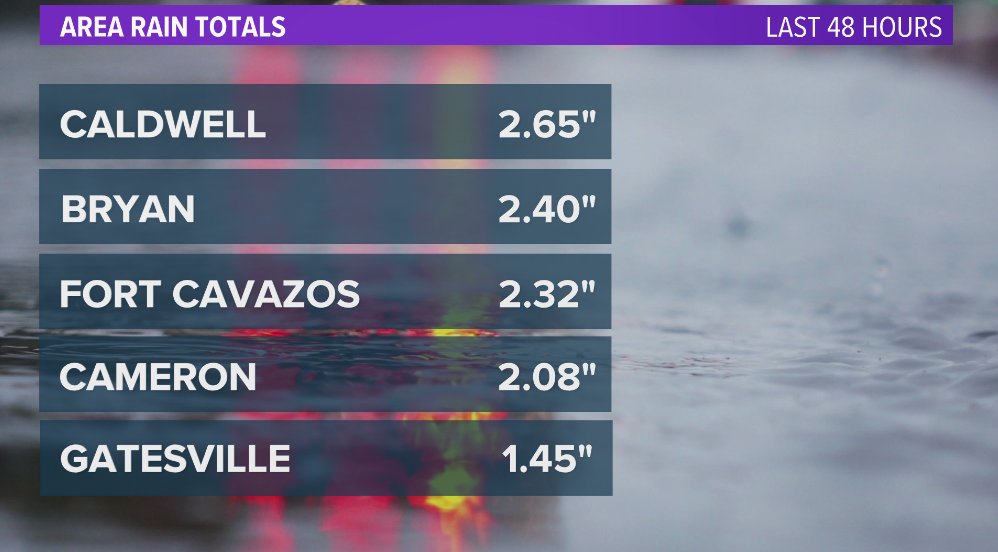
How much rain has fallen??
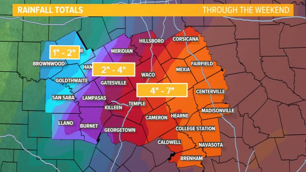
Well, as of 3:30, most areas across Central Texas have seen over 2" of rain in the previous 48 hours...with more on the way.
We could see an additional 2-4", especially across parts of the Brazos Valley through tomorrow.
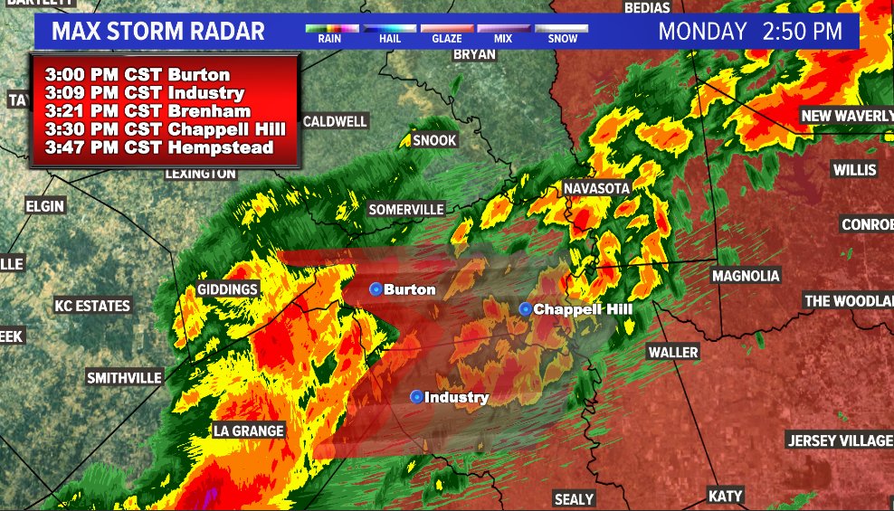
Heads up friends (2:50PM):
A FLOOD WATCH has been issued for parts of Central Texas/Brazos Valley from 3am through 6pm tomorrow.
This area received over 2" of rain, and is primed for another 2-3" overnight and into tomorrow.
If you see standing water, find an alternate route.
Checking on some estimated rainfall totals this morning (as of 8:45):
Troy - 2.07"
Temple - 2.33"
Salado - 2.82"
Hearne - 1.28"
B/CS - 0.90"
Rain should continue through this morning before ending from west to east this evening.
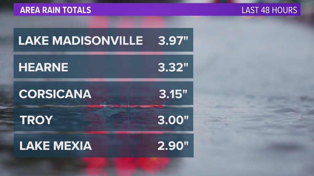
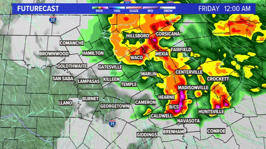
Some of the totals by week's end look ... scary
Alright friends,
It was 16° this morning. Comparatively, the highest temperature recorded in the Brazos Valley in 2023 was 112°.
That raises an interesting question...which do you prefer? The scorching summer heat? Or the occasional "Winter Break" we get in Jan/Feb?
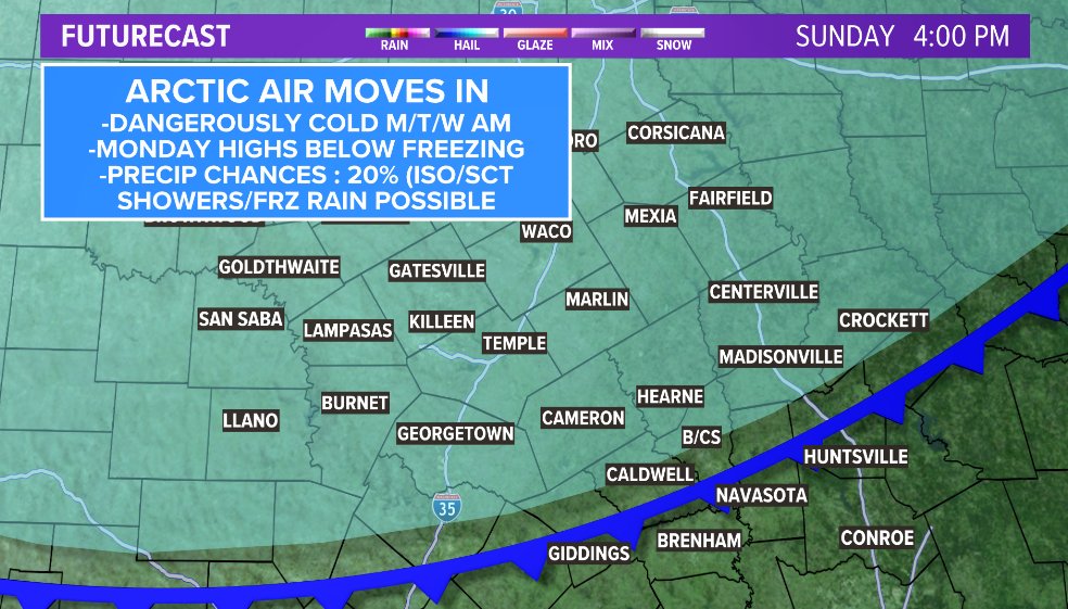
Winter is coming!
-Arctic air is currently moving through Oklahoma & the panhandle
-We expect it's arrival later this evening/tonight
-Freezing rain possible late Sunday into Monday morning
-Some travel impacts (primarily elevated surfaces)
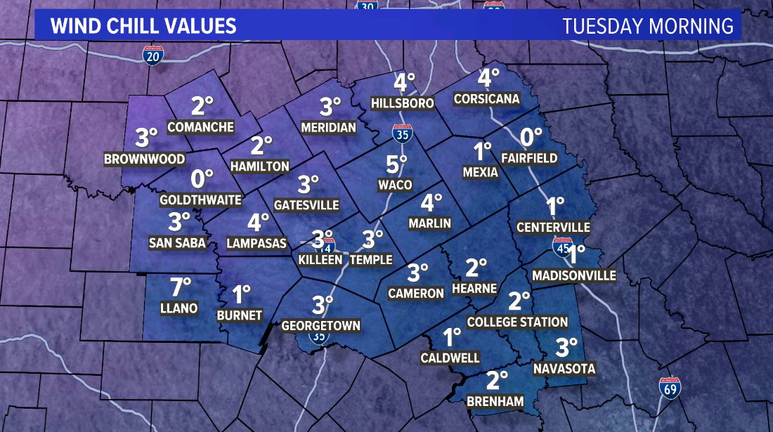
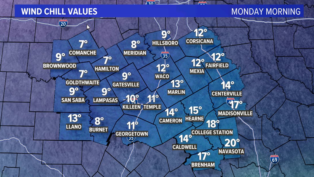
-Dangerously Cold Mon/Tue/Wed AM
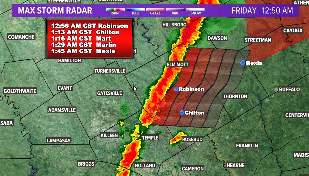
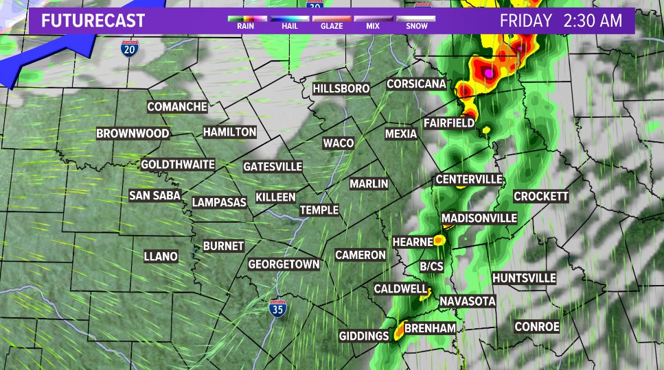
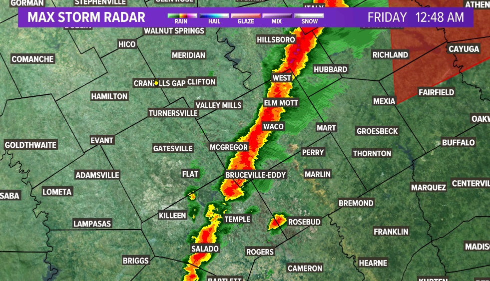
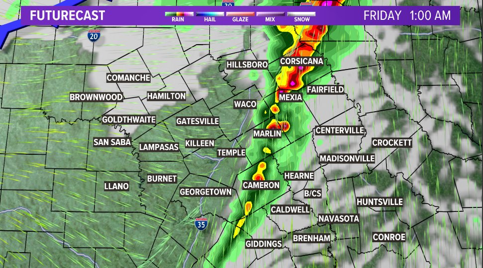
1:00 am UPDATE -
Storms have DE-intensified over the last 15 minutes as they cross I-35. Hail cores have disappeared from radar.
That doesn't mean hail can't redevelop, but as of right now, JUST RAIN with frequent lightning and occasionally gusty winds through Central Texas
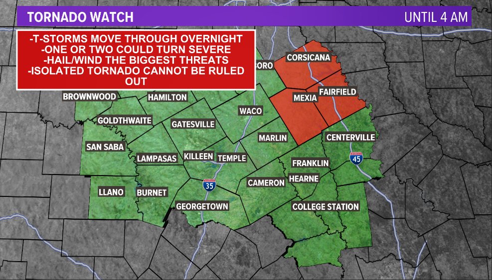
- A TORNADO WATCH is in effect for Limestone, Freestone & Navarro until 4am
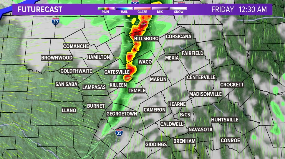
-Strong to severe thunderstorms are possible as our first cold front moves through.
-For most, the threats are strong winds & small hail, but an isolated tornado cannot be ruled out.
-Timing: 12a - 2:30a
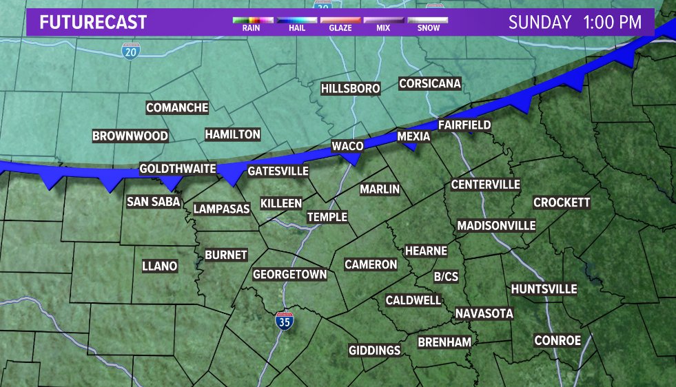
Winter Weather updates:
- We've added a 20% chance of a wintry mix by Sunday evening/night.
- Temperatures likely don't climb above freezing again until Tuesday afternoon.
- Start those outdoor preps SATURDAY. Bring in pets/plants and cover exposed pipes.
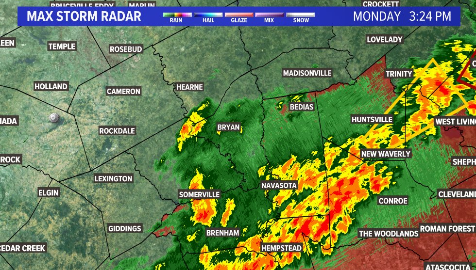
3:20 UPDATE -
Most of the storms have moved into Grimes County at this time, but some rain continues in Washington County.
B/CS - Get ready for a "round 2" to move through as storms move NE along the frontal boundary and the activity expands a bit to the west.
2:45 WEATHER UPDATE -
Line of storms about to move through Washington county is expanding a bit to the west, and intensifying as it moves east.
Expect gusty winds, heavy rainfall and possible small hail as this storm moves through Washington County.
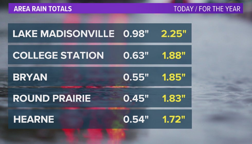
How much rainfall has your town received this first week of 2024?
Most are off to a great start, but we are still in a deficit, and will always take more rain!
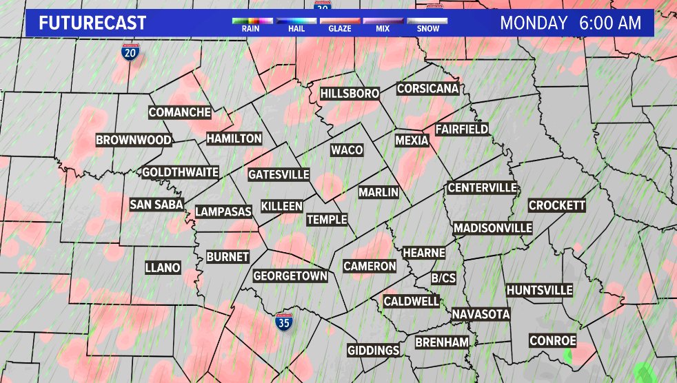
It's in the forecast for Monday, but this time, it could be accompanied by strong thunderstorms
Light rain is making it's presence known along I-35 right now. This is still out ahead of the main line of showers.
For the main event, we are still looking at about another hour before it makes it into Central Texas.
Timing or tonight:
-Rain moves into our western counties around midnight
-Along the I-35 corridor between 2 and 4
-Into the Brazos Valley before daybreak
Expect the rain to end along and west of 35 before you wake up.
Totals will be in the .25" - 1" range.