If and when you shop on Amazon please use the link below as we are an Amazon affiliate and any purchases made from Amazon using this link will help support the show. Thanks! https://t.co/k6KnX43Ina…
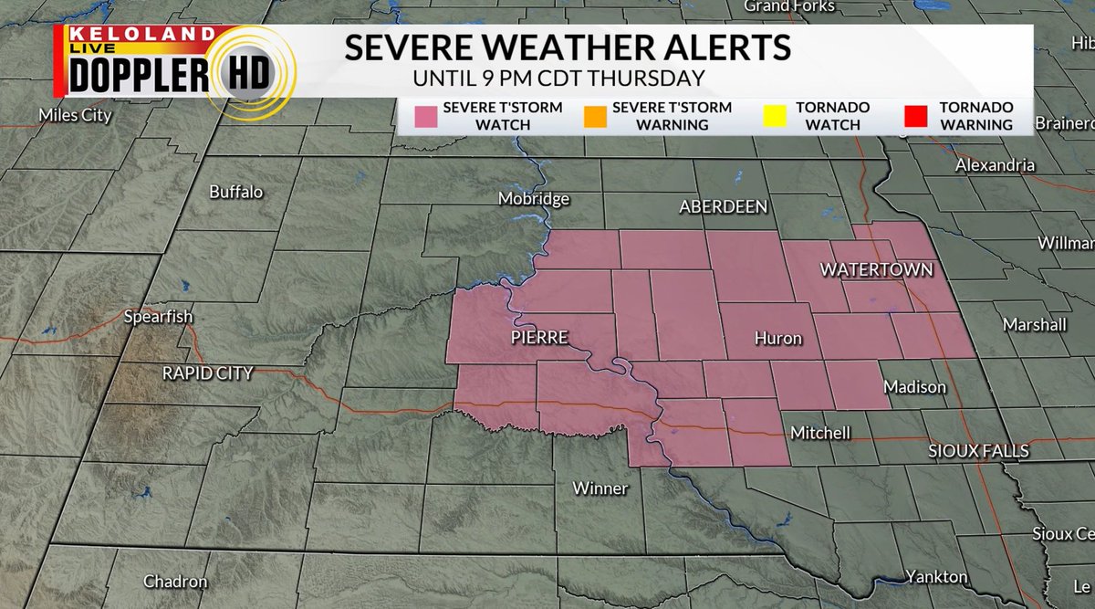
A Severe Thunderstorm Watch has been issued for portions of central and eastern South Dakota until 9 PM CDT Thursday. Damaging wind gusts, large hail, and a tornado or two is possible with storms that develop this afternoon and evening.
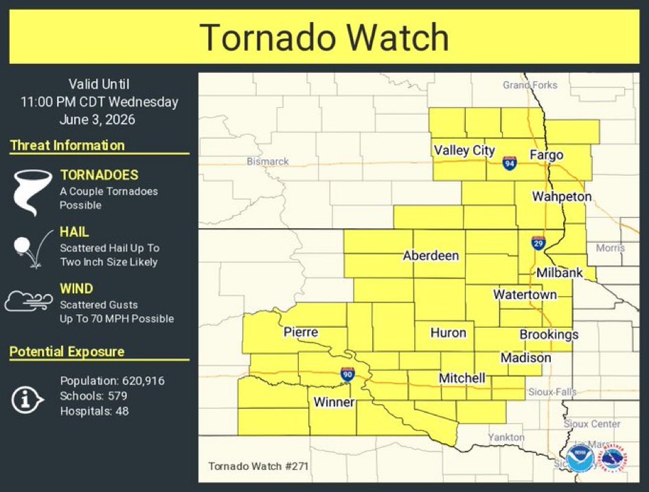
The Tornado Watch has been expanded to the east and to the south through 12 AM CDT/ 11 PM MDT. Stay weather aware and keep an eye out for severe storm warnings and tornado warnings through the remainder of the evening and overnight.
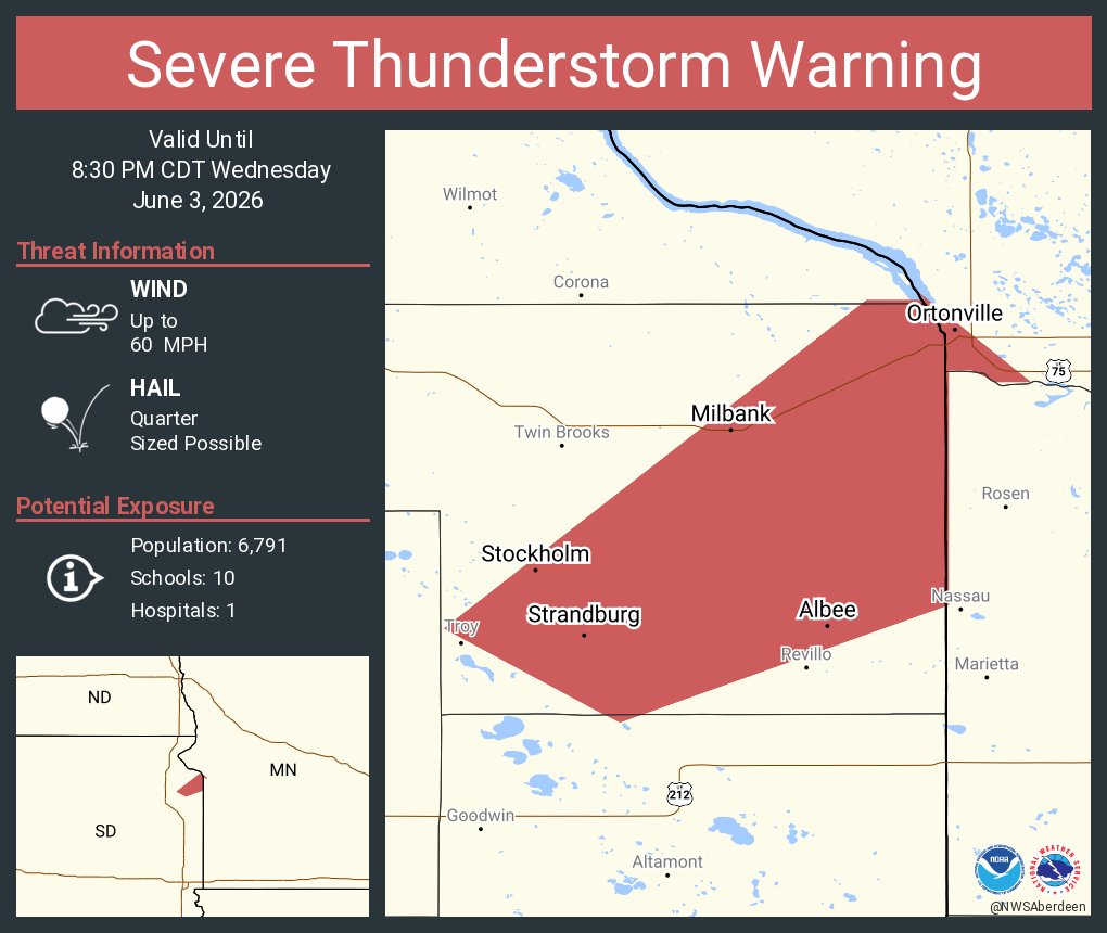
Severe t'storm warning for portions of Beadle and Kingsbury Counties until 9 pm CDT Wednesday. This storm is moving northeast at 20 mph. Heads up along US Highway 14 between Huron and Iroquois.
Severe Thunderstorm Warning continues for Oacoma SD and Iona SD until 8:15 PM CDT. This storm will contain wind gusts to 70 MPH and golf ball sized hail!
Tornado warning for northeastern Tripp County until 8:30 pm CDT/7:30 MDT Wednesday. Radar indicated rotation just south of Hamill. This storm is moving east at 25 mph. Seek shelter immediately
An active weather pattern remains in place through the end of the week. While we get a break by Saturday, it's short-lived...as more rain and storms return for the start of next week. Find out more in your extended forecast: https://t.co/7zSjTp7VlP
A tornado watch is in effect until 11 pm CDT/10 pm MDT Wednesday night for portions of central, southern, east-central, and northeastern South Dakota. Keep an eye out for updates.
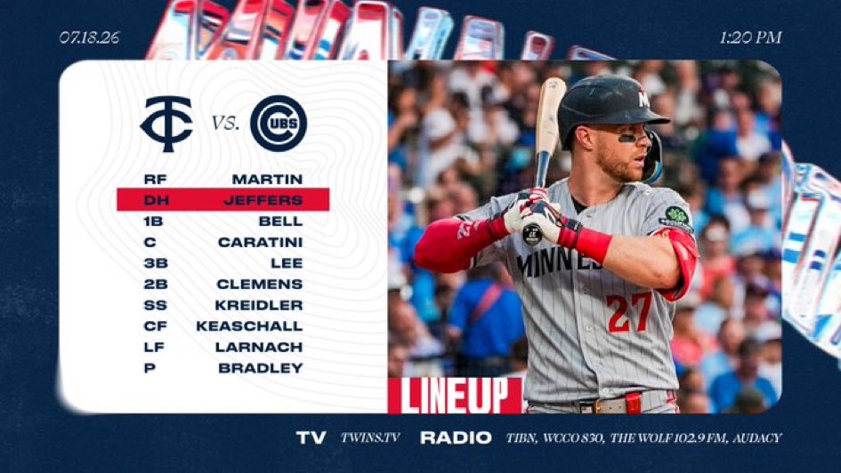
This is the first time the Minnesota Twins have swept the Boston Red Sox at Fenway Park in 32 years, dating back to June 13-15, 1994.
It was so long ago that Roger Clemens was pitching for the Red Sox.
Now, his kid, Kody, is playing for the Twins.
A DESTRUCTIVE Severe Thunderstorm Warning has been issued for Clay, Bon Homme, Yankton, Turner, and Hutchinson counties until 4:15 PM CDT Sunday. This storm is capable of producing 80 MPH wind gusts and ping pong ball size hail as it moves east at 45 MPH.
A Tornado Warning has been issued for Hutchinson, Turner, and Yankton counties until 4:15 PM CDT Sunday. This storm is capable of producing a tornado and ping pong ball size hail as it moves east at 50 MPH. Seek shelter immediately!