Hey everyone! If you haven't already, I'd love it if you gave me a follow on Facebook and Instagram as well! Thanks!
https://t.co/xT2emUuFXH
https://t.co/IqOZPB9HnV
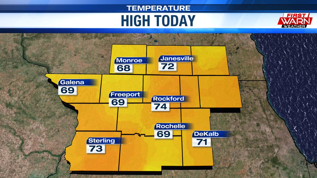
Yesterday was the first day this month with a high temperature cooler than the daily normal, and today was the first day of June that Rockford didn't hit at least 80°. Sort of refreshing if you ask me
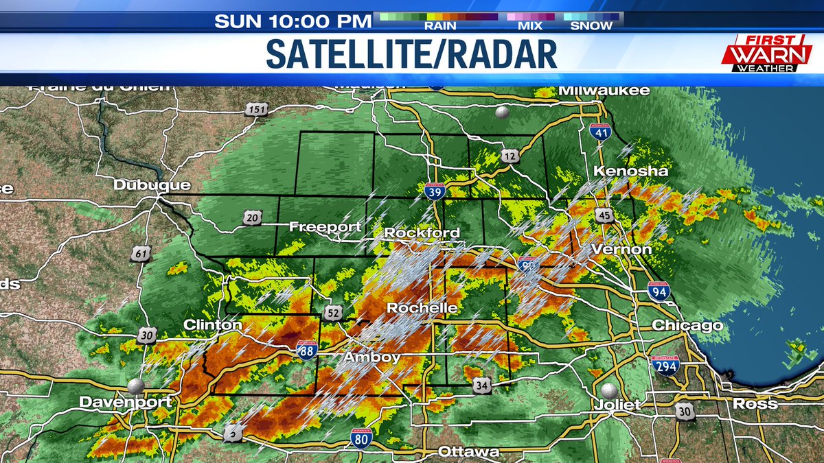
There are no longer any active warnings in the Stateline. The storms have pushed eastward over Chicagoland and the rest of the rain will soon move out as well
A severe thunderstorm warning has been issued for far southern DeKalb County until 11:45PM. This storm is moving eastward at 40mph and features 70mph wind gusts and 1 inch hail as well as heavy downpours and lot of lightning
A severe thunderstorm warning has been issued for the entirety of DeKalb County until 10:45PM. This storm is moving northeast at 45mph bringing heavy rainfall, lots of lightning, and 60mph wind gusts
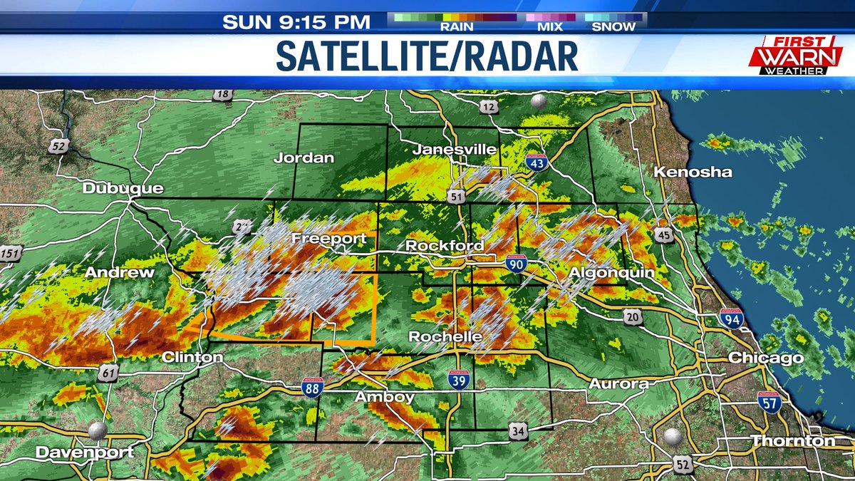
The severe thunderstorm warning for western Ogle County was allowed to expire at 10:00. No warnings are currently in effect across the Stateline. Severe thunderstorm watch remains in effect until 1:00AM
A severe thunderstorm warning is in effect until 10:00PM for most of Carrol County, southern Stephenson County, and western Ogle County. This storm is moving to the east at 40mph bringing 60mph wind gusts, penny to quarter size hail, heavy rain, and lots of lightning
A severe thunderstorm warning has been issued for slivers of northwestern Carroll and southwestern Jo Daviess counties until 9:00PM. 70mph wind gusts are possible with this storm
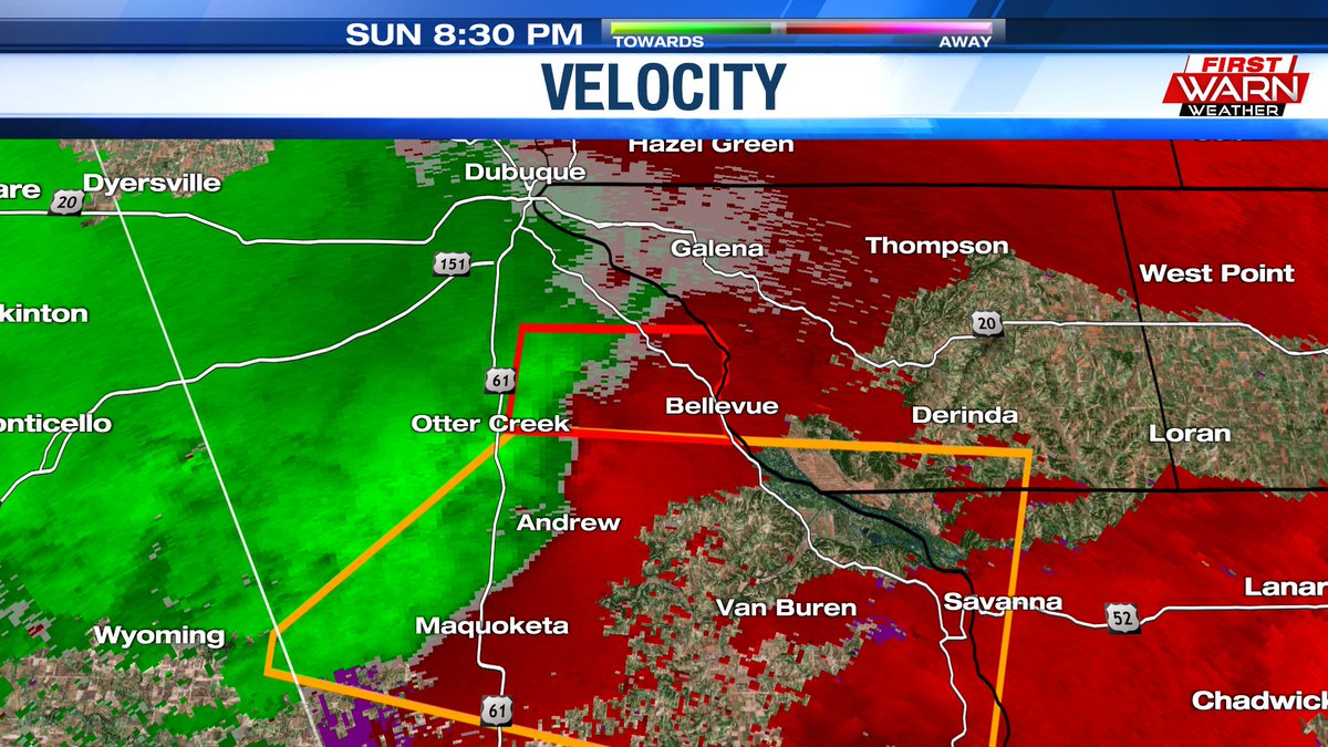
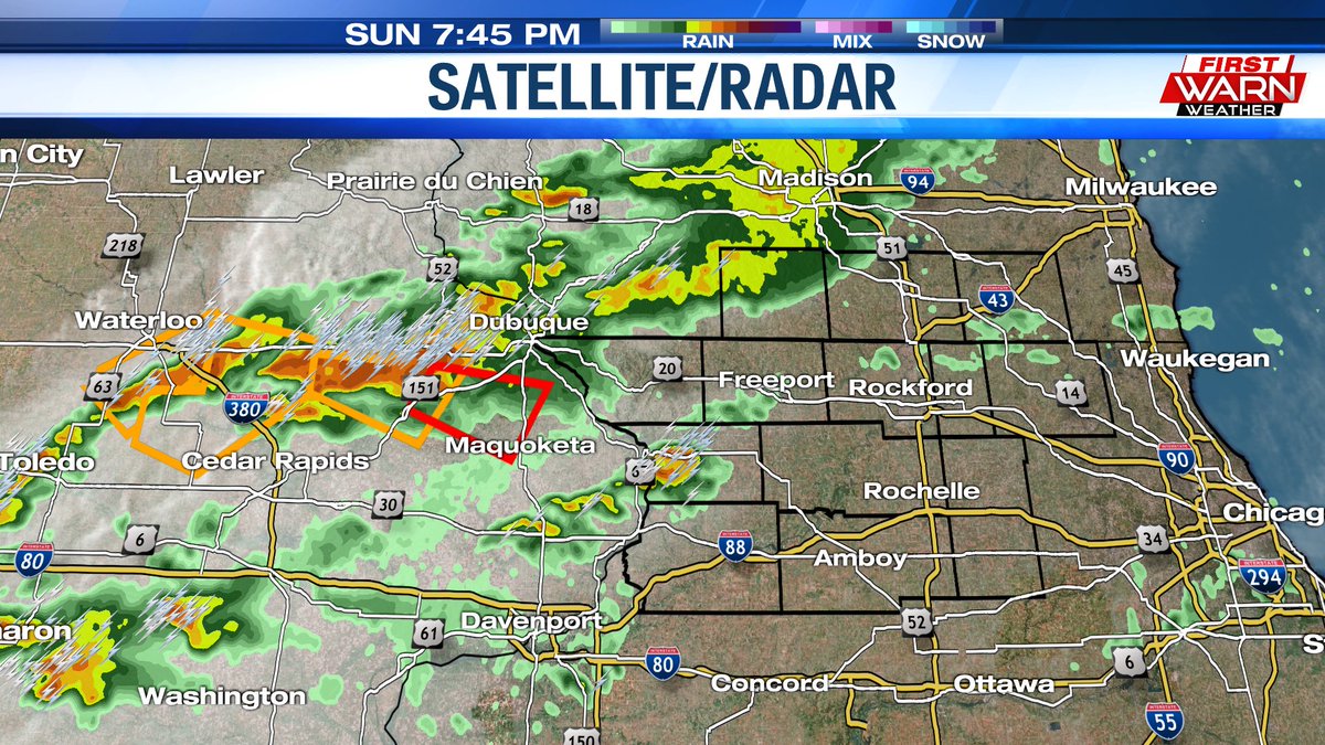
A tornado warning has been issued just south of Dubuque, IA tied to a storm headed in our direction. No watches or warnings have been issued for the Stateline as of yet
Several thunderstorms are beginning to bubble up to our west and northwest. There's a good chance that some of these storms could be on the stronger side a bit later this evening before moving into the Stateline
A line of strong storms is slowly, but surely, pushing southward toward the Stateline. Looking at a 2:00-3:00 time frame for these storms to start moving in
Keeping a very close eye on these storms beginning to develop very quickly over northern Iowa. If these continue to blow up, they could bring the Stateline its first chance for strong thunderstorms over the next hour or two