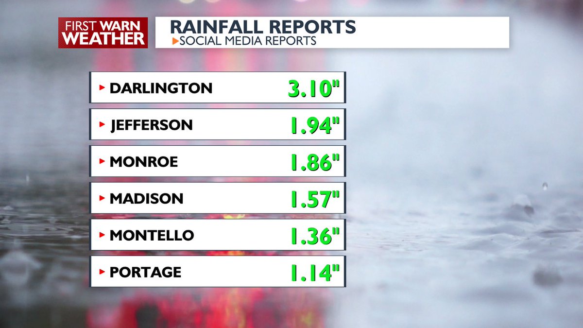
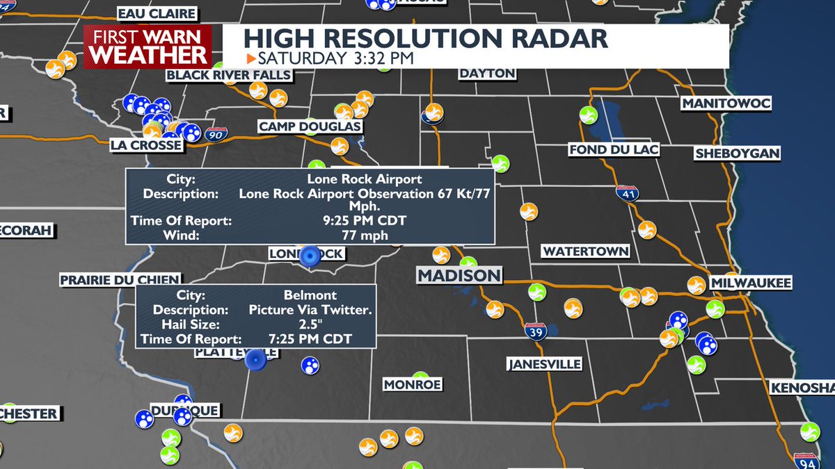
An ALERT DAY has been added to the forecast for Sunday for the potential of severe thunderstorms, some of which may produce heavy rainfall, Friday will be very warm and humid, but should be dry. Gary Cannalte's Forecast: https://t.co/g0uuGU4ob1
An ALERT DAY has been added to the forecast for Sunday for the potential of severe thunderstorms, some of which may produce heavy rainfall, Friday will be very warm and humid, but should be dry. Gary Cannalte's Foxcast: https://t.co/c95rEggqz8
An ALERT DAY has been added to the forecast for Sunday for the potential of severe thunderstorms, some of which may produce heavy rainfall, Friday will be very warm and humid, but should be dry. Gary Cannalte's Forecast: https://t.co/g0uuGU4ob1
Temperatures will be warm both this afternoon and tomorrow with highs in the 80s. We have a chance of rain over the weekend with cooler temperatures for next week. Meteorologist Jacob Montesano breaks it all down.
Despite seeing more rainfall the last 7 days, this week's drought monitor continues to show severe and extreme drought across a lot of central and southern Wisconsin.
Thursday will be very warm and humid, but it should stay dry. Friday will be dry as well, but the humidity should begin to fall. Shower and thunderstorm chances arrive later Saturday afternoon into Sunday. Gary Cannalte's Forecast: https://t.co/g0uuGU4ob1
Thursday will be very warm and humid, but it should stay dry. Friday will be dry as well, but the humidity should begin to fall. Shower and thunderstorm chances arrive later Saturday afternoon into Sunday. Gary Cannalte's Forecast: https://t.co/g0uuGU4ob1
Wednesday and Thursday will be very warm and humid, but rain chances will remain very low. Temperatures will be near normal this weekend, but there will be some chances for rain. Gary Cannalte's Forecast: https://t.co/g0uuGU4W0z
Wednesday and Thursday will be very warm and humid, but rain chances will remain very low. Temperatures will be near normal this weekend, but there will be some chances for rain. Gary Cannalte's Forecast: https://t.co/g0uuGU4ob1
Temperatures and humidity levels will climb later this week. This will lead to shower and thunderstorm chances from Wednesday PM through the weekend, but most of the time it won't be raining. Gary Cannalte's Forecast: https://t.co/g0uuGU4ob1
Temperatures and humidity levels will climb later this week. This will lead to shower and thunderstorm chances from Wednesday PM through the weekend, but most of the time it won't be raining. Gary Cannalte's Forecast: https://t.co/g0uuGU4ob1
Warm weather is likely for the next 10 days, but it will become more humid by the middle of the week before the air becomes drier by the weekend. I'll let know what our chances for rain will be this week. Gary Cannalte's Forecast: https://t.co/g0uuGU4ob1
Warm weather is likely for the next 10 days, but it will become more humid by the middle of the week before the air becomes drier by the weekend. I'll let know what our chances for rain will be this week. Gary Cannalte's Foxcast: https://t.co/c95rEggqz8
Warm weather is likely for the next 10 days, but it will become more humid by the middle of the week before the air becomes drier by the weekend. I'll let know what our chances for rain will be this week. Gary Cannalte's Forecast: https://t.co/g0uuGU4ob1
Conditions will be quiet and comfortable for the foreseeable future. There are a few chances of rainfall by mid-week, although we're not expecting a lot of rainfall at this time. Meteorologist Jacob Montesano breaks it all down.
With the rain we saw the last two days, we are now over 2 inches above normal for the month of July. Despite that, we are STILL at a fairly large deficit since the beginning of June.
The severe weather outlook has increased to an enhanced risk for Dane county and areas to the south. We'll see large hail, gusty winds, heavy rainfall, and a small chance of tornadoes with these storms.