RIDGE RIDING COLD AIR PATTERN AHEAD..
I keep seeing these warm-crazed forecasts and winter is dead posts and I just don't get it (or see it) evolving.
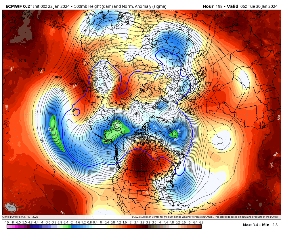
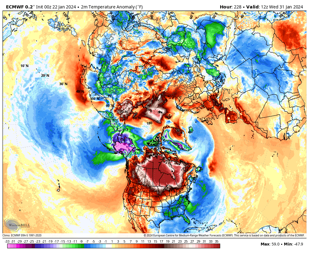
The upcoming 5-10 day pattern is a reprieve from the below average temperature or what some call call the #JanuaryThaw .. However, going into week 1 of February you can obviously see the impacts of the INTENSE ridge over the northern plains. I call this pattern ridge riding cold air as it drops down the front side of the trough directly into the OH Valley and northeast.
You can literally trace your air parcel to the north pole in these scenario seeding a deeper mean trough over the eastern USA. Modeling likes to lift these troughs out fast (so careful with the models esp ensembles).
Now, the ridge correcting east would be a worry to me and would throw this forecast into a bust..but the overall correction shouldn't be east but more west as heights build east of Hawaii. This interaction would push the ridge west and correct the trough east by week 1+2 in February.
Theres a TON to look at here and still very excited for the back half of Winter
Stepping into the weekend with style! Embrace the power of black shoes on this FunShoe Friday – where each step brings confidence, elegance, and a touch of mystery. Walk the path of your dreams, one fabulous stride at a time! 👠✨
#teamsteele#heels#highheels#heelsaddict