We're excited to talk about the future of mapping and AR at Locate.
@Fantasmoio scanned our event venue and used our @Mapbox Unity SDK to give it location context. So excited for this. #ExploreLocate
I could not be more excited about what the @mapbox team has put together for Locate. It's map-geek heaven. The people we have coming & the things they are talking about are amazing. #explorelocate Check it out: https://t.co/gnZfLPk6ZI.
Looking for some satellite inspired #MondayMotivation? Spring is here and you can see it from space!
More #GOESEast imagery here: https://t.co/aA2Tw1ZbIm
Here comes Space Invad-AR, our very own world-scale AR game. Download it for yourself and start hunting for Aliens or view the source code and build your own https://t.co/iXwMBVQWXI #AR#builtwithmapbox#unity
Introducing AuGeo! A mobile augmented reality app for your #GIS data. AuGeo lets you explore the possibilities of using #ArcGIS data in an #AR environment. Esri Product Engineer, Erwin Soekianto gives you an inside look. Learn more: https://t.co/wlawn3Nqur @AppStudioArcGIS
At Locate @philogb, Head of Data Viz at Uber will dive into state of big data, & how important data visualizing is to real-time decision making. Hear more of what he'll cover and register for Locate, May 30-31st in San Francisco https://t.co/htkeaLEqIt #goLocate#explorerswanted
Introducing Mapbox AR - the location platform for #AugmentedReality https://t.co/u46XF7vVo4 See it in person at #GDC18 March 21-23rd at our booth in the South Hall
Augmented Reality: We’re leveraging 200M+ AR-enabled mobile phones to build apps that project map data into the real world. May 30 — 31, 2018, Pier 27, San Francisco. Introducing Locate: https://t.co/OjowRorBeu
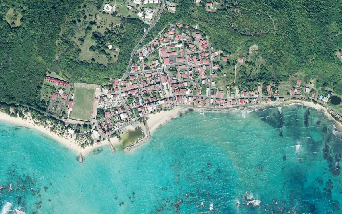
For this year’s #CaribeWave2018, we’ve updated our satellite imagery of some Caribbean islands to help stakeholders create better risk assessments, plan evacuation routes, and more https://t.co/1rTrIVHY1A
I've been playing around with EU population data (2011). Tricky to design interactive map of 1.9 million 1km grid squares that works visually at all scales. Anyway, this is my latest effort. Go explore Europe https://t.co/4ijYZqzoY7
Today we're introducing the fastest maps for @MSPowerBI with our Mapbox Visual plugin, letting you create fast, customizable maps https://t.co/z0gqz07b8k