The FWHA, in coordination with INDOT, has issued a Notice of Intent (NOI) to prepare a Tier 2 Environmental Impact Statement (EIS) for Section 2 of the Mid-States Corridor.
📝 The 30-day public comment period runs from June 1 to July 1. View the NOI here: https://t.co/X85YSHt563
Updated analysis shows that anticipated relocation impacts are lower than originally estimated in Tier 1. Based on current information, relocation impacts are now projected to be roughly 50% less than earlier estimates.
Why Reduced Conflict Intersections (RCIs)? Hear how this intersection design can reduce the stress of crossing a four-lane, high-speed divided highway.
🔗 https://t.co/YYqDhnUMGF
As part of Tier 2 planning, a TREDIS analysis has been completed for Mid-States Section 2. TREDIS is a nationally used tool that examines how transportation projects may affect travel efficiency, business activity, freight movement, and regional economic performance over time.
Traffic modeling shows the Mid-States Corridor is expected to divert an average of 1,700 trucks per day off U.S. 231 through Jasper and Huntingburg. Removing through-truck traffic can significantly change the day-to-day driving experience, improving overall traffic flow.
The TREDIS analysis shows Section 2 of the Mid-States Corridor has a benefit-cost ratio of more than 4 to 1, meaning the projected benefits of constructing the roadway are more than four times greater than the project costs.
Read more about it in the upcoming newsletter.
Why are QRIs being considered? QRIs don't require traffic on the Mid-States Corridor or the side street to stop. They also reduce conflict points at the main intersection by redirecting certain turning movements onto a connector roadway.
🔗 https://t.co/lkE97v6kOZ
Mitigation sites are one way environmental considerations identified during project planning are addressed, including those being evaluated as part of the Mid-States Corridor. These sites are managed over time to allow natural features to re-establish.
New data gives us a clearer picture of what the Mid-States Corridor means for everyday travel. 🚗 A Tier 2 analysis shows peak-time commuters could save up to 28 min. per day—that’s 2½ hours every workweek—through improved travel efficiency.
Learn more: https://t.co/ea0AmTIrhE
Why Reduced Conflict Intersections (RCIs)? Hear how early questions about an RCI, and crash data, led to deeper conversations within a small community.
🔗 https://t.co/Fs4iQNKeMX
As part of the Mid-States Corridor planning process, travel modeling is used to understand how different alternatives may affect traffic patterns and daily travel. Current modeling indicates the alternatives being evaluated could save approximately 600 vehicle hours per day.
Mitigation sites are areas where environmental work can take place over time. This type of environmental consideration is a standard part of the planning process and helps ensure natural resources are thoughtfully considered alongside transportation needs.
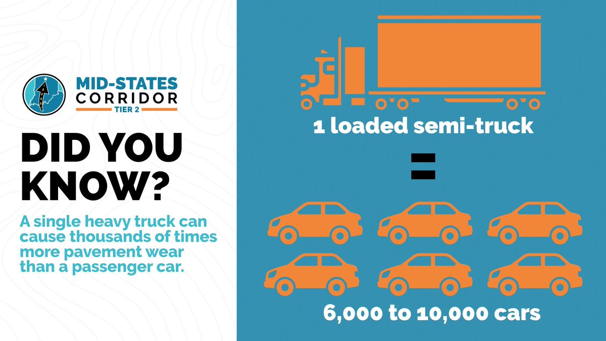
The Mid-States Corridor is expected to reduce traffic on US 231 by 43% overall, including an 88% reduction in trucks, as long-distance freight shifts to the new corridor. That removes more than 1,700 semi-trucks per day from US 231, improving local travel & reducing roadway wear.
Why Reduced Conflict Intersections (RCIs)? Hear testimonials from two people who were originally skeptical about RCIs, and what they learned that changed their perspective.
🔗 https://t.co/G3Uh8NeqPz
Myth ❌: RCIs slow everyone down.
Fact ✅: FHWA data shows RCIs increase throughput by approximately 30% and reduce intersection travel time by roughly 40% (https://t.co/BBkVghp25M).
Our team has met fire chiefs and emergency response officials. Discussions included review of modeled emergency response times, potential route changes, and mutual aid considerations between volunteer fire districts to address any impacts associated with the Mid-States Corridor.
Take a look at where Reduced Conflict Intersections are already improving safety and efficiency. 🗺️
This map highlights Reduced Conflict Intersections (RCIs) located throughout the state. Many more of these innovative intersections are in the design and construction phase.
Now Available: The Latest Edition of the Mid-States Corridor Newsletter
This edition shares new Tier 2 analysis that provides a clearer picture of travel-time savings, including updated data on daily and peak-hour trips.
🔗 Read the full newsletter here: https://t.co/oAqEYl5oRW
Wondering how to read the Screening of Alternatives maps? 🗺️
Understanding the map key and what each element represents is the first step to understanding potential impacts. View large-scale maps of Alternative 2B & 3B on the Mid-States Corridor website: https://t.co/hoaw6hm0eP
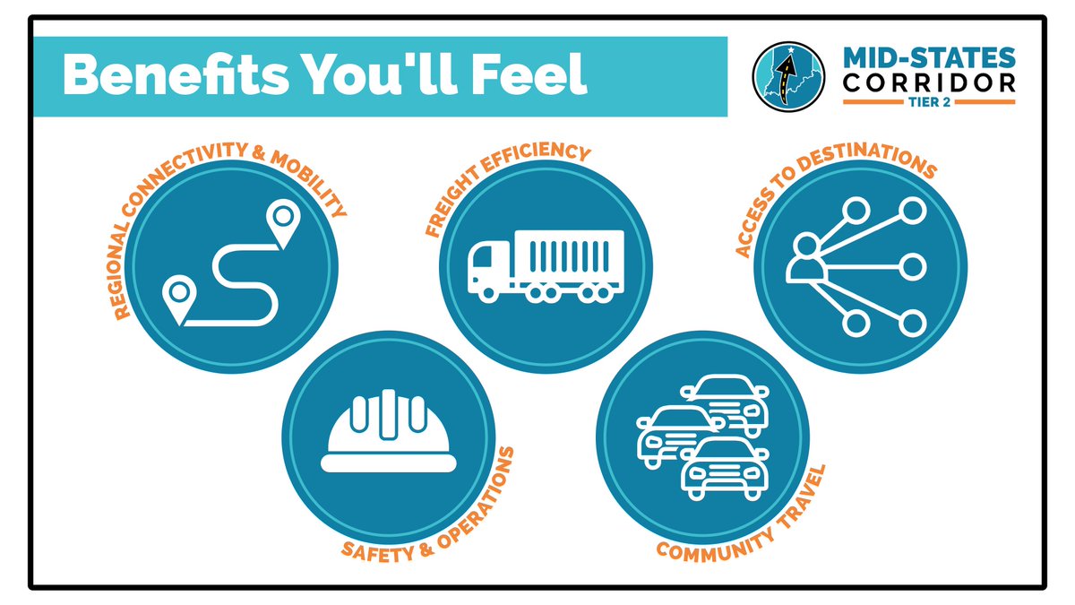
The Mid-States Corridor is designed to improve how southern Indiana moves, works, and connects.
✅ Strengthened connections across southern IN
✅ Enhanced truck & freight movement
✅ Improved access to major employers & critical destinations
✅ Safer travel
✅ Reduced congestion