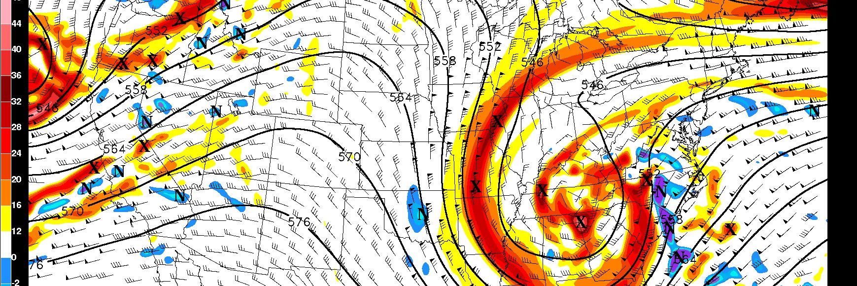
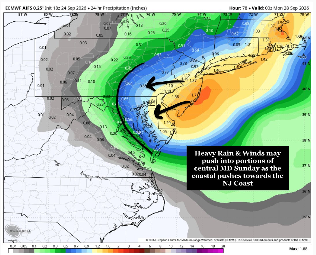
This nor’easter is forecast to make just 10 miles of net northward progress over 37 hours from late Saturday to midday Monday 🤯
The storm's pit stop near New York and New Jersey will keep water levels elevated through several high tide cycles, leading to major coastal flooding.
18z Euro AIFS is certainly something... the trend for a stronger, slower, tucked ULL just off the NJ coast seems to be coming to fruition. This will worsen impacts on Sunday from the eastern shore to NYC, with impacts being felt as far west as the DC/Balt region. Big hit for NJ/NYC. #MdWx
This. Beach erosion from this system will likely be awful in places with repeated bouts of moderate coastal flooding causing problems. The LLJ will engender the higher impact surface winds. But the strength, placement and duration of that is TBD. Periods of hvy rain as well.
I generally keep this account to weather and a few other niche arenas. Though for today, a brief crossover share from my IG page as we reflect on this day, 25 years ago.
@Stormchaser Aside from the EF scale predate, the (presumably) Motorola HTs are featuring LCD displays. The Sabers et al didn't feature those until the 90s and were fairly rudimentary at first. Those appear to be a bit more advanced.
Signal is there for training cells⛈️ today across the area, especially in NNJ into SNY. Some of those areas have already seen rainfall on the order of 0.75-2"+. Severe weather and flash flooding dual threat today, though the latter seems to be more prominent for NNJ on east.
I am decently confident somewhere between Perth Amboy, NJ and Saratoga Springs, NY will walk away with double digit rainfall totals. We don’t know who exactly, and it will be isolated, but this is the perfect environment for something like that to happen.
A significant event is looking more likely Saturday. Multiple rounds of storms expected, which may begin before noon and extend after sunset. There is a significant risk of wind damage, w/ a notable risk of flooding & potential for tornadoes. See reply post for larger graphics.