A Severe T-Storm Watch is in effect until 10pm for portions of the eastern WV panhandle & western MD. Damaging wind gusts & isolated large hail are possible with storms between 7-11pm. There is uncertainty to if this threat continues south due to abundant dry air over the region.
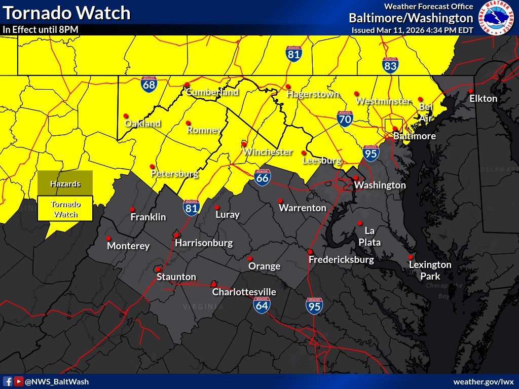
Tornado Watch, canceled. One last chance for damaging winds with a cold front that moves E across the area 6-10pm. Possible a Severe Thunderstorm Watch gets issued for that. Regardless, it will be gusty with & after the front with temps dropping 20-30 degrees overnight.
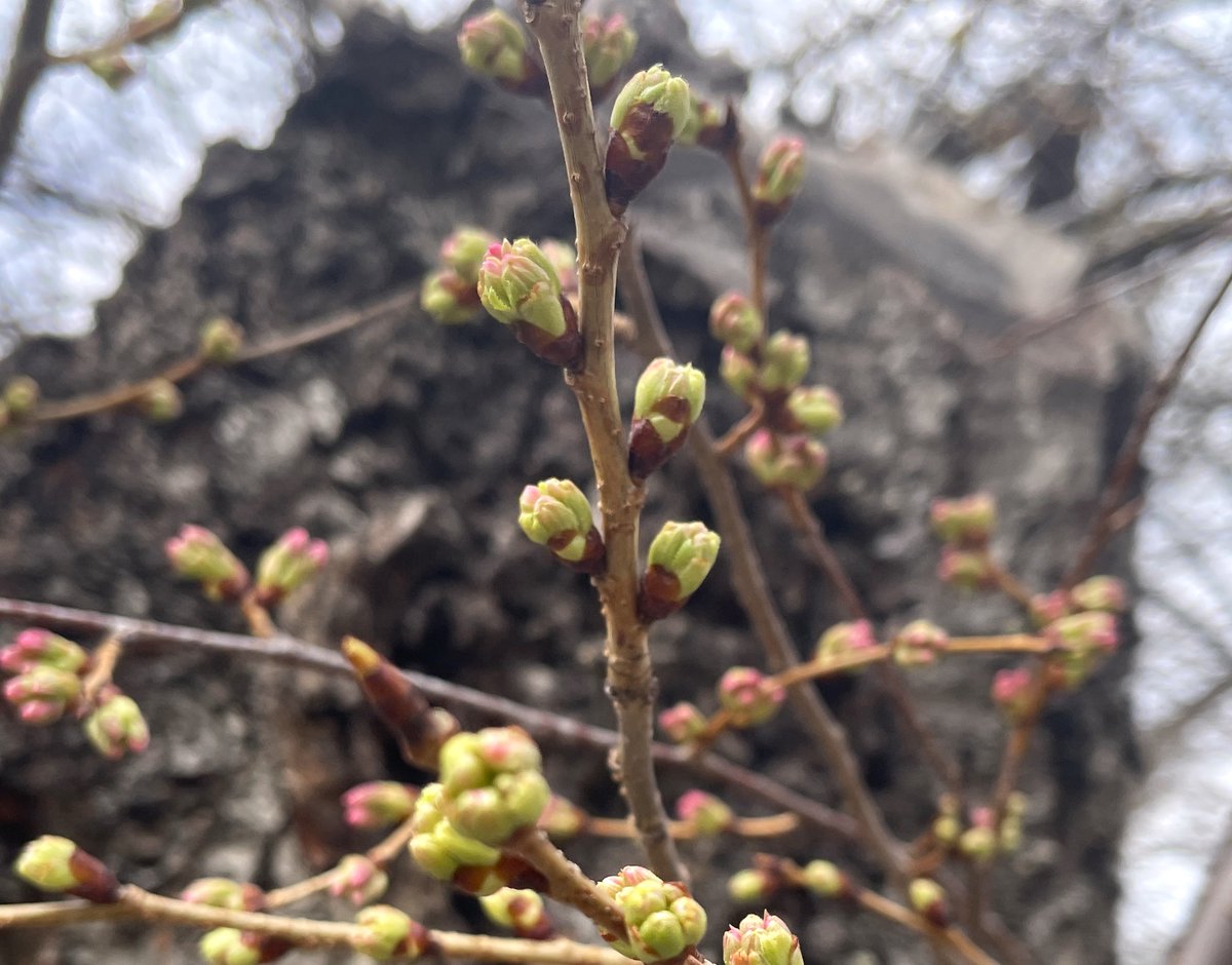
Oh, we're halfway there! The cherry blossoms have reached Florets Extended, the 3rd of 6 stages.
🌸🌸🌸/🌸🌸🌸
Follow along online: https://t.co/h04Gu0ksc1
#Cherryblossom#BloomWatch#WashingtonDC
JUST IN: In the midst of this chaotic, wild weather… National park Service confirming cherry blossoms have reached stage 3! “Extension of florets” …we are halfway there. Peak bloom is still predicted for 3/29 through 4/1. That is 70% of the Yoshino cherry blossoms are open. 🌸
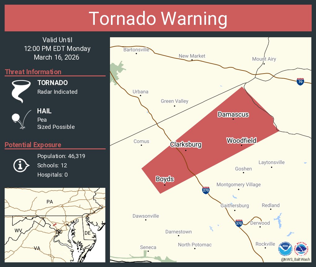
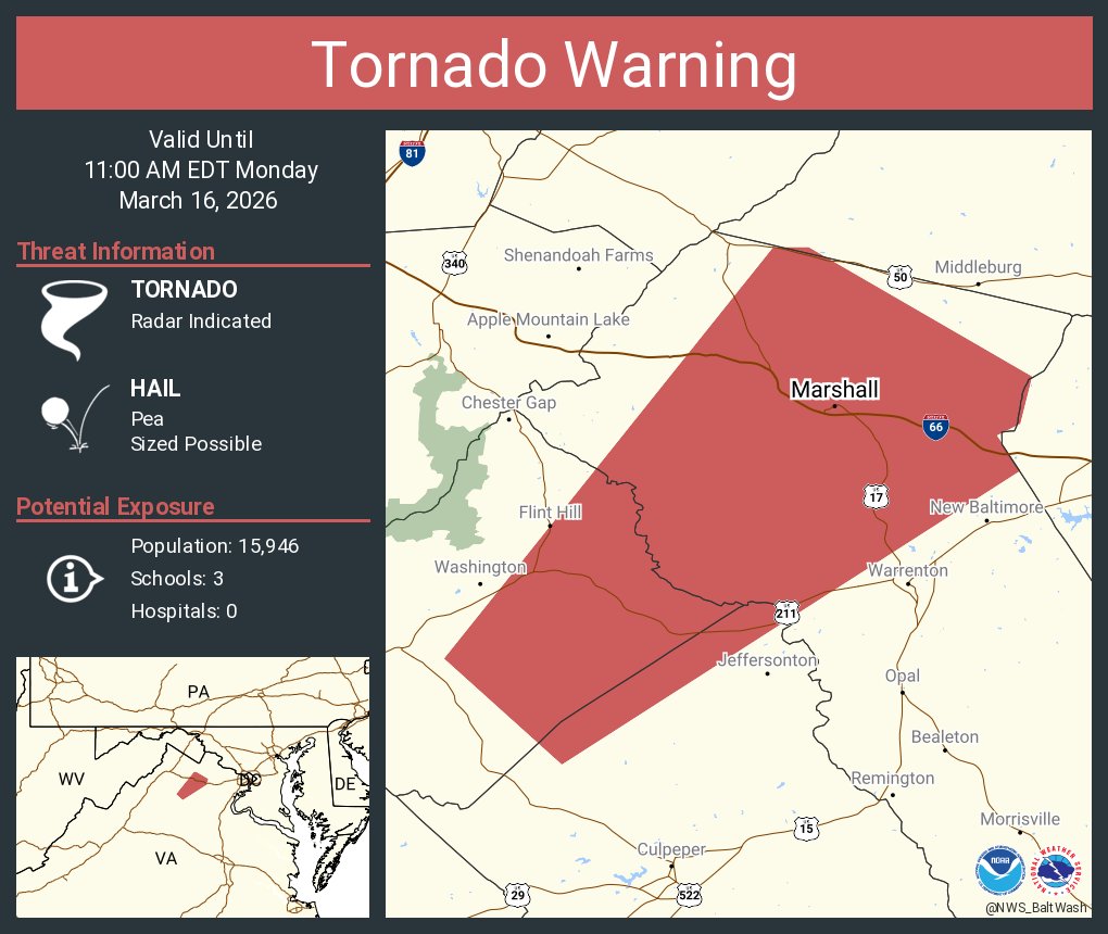
The Tornado Watch was expanded further east to include portions of Northern VA towards the Baltimore metro areas. The Watch remains in effect until 8 PM.
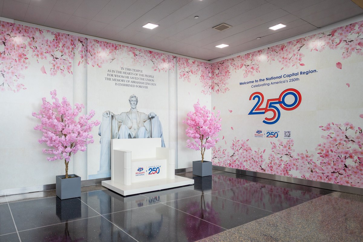
NEW PHOTO OP!! Have you ever wondered what it would be like to sit in Lincoln’s chair? Well now you can!! Take a seat at our new installation and let us know what you think!
📍 National Hall, near Solid State Books
For those wondering when the last White Christmas was in the metro areas, it was back in 2009 after the snowstorm on Dec 19. Looking at this year, the pattern appears mild which suggests chances are very low. #MDwx#VAwx#DCwx#WVwx