The City of North Myrtle Beach continues to monitor Tropical Storm Debby. We are thankful that North Myrtle Beach saw much lesser impacts than what was projected.
Read More: https://t.co/s4qnyfZWfP
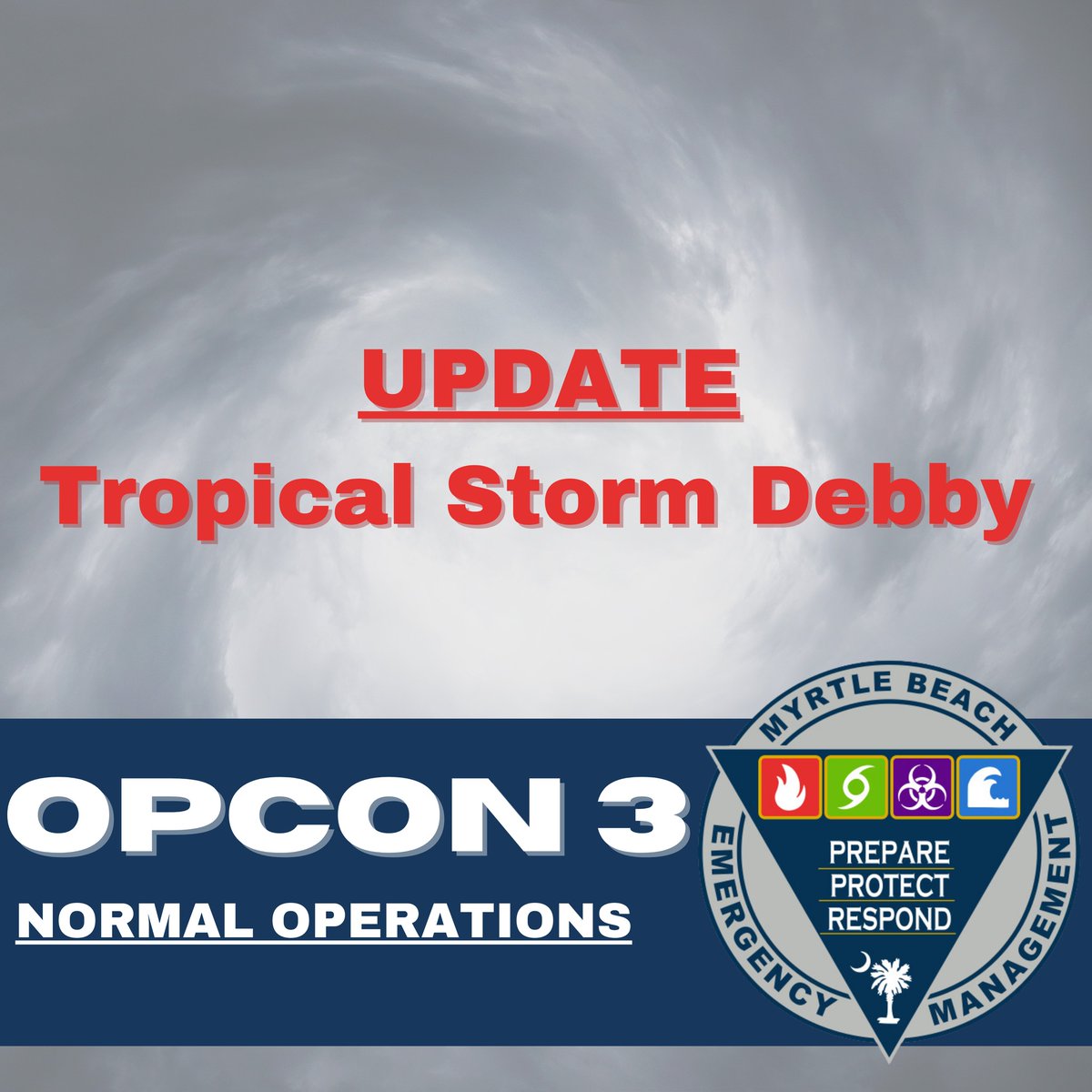
The City of Myrtle Beach has moved back to Operational Conditions Level Three, which is our normal state of operations. The Emergency Management team continues to monitor Tropical Storm Debby as it passes through the Carolinas.
#CityofMyrtleBeach#MyrtleBeach
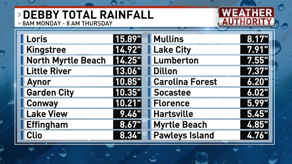
Here's a look at the total rainfall from Monday morning through this morning via @NWSWilmingtonNC. No wonder we've had extensive flooding in some areas. #scwx#ncwx
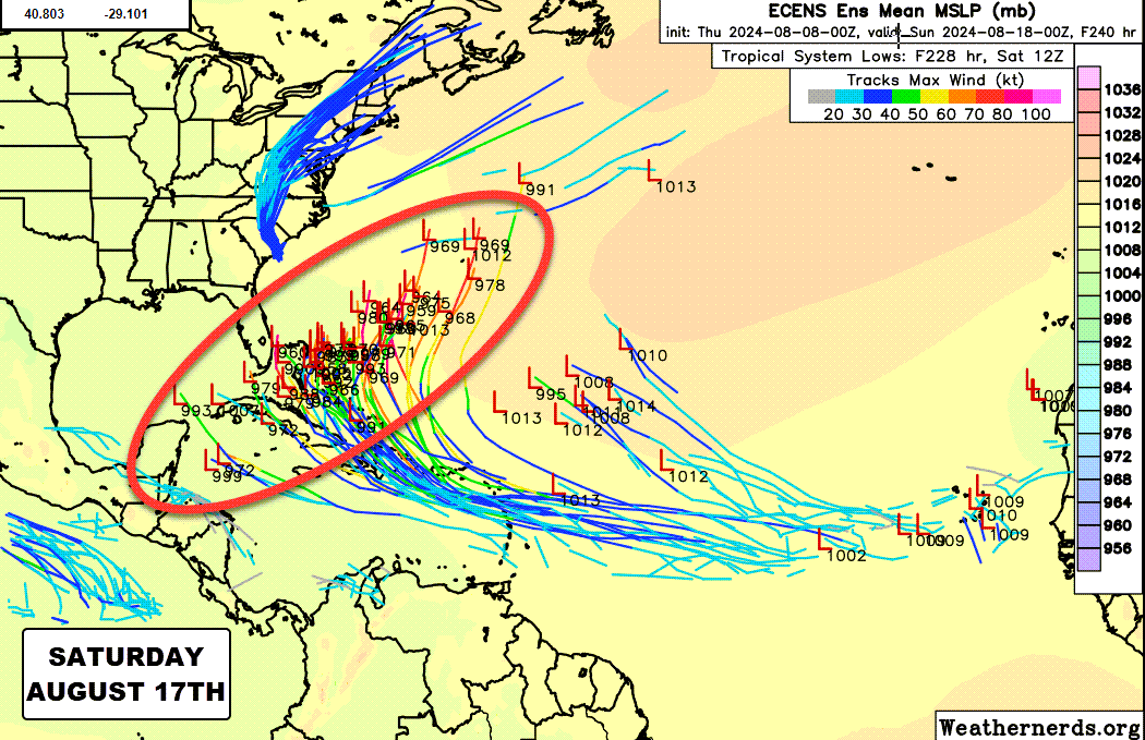
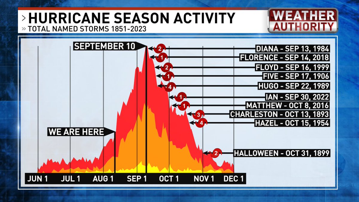
We're nowhere near the peak of hurricane season. In fact, the tropical wave train is just about to start rolling. First up, low pressure could form in the central Atlantic earlynext week. Late next week, it begins to turn north, but the million-dollar question is, where? #scwx #ncwx
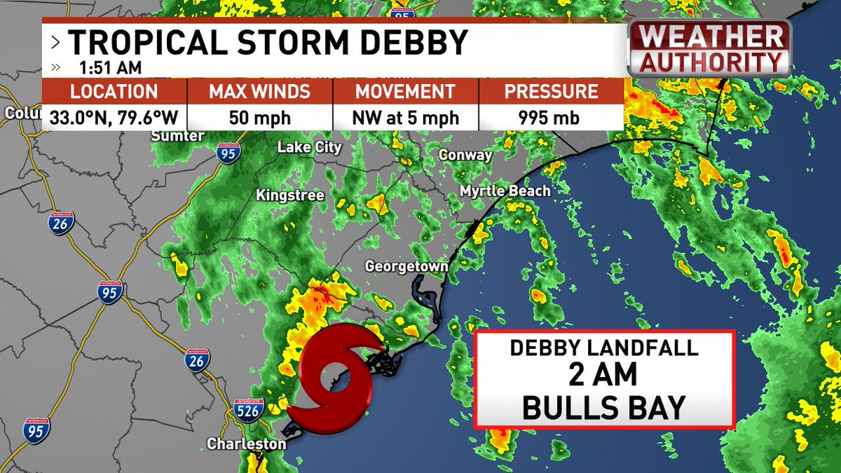
2 AM - #Debby makes landfall at Bulls Bay with 50 mph winds. Bulls Bay is also the location that recorded a massive 20 ft. storm surge with Hurricane Hugo in 1989. It's still the highest surge ever recorded on the east coast. #scwx#Ncwx
As #Debby comes ashore overnight, the heaviest bands of showers and storms will transition inland. The widespread heavy rain should move north and west of the area in the morning, with scattered activity in the afternoon. Expect an additional 3-7" of rain for many areas inland between now and Thursday evening. Lesser amounts for the coast. #scwx #Ncwx
10 AM WEDNESDAY TROPICAL UPDATE
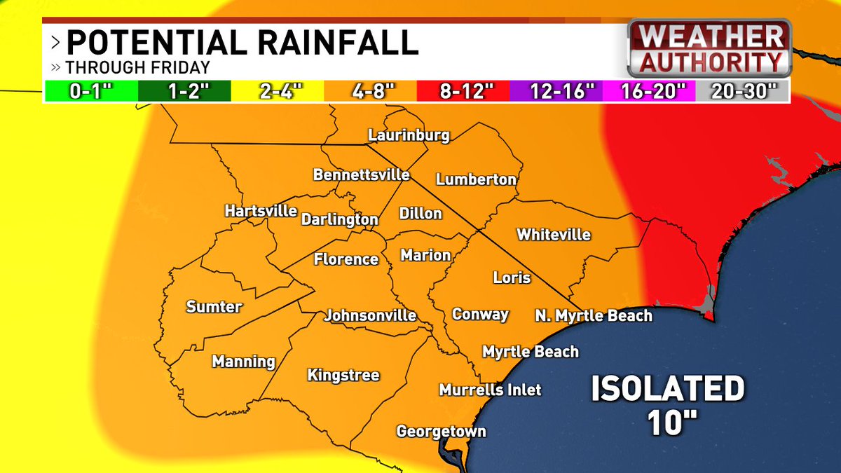
We've been very lucky. Tropical Storm Debby ingested tons of dry air over the past 24 hours, which helped to cut down on extreme rain totals so far. That said, there WILL be rounds of extremely heavy rain. Here's a breakdown of what to expect.
TIMING - The worst of the weather is this afternoon through Thursday with conditions improving Thursday night into Friday. We're back to typical summertime weather Friday through the weekend.
RAIN - Satellite, radar and forecast models insist we'll see rounds of extremely heavy rain this afternoon through Thursday morning. The rain will be scattered but still heavy at times for the afternoon and evening. Most areas will receive an additional 4-8" of rain with isolated spots up near 10". Extreme flooding could occur in those areas that get persistent heavy rain. Flash flooding can lead to ditches and retention ponds overflowing, washed-out roads, and the possibility of water entering structures. Take flash flood warnings seriously!
WIND - The center of Debby will likely come ashore south of us overnight. Expect wind gusts of 25-35 today, 30-40 tonight, and 35-45 on Thursday. With Debby a little stronger, a gust of 50-55 along the immediate coast is not out of the question. Winds will fall quickly Thursday evening and Friday. With all the rain and loose soil, a few trees could fall, and isolated power outages would be possible.
TORNADO - The tornado threat is very low and mainly confined to the coast today and tonight.
ALONG THE COAST—A prolonged period of onshore winds will produce rough surf, dangerous rip currents, and coastal flooding. A 2-4 ft. storm surge will come in rounds today and tonight around high tide at 10:10am Wednesday, 10:15pm Wednesday, 10:55am Thursday, and 10:56pm Thursday. Minor coastal flooding is expected, but nothing like previous hurricanes. RIVERS - Area rivers will rise into moderate to major flood stage. Almost all rivers are expected to stay well below the levels reached in Hurricane Matthew and Hurricane Florence.
CAN YOU COME TO THE BEACH Friday and beyond? I think so, but keep in mind that there's no way to know right now how much flooding lingers and if there will be road closures & power outages. Check with SCDOT and NC DOT for road information. #scwx #ncwx