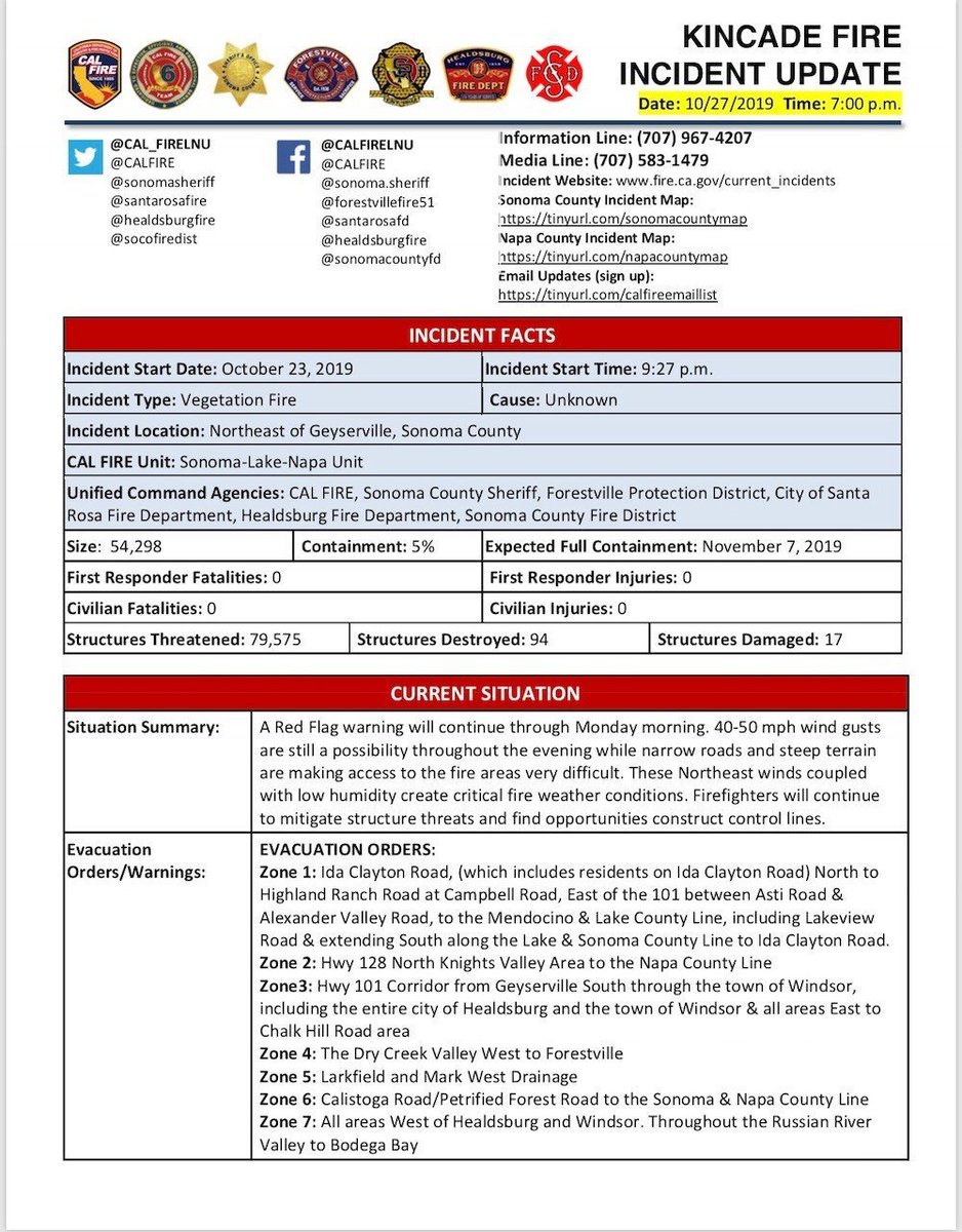
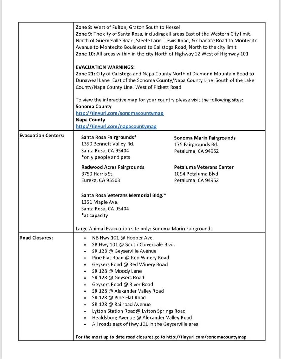
#KincadeFire off John Kincade Road and Burned Mountain Road, northeast of Geyserville in Sonoma County is 54,298 acres and 5% contained. https://t.co/0lE746SI6V
Interactive map for #Kincade file. Yellow numbers = fire locations via twitter. Next satellite pass mid-day. Open map after 4pm and that data should appear. In other words, satellite hotspot data is never ‘real time’.
Open #GISsurfer map: https://t.co/XsUttACv8d
#LeilaniEstatesEruption#KilaueaVolcano LATEST: Incredible new footage taken by the incomparable Brad Lewis of the #fissure8 fountain that has fired non-stop for nearly 2 weeks now, as USGS reports possible increase in eruption rate https://t.co/au7CKsv3Qx @HawaiiNewsNow#HINews
“When you’re a kid, Jesus sounds like a hippie or Bernie Sanders or something so it all sounds pretty nice. But then the rules get confusing. You go to Catholic school and some guy in a dress named Brother Roy starts beating you cause you got in a fight. It’s sorta like Gitmo.. ”
New video shows lava in the Lanipuna Gardens subdivision claiming another home, at least the 28th that has been destroyed by the Kilauea eruptions. https://t.co/CiSNf9Brdn #HINews
These incredible satellite images provide a stunning before-and-after look at the historic devastation in Leilani Estates, where at least 37 structures have been destroyed by lava from recent Kilauea eruptions. READ MORE: https://t.co/zBPZgaC9S6
“When I’m home, nobody will talk to me. It’s like I am dead. I don’t like quiet because then I have nothing. So I ride the train into the city. Compared to home, the city is like heaven. There are a million people you can ask for help. There are people to help you up.. "