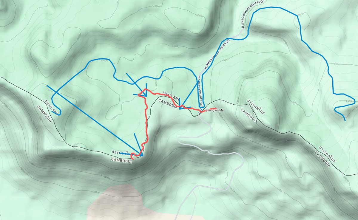
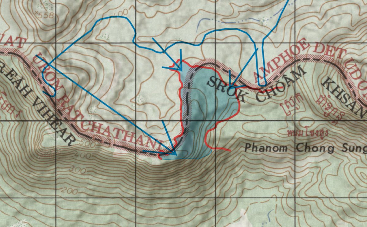
I agree with the logic of the argument that Cambodia's claim of following the exact 1904 maps to determine the boundary is worse and less precise than using the geographic watershed, but then you can't just refer to your own vague and old line instead. It doesn't even follow the contours on Thailand's own official topographic maps.
This Cambodian finger-grip on the plateau that has been built across much of the disputed area cannot be something Thai military planners are particularly happy about.
My guess is that the Thai Army's strategy and objectives are to capture most of the Cambodian positions on the plateau that have been fortified over the past few years and to ensure in future are fewer battlefields where Thailand and Cambodia will be fighting on level ground.
eg:
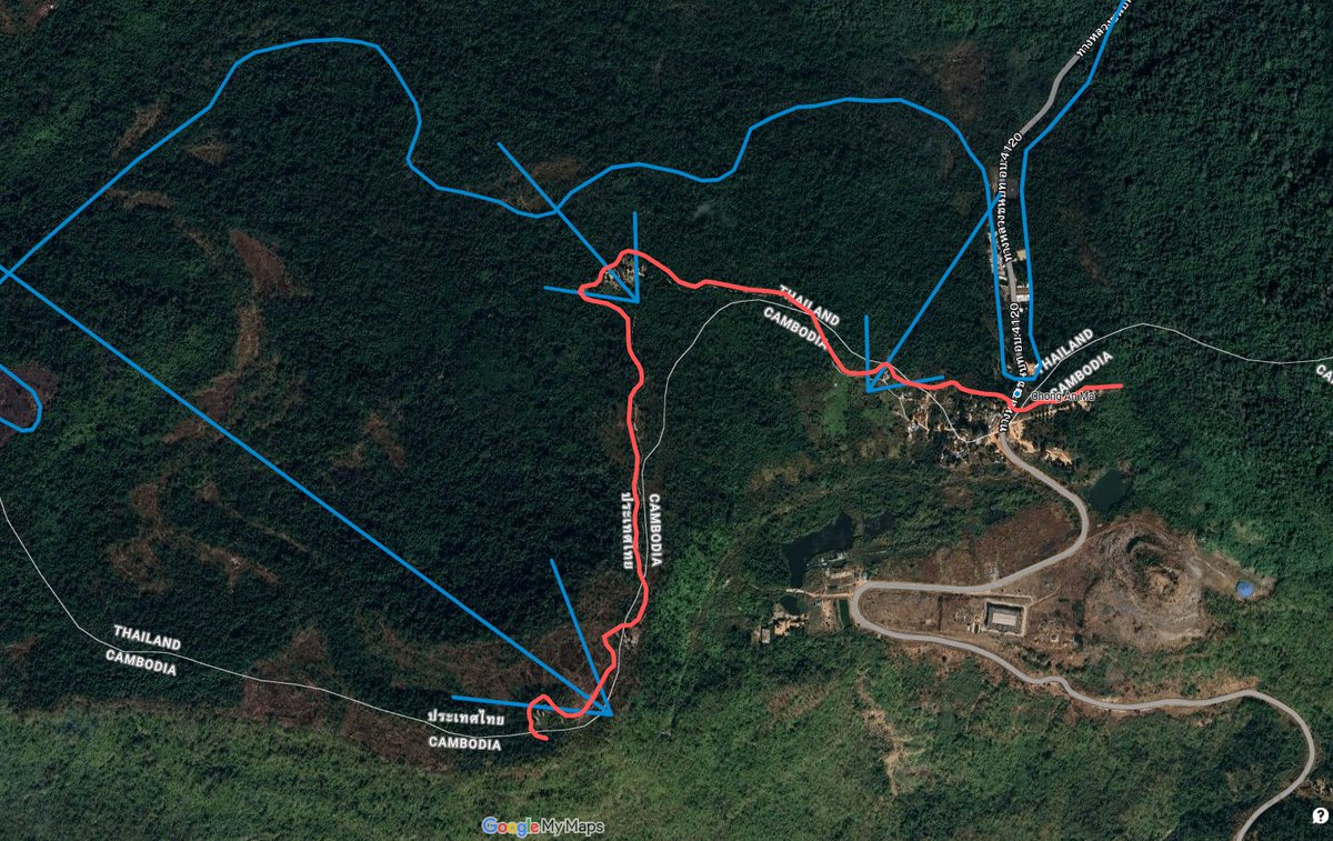
This assessment seems to be confirmed by a statement today from the 2nd Area Army saying they recaptured all territory in the Chong An Ma area upto the line demarcated to the 50k map indicated line. This would suggest ONLY the frontline positions to the West of the town.
Thailand's Army Military Force Reserves have claimed that the Thai Army has captured and raised its flag over the Chong An Ma area. I suspect they are referring to the Huai Bon frontline outposts area rather than the whole plateau (including civilian residential areas).
This is where a Thai patrol stepped on a landmine, arguably sparking the conflict, on July 23rd.
Either way, I'll await any geolocatable photos to confirm.
There are a few larger more fortified positions behind the border town, which I would be surprised if they have been captured (as they are more unambiguously within Cambodian territory), but you never know.
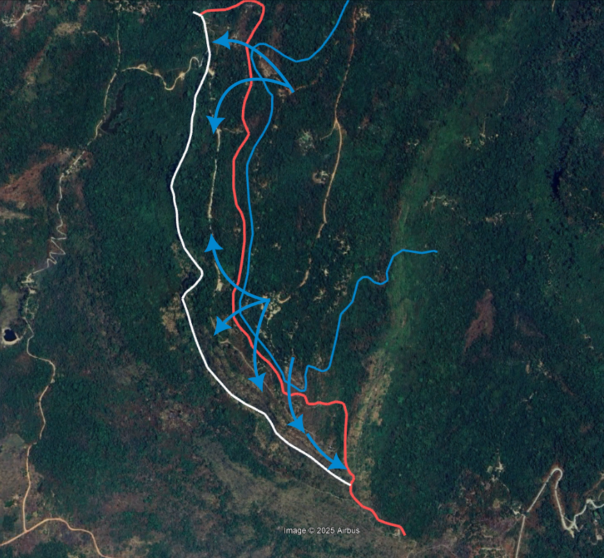
The Thai Armed Forces have confirmed that they captured the Phu Makhua hilltop on the second day of clashes with Cambodian forces. Phu Makhua is a massif in the Dangrek Mountains around 3km NW of the Preah Vihear temple complex.
In Nov 2022, Cambodian troops built a road along the Phu Makhua ridgeline (white line) and strengthened their positions at the top of the ridge. Their positions on the ridge meant this was one of the few sections of the border where Cambodian troops were actually positioned above Thai soldiers.
In early July, Thai troops noted that backhoes and excavators were digging trenches between the Thai and Cambodian positions on Phu Makhua.
Fighting over the positions was apparently intense, with the Thai advance supported by artillery fire and airstrikes. Approx 0.65km2 of territory was captured in the operation.
On the first day of the clashes, Thailand destroyed a supply cable-car system that was used to ferry supplies up the ~150m ridge.
If we split this into sectors
And also note that the Thai forces are probably underrepresented here because
1. Theyre probably not as well mapped on Cambodian maps
2. Blue is harder to see against the background in these jpg crunched low-res maps.
🧵A detailed timeline on escalations in the lead-up to yesterday's clashes between Thailand and Cambodia.
Much of the escalation seems to stem from Cambodia, with their troops fortifying many sectors before the May 28 clashes and surging strategic assets immediately after.
🗺️ - heatmap of Cambodian military developments prior to July 24th.