FUNGA is now in the Cambridge Dictionary. 🍄
At Mycosoft, we see this as more than a new word—it is language finally catching up with biological reality. This milestone reflects years of work by the Fungi Foundation, scientists, and the global community.
Flora. Fauna. Funga.
https://t.co/jRbueudWja
We will be at @NavyGoldCoast, San Diego.
Aug 17–20 · SD Convention Center · @Mycosoft booth
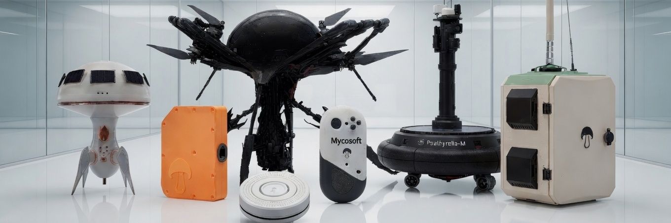
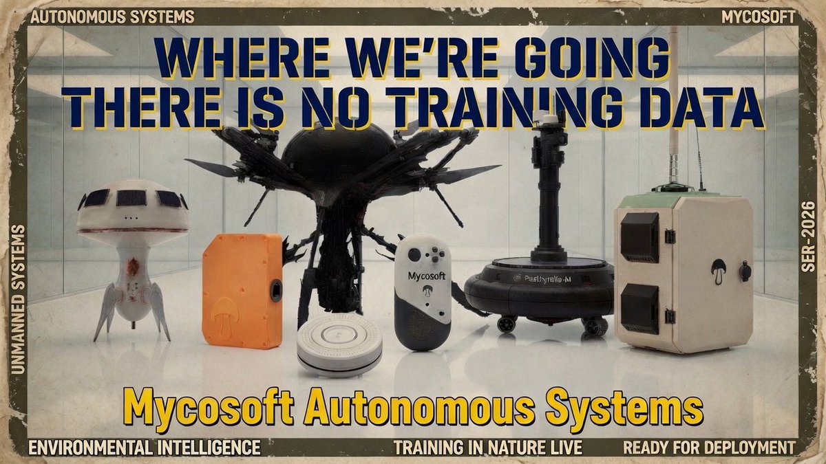
Showing of our land/sea/air autonomous sensing droids, built to sense the the real world and provide actionable intelligence to operators in the environment.
Come touch the hardware.
NEW: An "experimental explosion" off the Florida East Coast occurred this afternoon at 3:04 PM. It was large enough to register with a 3.9 magnitude. Historically, this region has been used by the Navy to conduct underwater explosions, including back in 2021. Did you feel it?
The world's first real droid.
Giving nature its own computer.
https://t.co/gu8RBBGjFx
For billions of years, fungi have been the Earth's oldest and most sophisticated communication network. Beneath every forest floor, meadow, and ecosystem, mycelial networks exchange information, nutrients, and warnings at scales we're only beginning to understand.
Mushroom 1 is humanity's first attempt to listen. By deploying persistent, solar-powered sensor stations that tap into environmental signals from soil bioelectrics to atmospheric conditions, we can finally give nature a voice.
This isn't just monitoring. It's Environmental Intelligence. It is Mycosoft's first non-human computer made to interact with nature directly, including the mycelium networks of Earth through its ground-actuated Fungal Computer Interface probe. Mushroom 1 brings live biospheric, acoustic, thermal, chemical, mechanical, and bioelectric signals into the Mycosoft stack from the place where any signal is created in Nature.
Environmental Intelligence is a new paradigm where the natural world becomes an active participant in our decision-making, warning us of fires before they ignite, detecting contamination before it spreads, and revealing the hidden health of ecosystems in real-time.
Introducing: The Earth Simulator from @Mycosoft
https://t.co/g7P45BiTv2
Earth Simulator is Mycosoft’s living environmental intelligence map — a nature-first Common Relevant Environmental Picture for seeing Earth as one connected system.
This is Earth Simulator, a highly detailed, very beautiful large codebase application I've been building by myself for almost 2 years using the worlds consolidated data, it is the first of its kind map to use hybridized global data sets, live sensor data from environmental Droids and a non LLM, Nature Learning Model driven AI that can monitor it all continuously.
try it out, its not complete but works...
https://t.co/tLCT2lpqsC
It has live sensor data from @Mycosoft devices,
tissue collections from @MycoDAO,
global observations of species from @inaturalist@GBIF@fungidb and many more,
live mycelium locational data from @globalfungi,
live AIS/ADS from on our own onsite SDR scraping systems and APIs,
live cameras in a AI monitoring system called Eagle Eye that not only finds, sees and maps camera streams but identifies what is in the video using YOLO26/SAHI,
live satellite data of starlink, gps, military & debris,
US Military base locations & tenant information,
live AQS & AQI Air sensors,
live rail, train, trolly locations, crossings & stations,
All available power grid infrastructure including transmission lines, power plants and live grid metrics,
All telecom including cell towers, AM/FM radio antennas, Radar, datacenters,
All sea cables, ocean buoys data, vessels data,
many ports, hospitals, fire departments, police stations, schools, city facilities and more,
live port of entry crossing times, cameras and data,
live civic panel showing all the governments, jurisdictions and political leadership of an area in view including local elections, departments and events.
that's just like half of it...
Most maps show where things are. Earth Simulator shows what is happening around them. Mycosoft’s Earth Simulator is a living environmental intelligence map built to help humans and AI see Earth as one connected system. It brings together satellite imagery, weather, natural hazards, air quality, biodiversity, aircraft, vessels, satellites, power infrastructure, telecom networks, submarine cables, civic context, cameras, regional science projects, and real field-device telemetry into one interactive operational picture.
Instead of forcing scientists, operators, investors, conservation teams, infrastructure planners, and governments to jump between scattered dashboards, Earth Simulator gives them a single place to ask: what is happening here, what is nearby, what is changing, and what might it affect?
What makes Earth Simulator different is not simply the number of layers. It is the way those layers can be understood together. A wildfire corridor, nearby aircraft, wind patterns, air quality, power lines, water systems, species observations, sensor readings, and regional project data can all appear in the same spatial context.
MYCA, Mycosoft’s operating intelligence, reads the active view and turns visible signals into situational understanding: events, organisms, infrastructure, vehicles, vessels, satellites, cameras, and field devices become part of one shared canvas for investigation. That is the shift from a map to an intelligence system — not just seeing data, but seeing relationships.
Earth Simulator is the public front door to Mycosoft’s broader NatureOS stack: MYCA for AI interpretation, MINDEX our Intelligent Database for provenance and biological data integrity, Our novel Nature Learning Models for learning from physical environmental signals, and AVANI our deterministic AI for governed, responsible action. Our thesis is simple: the next generation of AI cannot be trained only on the internet.
It has to learn from the planet itself — from sensors, ecosystems, infrastructure, weather, biology, and real-world change. Earth Simulator is where that thesis becomes visible: one map, many systems, live context, AI-readable reality, and a new foundation for planetary intelligence.
ReadMe: https://t.co/MbDLHnw34D
Technical Doc: https://t.co/nRaR7bT4CM
Code: https://t.co/Gz8WYyVJ07
https://t.co/lMslaPyGrr
Introducing: The Earth Simulator from @Mycosoft
https://t.co/g7P45BiTv2
Earth Simulator is Mycosoft’s living environmental intelligence map — a nature-first Common Relevant Environmental Picture for seeing Earth as one connected system.