Wildfires emit gases that can react in sunlight to form surface ozone. Though ozone high in the atmosphere shields Earth from UV radiation, surface ozone near the ground can irritate lungs and worsen respiratory diseases.
Learn more: https://t.co/VnySgszYwJ
Wildfires are creating unhealthy air far from active flames.
According to a new NASA study, wildfires have worsened ground-level ozone pollution across much of the U.S. since 2015. NASA’s satellite data and models help track air quality patterns across states and fire seasons.
The data helps scientists track how crops grow, how irrigation affects the land, and how land-use changes across large areas. Learn more: https://t.co/eE6kigTQH7
This may look like abstract art, but it’s agricultural data taken by the NISAR satellite.
Collected over the Maize Triangle in South Africa, each color in the data provides clues about crop types and how they changed over the growing season.
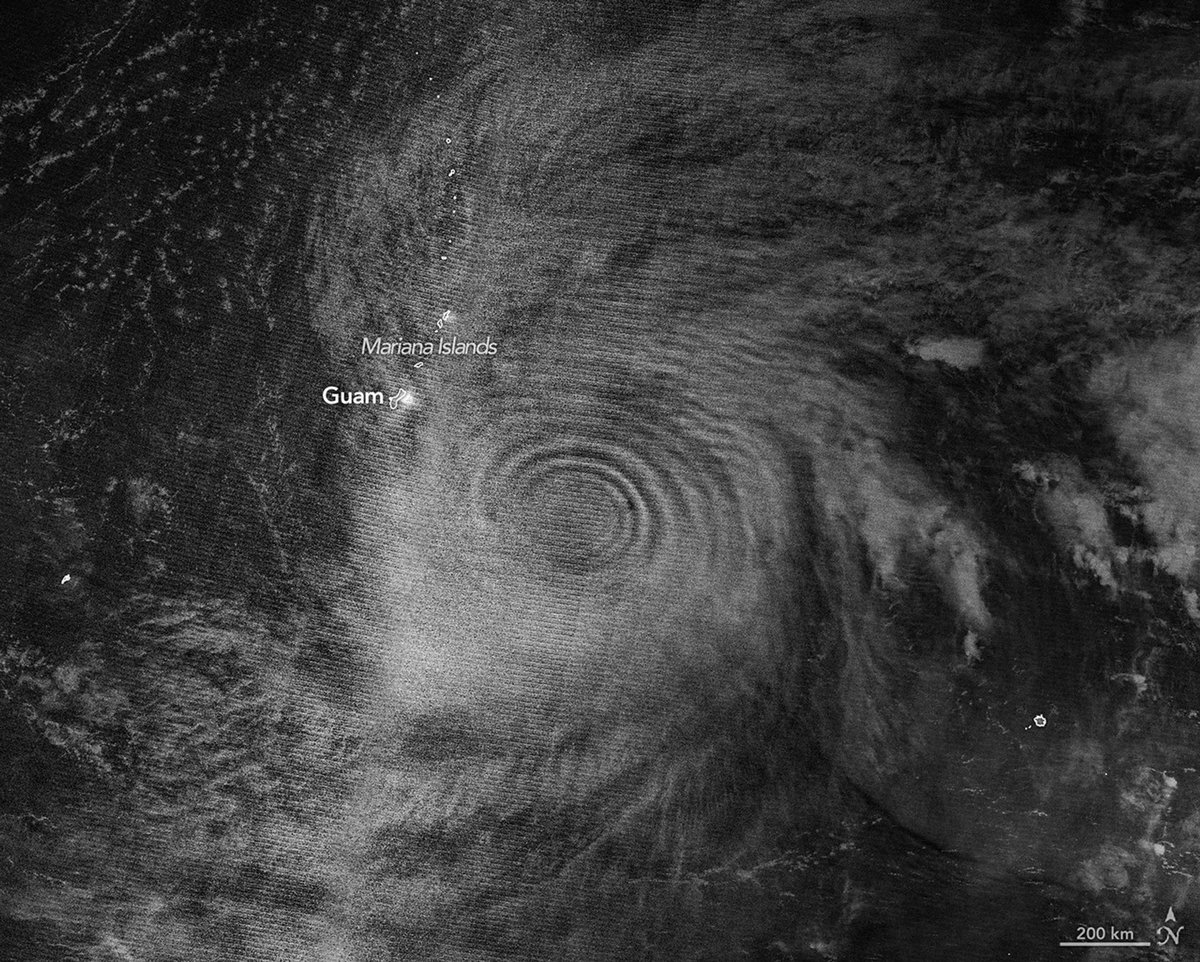
As Super Typhoon Sinlaku intensified in mid-April 2026, the violent typhoon created atmospheric gravity waves in Earth’s upper atmosphere.
The waves are visible in this nighttime @noaa-20 satellite image because of airglow in the mesosphere.
June 1 is the start of the Atlantic hurricane season.
NASA’s satellites and views from the @Space_Station help scientists see storms from space and track how they evolve. This data helps communities better prepare for and respond to storms.
Austral autumn leaves falling down like pieces into place 🎵🍂
The Magallanes region of Chile is home to the southernmost temperate forests in the world. Landsat 9 saw the trees in their red & orange splendor during southern hemisphere fall on April 12.
https://t.co/m7ZFg8AvlR
Spinning out? We get it. 🌀
Landsat 8 captured these swirling clouds over the Southern Ocean on Feb. 11, 2026. The counterrotating spirals formed as flowing air was deflected by Peter I island and spun into eddies.
A NASA sensor is helping firefighters stay safe — and gathering critical science data! 🔥👨🚒
NASA’s FireSense project installed the sensors on fire bulldozers to alert the firefighters driving them when their surroundings are getting too hot.
This work is part of a collaboration between @NASA FireSense and @ALForestryComm.
The teams are planning to add another NASA science instrument to the fire dozers to measure temperature, spread rate, flame length, fire convection, and gas emissions.
An El Niño will likely arrive later in the year, according to sea level data from Sentinel-6 Michael Freilich. The satellite—which measures the height of the entire ocean every 10 days—captured a swell of warm water hundreds of miles wide in the Pacific Ocean off the coast of South America.
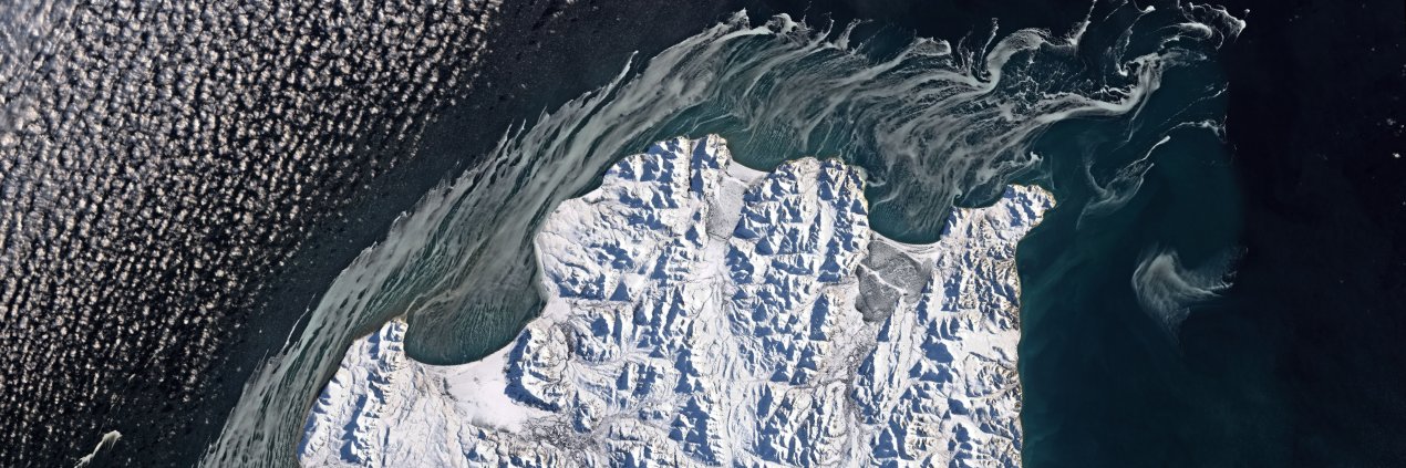
Out like a lion!
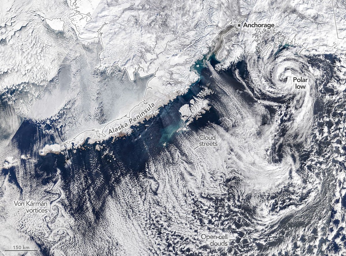
Winter came to a stormy end in southern Alaska, where heavy snow and cloud formations like cloud streets and Von Kármán vortices were visible to @NASA's Terra satellite on March 19.
https://t.co/fciwAIDUXE
40 years of growth in Las Vegas 🏙️
The @nasa@usgs Landsat satellites have been studying our planet for nearly 54 years. With such a long data record, scientists can see long-term changes like how cities expand over time.
Do you have a favorite rock or mineral? These scientists do! 🪨
We asked scientists with the @nasa@usgs GEMx project what they love about their favorite minerals. GEMx aims to better understand mineral resources in the western U.S.
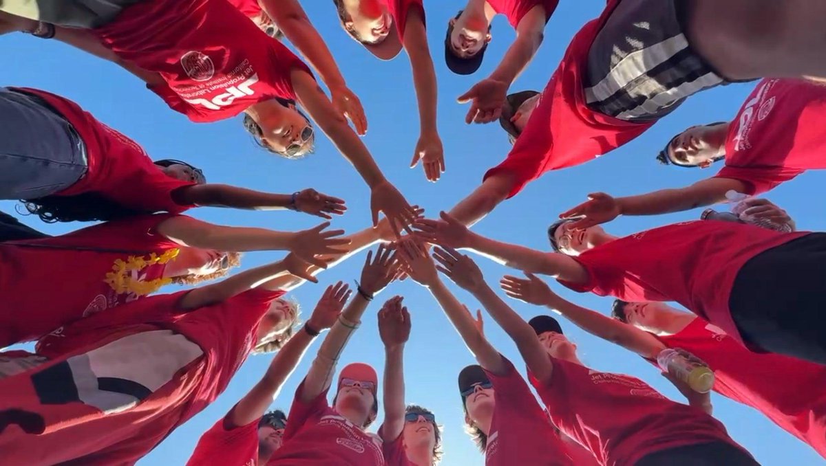
Interns on 3! 1, 2, 3, INTERNS! 🙌
Ready to put your hand in & join the @NASA internship squad? Applications are due at 11:59 p.m. EDT TONIGHT! 🕛
Get application tips: https://t.co/Gw6Z4AvBQp
Apply: https://t.co/W3MldSoGl9
There are thousands of abandoned mines across the American West, each with the potential to release contaminated water into vital rivers and lakes.
NASA’s EMIT instrument on the @Space_Station is helping identify these areas for remediation by mapping surface minerals on Earth.