Areas of fog will again develop late tonight into early Thursday, mainly west of I-77. Lows will range from the upper 30s to lower 40s, with the coolest readings from inland Northwest Pennsylvania into Northeast Inland Ohio.
🌫️ Dense fog across Northwest Ohio will likely lift by mid-morning, though low clouds may persist into the early afternoon. ☀️ Elsewhere, seasonable, sunny, and dry weather is expected. Another round of patchy dense fog may develop later tonight.
❄️Want to become a better winter weather spotter? Join NWS Cleveland for virtual Winter SKYWARN training on Monday, Nov. 23!
Great Lakes offices are offering 5 virtual courses in Nov. and Dec. Choose the session that works for you and register here: https://t.co/5qRYQiwMow
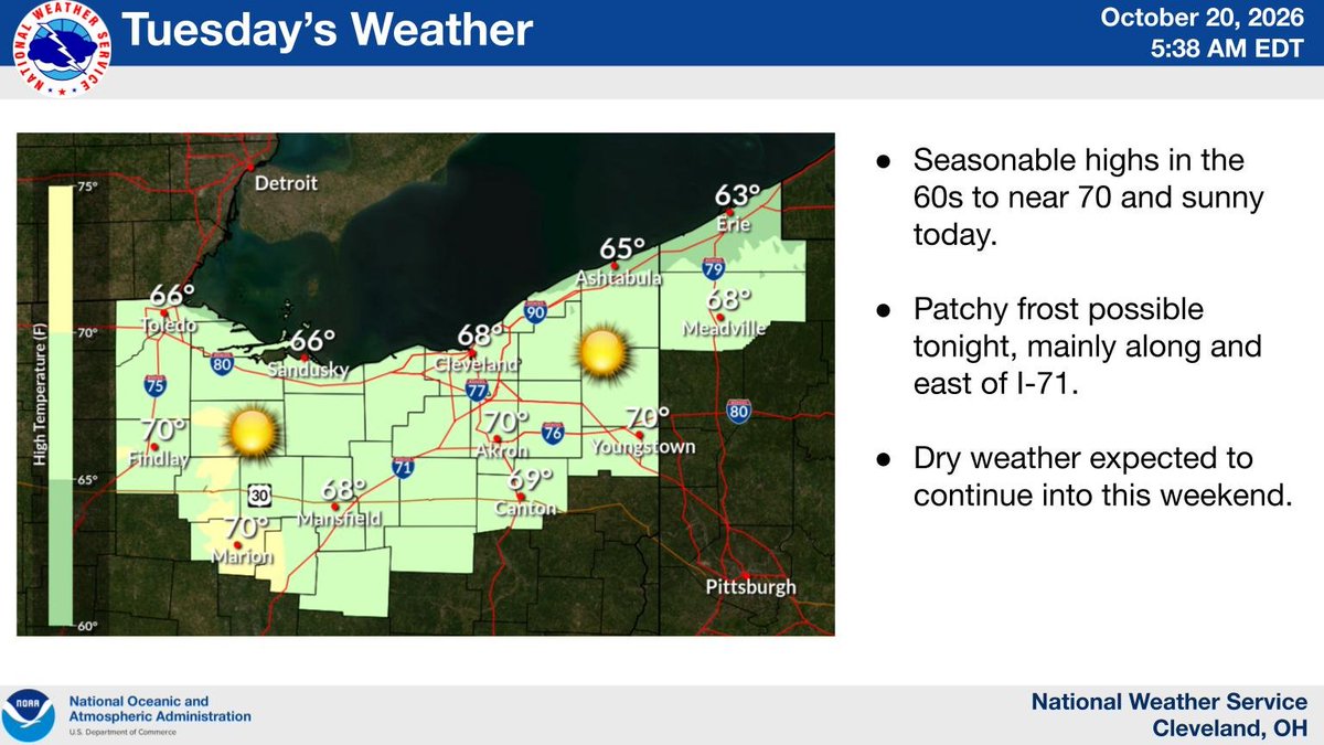
☀️ Seasonable and dry weather is expected today, with highs in the 60s to near 70. Patchy frost is possible again tonight, mainly along and east of the I-71 corridor.
Dry and mild weather is in store for the next week! ☀️🍂 No rain is expected, with high temperatures generally in the 60s. A few spots could reach 70°F Tuesday, followed by a slight cooldown Friday and moderating temperatures over the weekend.
☀️ Seasonable highs in the 60s and sunny weather are expected today with the dry weather pattern extending into next weekend. Patchy frost is possible again tonight, mainly along and east of the I-71 corridor.
After a frosty start, it will be a sunny Sunday with highs in the lower 60s. Temperatures tonight will be slightly milder than last night, but will still be chilly enough to support some frost away from the Lake Erie shoreline. Frost potential is greater farther east. #OHwx#PAwx
A freeze warning is in effect from 1am to 9am Sunday for most of Northern Ohio and Northwest Pennsylvania. Temperatures as low as 30 degrees can be expected. A frost advisory is in effect for the lakeshore areas east of Cleveland from 1am to 9am Sunday with lows in the mid 30s.
Lake effect rain showers linger across portions of the area this morning, particularly across North Central Ohio. This activity will end by this afternoon as sunshine breaks out, with highs ranging from the upper 40s to lower 50s across the area. #OHwx#PAwx
The coldest night we've seen this fall is in store tonight into early Sunday, with lows forecast to range from the upper 20s to lower 30s away from Lake Erie with slightly milder values along the lakeshore. Widespread frost is likely, especially away from Lake Erie. #OHwx#PAwx
Special Marine Warning including the Avon Point to Willowick OH beyond 5 nm off shoreline to US-Canadian border, Vermilion to Avon Point OH beyond 5 nm off shoreline to US-Canadian border, Reno Beach to The Islands OH and The Islands to Vermilion OH until 6:30 PM EDT
A Freeze Watch has been issued for Late Saturday Night through Sunday Morning. Sub-freezing temperatures are expected for most of the area on Saturday night, except areas near Lake Erie.