Partly cloudy & mild conditions will prevail today & tonight. However, a cold front will move through Thursday, bringing colder weather for late week. Frost or a light freeze are possible across much of the area this weekend.
Partly cloudy and mild conditions will prevail through Wednesday. However, a cold front will move through Thursday, bringing colder weather for late week. Frost or a light freeze are possible across much of the area this weekend.
It will be partly cloudy and mild over the next couple days, then a dry cold front will push through Wednesday night bringing colder weather for the end of the week.
The dry and breezy conditions Thursday will result in increased fire danger. Exercise caution and heed burn bans.
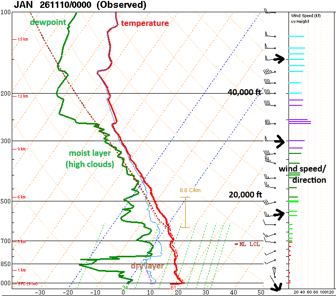
@chefschram In the black text, that's pressure in millibars, 1000 mb near the surface, then decreasing with height. The red text is height in kilometers.
Did you know we launch weather balloons twice per day to measure weather conditions above the surface? This chart shows the data from tonight's weather balloon launch, dry air near the surface with light northwest wind. Higher up, moisture increases where there are high clouds.
☀️Nice week through midweek with seasonable warmth. Late week cold front will bring 🍃gusty winds and likely widespread frost and 🥶light freeze this weekend.
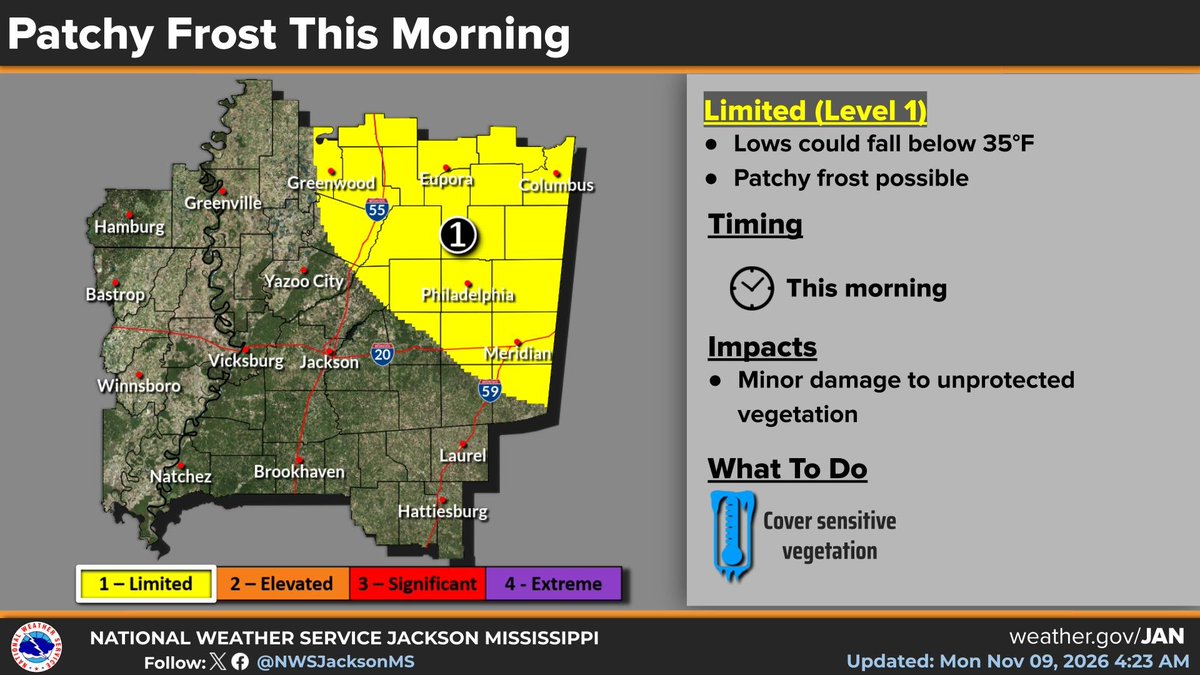
High clouds will move across the area tonight, but the dry weather will continue. It will be cool again, and patchy frost is possible once again across parts of northern and eastern Mississippi.
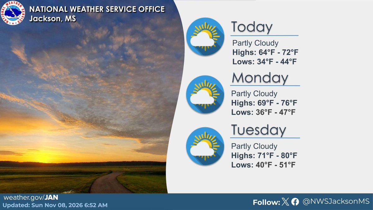
⛅ Mostly sunny to partly cloudy skies will prevail through the weekend into early next week. Highs will range in the 60s to 70s today. Lows will range from the low 30s just above freezing to mid 40s tonight before a little warmer into the early parts of the work week.
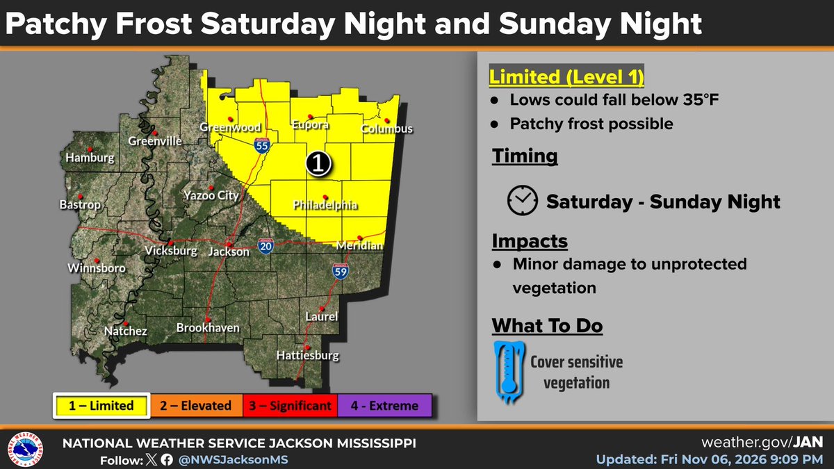
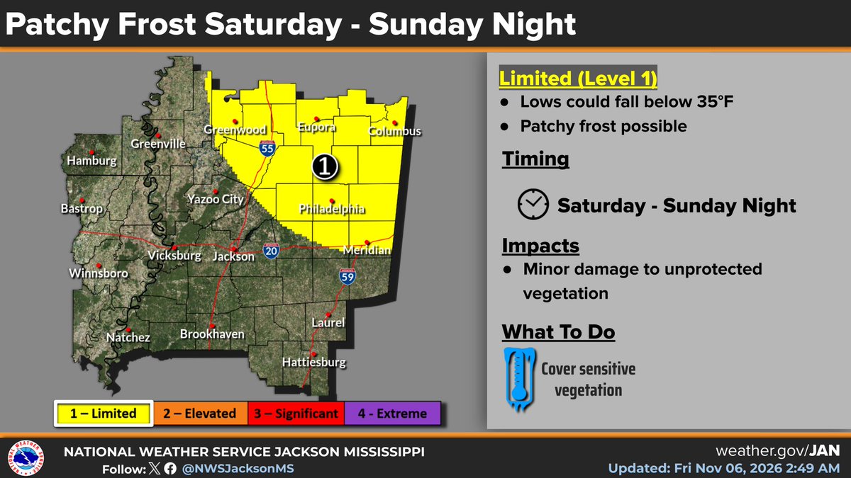
We have a chilly night ahead, with patchy frost possible across portions of northern and eastern Mississippi. You might consider covering sensitive vegetation. Have a good night, everyone.
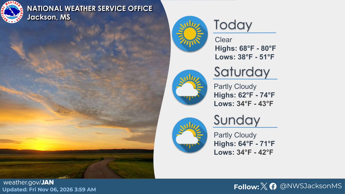
⛅Mostly sunny to partly cloudy skies will prevail through the weekend into early next week. Highs will range in the 60s to 70s today and Sunday. Lows will range from the low 30s just above freezing to mid 40s this weekend before a little warmer into the start of the work week.
☀️Clear skies today then partly cloudy skies this weekend. Highs will range in the 70s to near 80 degrees today and 60s to 70s this weekend. Lows will range in the 40s to low 50s today then drop to the 30s into the weekend.
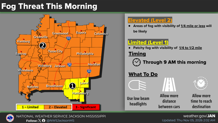
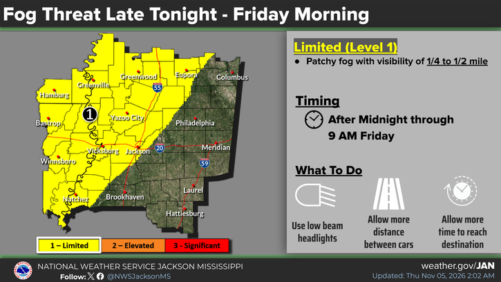
Areas of patchy fog are expected to develop early this morning, with visibility down to one quarter mile to half a mile. Be prepared to slow down when driving.
Patchy frost will be possible across parts of northeast Mississippi this weekend. Be sure to cover sensitive vegetation
Good evening, areas of patchy fog are expected to develop tonight into the morning, with visibility down to one quarter mile to half a mile. Be prepared to slow down when driving.
⚠️Areas of fog are ongoing and remain possible this morning, with visibility down to one quarter mile or less in any areas of dense fog. Be prepared to slow down when driving. Additional fog development is possible tonight.