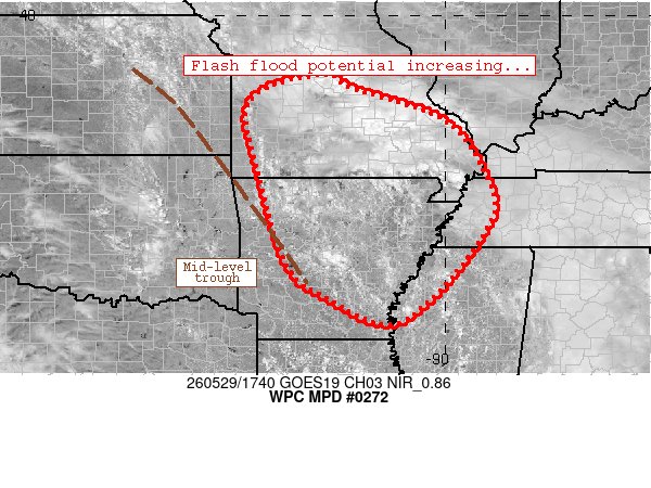
#WPC_MD 0272 affecting southern Missouri, much of Arkansas, western Tennessee, northwestern Mississippi, #tnwx#kywx#mowx#mswx#arwx, https://t.co/3YPhs4xoiK
5/28: GOES-E shows that Saharan dust is reaching the eastern Caribbean Sea. Saharan Air Layer activity usually ramps up in mid-June, peaks from late June to mid-August and begins to rapidly subside after mid-August.
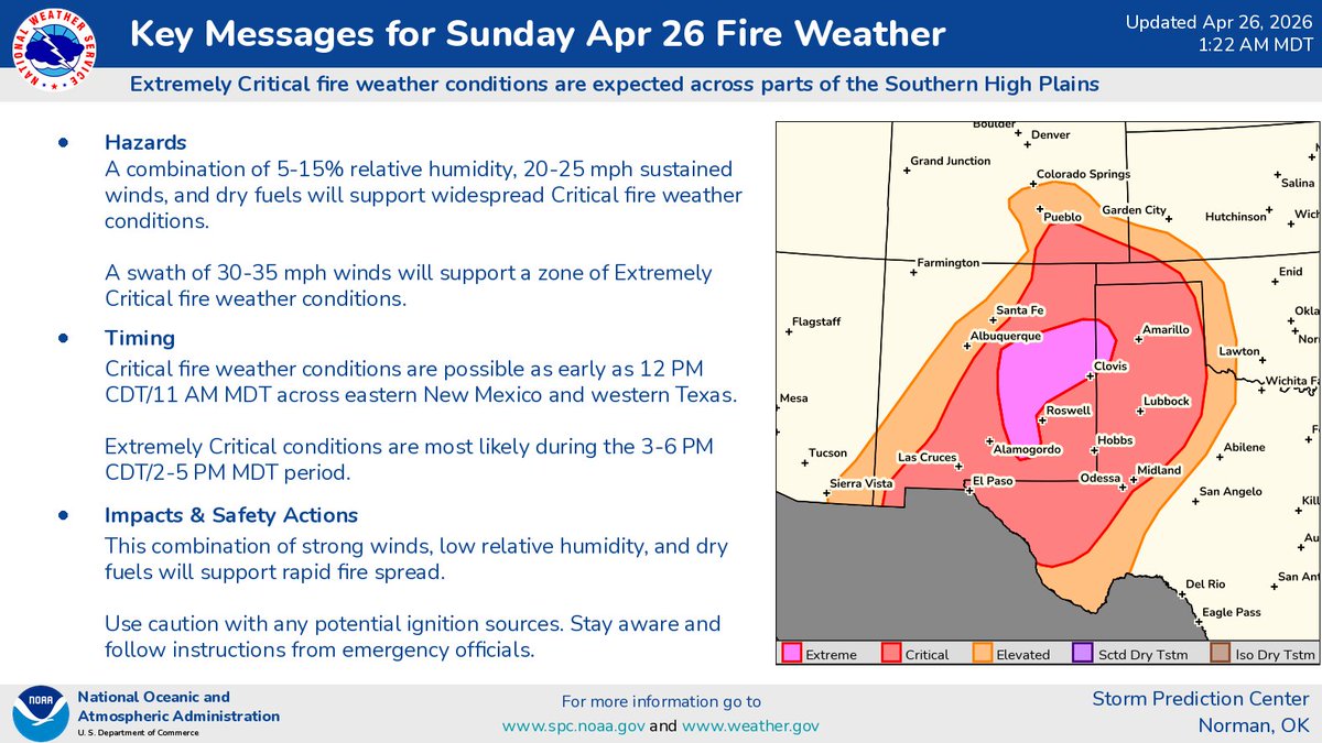
Areas across New Mexico and the TX/OK Panhandles area down into West Texas should be extremely careful with any activity that may cause sparks today and Monday. Critical to Extremely Critical fire weather conditions the next 2 days.
Fire weather concerns continue today through Monday. Sunday has even greater concern with extremely critical fire weather across the Southern Plains. Be sure to stay weather aware and follow instructions of emergency officials.
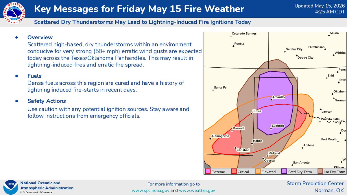
Folks in the High Plains should stay alert for thunderstorms that may spark fires today. Have multiple ways to get information, and follow instructions from emergency officials.
An active severe thunderstorm pattern is expected through early next week. Multiple days of severe storms are expected across portions of the Plains to the Mid/Upper Mississippi Valley starting today (Thursday 5/14) and persisting through Tuesday (5/19).
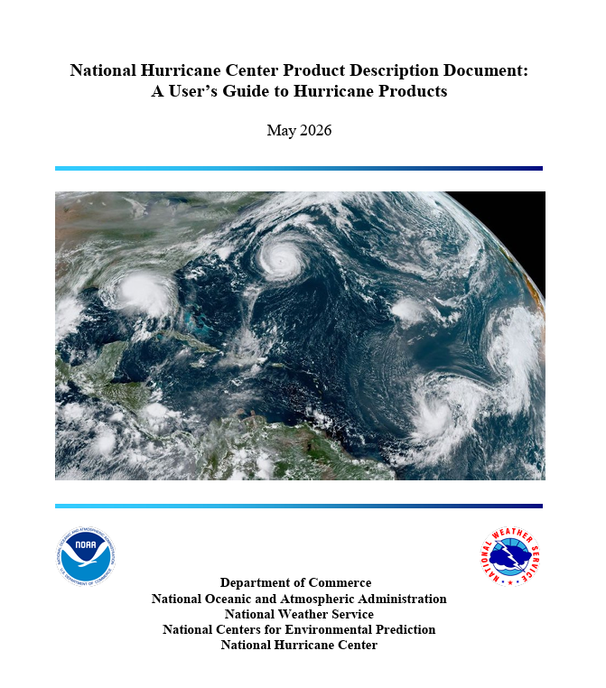
Do you know the difference between a Tropical Cyclone Public Advisory, a Tropical Cyclone Discussion, and a Tropical Weather Outlook?
Before hurricane season ramps up, take a few minutes to brush up on the products issued by the National Hurricane Center.
NHC just updated its guide explaining what each product is, who it’s for, and when it’s issued: https://t.co/WkMivYJTPi
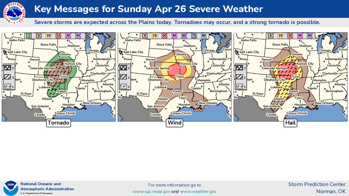
4/26: Stay weather aware today/tonight as another round of severe storms brings the possibility of very large hail (2-3") and strong tornadoes (EF-2+).
Critical to extremely critical fire weather today from New Mexico into West Texas and the Panhandles area. Use extra caution today. Blowing dust and high winds can also cause difficulties for drivers.