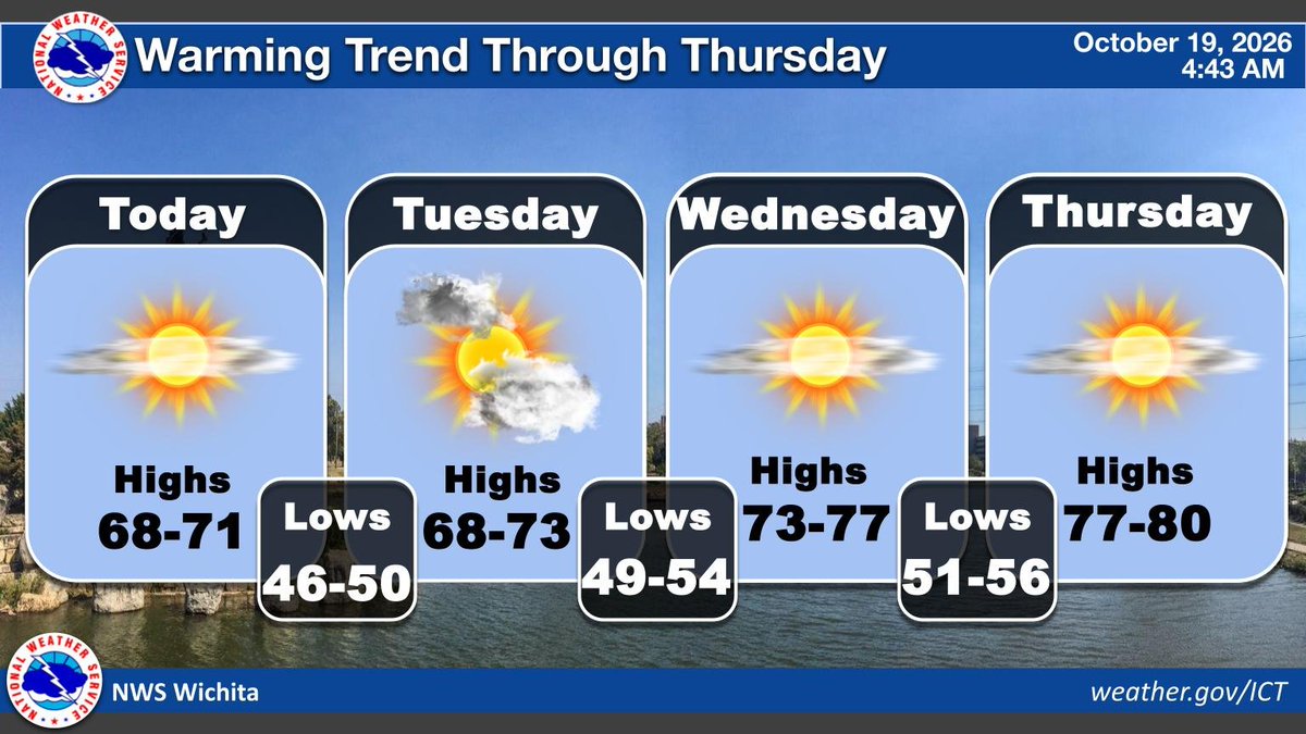
Above normal temperatures will continue through the end of the week and into the weekend. A few clouds are expected, along with breezy conditions on Friday. #KSwx
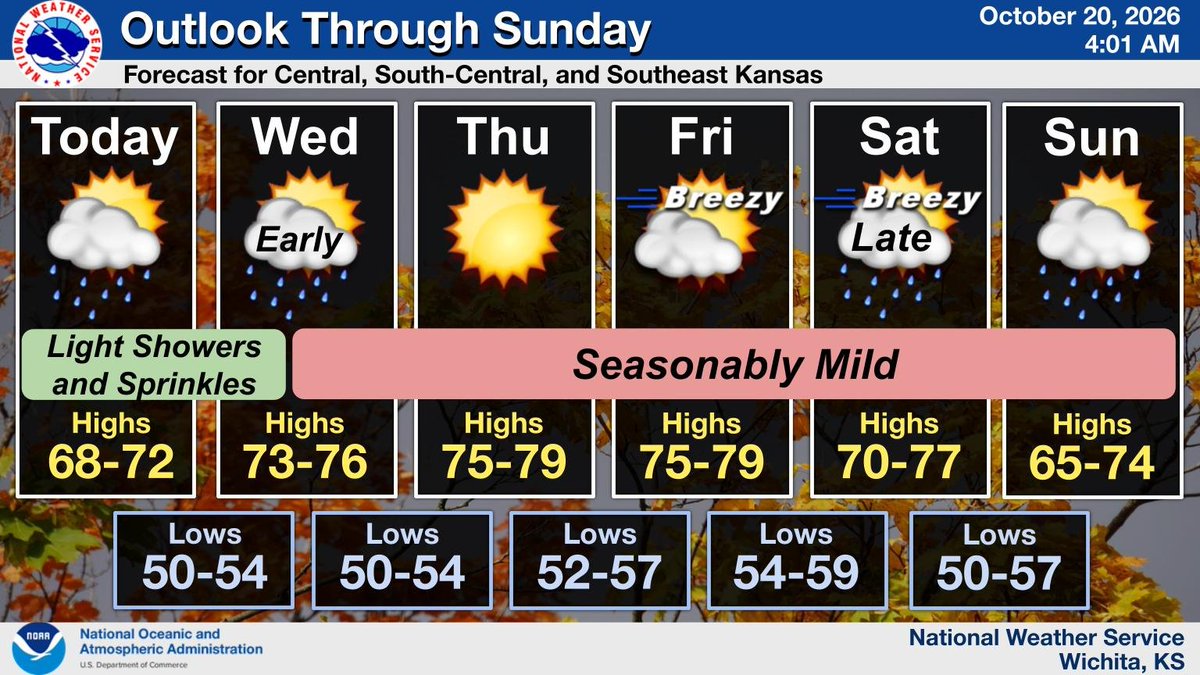
Light showers and sprinkles will impact the region this morning. Otherwise, seasonably warm conditions will prevail through the end of the work week. #kswx
3:55PM ... A few showers are moving across portions of central and south-central Kansas this afternoon. An occasional lightning strike cannot be ruled out from time to time. #kswx
Light rain showers and sprinkles will impact the region today and tonight. Otherwise, seasonably warm conditions will prevail this week, with the next chance of rain arriving late Saturday into Sunday. #kswx
A smattering of off-and-on light rain showers will impact the region late tonight through Wednesday morning, but rainfall amounts will remain light. Otherwise, seasonably warm temperatures prevail this week, with the next chance of rain arriving late Saturday or Sunday. #kswx
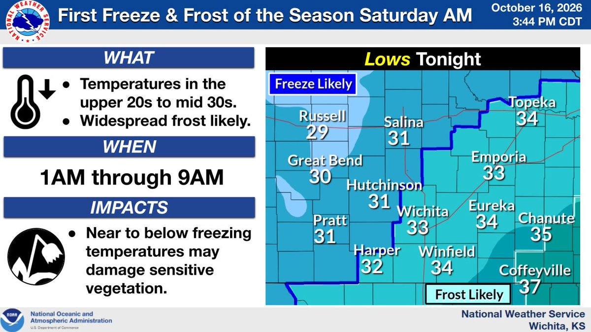
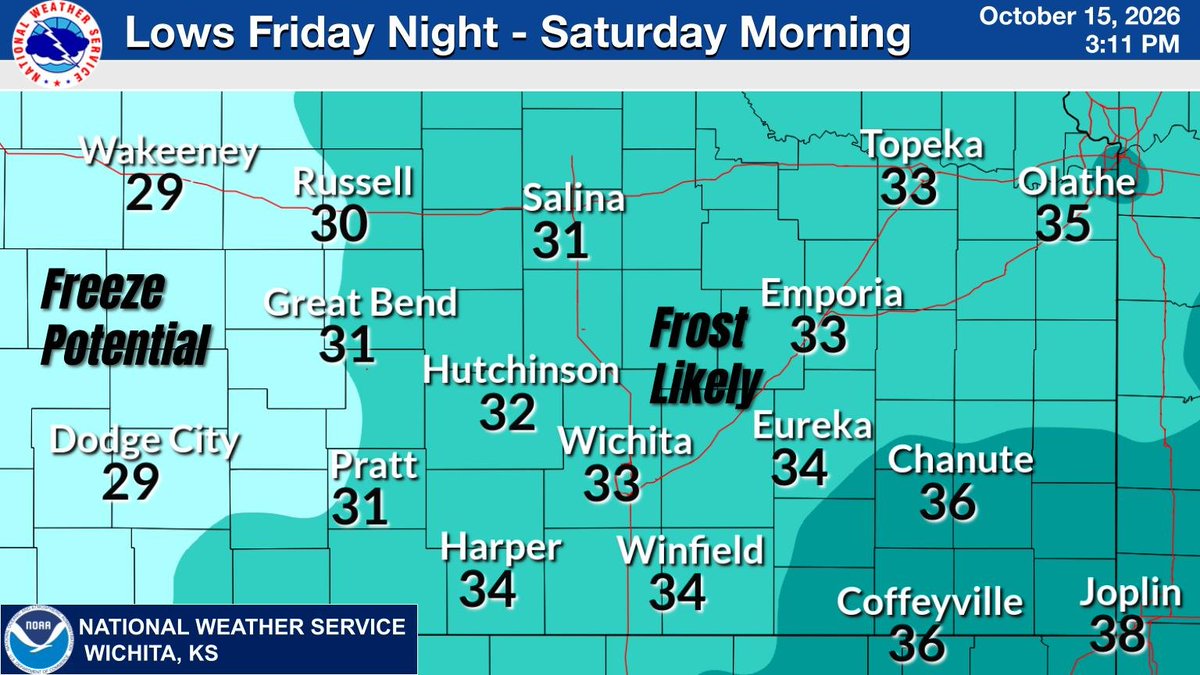
Temperatures early Saturday morning are forecast to fall into the upper 20s to mid 30s for the first time this season. These colder temperatures may damage sensitive vegetation. #kswx
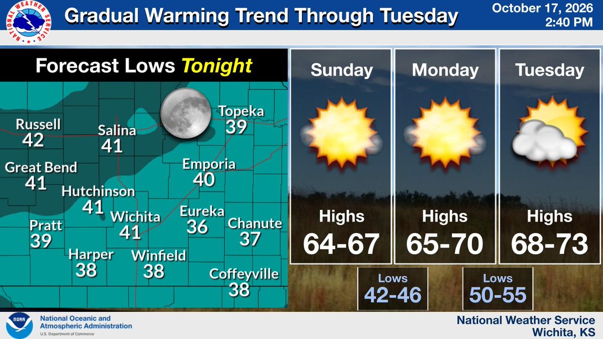
lingering through the weekend. Low temperatures near 30 Tonight will support frost across much of the area. A warming trend will commence next week. #kswx
The first frost/freeze of the season is possible late Tonight into Saturday morning with lows around 30 in some areas. Those with sensitive plants should take action to protect them. #kswx
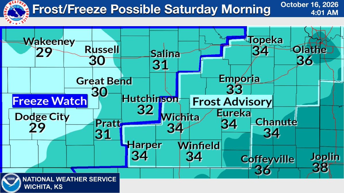
Cold temperatures are expected late Friday night into Saturday morning with lows in the lower 30s. A Freeze Watch is in effect for portions of central Kansas with frost potential across much of the area. Those with sensitive plants should take action to protect them. #kswx
[Thursday 6:41 AM]...Areas of showers and drizzle will impact the region this morning. The greatest potential for moderate to heavy rainfall at times will be over southeast Kansas. #kswx
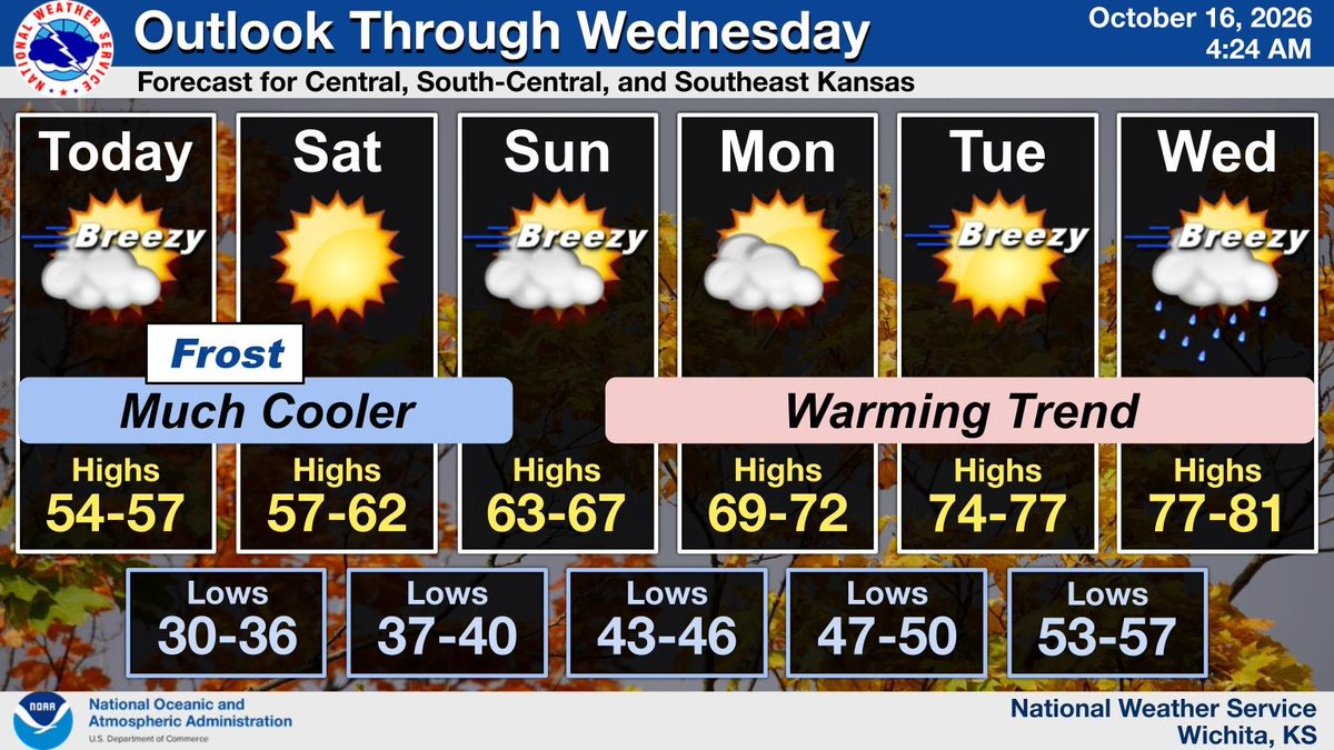
The coolest air of the fall season thus far will spread south across the region the next few days. Low temperatures in the 30s Friday night will support frost across much of the area. A warming trend will commence next week. #kswx
Areas of rain and drizzle will gradually end from west to east today. Localized heavy rain is possible over far southeast Kansas. Gusty north winds will usher in cooler temperatures from the north. #kswx
Rain will clear out of the area on Thursday with breezy conditions developing behind it. Clearing skies and much cooler temperatures are expected for Friday and Saturday. #KSwx
Heavy rainfall is expected to continue across the area through tonight and into Thursday morning. The heaviest rainfall will fall across south-central and southeast KS where a Flood Watch remains in effect. #KSwx