Kiva is an easy way to make a real difference in someone's life. Will you join me in helping Jasitina in Rushere to pursue their dream? https://t.co/P4uoZ3OoI3 #microloan#kivalove via @Kiva
@SJC_fishy Did they try to pitch it to you as an "free upgrade" each time? 😂 I hate when rental companies use that approach... There should be some incentive – and possibility – to choose a more fuel-efficient, hybrid or EV option. #ClimateCrisis
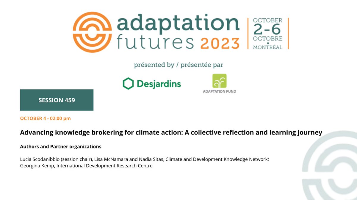
How can we best equip global researchers for knowledge brokering? Join the discussion with IDRC’s @GeorginaCundil1 and our partners at @cdknetwork at #AdaptFutures23. To learn more: https://t.co/Xh8vcaCb8u
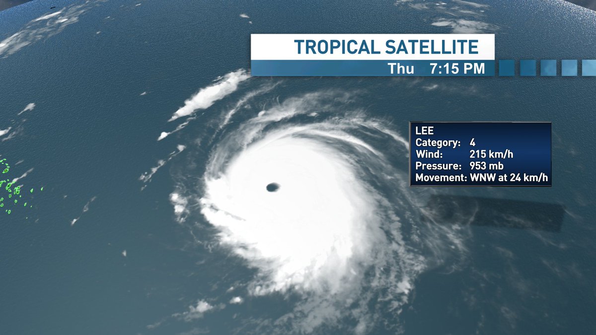
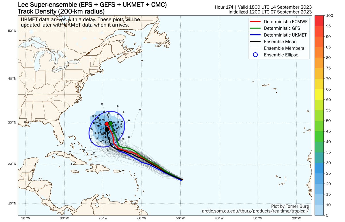
1:30pm update: Lee has been "captured" by an upper level mid-latitude low. This kept the centre offshore Yarmouth; will now swing NE with the upper low.
The heaviest rain to N &W of centre; strongest winds east of centre, but reports of strong NW winds on NW side of storm...
From next Tuesday forward, there is considerable spread in the guidance and below is just the ECMWF members! Enough so that we go from pretty high confidence down to zero heading into late next week and next weekend. Is eastern North America in play? Absolutely, but its very likely we won't have some confidence for some tighter goal posts until next week. Regardless #Lee will be a dangerous and powerful hurricane as it decides its fate on North America.
@weathermodels_
Friday #TropicalTidbit video update on Major Hurricane #Lee, expected to remain strong for the next several days as it tracks north of the Caribbean. Any potential land impacts to #Bermuda, #Canada, or the northeastern U.S. remain many days away and are highly uncertain. It's a good opportunity to ensure you have a hurricane plan just in case the storm comes your way.
Shout-out to the lawn guy who ruined the audio at the end, but I'm too lazy to re-shoot 😅
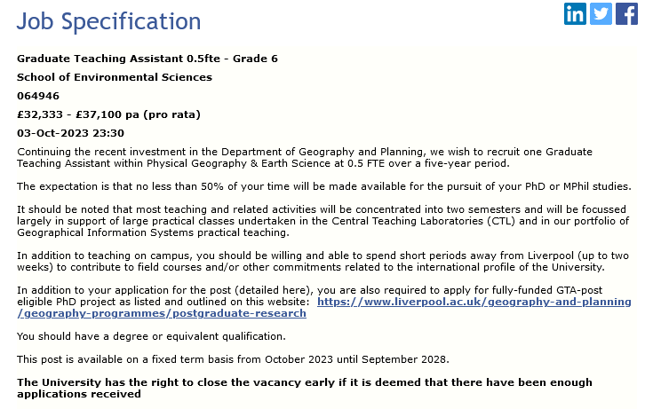
Interesting in a PhD in peatlands + GHGs? We're recruiting at @livunigeog for a position which is 50% Graduate Teaching Assistant and 50% PhD
One of the PhD options is my project: "Unravelling the true climate effect of peatland restoration"
Job link 👇
https://t.co/tYsG7AX2e6
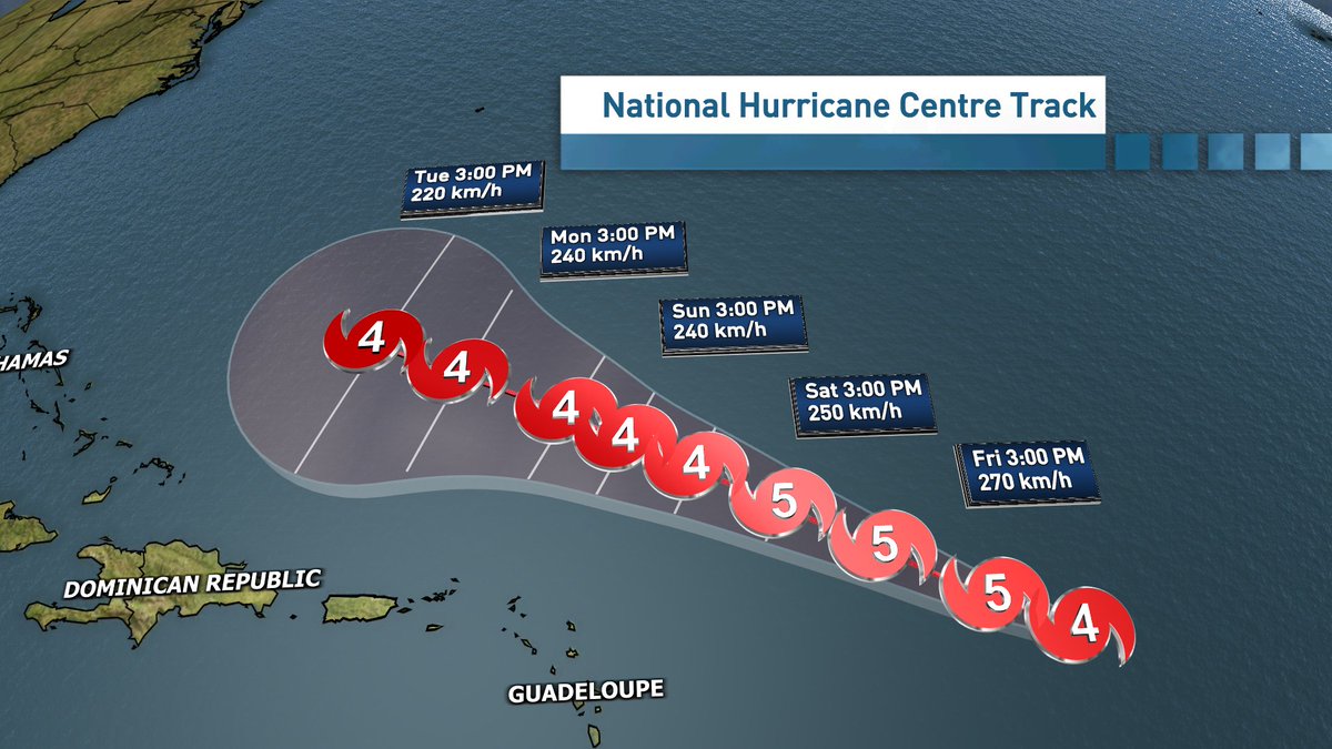
Hurricane #Lee has continued to outperform even the most aggressive intensity forecasts and may soon become a Category 5 storm.
Two hurricane models are forecasting that Lee's maximum sustained winds will increase to 195-205 mph tomorrow, which would be the highest wind speeds ever observed in an Atlantic hurricane.
#Lee has the potential to be one of the strongest hurricanes we've ever observed in the Atlantic Ocean.
Hurricane #Lee Advisory 10: Lee Now a Category 4 Hurricane. Rip Currents and Hazardous Surf Will Spread Across the Northern Caribbean Friday and Begin Affecting the Mainland U. S. By Sunday. https://t.co/tW4KeGe9uJ
Hurricane Lee now a category 4 hurricane.
@NHC_Atlantic is forecasting cat 5 strength by Friday.
Beyond official 5 day cone, there are many factors & uncertainty remains, however a turn north is looking more likely mid-next week.
One to watch in Atlantic Canada.
#nsstorm#nbstorm
This is one of the most impressive rapid intensification episodes I've ever seen in the Atlantic. Hurricane #Lee went from having no eye this morning to possibly Cat 5 intensity this evening. Absolutely incredible.
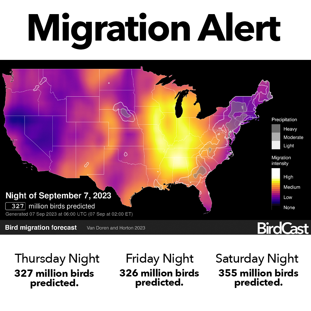
Migration Alert! Tonight thru Saturday, expect over 300 MILLION birds in the air each night. Bright lights can disorient them—make a difference by turning off non-essential lights and making windows safer. #LightsOutForBirds#LightsOutTexas#DarkSkies https://t.co/CboDf0WiNr
Catastrophic flooding unfolding in Chai Wan, Hong Kong 🇭🇰
158.1mm of rain fell in just one hour. This breaks the heaviest one hour rainfall record. Records date back to 1884.
��� via @yangyubin1998
Tonight was our first Monarch count - we'll be making reports throughout the month, so check back regularly. 15 Monarchs were observed this evening, feeding on the Woodland Sunflower and goldenrod at the base of the Tip Tower.