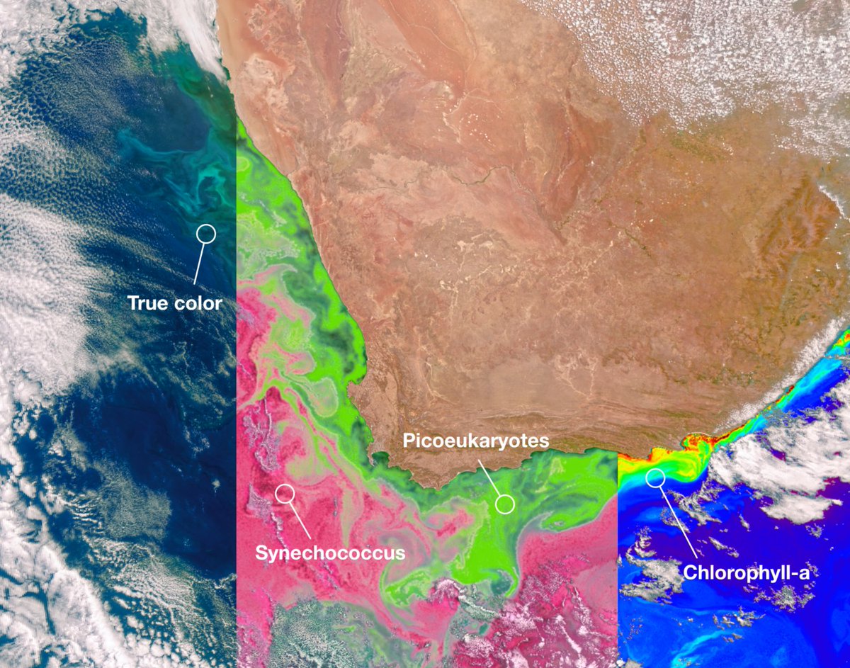
Just in – data from our newest Earth-observing satellite, PACE!
With PACE data, scientists can study microscopic life in the ocean and particles in the air, allowing us to monitor ocean health, air pollution, and impacts of climate change. More: https://t.co/qq4OBYhxYC
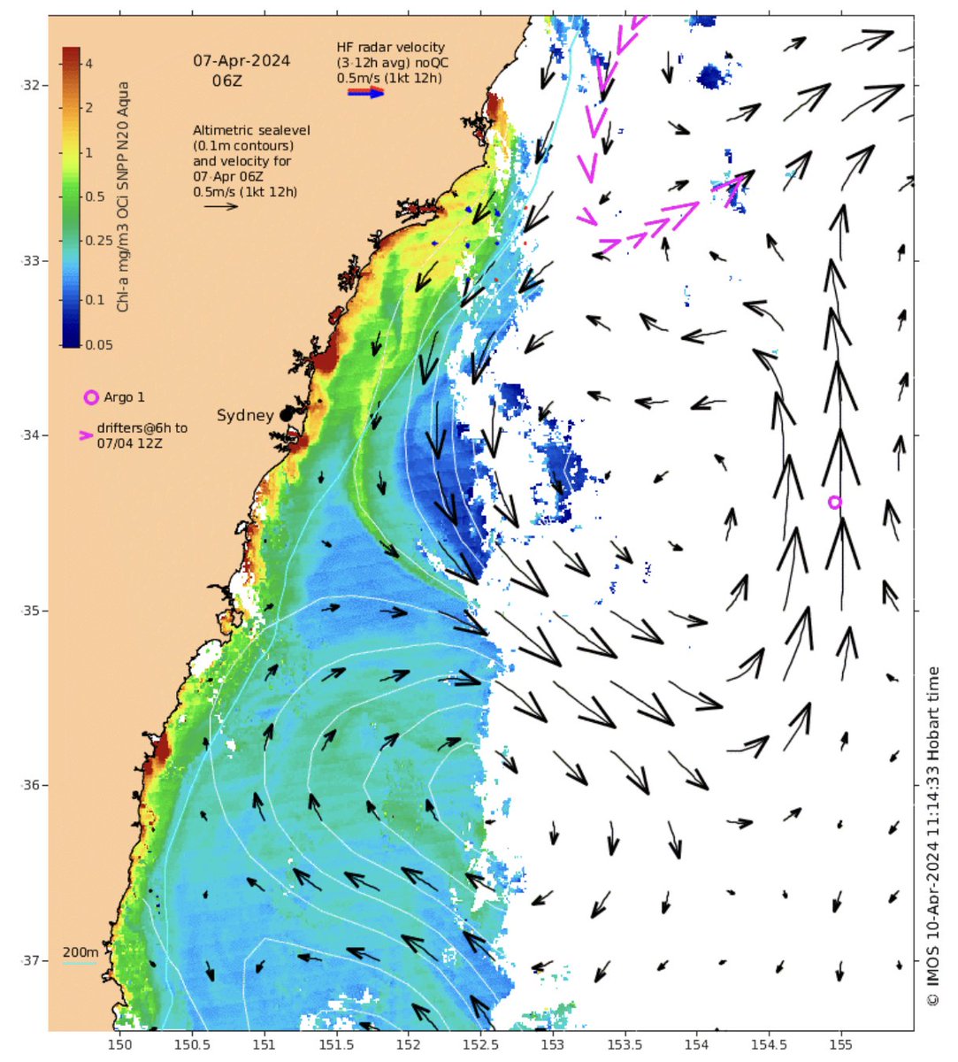
You can see the effect of an increase in the amount of freshwater flowing into the ocean in this ocean colour image from @IMOS_AUS oceancurrent (red patches along the coast next to rivers and estuaries). Note how the plumes flow north due to Coriolis!
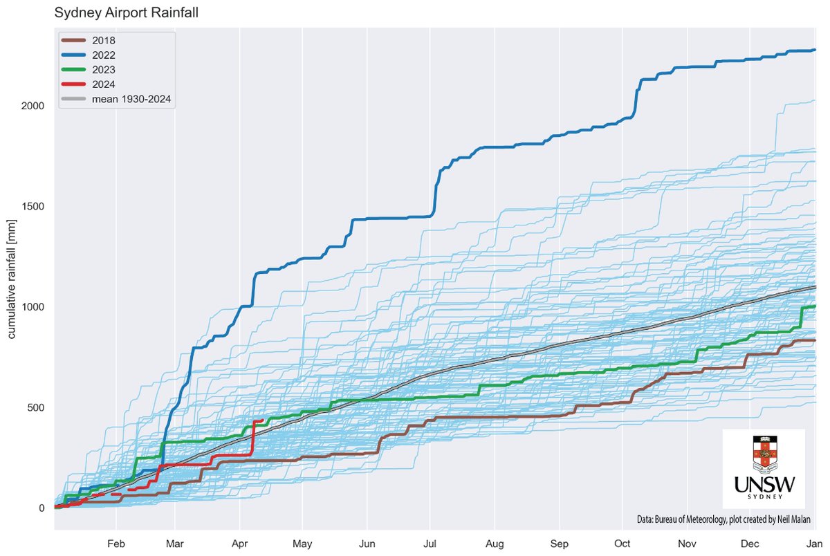
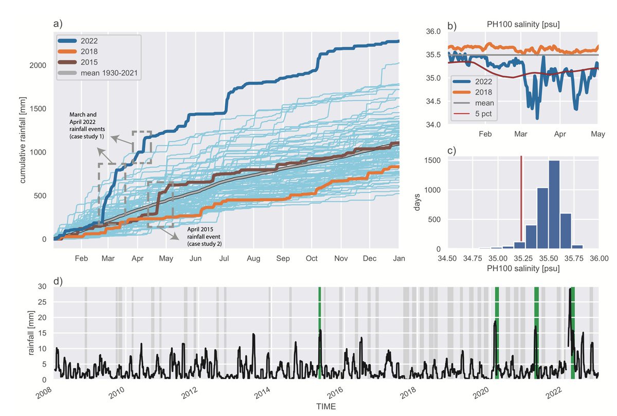
It's been a rather rainy week here in Sydney, it felt a lot like the record rains of 2022. So I plotted up the data and wow! This week has been an almost perfect match with April 2022. However, in 2022 we had already received an entire year's worth of rainfall by this stage.
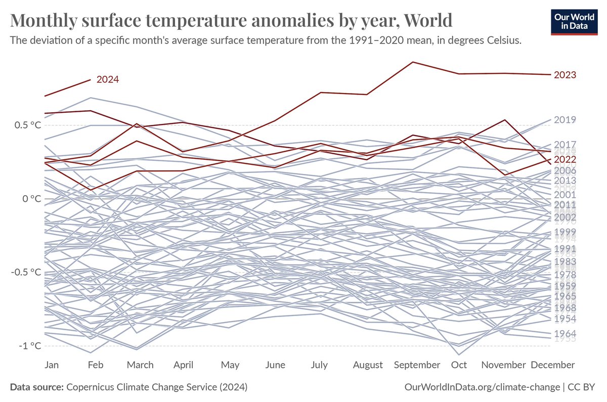
Last June was the warmest on record,
last July too,
last August too,
last September too,
last October too,
last November too,
last December too,
last January too,
and last February too.
https://t.co/o7gZ0GxpEy
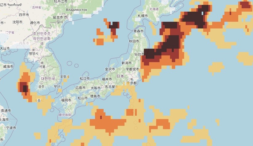
Sea temps across much of the global ocean are alarmingly high, with extensive MHW activity. However, coastal waters off Japan have been in a near-permanent MHW state for ~1 year. The current winter MHW is remarkable, with max intensity of >11 degC !!! #marineheatwaves#MHWs
Sea temps across much of the global ocean are alarmingly high, with extensive MHW activity. However, coastal waters off Japan have been in a near-permanent MHW state for ~1 year. The current winter MHW is remarkable, with max intensity of >11 degC !!! #marineheatwaves#MHWs
What does it all mean? With an increase in extreme rainfall expected in the future, we need to pay more attention to freshwater discharge in normally ‘dry’ areas such as eastern Australia.
To keep pace with a changing climate, and the expected increase in extreme events, we need to include freshwater discharge in our model simulations, and ensure our observe networks don’t neglect coastal salinity.
Floodwaters pulsing into the sea normally clear within six days, but the 2022 floods in eastern Australia were different.
It can leave a 50 metre thick layer of brown water in the sea – and cause real problems, write @NeilMalan + @moninya (@UNSW). https://t.co/H5LSjB9l2N
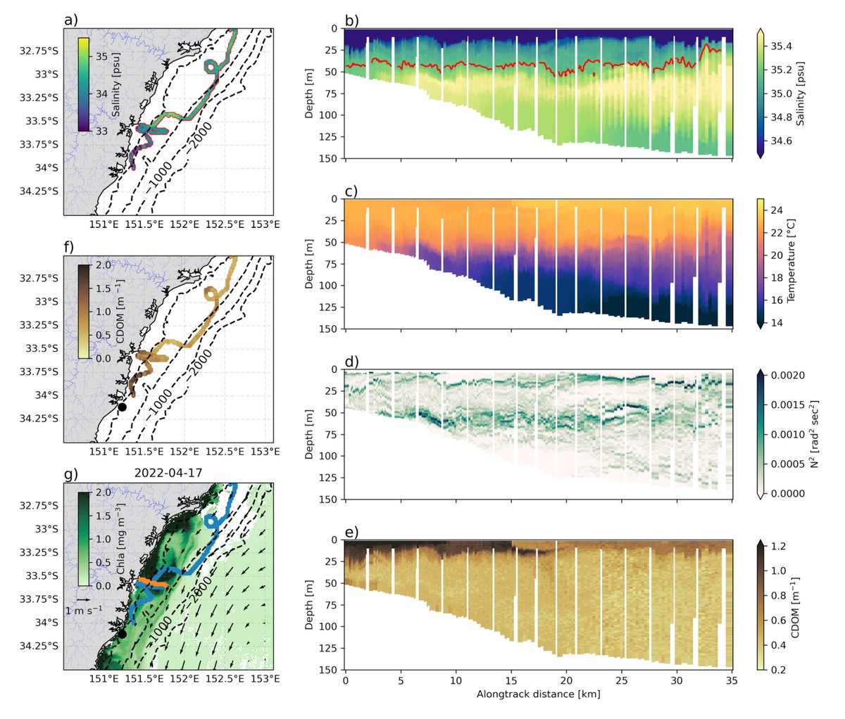
Gliders showed extreme low salinity waters extended more than 70km offshore and persisted for months. We observed a vertical double-stacking phenomena with two layers of fresher water extending deeper than 50m. Stratification was controlled by salinity rather than temperature.
It turns out it hangs around for a surprisingly long time.
We used a combination of moorings, gliders and remote sensing to define an observational extremes framework for salinity. This allowed us to track the extent and longevity of freshwater plumes associated with floodwaters